Delaware Route 3
| ||||
|---|---|---|---|---|
 | ||||
| Route information | ||||
| Maintained by DelDOT | ||||
| Length: | 5.87 mi[1] (9.45 km) | |||
| Existed: | 1968[2] – present | |||
| Major junctions | ||||
| South end: |
| |||
|
| ||||
| North end: |
| |||
| Location | ||||
| Counties: | New Castle | |||
| Highway system | ||||
| ||||

Delaware Route 3 (DE 3) is a state highway northeast of Wilmington in New Castle County, Delaware. The route runs from an interchange at Interstate 495 (I-495) in Edgemoor north to DE 92 in Hanbys Corner. The route passes through the suburban areas of Brandywine Hundred, Bellefonte, and Arden. It intersects U.S. Route 13 (US 13) in Edgemoor, US 13 Business (US 13 Bus.) in Bellefonte, and I-95 near Bellevue State Park. DE 3 was built as a state highway during the 1920s and 1930s. By 1968, the route was designated between US 13 (now US 13 Bus.) north to DE 92 on Marsh Road. The route was moved to its current alignment and terminus by 1984.
Route description
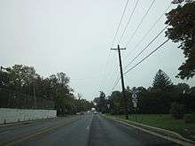
DE 3 begins at an intersection with Hay Road at an interchange with I-495 in an industrial section of Edgemoor, heading northwest on four-lane divided Edgemoor Road. After the I-495 interchange, the road passes over Amtrak's Northeast Corridor and intersects US 13 in areas of businesses. Past this intersection, DE 3 enters a more residential area as a three-lane undivided road with two southbound lanes and one northbound lane. The route narrows to two lanes and turns west and north, coming to an intersection with US 13 Bus. At this point, DE 3 turns northeast to form a concurrency with that route on four-lane undivided Philadelphia Pike, running through residential and commercial areas. DE 3 splits from US 13 Bus. in Bellefonte by turning northwest onto Washington Street Extension, a four-lane divided highway. The route passes to the southwest of Mount Pleasant High School and turns north onto Marsh Road, a four-lane undivided road that forms the western boundary of Bellevue State Park. The road becomes a divided highway as it comes to an interchange with I-95.[3][4]
Immediately after this interchange, DE 3 crosses under CSX's Philadelphia Subdivision and narrows into a two-lane undivided road that heads into Brandywine Hundred, passing residential neighborhoods and a few businesses. The route gains a second southbound lane between Wilson Road/Veale Road and Silverside Road. The road turns northeast and forms the western border of Arden. DE 3 turns north again and runs between neighborhoods to the west and woodland to the east, ending at an intersection with DE 92 in Hanbys Corner. Marsh Road continues north past this intersection as an unnumbered road toward the Pennsylvania border.[3][4]
DE 3 has an annual average daily traffic count ranging from a high of 13,893 vehicles at the Carr Road intersection to a low of 5,021 vehicles on Washington Street Extension.[1] None of DE 3 is part of the National Highway System.[5]
History
What is now DE 3 existed as a county road by 1920.[6] Four years later, the road was upgraded to a state highway between Philadelphia Pike and Harvey Road.[7] The state highway was extended north to Naamans Road by 1931.[8] By 1968, DE 3 was designated to run from US 13 (now US 13 Business) north to DE 92 along Marsh Road.[2] DE 4 was extended onto the Washington Street Extension portion of present-day DE 3 three years later.[9] DE 4 was removed from Washington Street Extension by 1981.[10] Three years later, DE 3 was extended to I-495 in Edgemoor. At this time, DE 3 was realigned to follow Washington Street Extension from Marsh Road to a concurrency with US 13 Business, heading southwest along that route before heading southeast along Edgemoor Road.[11]
Major intersections
The entire route is in New Castle County.
| Location | mi[1] | km | Destinations | Notes | |
|---|---|---|---|---|---|
| Edgemoor | 0.00 | 0.00 | Southern terminus, I-495 exit 4 | ||
| 0.23 | 0.37 | ||||
| Bellefonte | South end of US 13 Bus. overlap | ||||
| 1.73 | 2.78 | North end of US 13 Bus. overlap | |||
| 2.55 | 4.10 | I-95 exit 9 | |||
| Hanbys Corner | 5.87 | 9.45 | Northern terminus | ||
1.000 mi = 1.609 km; 1.000 km = 0.621 mi
| |||||
See also
 U.S. Roads portal
 Delaware portal
References
- 1 2 3 Staff (2011). "Traffic Count and Mileage Report: Interstate, Delaware, and US Routes" (PDF). Delaware Department of Transportation. Retrieved May 17, 2012.
- 1 2 Delaware State Highway Department (1968). Official Highway Map (PDF) (Map). Dover: Delaware State Highway Department. Northern New Castle County inset. Retrieved November 24, 2015.
- 1 2 Delaware Department of Transportation (2008). Delaware Official Transportation Map (PDF) (Map). Dover: Delaware Department of Transportation. Northern New Castle County inset. Retrieved November 24, 2015.
- 1 2 Google (February 5, 2011). "overview of Delaware Route 3" (Map). Google Maps. Google. Retrieved February 5, 2011.
- ↑ National Highway System: Delaware (PDF) (Map). Federal Highway Administration. 2010. Retrieved February 10, 2012.
- ↑ Delaware State Highway Department (1920). Official Road Map (PDF) (Map). Dover: Delaware State Highway Department. Retrieved November 24, 2015.
- ↑ Delaware State Highway Department (1924). Official Road Map (PDF) (Map). Dover: Delaware State Highway Department. Retrieved November 24, 2015.
- ↑ Delaware State Highway Department (1931). Official Road Map of the State of Delaware (PDF) (Map). Dover: Delaware State Highway Department. Retrieved November 24, 2015.
- ↑ Delaware Department of Highways and Transportation (1971). Delaware Highways Official Map (PDF) (Map). Dover: Delaware Department of Highways and Transportation. Northern New Castle County inset. Retrieved November 24, 2015.
- ↑ Delaware Department of Transportation (1981). Delaware Official State Highway Map (PDF) (Map). Dover: Delaware Department of Transportation. Northern New Castle County inset. Retrieved November 24, 2015.
- ↑ Delaware Department of Transportation (1984). Official State Highway Map (PDF) (Map). Dover: Delaware Department of Transportation. Northern New Castle County inset. Retrieved November 24, 2015.
External links
 Media related to Delaware Route 3 at Wikimedia Commons