Interstate 495 (Delaware)
| ||||
|---|---|---|---|---|
_map.svg.png) | ||||
| Route information | ||||
| Auxiliary route of I‑95 | ||||
| Maintained by DelDOT | ||||
| Length: | 11.47 mi[1] (18.46 km) | |||
| Existed: | 1962[2] – present | |||
| History: | Completed in 1977[3] | |||
| Major junctions | ||||
| South end: |
| |||
|
| ||||
| North end: |
| |||
| Location | ||||
| Counties: | New Castle | |||
| Highway system | ||||
| ||||
Interstate 495 (I-495) is a 11.47-mile (18.46 km) long Interstate highway in the U.S. state of Delaware. The highway serves as a six-lane bypass of I-95 around the city of Wilmington. I-495 begins at an interchange with I-95 and I-295 near Newport to the southwest of Wilmington. From here, the road heads east to the Port of Wilmington, where it turns northeast and crosses the Christina River as it heads to the east of downtown Wilmington. Upon reaching Edgemoor, I-495 runs between the Delaware River to the east and U.S. Route 13 (US 13) to the west, continuing to Claymont. In Claymont, I-495 turns north and merges into northbound I-95 at an interchange with Delaware Route 92 (DE 92) just south of the Pennsylvania state line.
Plans for a bypass of Wilmington to the east date back to 1948 and was incorporated into the Interstate Highway System in 1956. This interstate bypass was numbered I-495 in the 1960s. Construction on building I-495 took place during the course of the 1970s, with the entire length of the highway completed and opened to traffic in 1977. Between 1978 and 1980, I-95 was designated along the I-495 alignment while the South Wilmington Viaduct along I-95 was reconstructed; during this time the route through Wilmington was known as I-895. The US 13/DE 3 interchange in Edgemoor opened in 1988. In 2014, the bridge over the Christina River was closed due to tilting support columns until repairs were completed.
Route description
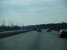
I-495 begins at an interchange with I-95/US 202 and I-295 near Newport, heading to the east on a six-lane freeway. At the southern terminus, southbound I-495 also has a ramp that provides easier access to the DE 141 interchange along I-95. The route runs between the Christina River to the north and a landfill to the south prior to reaching an interchange with US 13 and the southern terminus of US 13 Bus. to the north of Wilmington Manor. Past this, the highway enters industrial areas and reaches the DE 9A exit near the Port of Wilmington, turning to the northeast. I-495 crosses over the Christina River into the eastern part of Wilmington and passes near another landfill as it comes to the 12th Street exit.[4][5]
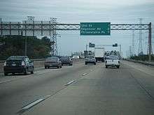
The road runs through some marshland before coming to an interchange in industrial Edgemoor that connects to the southern terminus of DE 3 as well as to US 13. Following this interchange, I-495 runs between US 13 and suburban areas to the west and Amtrak’s Northeast Corridor and the Delaware River to the east. I-495 continues along this configuration until it reaches Claymont. US 13 heads farther west from the freeway and I-495 makes a turn to the north away from the railroad tracks and the river near the Claymont station along SEPTA's Wilmington/Newark Line that uses the Northeast Corridor. The road comes to another exit for US 13 before merging into I-95 at the DE 92 interchange near the Tri-State Mall and the Pennsylvania border.[4][5] Southbound, the I-495 splitoff from I-95 actually starts in Pennsylvania, but crosses into Delaware 220 feet (67 m) later before the exit to DE 92.[5][6]
I-495 has an annual average daily traffic count ranging from a high of 90,379 vehicles at the south end of Wilmington near the Christina River to a low of 19,234 vehicles at the ramp to I-95 at the southern terminus.[1] As part of the Interstate Highway System, the entire length of I-495 is a part of the National Highway System.[7]
History
In 1948, the Wilmington Transportation Study proposed two new roads running between the southern end of Wilmington and the Pennsylvania border to improve traffic flow in the Wilmington area. Route A followed the current alignment of I-95 through the city while Route B bypassed the city to the east along the current alignment of I-495.[8] In 1956, the Interstate Highway System was created, with FAI-3 proposed along the current alignment of I-495.[9] In 1960, design work on FAI-3 was underway.[10] The route of FAI-3 was numbered as I-495 in 1962.[2] In 1968, structural design for bridges along I-495 was underway. The same year, the first construction contracts began with three demolition contracts, the building of a culvert under the Penn Central line at Holly Oak Creek, and the relocation of a section of US 13 to the west to allow for room to build I-495.[11] In 1970, work continued on relocating US 13 along with the construction of bridges carrying the interstate over Stoney Creek.[12] A contract was awarded to build I-495 between Edgemoor and I-95 in Claymont in 1971. The same year, work was underway on building the bridge over the Christina River. Design work on the interstate was completed at this time.[13] The following year, construction contracts were awarded to build I-495 south of the Christina River and to stabilize the road near Cherry Island. Paving was also underway between the Christina River and Edgemoor.[14] In 1973, contracts were let to build structures along the freeway between the Christina River and Edgemoor.[15] Work on the highway between New Castle Avenue and the Christina River bridge was finished in 1975.[16] In 1976, the first section of I-495 was opened between US 13 and I-95 in Claymont.[17] The same year, the bridge carrying the highway over Edgemoor Road was completed.[18] In June 1977, the remainder of I-495 was completed and opened to traffic.[3]

On June 28, 1978, the American Association of State Highway and Transportation Officials (AASHTO) approved rerouting I-95 along the I-495 alignment. However, AASHTO disapproved renumbering the alignment of I-95 through Wilmington as I-595.[19] On October 27 of that year, AASHTO gave conditional approval for I-95 through Wilmington to be designated as I-195 from I-95 near Newport north to US 202 while the route from US 202 to I-95 in Claymont would become I-395.[20] I-895 was designated along the conditionally approved route of I-195 and I-395 on June 25, 1979.[21] In 1980, the South Wilmington Viaduct along I-895 was reconstructed.[22] On November 14, 1980, I-95 and I-495 were returned to their original alignments, with I-895 decommissioned.[23] In 1988, an interchange was built at US 13 and DE 3 in Edgemoor. This interchange was numbered as exit 4, which resulted in the US 13 interchange in Claymont being renumbered from exit 4 to exit 5.[24][25] In February 1988, a tanker drove off the Christina River bridge and exploded, with the truck driver killed. The accident forced the closure of I-495 in order to repair the heat damage to the bridge structure.[26] In 2000, through traffic from I-95 was detoured onto I-495 while I-95 was rebuilt between Wilmington and the Pennsylvania border.[27]
On June 2, 2014, the bridge over the Christina River was closed after it was discovered that four support columns were tilting.[28] I-495 was closed to traffic between the DE 9A and 12th Street interchanges. DelDOT officials at first said that the bridge would remain closed indefinitely.[29] They later announced plans to have the southbound side of the bridge reopen by Labor Day, with the northbound side to follow by late September.[30] The southbound lanes reopened on July 31,[31] a month earlier than expected, and the northbound lanes reopened on August 23.[32] During the closure, traffic was detoured onto I-95, and several major roads in the Wilmington area experienced increased traffic congestion.[33]
Exit list
The entire route is in New Castle County.
| Location | mi[1] | km | Exit | Destinations | Notes |
|---|---|---|---|---|---|
| Newport | 0.00 | 0.00 | Southern terminus, I-95 exit 5D | ||
| 5 | Southbound exit, access to Wilmington Airport | ||||
| Southbound exit | |||||
| Minquadale | 1.98 | 3.19 | 1 | Northbound exit and southbound entrance, access to Wilmington Station | |
| Southbound exit and northbound entrance, access to Wilmington Station | |||||
| Wilmington | 2.97 | 4.78 | 2 | Access to Riverfront Attractions | |
| 4.45 | 7.16 | 3 | 12th Street | ||
| Edgemoor | 5.97 | 9.61 | 4 | Split into exits 4A (US 13 / DE 3 north) and 4B (DE 3 south) southbound | |
| Claymont | 10.83 | 17.43 | 5 | ||
| 6 | Southbound exit | ||||
| 11.47 | 18.46 | Northern terminus, I-95 exit 11, southbound exit begins in Pennsylvania and runs for 220 ft (67 m) before crossing into Delaware | |||
| 1.000 mi = 1.609 km; 1.000 km = 0.621 mi | |||||
See also
-
 U.S. Roads portal
 -
 Delaware portal
References
- 1 2 3 Staff (2011). "Traffic Count and Mileage Report: Interstate, Delaware, and US Routes" (PDF). Delaware Department of Transportation. Retrieved May 17, 2012.
- 1 2 "Report of the State Highway Department of the State of Delaware" (PDF) (1962 ed.). Dover, Delaware: Delaware State Highway Department. 1962: 93. Retrieved December 4, 2014.
- 1 2 "Annual Report" (PDF) (1977 ed.). Dover, Delaware: Delaware Department of Highways and Transportation. 1977: 11. Retrieved December 4, 2014.
- 1 2 Delaware Department of Transportation (2008). Delaware Official Transportation Map (PDF) (Map). Dover: Delaware Department of Transportation. Retrieved November 24, 2015.
- 1 2 3 Google (May 5, 2010). "overview of Interstate 495" (Map). Google Maps. Google. Retrieved May 5, 2010.
- ↑ Bureau of Maintenance and Operations (January 2015). Roadway Management System Straight Line Diagrams (Report) (2015 ed.). Pennsylvania Department of Transportation. Retrieved June 30, 2015.
- Delaware County (PDF)
- ↑ National Highway System: Delaware (PDF) (Map). Federal Highway Administration. 2010. Retrieved February 10, 2012.
- ↑ "Report of the State Highway Department" (PDF) (1950 ed.). Dover, Delaware: Delaware State Highway Department. July 1, 1950: 27–29. Retrieved November 9, 2014.
- ↑ "Report of the State Highway Department" (PDF) (1956 ed.). Dover, Delaware: Delaware State Highway Department. July 1, 1956: 8, 21. Retrieved November 9, 2014.
- ↑ "Delaware State Highway Department Annual Report" (PDF) (1960 ed.). Dover, Delaware: Delaware State Highway Department. August 1, 1960: 10. Retrieved December 4, 2014.
- ↑ "Annual Report" (PDF) (1968 ed.). Dover, Delaware: Delaware State Highway Department. June 30, 1968: 18, 20. Retrieved December 4, 2014.
- ↑ "Annual Report" (PDF) (1970 ed.). Dover, Delaware: Delaware State Highway Department. June 30, 1970: 19. Retrieved December 4, 2014.
- ↑ "Annual Report" (PDF) (1971 ed.). Dover, Delaware: Delaware Department of Highways and Transportation. November 15, 1971: 6. Retrieved December 4, 2014.
- ↑ "Annual Report" (PDF) (1972 ed.). Dover, Delaware: Delaware Department of Highways and Transportation. October 15, 1972: 5. Retrieved December 4, 2014.
- ↑ "Annual Report" (PDF) (1973 ed.). Dover, Delaware: Delaware Department of Highways and Transportation. 1973: 3. Retrieved December 4, 2014.
- ↑ "Annual Report" (PDF) (1975 ed.). Dover, Delaware: Delaware Department of Highways and Transportation. 1975: 13. Retrieved December 4, 2014.
- ↑ Delaware Department of Highways and Transportation (1976). Delaware Highways Official Map (PDF) (Map). Dover: Delaware Department of Highways and Transportation. Retrieved November 24, 2015.
- ↑ "Annual Report" (PDF) (1976 ed.). Dover, Delaware: Delaware Department of Highways and Transportation. 1976: 17. Retrieved December 4, 2014.
- ↑ Special Committee on U.S. Route Numbering (June 29, 1978). "Route Numbering Committee Agenda Showing Action Taken by the Executive Committee" (PDF) (Report). Coeur d'Alene, ID: American Association of State Highway and Transportation Officials. p. 496. Retrieved November 13, 2014 – via Wikimedia Commons.
- ↑ Special Committee on U.S. Route Numbering (October 28, 1978). "Route Numbering Committee Agenda Showing Action Taken by the Executive Committee" (PDF) (Report). Louisville, KY: American Association of State Highway and Transportation Officials. p. 497. Retrieved November 13, 2014 – via Wikimedia Commons.
- ↑ Special Committee on U.S. Route Numbering (June 25, 1979). "Route Numbering Committee Agenda Showing Action Taken by the Executive Committee" (PDF) (Report). Buford, GA: American Association of State Highway and Transportation Officials. p. 501. Retrieved November 13, 2014 – via Wikimedia Commons.
- ↑ Federal Highway Administration (2012). "NBI Structure Number: 1748 059". National Bridge Inventory. Federal Highway Administration.
- ↑ Special Committee on U.S. Route Numbering (November 14, 1980). "Route Numbering Committee Agenda" (PDF) (Report). Las Vegas, NV: American Association of State Highway and Transportation Officials. p. 519. Retrieved November 13, 2014 – via Wikimedia Commons.
- ↑ Delaware Department of Transportation (1987). Official State Highway Map (PDF) (Map). Dover: Delaware Department of Transportation. Retrieved November 24, 2015.
- ↑ Delaware Department of Transportation (1988). Official State Highway Map (PDF) (Map). Dover: Delaware Department of Transportation. Retrieved November 24, 2015.
- ↑ Haner, Jim (February 27, 1988). "Truck Falls Off Span, Explodes; Driver Killed". The Philadelphia Inquirer. Retrieved December 4, 2014.
- ↑ "First Segment of I-95 Southbound Reconstruction". Delaware Department of Transportation. May 19, 2000. Retrieved November 14, 2014.
- ↑ "I-495 Closed at Bridge Over Christina River". Philadelphia: WCAU-TV. June 2, 2014. Retrieved June 2, 2014.
- ↑ "I-495 Bridge Over Christina River To Remain Closed Indefinitely". Philadelphia: KYW-TV. June 2, 2014. Retrieved June 4, 2014.
- ↑ "Delaware I-495 bridge closed through summer". The News Journal. Wilmington, DE. June 10, 2014. Retrieved June 10, 2014.
- ↑ Chase, Randall (July 31, 2014). "Damaged Delaware bridge on I-495 partially reopens". Associated Press. Retrieved August 3, 2014.
- ↑ "All I-495 lanes open". The News Journal. Wilmington, DE. August 23, 2014. Retrieved August 24, 2014.
- ↑ "I-495 bridge closure means weeks of traffic chaos". The News Journal. Wilmington, DE. June 12, 2014. Retrieved December 4, 2014.
External links
 Media related to Interstate 495 (Delaware) at Wikimedia Commons
| ||