Interstate 95 in Delaware
| |||||||
|---|---|---|---|---|---|---|---|
_map.svg.png) | |||||||
| Route information | |||||||
| Maintained by DelDOT | |||||||
| Length: | 23.43 mi[1] (37.71 km) | ||||||
| Existed: | 1956[2] – present | ||||||
| History: | First section opened in 1963, completed in 1968[3][4] | ||||||
| Major junctions | |||||||
| South end: |
| ||||||
|
| |||||||
| North end: |
| ||||||
| Location | |||||||
| Counties: | New Castle | ||||||
| Highway system | |||||||
| |||||||

Interstate 95 (I-95) is an Interstate highway running along the East Coast of the United States from Miami, Florida north to the Canadian border in Houlton, Maine. In the state of Delaware, the route runs for 23.43 mi (37.71 km) across the Wilmington area in northern New Castle County from the Maryland state line near Newark northeast to the Pennsylvania state line in Claymont. I-95 is the only primary (2-digit) Interstate highway that enters Delaware, although it also has two auxiliary routes within the state (I-295 and I-495). Between the Maryland border and Newport, I-95 follows the Delaware Turnpike or John F. Kennedy Memorial Highway, a toll road with a toll plaza near the state line. In Newport, the interstate has a large interchange with Delaware Route 141 (DE 141) and the southern termini of I-295 and I-495, the latter interstate providing a bypass of Wilmington. I-95 heads north through the heart of Wilmington concurrent with U.S. Route 202 (US 202) on the Wilmington Expressway. Past Wilmington, I-95 continues northeast to Claymont, where I-495 rejoins the route right before the Pennsylvania state line.
Plans for a road along the I-95 corridor through Wilmington to the Pennsylvania border predate the Interstate Highway System. After the Delaware Memorial Bridge was built in 1951, the Delaware Turnpike was proposed between the bridge approach in Farnhurst and the Maryland border near Newark in order to alleviate traffic congestion on parallel US 40. With the creation of the Interstate Highway System in 1956, both these roads were incorporated into I-95. Construction on the Delaware Turnpike began in 1957 and ended in 1963. Construction on building I-95 through Wilmington began in the early 1960s. I-95 was completed north from Newport to downtown Wilmington in 1966 and north to the Pennsylvania border in 1968. Between 1978 and 1980, I-95 was temporarily rerouted along the I-495 bypass route while the South Wilmington Viaduct was reconstructed; during this time the route through Wilmington was designated as I-895. Improvements continue to be made to the highway including widening projects and reconstruction of sections of the road and interchanges.
Route description
Delaware Turnpike
| |
|---|---|
| Location: | Newark-Farnhurst |
| Length: | 13.68 mi[1] (22.02 km) |
| Existed: | 1963[3]–present |
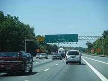
I-95 enters Delaware from Maryland southwest of Newark in New Castle County. From the state line, the highway heads east as the six-lane Delaware Turnpike (John F. Kennedy Memorial Highway) through wooded areas. Not far from the Maryland border, the road comes to a toll plaza. I-95 widens to eight lanes and comes to a modified cloverleaf interchange with DE 896, which heads north to Newark and the University of Delaware and south to US 301. Following this interchange, the interstate highway runs between industrial areas to the north and farm fields to the south, coming to bridges over Norfolk Southern's Delmarva Secondary railroad line and DE 72. The road heads through more woodland with nearby suburban development as it curves northeast, with the median widening for the Delaware Welcome Center service plaza accessible from both directions. A short distance later, I-95 reaches the DE 273 interchange west of Christiana. The freeway continues northeast and comes to a modified cloverleaf interchange with the DE 1/DE 7 freeway to the northwest of the Christiana Mall. This interchange has flyover ramps between southbound I-95 and southbound DE 1/DE 7 and northbound DE 1/DE 7 and northbound I-95; the northbound ramp splits onto both sides of the northbound lanes of I-95.[5][6]
Past this interchange, I-95 widens to ten lanes and passes under DE 58, with a ramp from southbound I-95 to westbound DE 58 that provides the missing connection between southbound I-95 and northbound DE 7. The highway continues through woods before passing through Churchman's Marsh, where it crosses the Christina River. After this bridge, I-95 has a northbound ramp to Airport Road that serves to provide access to southbound US 202/DE 141. At this point, the lanes of the interstate split further apart and the northbound ramp for I-295 and northbound DE 141 splits off to parallel the northbound lanes of I-95. The ramp to northbound I-295 has two lanes while northbound I-95 carries four lanes. After this, I-95 crosses US 202/DE 141, at which point US 202 becomes concurrent with the interstate. Upon crossing DE 141, the ramp to northbound DE 141 from the northbound I-295 ramp splits off while the ramp from DE 141 to northbound I-95 merges in from the left. Southbound, a collector/distributor ramp serves to provide access between I-95 and DE 141. Not far after encountering DE 141, I-295 splits off to the southeast, with the northbound entrance from I-295 and the southbound exit to I-295 and southbound entrance from I-295 on the left side of the road. At this point, the Delaware Turnpike splits from I-95 and follows I-295 southeast to an interchange with US 13/US 40 in Farnhurst, where the turnpike ends and I-295 continues east as the Delaware Memorial Bridge approach. After I-295, I-95/US 202 turns north and comes to a northbound exit and southbound entrance with the southern terminus of I-495, which bypasses Wilmington to the east.[5][6]
Wilmington Expressway

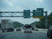
Following the I-495 interchange, the median narrows and I-95/US 202 heads northeast through marshland as the six-lane Wilmington Expressway, crossing the Christina River. The freeway comes to a bridge over Norfolk Southern's Shellpot Branch and continues through more wetlands, with Amtrak's Northeast Corridor running a short distance to the northwest. The road heads into Wilmington and curves to the north, passing to the west of Frawley Stadium, home of the Wilmington Blue Rocks baseball team. I-95/US 202 heads towards downtown Wilmington and crosses onto a viaduct, passing over the Northeast Corridor and coming to an interchange that provides access to the downtown area by way of DE 4 and DE 48. At this point, the four-lane freeway continues northeast, with one-way northbound North Adams Street to the east and one-way southbound North Jackson Street to the west serving as frontage roads. I-95/US 202 continues through residential areas to the west of downtown Wilmington, passing over DE 9, with a southbound exit. Farther northeast, the freeway heads into an alignment below street level and comes to an interchange with DE 52. Past this interchange, the road heads to the north and crosses Brandywine Creek, heading through Brandywine Park, which is a part of the Wilmington State Parks complex. The freeway curves northeast again and passes under CSX's Philadelphia Subdivision before reaching an interchange with the northern terminus of DE 202 at the northern edge of Wilmington, at which point US 202 splits from I-95.[5][6]
Past US 202, I-95 leaves Wilmington for the suburban Brandywine Hundred area and heads northeast as a four-lane road, passing southeast of the Rock Manor Golf Club and running along the northwest side of the CSX line. The freeway curves east to pass over the railroad tracks and continues through wooded areas to the south of the CSX tracks, coming to a diamond interchange with DE 3 near Bellefonte. After this exit, I-95 and the rail line curve to the northeast and continue through woodland with nearby residential areas, passing northwest of Bellevue State Park. The highway comes to a northbound exit and southbound entrance with Harvey Road near the villages of Arden, Ardentown, and Ardencroft. Past this interchange, the freeway curves east away from the CSX tracks and winds northeast near suburban neighborhoods in Claymont. In Claymont, the interstate comes to a diamond interchange with DE 92, at which point I-495 also merges onto the northbound direction of the interstate. Following the interchange, I-95 passes to the west of the Tri-State Mall before it crosses the state line into Pennsylvania.[5][6] The southbound exit from I-95 to I-495 is located in Pennsylvania 132 feet (40 m) before the Delaware state line.[6][7]
I-95 in Delaware has an annual average daily traffic count ranging from a high of 169,865 vehicles at the DE 1/DE 7 interchange in Christiana to a low of 48,906 vehicles at the DE 92 interchange in Claymont.[1] As part of the Interstate Highway System, the entire length of I-95 in Delaware is a part of the National Highway System.[8]
Tolls

I-95 has a toll plaza along the Delaware Turnpike near the Maryland border in Newark that charges $4.00 for cars. Cash or E-ZPass is accepted for payment of tolls.[9]
When the highway first opened in 1963, the toll at the state line was 30 cents.[3] Prior to 1976, ramp tolls were collected at the DE 896, DE 273, and DE 7 interchanges.[10] The ramp tolls required exact change, and many motorists were caught by police evading the tolls because they did not have the proper change.[11] In 1970, an attempt was made to use the honor system for motorists without the proper change at the tollbooth to pay the tolls by mailing them. However, it was discontinued after a month because most motorists did not mail in their tolls.[12] In 1976, Governor Sherman W. Tribbitt signed House Bill 1278, which was sponsored by Representative Gerard A. Cain. This bill called for the elimination of the three ramp tolls while keeping the mainline toll plaza near the Maryland border.[13] The ramp tolls stopped being collected on October 1, 1976.[14]
In 1981, plans were announced to demolish the former toll booths at the DE 273 and DE 7 interchanges; however, the DE 896 interchange toll booths were to remain to collect tolls from trucks.[10] The mainline toll plaza was planned to be closed on July 1, 1981 after the bonds to construct the road were paid off, but was kept by "Operation Overhaul", a $93 million project by Governor Pierre S. du Pont IV that would use the tolls collected at the toll plaza to fund improvements to the turnpike along with other roads in the state of Delaware.[15] In the summer of 2011, reconstruction of the Delaware Turnpike toll plaza was completed in a $32.6 million project, adding high-speed E-ZPass lanes.[16] As of 2011, the Delaware Turnpike was the third most expensive toll road in the United States based on a cost-per-mile average, at a rate of 23 cents per mile (14 ¢/km).[17]
Services
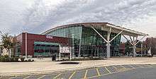
The Delaware Welcome Center service plaza is located in the median of I-95 between the DE 896 and DE 273 interchanges east of Newark.[5][6] The service plaza offers a Sunoco gas station, a convenience store, multiple fast-food restaurants, a Delaware Visitor Center offering tourist information, and retail options including a store called Postcards from Delaware that sells Delaware-related merchandise. The Delaware Welcome Center is run by HMSHost.[18][19]
When the Delaware Turnpike opened in 1963, a Hot Shoppes restaurant and an Esso service station was located along the road in the median. In 1964, a proposal was made to build a truck stop and motel next to the existing facilities.[20] The truck stop proposal was off and on for several years until a truck stop was built just over the border in Maryland in 1975.[21] In 1983, Hot Shoppes was replaced by Roy Rogers and Bob's Big Boy in order to offer both sit-down dining and fast food.[22][23] This was the largest Roy Rogers and Bob's Big Boy location at the time and restaurant namesake Roy Rogers and Lieutenant Governor Michael Castle were in attendance for the opening.[22] In September 2009, the Delaware Welcome Center was closed for a reconstruction project that would construct a new service plaza building, new gas pumps, new truck parking, and an improved visitor center.[24] The renovated service plaza opened in June 2010 at a cost of $35 million.[25]
History
Planning and construction
In 1948, the Wilmington Transportation Study proposed two new roads running between the southern end of Wilmington and the Pennsylvania border to improve traffic flow in the Wilmington area. Route A followed the current alignment of I-95 while Route B bypassed the city to the east along the current alignment of I-495.[26] Plans for building Route A were made in 1950 but were deferred a year later due to opposition.[27]
Following the completion of the Delaware Memorial Bridge and the connecting New Jersey Turnpike in 1951, through traffic coming from the bridge led to significant congestion on US 13 and US 40.[28] As a result of this, suggestions were made in 1954 for a limited-access road to be constructed leading to the bridge that would alleviate congestion on US 40.[3][28] In 1956, the Interstate Highway System was created, with two routes proposed along the current alignment of I-95. FAI-1 was proposed to run from the Maryland state line east to an interchange west of Farnhurst while FAI-2 was proposed between this interchange and the Pennsylvania border through the western part of Wilmington.[29] The corridor following FAI-1 and FAI-2 would become designated as part of I-95, an Interstate Highway running along the East Coast of the United States.[2] FAI-1 was originally planned as a free Interstate Highway using federal funds; however, the road would not have been completed until 1967 under this plan. As a result, the state of Delaware financed the road with bond issues and would build it as a toll road called the Delaware Turnpike.[30]
The first construction contracts for the Delaware Turnpike were awarded in 1957, with construction soon following that year.[31] Construction began on building a new bridge over US 13/US 40 at the Farnhurst interchange in 1958 that would connect the Delaware Turnpike to the I-295/US 40 approach to the Delaware Memorial Bridge. The same year, plans were made for several bridges along I-95.[32] In 1959, work began on rebuilding the Farnhurst interchange to Interstate Highway standards.[33] The same year, recommendations were made for the design and right-of-way acquisition along the planned route of I-95 as well as the construction of several contracts between the Maryland border and Farnhurst along the Delaware Turnpike, including the interchange with DE 41/DE 141 and between I-95, I-295, and I-495 near the Christina River.[34] The proposed routing for I-95 through Wilmington would take it through the central core between Adams and Jackson streets. Locals tried to fight routing I-95 through the central core and instead suggested routing it along Bancroft Parkway to the west or the present-day route of I-495 to the east. However, the lame-duck Republican-controlled city council approved routing I-95 along Adams and Jackson streets in 1957. The demolition of homes began in January 1959.[3]
A year later, construction began on overpasses and ramps at the Farnhurst interchange.[35] The same year, suggestions were made to build I-95 across the Christina Marsh as well as construct the bridges over the Christina River and the Pennsylvania Railroad in Wilmington.[36] A contract was awarded for the Christina River interchange in 1961.[31] By 1961, all construction contracts along the Delaware Turnpike had been completed except for the DE 41/DE 141 interchange and the Christina River interchange. In 1962, the I-95 bridges over the Christina River, the Pennsylvania Railroad, and Little Mill Creek were finished while plans were made for the South Wilmington Viaduct that would cross over several railroad tracks belonging to the Pennsylvania Railroad, Baltimore and Ohio Railroad, and the Reading Railroad.[37] The same year, the roadway was built between the Christina River interchange and the South Wilmington Viaduct.[38] The new northbound lanes of DE 41/DE 141 through the I-95 interchange opened in November 1962.[39] The southbound lanes of DE 41/DE 141 opened in June 1964, enabling directional flow of DE 41/DE 141 through the interchange.[38] In September 1963, construction work on the turnpike was halted by picketing workers.[40]
The Delaware Turnpike, along with the connecting Northeast Expressway in Maryland, was dedicated by President John F. Kennedy, Delaware Governor Elbert N. Carvel, and Maryland Governor J. Millard Tawes in a ribbon-cutting ceremony at the state line on November 14, 1963.[41][42] The Delaware Turnpike was opened to traffic at midnight on November 15, 1963. The first motorist to pay a toll on the turnpike was Omero C. Catan, also known as "Mr. First", of Teaneck, New Jersey, who marked this occasion as the 517th first moment he achieved.[43] The completion of the Delaware Turnpike allowed motorists to travel from Washington, D.C. to Boston without having to stop at a traffic light. Construction of the Delaware Turnpike cost $30 million.[3] Following the opening of the turnpike, traffic levels on US 40 and US 301 fell by 40 to 50 percent.[44] The rerouting of traffic to the Delaware Turnpike led to the reduction in profits for businesses along US 13 and US 40, with several businesses forced to close.[45][46] Meanwhile, the Delaware Turnpike saw more traffic volume than originally projected.[47] Eight days after dedicating the toll road, President Kennedy was assassinated in Dallas. As a result, both the Delaware Turnpike and the Northeast Expressway were renamed the John F. Kennedy Memorial Highway in his honor in December 1963.[3][48] On the one year anniversary of the dedication of the Delaware Turnpike on November 14, 1964, a memorial service and wreath laying in honor of Kennedy was held at the state line, with Governor Carvel in attendance.[42]

The remainder of I-95 between the Christina River interchange and the Pennsylvania border would be built as a non-tolled freeway.[37] In April 1964, construction contracts were awarded for bridges at the Christina River interchange that would carry I-95 and I-495 traffic over I-295. In late spring of 1964, construction on the South Wilmington Viaduct began. In June of that year, the substructure of the I-95 bridge over the Brandywine Creek was completed.[38] In August 1964, construction began on the I-95 interchange with Naamans Road and the northern terminus of I-495 in Claymont. In 1965, construction was underway to build the below-surface alignment of I-95 between Fourth Street and the Brandywine Creek in Wilmington.[49] The construction of I-95 through Wilmington led to demolition of 360 to 370 homes in the West Side neighborhood between Adams and Jackson streets. The construction of the highway led to the decline of the residential and commercial base in Wilmington.[3] Work was also underway on the portion of I-95 northeast of Wilmington, which would parallel the Baltimore and Ohio Railroad.[49] In 1966, I-95 was completed and opened to traffic between the Christina River interchange with I-295 and I-495 and downtown Wilmington, where ramps connected the highway to Maryland Avenue and Lancaster Avenue. The completion of this section of I-95 provided an uninterrupted freeway connection between Wilmington and Baltimore.[50] The ramps to downtown Wilmington were added as a compromise of building the freeway through the city and would bring economic development to the Wilmington Riverfront.[3] In August 1968, I-95 between the South Wilmington Viaduct and US 202 was completed and opened to traffic.[51] On November 1, 1968, the freeway was opened between US 202 and the Pennsylvania border.[4][51][52] With this, the entire length of I-95 in Delaware was constructed, making Delaware the third state to complete its section of I-95.[4]
Improvements
| |
|---|---|
| Location: | Newport–Claymont |
| Length: | 10.78 mi[1] (17.35 km) |
| Existed: | 1979[53]–1980[54] |
In November 1968, work began to widen the Delaware Turnpike from four to six lanes to handle increasing traffic volumes.[3][55] The widening project was completed in December 1969, one year ahead of schedule.[55] In 1969, a plan was made to widen the turnpike between DE 896 and DE 273 to ten lanes and between DE 273 and DE 141 to 12 lanes in a 3-3-3-3 local-express lane configuration.[56] This was later scaled down to a proposal to widen the road to eight lanes total.[21] The widening of the Delaware Turnpike to eight lanes occurred in the 1980s.[3] From 1971 to 1978, a north-south extension of the Delaware Turnpike running south to Dover was studied. This extension of the turnpike evolved into a "Relief Route" for US 13 and was built as DE 1 between 1987 and 2003.[57]
On June 28, 1978, the American Association of State Highway and Transportation Officials (AASHTO) approved rerouting I-95 along the I-495 alignment. However, AASHTO disapproved renumbering the alignment of I-95 through Wilmington as I-595.[58] On October 27 of that year, AASHTO gave conditional approval for I-95 through Wilmington to be designated as I-195 from I-95 near Newport north to US 202 while the route from US 202 to I-95 in Claymont would become I-395.[59] I-895 was designated along the conditionally approved route of I-195 and I-395 on June 25, 1979.[53] In 1980, the South Wilmington Viaduct was reconstructed.[60] On November 14, 1980, I-95 and I-495 were returned to their original alignments, with I-895 decommissioned.[54] US 202 was designated concurrent with I-95 through Wilmington in 1984.[61][62]
In 2000, I-95 was completely rebuilt between US 202 and the Pennsylvania border.[63] The reconstruction completely tore apart the concrete pavement and replaced it with asphalt and also improved drainage and rebuilt bridges.[64] In April 2000, the southbound lanes were closed, with the lanes between DE 3 and US 202 reopening in May and the remainder reopening in mid-summer.[63][64] In July, the northbound lanes were closed, with the lanes reopening between US 202 and DE 3 in September and the remainder reopening in October.[63][65][66] During the closure, through traffic was detoured to I-495.[64]

In 2003, work began on rebuilding the bridge carrying DE 58 over the highway to allow for future improvements to I-95, with completion in fall 2006, a year behind schedule.[67] In May 2007, construction began to widen I-95 between the DE 1/DE 7 and DE 141 interchanges from eight to ten lanes due to rising traffic levels and increased development. The widening project was completed in November 2008.[68] Traffic congestion at the cloverleaf interchange with DE 1/DE 7 in Christiana led to DelDOT to improve the interchange. The project included adding flyover connecting ramps from northbound DE 1 to northbound I-95 and from southbound I-95 to southbound DE 1 which allowed for easier merging patterns and the elimination of lengthy backups on the former ramp design.[69][70] Construction of a new "ring access road" around Christiana Mall began in February 2011[71] and was completed in March 2012, with a newly built bridge over DE 1, just south of the I-95 interchange.[72] The ramp from southbound I-95 to southbound DE 1/DE 7 opened on August 27, 2013 and the ramp from northbound DE 1/DE 7 to northbound I-95 opened on October 17, 2013, with a ribbon cutting ceremony attended by Governor Jack Markell and DelDOT secretary Shailen Bhatt.[73][74]
In December 2011, a project began to improve the interchange between I-95 and US 202/DE 202 in order to reduce congestion. The project widened the ramp between northbound I-95 and northbound US 202 to two lanes, the ramp between southbound US 202 and southbound I-95 was extended to modern standards, and the ramp between southbound I-95 and southbound DE 202 was relocated from a cloverleaf loop to a directional ramp that intersects DE 202 at a signalized intersection. In addition, the interchange ramps were repaved and bridges were rehabilitated. The project was finished in July 2015, months behind schedule due to the closure of I-495 in 2014. On August 7, 2015, a dedication ceremony to mark the completion of the project was held, with Governor Markell, Senator Tom Carper, and DelDOT secretary Jennifer Cohan in attendance. The project, which cost over $33 million, was 80-percent funded by the federal government.[75]
On June 2, 2014, the I-495 bridge over the Christina River was closed after it was discovered that four support columns were tilting.[76] During this closure, traffic from I-495 was detoured onto I-95, and several major roads in the Wilmington area experienced increased traffic congestion.[77] The southbound lanes of I-495 reopened on July 31,[78] a month earlier than expected, and the northbound lanes of I-495 reopened on August 23.[79]
In 2016, a project began to improve the interchange with DE 141. The project will reconstruct the bridges that carry DE 141 over I-95 and will add safety improvements to the interchange ramps.[80] In June 2016, the ramp from northbound I-95 to northbound DE 141 closed until June 2017 to allow for reconstruction of the bridge along northbound DE 141.[81]
Exit list
The entire route is in New Castle County.
| Location | mi[1] | km | Exit | Destinations | Notes |
|---|---|---|---|---|---|
| Newark | 0.00 | 0.00 | Continuation into Maryland; southern terminus of the Delaware Turnpike | ||
| 0.54 | 0.87 | Newark Toll Plaza | |||
| 2.34 | 3.77 | 1 | Split into exits 1A (south) and 1B (north) southbound | ||
| 5.10 | 8.21 | Delaware Welcome Center | |||
| 6.63 | 10.67 | 3 | Split into exits 3A (east) and 3B (west) northbound | ||
| Christiana | 7.89 | 12.70 | 4A | DE 1/DE 7 exit 165 | |
| 8.13 | 13.08 | 4B | DE 1/DE 7 exit 165, access to Christiana Hospital | ||
| Newport | 10.56 | 16.99 | 5A | Southern terminus of concurrency with US 202, DE 141 exit 3 | |
| 11.50 | 18.51 | 5B | DE 141 exit 3 | ||
| 11.75 | 18.91 | 5C | Southern terminus of I-295; northern terminus of concurrency with the Delaware Turnpike; northbound exit and southbound entrance | ||
| 12.65 | 20.36 | 5D | Southern terminus of I-495; northbound exit and southbound entrance | ||
| 13.34 | 21.47 | 5C | Southbound exit and northbound entrance | ||
| Wilmington | 14.78 | 23.79 | 6 | Northbound exit and entrance, access to Wilmington Station and Riverfront Attractions | |
| 15.45 | 24.86 | Southbound exit and entrance, access to Wilmington Station | |||
| 15.68 | 25.23 | 7 | Split into exits 7A (south) and 7B (north) southbound | ||
| 16.97 | 27.31 | 8 | Northern terminus of concurrency with US 202; split into exits 8A (DE 202) and 8B (US 202), access to Wilmington Hospital and Alfred I. duPont Hospital for Children | ||
| Bellefonte | 19.12 | 30.77 | 9 | ||
| Claymont | 21.30 | 34.28 | 10 | Harvey Road | Northbound exit and southbound entrance |
| 23.10 | 37.18 | 11 | Southbound exit via I-495 exit 6 | ||
| 23.43 | 37.71 | Northern terminus of I-495; southbound exit and northbound entrance, southbound exit located in Pennsylvania 132 ft (40 m) before state line | |||
| 23.43 | 37.71 | – | Continuation into Pennsylvania | ||
1.000 mi = 1.609 km; 1.000 km = 0.621 mi
| |||||
Auxiliary routes
I-95 has two auxiliary routes that are located within the state of Delaware.[5] I-295 runs from I-95 near Newport east to the Delaware Memorial Bridge, where it crosses the Delaware River into New Jersey. Once in New Jersey, I-295 intersects the southern terminus of the New Jersey Turnpike and continues northeast a bypass route of Philadelphia. I-295 reaches its northern terminus at I-95 near Trenton, New Jersey.[5][82] I-495 is a bypass of Wilmington to the east. I-495 runs from I-95 south of Wilmington near Newport, passing through the Port of Wilmington and running along the Delaware River, before merging back in with I-95 at the Pennsylvania state border in Claymont.[5]
See also
-
 U.S. Roads portal
 -
 Delaware portal
References
- 1 2 3 4 5 Staff (2011). "Traffic Count and Mileage Report: Interstate, Delaware, and US Routes" (PDF). Delaware Department of Transportation. Retrieved May 17, 2012.
- 1 2 Official Route Numbering for the National System of Interstate and Defense Highways (Map). American Association of State Highway Officials. August 14, 1957. Retrieved November 9, 2014.
- 1 2 3 4 5 6 7 8 9 10 11 Burke, Melissa Nann (November 14, 2013). "I-95 in Delaware linked East Coast, divided city of Wilmington". The News Journal. Wilmington, DE.
- 1 2 3 Smith, Carl G. (November 1, 1968). "I-95 Opens Here: When Will All of It?". The Evening Journal. Wilmington, DE. p. 31.
- 1 2 3 4 5 6 7 8 Delaware Department of Transportation (2008). Delaware Official Transportation Map (PDF) (Map). Dover: Delaware Department of Transportation. Retrieved November 24, 2015.
- 1 2 3 4 5 6 Google (November 28, 2014). "overview of Interstate 95 in Delaware" (Map). Google Maps. Google. Retrieved November 28, 2014.
- ↑ Bureau of Maintenance and Operations (January 2015). Roadway Management System Straight Line Diagrams (Report) (2015 ed.). Pennsylvania Department of Transportation. Retrieved June 30, 2015.
- Delaware County (PDF)
- ↑ National Highway System: Delaware (PDF) (Map). Federal Highway Administration. 2010. Retrieved February 10, 2012.
- ↑ "I-95 Newark Toll Plaza Rates". Delaware Department of Transportation. Retrieved November 30, 2014.
- 1 2 Marshall, Steve (August 9, 1981). "Those old toll booths on I-95 coming down". Sunday News Journal. Wilmington, DE.
- ↑ Wilson, Charles P. (September 30, 1973). "Unmanned Toll Stations Lose $25,000". The Philadelphia Inquirer. p. 6-E.
- ↑ "Pike honor system will be discontinued". The Morning News. Wilmington, DE. July 2, 1970.
- ↑ Felton, John (July 30, 1976). "Law removes 3 pike tolls - well...almost". The Morning News. Wilmington, DE. p. 3.
- ↑ "Toll-Free Newark's Cheers Misdirected, GOP Claims". The Morning News. Wilmington, DE. October 1, 1976. p. 4.
- ↑ Loeb, Vernon (March 25, 1979). "What the (I-95) traffic will bear in Delaware". The Philadelphia Inquirer. p. 1-B.
- ↑ "TRAFFIC ALERT - New Highway Speed E-ZPass Lanes at I-95 Newark Toll Plaza Operational for the July 4th Holiday Weekend". Delaware Department of Transportation. June 28, 2011. Retrieved July 8, 2011.
- ↑ Piazza, Jo. "Where Are America's Most Expensive Highways and Byways?". Fox News. Retrieved October 4, 2014.
- ↑ "Delaware Welcome Center Travel Plaza". HMSHost. Retrieved November 30, 2014.
- ↑ "Delaware Rest Area Locations - I-95 Service Area". Delaware Department of Transportation. Retrieved November 30, 2014.
- ↑ Frank, William P. (July 8, 1964). "Truck stop ok'd for turnpike". The Morning News. Wilmington, DE.
- 1 2 Clements, Nan (November 12, 1978). "The turnpike is 15 and still growing". Sunday News Journal. Wilmington, DE. p. F-7.
- 1 2 Soulsman, Gary (May 12, 1983). "Rootin,' tootin' booster". The Evening Journal. Wilmington, DE. p. D1.
- ↑ Grant, Tom (September 25, 1986). "Fast food a winner along I-95". The Compass. p. 1.
- ↑ "Delaware Welcome Center Travel Plaza Closes Tuesday for Renovations". Delaware Department of Transportation. September 3, 2009. Retrieved November 30, 2014.
- ↑ "HMSHost Previews Delaware Welcome Center, Restaurants and Stores on June 18, 2010". HMSHost. June 18, 2010. Retrieved November 30, 2014.
- ↑ "Report of the State Highway Department" (PDF) (1950 ed.). Dover, Delaware: Delaware State Highway Department. July 1, 1950: 27-29. Retrieved November 9, 2014.
- ↑ "Report of the State Highway Department" (PDF) (1951 ed.). Dover, Delaware: Delaware State Highway Department. July 1, 1951: 41. Retrieved November 9, 2014.
- 1 2 "Report of the State Highway Department" (PDF) (1954 ed.). Dover, Delaware: Delaware State Highway Department. July 1, 1954: 84. Retrieved November 9, 2014.
- ↑ "Report of the State Highway Department" (PDF) (1956 ed.). Dover, Delaware: Delaware State Highway Department. July 1, 1956: 8, 21. Retrieved November 9, 2014.
- ↑ Ingraham, Joseph C. (November 10, 1963). "Another North-South Highway Link". The New York Times.
- 1 2 "Report of the State Highway Department of the State of Delaware" (PDF) (1961 ed.). Dover, Delaware: Delaware State Highway Department. 1961: 28, 59. Retrieved November 10, 2014.
- ↑ "Delaware State Highway Department Annual Report" (PDF) (1958 ed.). Dover, Delaware: Delaware State Highway Department. 1958: 40-41. Retrieved November 10, 2014.
- ↑ "Delaware State Highway Department Annual Report" (PDF) (1959 ed.). Dover, Delaware: Delaware State Highway Department. March 1, 1960: 22. Retrieved November 10, 2014.
- ↑ "Delaware State Highway Department Annual Report" (PDF) (1959 ed.). Dover, Delaware: Delaware State Highway Department. March 1, 1960: 17. Retrieved November 10, 2014.
- ↑ "Delaware State Highway Department Annual Report" (PDF) (1960 ed.). Dover, Delaware: Delaware State Highway Department. August 1, 1960: 6. Retrieved November 10, 2014.
- ↑ "Delaware State Highway Department Annual Report" (PDF) (1960 ed.). Dover, Delaware: Delaware State Highway Department. August 1, 1960: 14. Retrieved November 10, 2014.
- 1 2 "Report of the State Highway Department of the State of Delaware" (PDF) (1962 ed.). Dover, Delaware: Delaware State Highway Department. 1962: 59, 93. Retrieved November 10, 2014.
- 1 2 3 "Annual Report" (PDF) (1964 ed.). Dover, Delaware: Delaware State Highway Department. 1964: 20. Retrieved November 10, 2014.
- ↑ "Annual Report Delaware State Highway Department" (PDF) (1963 ed.). Dover, Delaware: Delaware State Highway Department. December 31, 1964: 23. Retrieved November 10, 2014.
- ↑ "Turnpike Work Halted by Pickets". The Morning News. Wilmington, DE. September 26, 1963.
- ↑ Frank, William P. (November 15, 1963). "JFK dedicates Del., Md. turnpikes". The Morning News. Wilmington, DE. p. 1.
- 1 2 "Kennedy Memorial Service Marks Turnpike Anniversary". The Sunday Bulletin. Philadelphia, PA. November 15, 1964. p. 3.
- ↑ "Mr. First nets 517th on turnpike". The Morning News. Wilmington, DE. November 15, 1963. p. 3.
- ↑ "Pike Diverts 40-50 Pct. of Cars From 40, 301". The Evening Journal. Wilmington, DE. December 23, 1963.
- ↑ Parks, Jr., James P. (November 29, 1963). "Pike pull pinches merchants". The Morning News. Wilmington, DE. p. 3.
- ↑ "U.S. 40 merchants bemoan lost trade". The Morning News. Wilmington, DE. November 15, 1964.
- ↑ Frank, William P. (November 13, 1964). "Turnpike Beats All Predictions". The Morning News. Wilmington, DE.
- ↑ "'Turnpike' Signs Stay on Kennedy Highway". The Morning News. Wilmington, DE. December 17, 1963. p. 3.
- 1 2 "Annual Report" (PDF) (1965 ed.). Dover, Delaware: Delaware State Highway Department. 1965: 33. Retrieved November 11, 2014.
- ↑ "Annual Report" (PDF) (1966 ed.). Dover, Delaware: Delaware State Highway Department. 1966: 12. Retrieved November 11, 2014.
- 1 2 "Annual Report" (PDF) (1968 ed.). Dover, Delaware: Delaware State Highway Department. June 30, 1968: 20. Retrieved November 11, 2014.
- ↑ "Annual Report" (PDF) (1969 ed.). Dover, Delaware: Delaware State Highway Department. June 30, 1969: 8. Retrieved November 11, 2014.
- 1 2 Special Committee on U.S. Route Numbering (June 25, 1979). "Route Numbering Committee Agenda Showing Action Taken by the Executive Committee" (PDF) (Report). Buford, GA: American Association of State Highway and Transportation Officials. p. 501. Retrieved November 13, 2014 – via Wikimedia Commons.
- 1 2 Special Committee on U.S. Route Numbering (November 14, 1980). "Route Numbering Committee Agenda" (PDF) (Report). Las Vegas, NV: American Association of State Highway and Transportation Officials. p. 519. Retrieved November 13, 2014 – via Wikimedia Commons.
- 1 2 "Turnpike wider, so barriers go". The Morning News. Wilmington, DE. December 24, 1969.
- ↑ Mueller, Alan (December 23, 1969). "Plan to widen turnpike strip is discussed". The Morning News. Wilmington, DE. p. 2.
- ↑ "State Route 1 Project Timeline". Internet Archives WayBack Machine. Delaware Department of Transportation. Archived from the original on June 24, 2003. Retrieved October 16, 2014.
- ↑ Special Committee on U.S. Route Numbering (June 29, 1978). "Route Numbering Committee Agenda Showing Action Taken by the Executive Committee" (PDF) (Report). Coeur d'Alene, ID: American Association of State Highway and Transportation Officials. p. 496. Retrieved November 13, 2014 – via Wikimedia Commons.
- ↑ Special Committee on U.S. Route Numbering (October 28, 1978). "Route Numbering Committee Agenda Showing Action Taken by the Executive Committee" (PDF) (Report). Louisville, KY: American Association of State Highway and Transportation Officials. p. 497. Retrieved November 13, 2014 – via Wikimedia Commons.
- ↑ Federal Highway Administration (2012). "NBI Structure Number: 1748 059". National Bridge Inventory. Federal Highway Administration.
- ↑ Special Committee on U.S. Route Numbering (December 7, 1984). "Route Numbering Committee Agenda" (PDF) (Report). New Orleans, LA: American Association of State Highway and Transportation Officials. p. 546. Retrieved October 15, 2014 – via Wikimedia Commons.
- ↑ Delaware Department of Transportation (1985). Official State Highway Map (PDF) (Map). Dover: Delaware Department of Transportation. Retrieved November 24, 2015.
- 1 2 3 "I-95 Planning and Survival Guide to be Distributed Tuesday, January 25, 2000". Delaware Department of Transportation. January 21, 2000. Retrieved November 14, 2014.
- 1 2 3 "First Segment of I-95 Southbound Reconstruction". Delaware Department of Transportation. May 19, 2000. Retrieved November 14, 2014.
- ↑ "Transportation Secretary Canby Announces Closure". Delaware Department of Transportation. July 6, 2000. Retrieved November 14, 2014.
- ↑ "I-95 Northbound from Route 202 to Marsh Road Will Open to Local Traffic for Friday AM Rush Hour". Delaware Department of Transportation. September 21, 2000. Retrieved November 14, 2014.
- ↑ "I-95 Corridor Projects - Churchman's Road Bridge Over I-95". Delaware Department of Transportation. Retrieved November 12, 2014.
- ↑ "I-95 Corridor Projects - I-95 Mainline Widening". Delaware Department of Transportation. Retrieved November 12, 2014.
- ↑ "Major improvements underway to Route 1 and I-95 interchange". Newark Post. December 9, 2011. Retrieved March 24, 2012.
- ↑ "I-95 Corridor Projects – SR1 / I-95 Interchange". Delaware Department of Transportation. Retrieved March 24, 2012.
- ↑ "Christiana Mall Road Bridge to be Rebuilt". Delaware Department of Transportation. February 21, 2011. Retrieved March 24, 2012.
- ↑ "New Christiana Mall Road Bridge open". Newark Post. March 8, 2012. Retrieved March 24, 2012.
- ↑ Chang, David (August 27, 2013). "New Flyover Ramp Provides Easier Commute for Del. Drivers". Philadelphia, PA: WCAU-TV. Retrieved September 18, 2013.
- ↑ "Major Improvements Completed on I-95/SR-1 Interchange". Delaware Department of Transportation. October 17, 2013. Retrieved October 24, 2013.
- ↑ "I-95 and U.S. Route 202 Interchange Project Completion Ceremony" (Press release). Delaware Department of Transportation. August 7, 2015. Retrieved August 8, 2015.
- ↑ "I-495 Closed at Bridge Over Christina River". Philadelphia: WCAU-TV. June 2, 2014. Retrieved June 2, 2014.
- ↑ "I-495 bridge closure means weeks of traffic chaos". The News Journal. Wilmington, DE. June 12, 2014. Retrieved December 4, 2014.
- ↑ "Damaged Delaware bridge on I-495 partially reopens". Harrisburg, PA: WHTM-TV. Associated Press. July 31, 2014. Retrieved August 3, 2014.
- ↑ "All I-495 lanes open". The News Journal. Wilmington, DE. August 23, 2014. Retrieved August 24, 2014.
- ↑ "SR 141 and I-95 Ramp Interchange Project - Project Overview". Delaware Department of Transportation. Retrieved August 25, 2016.
- ↑ "Traffic Alert - SR 141 and I-95 Ramp Interchange Project Will Require the Closure of Exit 5B" (Press release). Delaware Department of Transportation. June 24, 2016. Retrieved August 25, 2016.
- ↑ New Jersey State Transportation Map (PDF) (Map). New Jersey Department of Transportation. 2012. Retrieved December 1, 2014.
External links
 Media related to Interstate 95 in Delaware at Wikimedia Commons
- I-95 at AARoads.com
- I-95 Widening
- I-95 at Exitlists.com
| Previous state: Maryland |
Delaware | Next state: Pennsylvania |
| ||