U.S. Route 13 in Delaware
| ||||
|---|---|---|---|---|
_map.svg.png) | ||||
| Route information | ||||
| Maintained by DelDOT and USACE | ||||
| Length: | 103.33 mi[1] (166.29 km) | |||
| Existed: | 1926[2] – present | |||
| Tourist routes: |
| |||
| Major junctions | ||||
| South end: |
| |||
|
| ||||
| North end: |
| |||
| Location | ||||
| Counties: | Sussex, Kent, New Castle | |||
| Highway system | ||||
| ||||

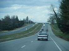
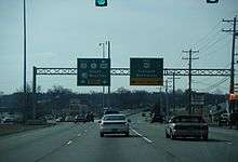
U.S. Route 13 (US 13) is a U.S. highway running from Fayetteville, North Carolina north to Morrisville, Pennsylvania. In the U.S. state of Delaware, the route runs for 103.33 mi (166.29 km). It traverses the entire length of the state from the Maryland state line in Delmar, Sussex County to the Pennsylvania state line in Claymont, New Castle County. US 13 connects many important cities and towns in Delaware, including Seaford, Dover, and Wilmington. The entire length of US 13 in Delaware is a multilane divided highway with the exceptions of the segment through Wilmington and parts of Philadelphia Pike in Claymont. Between the Maryland border and Dover, US 13 serves as one of the main north-south routes across the Delmarva Peninsula. From Dover north to the Wilmington area, the route is followed by the limited-access Delaware Route 1 (DE 1) toll road, which crosses the route several times and has multiple interchanges with it. US 13 bypasses downtown Wilmington to the east before it heads northeast of the city parallel to Interstate 495 (I-495) and the Delaware River to Claymont.
The portion of US 13 between Delmar and Dover was constructed as a state highway during the 1920s. Between Dover and Wilmington, the route was built as part of the cross-state DuPont Highway, which was completed in 1923 and improved transportation between northern and southern Delaware. North of Wilmington, what would become US 13 was originally built as the Philadelphia Pike in the 1820s and improved to a state highway by 1920. US 13 was designated through Delaware when the U.S. Highway System was created in 1926. The route was widened into a divided highway between Dover and Wilmington in the 1930s and between Delmar and Dover in the 1950s. US 13 was routed to bypass Dover in the 1950s. In 1970, US 13 was moved to its current alignment between Wilmington and Claymont on a bypass built in the 1930s. The portion of US 13 between Dover and Wilmington saw heavy traffic heading to the Delaware Beaches in the summer, which led to the construction of a freeway "Relief Route". This freeway was built as DE 1, which was completed in 2003. The construction of DE 1 necessitated the realignment of US 13 in two places.
Route description
Sussex County
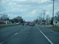
US 13 enters Delaware from Maryland in the town of Delmar in Sussex County. At the state line, the route intersects DE/MD 54, which follows the state line for several miles. US 13 continues north from the DE/MD 54 intersection on four-lane divided Sussex Highway, passing businesses. The route heads to the east of US 13 Dragway and Delaware International Speedway before leaving Delmar and running through wooded areas with some farm fields and development. The road crosses DE 30 and continues through a mix of farmland and woodland before it reaches Laurel. Here, US 13 heads past a few businesses and comes to an intersection with DE 24. Following this, the route crosses Broad Creek to the east of Records Pond and curves northwest. The road passes farm fields before it intersects the western terminus of US 9. Past this intersection, US 13 leaves Laurel and runs through farms and woods with occasional development. The route heads north again and comes to an intersection with DE 20 to the east of Blades, at which point DE 20 turns north for a concurrency with US 13. The road crosses the Nanticoke River and heads into Seaford, where it passes businesses prior to heading across Williams Pond. Past this, DE 20 splits from US 13 by heading to the west, while US 13 continues north through commercial areas.[3][4]
US 13 leaves Seaford and continues into rural areas with some development along the road. Near Hearns Pond, the highway passes to the east of a residential development as Bridgeville Highway intersects the road. The road continues near housing subdivisions and businesses before it comes to the DE 18 intersection near Cannon. US 13 heads north past more farmland before it comes to an intersection south of Bridgeville where DE 404 heads to the southeast and US 13 Bus. and DE 404 Bus. head northwest into Bridgeville. At this point, US 13 becomes concurrent with DE 404 and the two routes pass through rural areas with some development to the east of Bridgeville. North of town, US 13 Bus. rejoins the road at an intersection only accessible from the southbound direction. A short distance later, DE 404 splits from US 13 by heading to the west. From here, the highway runs through a mix of farms and woods with some homes and businesses along the road. Upon reaching Greenwood, the travel lanes of US 13 split to include businesses in the median. In Greenwood, the route crosses DE 16/DE 36. Upon departing Greenwood, the median narrows and the road heads back into rural areas.[3][4]
Kent County
US 13 continues north into Kent County, where the name of the road changes to Dupont Highway. The road runs through a mix of woodland and farmland with some homes, passing to the east of the small town of Farmington. To the south of Harrington, the route intersects DE 14 Truck and becomes concurrent with that route. The road head into Harrington and runs through commercial areas, passing to the east of the Delaware State Fairgrounds, which is where the Delaware State Fair is held and the Harrington Raceway & Casino is located. US 13/DE 14 Truck crosses Norfolk Southern's Indian River Secondary railroad line, with the median widening to include businesses in it. US 13 intersects DE 14, where the truck route ends, and continues near more commercial establishments before the median narrows again. The route leaves Harrington and traverses more farmland before crossing the Murderkill River in a wooded area to the west of Killens Pond State Park. US 13 passes more farms before it reaches Felton, where it intersects DE 12 and runs near homes and businesses. After heading out of Felton, the highway passes through rural areas of development before coming to Canterbury. Here, US 13 intersects DE 15 and forms a short concurrency with that route before it splits to the northwest along US 13 Alt. The road traverses woodland before it comes to a junction with DE 10 Alt. to the east of Woodside.[3][4]

Following this, US 13 heads through a mix of farms and woods before suburban residential and commercial development increases as the highway approaches Camden. The route comes to an intersection with DE 10 in the eastern part of town. The road passes near homes and businesses before US 13 Alt. rejoins the route in the northern part of Camden. US 13 heads into Rodney Village, where another US 13 Alt. splits off to the northwest. US 13 enters Dover at the Webbs Lane intersection and comes to an at-grade intersection with the western terminus of the limited-access Puncheon Run Connector, which heads east to provide access to and from the northbound direction of the DE 1 toll road. Past this, the route runs northeast through business areas with some nearby homes, crossing South State Street. The road curves north and passes over the St. Jones River, heading past more commercial areas. US 13 intersects Martin Luther King Jr. Boulevard, which heads west to State Capitol Complex, a short distance before four-lane divided Bay Road merges into the northbound direction of US 13. Past Bay Road, US 13 widens to six lanes and heads northwest, crossing DE 8. The road curves north and then northwest again as it is lined with several businesses. North of Silver Lake, US 13 intersects the northern terminus of US 13 Alt. along with Leipsic Road east of the Delaware Agricultural Museum and Village. The highway runs between Dover International Speedway and Dover Downs to the northeast and Delaware State University to the southwest. The route passes to the southwest of Dover Mall and heads past more businesses before coming to an intersection with Scarborough Road, which heads northeast to an interchange with DE 1 and southwest to DE 15 in the western part of Dover.[3][4]
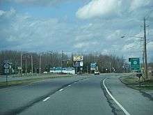
Past Scarborough Road, the road narrows back to four lanes and passes northeast of the Delaware Technical Community College Terry Campus. At the Denneys Road intersection, US 13 leaves Dover and continues past residential and commercial development. To the east of Cheswold, the route crosses DE 42 at Bishops Corner. Following this, the highway heads through a mix of residential development and farmland, curving north at Garrisons Lake along the Leipsic River. US 13 passes more development and rural areas as it continues north and enters Smyrna. Here, the name changes to Dupont Boulevard and it runs past businesses as it reaches a ramp to the DE 1 toll road to the east. The road bends to the northwest as it passes to the east of as residential neighborhood and intersects Smyrna-Leipsic Road. The route crosses Mill Creek to the east of Lake Como and heads through commercial areas in the eastern part of Smyrna. US 13 intersects DE 6, at which point that route turns north for a concurrency. In the northern part of town, DE 6 splits from US 13 by heading west along DE 300.[3][4]
New Castle County
US 13 crosses the Duck Creek into New Castle County, where it heads through rural residential and commercial development and leaves Smyrna. The name changes to Dupont Parkway and the road passes the Smyrna Rest Area before it comes to an interchange with DE 1, at which point the freeway crosses US 13. The highway continues northwest through wooded areas with some farm fields and homes. US 13 passes a northbound weigh station before it heads under the DE 1 freeway. The route curves north and comes to an intersection with the southern terminus of DE 71, which heads northwest to Townsend. A short distance past this intersection, the road passes under DE 1 again. The highway continues through woodland and development before it runs immediately to the east of DE 1 and passes near residential subdivisions. DE 1 curves northwest away from US 13, and US 13 crosses the Appoquinimink River and heads into residential areas.[3][4]
The route enters Odessa, where the median widens and the road curves to the northeast. In Odessa, US 13 is known as 5th Street northbound and 6th Street southbound in addition to Dupont Parkway. Through the town, the route passes homes with a few businesses, crossing DE 299. Upon leaving Odessa, the median narrows again and US 13 continues into rural areas along Dupont Parkway, passing under DE 1. The road curves north and crosses Drawyer Creek a short distance to the west of DE 1. The highway runs through a mix of farmland and residential subdivisions before it comes to an intersection with the southern terminus of DE 896 in Boyds Corner, where Pole Bridge Road heads east to an interchange with DE 1. Following this, US 13 passes under DE 1 again and runs through more farmland a short distance to the east of the Biddles Corner toll plaza on DE 1. As the highway approaches St. Georges, a partial interchange provides access to and from the northbound direction of DE 1.[3][4]
US 13 heads across the Chesapeake and Delaware Canal on the St. Georges Bridge, which is two lanes wide with bike lanes. Past the bridge, the name changes to Dupont Highway and the route becomes four lanes again as it runs through rural areas with some development before reaching an intersection with DE 72 and the southern terminus of DE 7 in the community of Wrangle Hill near Delaware City. Here, US 13 turns west to join DE 72 on four-lane divided Wrangle Hill Road while DE 7 continues north along Dupont Highway. A short distance later, the road comes to a diverging diamond interchange with DE 1, at which point US 13 splits from DE 72 and heads north along DE 1 on a six-lane freeway. The freeway runs through farmland and passes over Norfolk Southern's Reybold Running Track and DE 7 to the west of the Delaware City Refinery. US 13 and DE 1 continue concurrent on the freeway to Tybouts Corner, where DE 1 splits at an interchange to continue along the freeway and US 13 reverts to a four-lane divided surface road called Dupont Highway. Within the DE 1 interchange, US 13 has an at-grade intersection with the northern terminus of DE 71. A short distance later, the highway intersects Hamburg Road, where DE 9 Truck joins US 13. The road heads northeast through farmland with some businesses, passing to the east of the historic home Buena Vista, before continuing into suburban residential and commercial development. US 13 passes under Norfolk Southern's New Castle Secondary railroad line before US 40 merges into the northbound direction in State Road.[3][4]
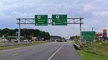
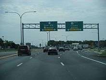
At this point, US 13 and US 40 continues northeast as an eight-lane highway. The road runs through commercial areas, coming to an intersection with DE 273 in Hares Corner. Past this intersection, US 13/US 40 passes between Wilmington Airport to the northwest and businesses to the southeast, reaching a cloverleaf interchange with the southern terminus of US 202 and DE 141 at the end of the airport property. Following this, the two routes narrow to six lanes, passing to the northwest of Wilmington University and heading through more commercial areas in Wilmington Manor before reaching an interchange with I-295 (Delaware Turnpike), where US 40 splits from US 13 by heading east along I-295 towards the Delaware Memorial Bridge. This interchange also provides access from US 13 to I-95 and I-495 via I-295. Past the I-295/US 40 interchange, the highway heads through more commercial areas in Minquadale. US 13 reaches an interchange with I-495, with access to and from the northbound lanes of I-495 and from the southbound lanes of I-495. Immediately after this interchange, US 13 Bus. splits from US 13 to head into downtown Wilmington.[3][4]
From here, US 13 enters Wilmington and heads northeast along four-lane undivided South Heald Street. The road curves north into industrial areas and reaches a southbound ramp providing access to DE 9 a short distance to the east. After this, the road passes over Norfolk Southern's Shellpot Branch railroad line on a bridge and intersects DE 9. Here, US 13 becomes concurrent with DE 9 and splits into a one-way pair following New Castle Avenue northbound and South Heald Street southbound, each carrying two lanes of traffic. The one-way streets traverse areas of urban rowhomes and businesses and merge on four-lane undivided South Heald Street. Along this stretch, US 13/DE 9 intersect the northern terminus of DE 9A. Following this, the road becomes East 4th Street and heads north-northwest across the Christina River on a drawbridge. US 13/DE 9 curves northwest and passes under Amtrak's Northeast Corridor railroad line, at which point northbound US 13 splits from the road by heading northeast on North Church Street at the crossing of a railroad spur. A block later, the concurrency between DE 9 and southbound US 13 ends at the point where southbound US 13 joins the road from North Spruce Street. US 13 continues along this one-way pair, carrying two lanes in each direction, through the eastern part of the city as it passes more urban development, heading to the west of Old Swedes Church on North Church Street. At East 11th Street, US 13 becomes two-way again and heads northeast over the Brandywine Creek on four-lane undivided Northeast Boulevard. Past the bridge, the route continues through urban residential and business areas as a four-lane divided highway.[3][4]
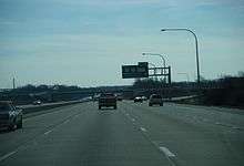
US 13 leaves the city limits of Wilmington and heads east through commercial areas, with the median turning into a center left-turn lane. The name changes to Governor Printz Boulevard and the route heads into Edgemoor. Here, it widens back into a divided highway and passes between a shopping center to the north and Amtrak's Northeast Corridor to the south before intersecting DE 3, which provides access to I-495. Immediately after, US 13 has a ramp to northbound I-495 and a ramp from southbound I-495. From this point, the route heads between suburban residential areas along with a few businesses to the northwest and I-495 to the southeast, with the Northeast Corridor and the Delaware River on the other side of I-495. US 13 passes through Holly Oak before it reaches Claymont. Here, the route turns northwest away from I-495 and the Delaware River, passing homes before it intersects the northern terminus of US 13 Bus. Here, US 13 turns northeast onto four-lane undivided Philadelphia Pike and runs through commercial areas, passing to the northwest of Archmere Academy. The route has an interchange with I-495, at which point it becomes a divided highway, before becoming undivided again as it enters industrial areas. The road passes under an abandoned railroad line in this area. US 13 becomes a divided highway and reaches the eastern terminus of DE 92 south of the Robinson House. Past this, the road runs under the Northeast Corridor and becomes undivided as it heads into Sunoco's Marcus Hook Industrial Complex. Here, US 13 continues into Pennsylvania, where it heads through more of the industrial complex in the borough of Marcus Hook.[3][4]
Portions of US 13 in Delaware are designated as part of the Delaware Byways system. The section between DE 20 and Swain Road north of Seaford is part of the Nanticoke Heritage Byway. The segments between US 13 Alt. in Dover and Commerce Street in Smyrna, DE 9 (New Castle Avenue) and A Street in Wilmington, and Swedes Landing Road and DE 9 (4th Street) are part of the Harriet Tubman Underground Railroad Byway.[5][6] US 13 in Delaware has an annual average daily traffic count ranging from a high of 77,774 vehicles at the US 202/DE 141 interchange to a low of 3,753 vehicles at the US 13 Bus. intersection in Claymont.[1] US 13 in Delaware is a part of the National Highway System between the Maryland border in Delmar and the Puncheon Run Connector in Dover, from DE 1 in Wrangle Hill to I-495 in Minquadale, and between DE 92 and the Pennsylvania border in Claymont.[7] US 13 in Delaware is designated a Blue Star Memorial Highway honoring those who have served in the United States Armed Forces; Blue Star Memorial Highway markers are located at the Smyrna Rest Area and in Seaford.[8]
Rest area
The Smyrna Rest Area is a rest area located along US 13 north of Smyrna, south of an interchange with DE 1.[3][4] The rest area has restrooms, vending machines, a payphone, a visitor center, meeting room, picnic area, and a pavilion. Also located at the Smyrna Rest Area is the Delaware Highway Memorial Garden, which consists of a path with bricks bearing the names of people who died along roads in Delaware.[9] The path serves as an alternative to roadside memorials, which are illegal in Delaware for safety reasons.[10] The site of the Smyrna Rest Area was originally established as a picnic area in 1937 and was expanded over the years. The current rest area building opened on November 18, 1991.[9]
History
Predecessor roads
Before the numbering of the U.S. Highway System, there were many roads that ran north-south across Delaware along the rough alignment of the present route. In the 18th century, the King's Highway ran between Dover and Wilmington; south of Dover it continued southeast toward Lewes. By the later part of that century, a post road ran from Horn Town, Virginia north across the Delmarva Peninsula. The road ran between Dover and Wilmington, where it continued northeast to the Pennsylvania border and headed toward Philadelphia.[11] In 1813, the Wilmington and Philadelphia Turnpike Company was chartered to build a turnpike running from the Brandywine Bridge in Wilmington northeast to the Pennsylvania border, where the roadway would continue to Philadelphia. A 3.75-mile (6.04 km) long portion of the road near Wilmington was finished in 1816 with the remainder completed in 1823.[12] With the Federal Aid Road Act of 1916, the Philadelphia Pike was to be improved by the state.[13] The Philadelphia Pike was upgraded to a state highway by 1920.[14]
Construction of state highways
The portion of US 13 between Dover and Wilmington was built as part of the DuPont Highway. The DuPont Highway was proposed in 1908 by Thomas Coleman DuPont as a modern road that was to run from Selbyville north to Wilmington as part of a philanthropic measure. This roadway was planned to improve travel and bring economic development to Kent and Sussex counties. The DuPont Highway was to be modeled after the great boulevards of Europe and was to have a 200-foot (61 m) wide right-of-way consisting of a 40-foot (12 m) wide roadway for automobiles flanked by dual trolley lines, 30-foot (9.1 m) wide roadways for heavy vehicles, 15-foot (4.6 m) wide unpaved roadways for horses, and sidewalks. Utilities were to be buried underground below the horse roadways. The highway was also to include agricultural experimental stations and monuments for future surveying. Trolley revenues would help pay for the construction of the roadway. After portions of the DuPont Highway were built, these portions were planned to be turned over to the state at no charge.[15]
In 1911, the Coleman DuPont Road, Inc. was established and construction on the highway began.[16] By 1912, construction was interrupted by litigation challenging both the constitutionality of the law establishing the road building corporation and the need for DuPont to acquire such a large right-of-way.[17] DuPont would narrow the proposed right-of-way to 100 feet (30 m) in order to compromise with opponents of the highway in addition to offering landowers whose properties were affected by the highway five times the assessed value of the land five years after the highway was completed.[16] The DuPont Highway would end up being built on a 60-foot (18 m) alignment with a 32-foot (9.8 m) wide roadway.[18] The length of the DuPont Highway between Selbyville and Wilmington was completed in 1923, with one of the final portions to be completed at the Drawyers Creek north of Odessa. A ceremony marking the completion of the highway was held in Dover on July 2, 1924.[19] The completion of the DuPont Highway improved transportation between northern and southern Delaware and would lead to the expansion of state highways in Delaware.[20]
Work also took place on constructing a state highway running from the Maryland border in Delmar north to Dover. By 1920, most of the highway in Sussex County had been completed with the exceptions of a portion north of Laurel and a portion north of Bridgeville. In Kent County, the state highway was completed between the Sussex County border and Farmington. The portion between Farmington and Woodside was under contract by 1920 while the portion between Woodside and Dover was under proposal.[14] By 1924, the entire length of the state highway between Delmar and Dover was completed.[21] A bascule bridge over the Nanticoke River in Seaford was completed in March 1925.[22] In 1925, recommendations were made to improve the South Market Street Causeway over the Christina River in Wilmington, which included a new bridge over the river.[22] Construction on the drawbridge began in May 1926.[23] In 1927, the new drawbridge, the four-lane South Market Street Bridge, opened over the Christina River on South Market Street in Wilmington, replacing a previous drawbridge that was only two lanes wide.[24]
With the proposal of the U.S. Highway System in 1925, US 13 was planned as one of three routes to pass through Delaware, running from the Maryland border in Delmar via Dover and Wilmington to the Pennsylvania border in Claymont.[22] US 13 was designated on November 11, 1926.[2] US 13 followed the state highway between the Maryland border in Delmar and Dover, the DuPont Highway between Dover and Wilmington, Market Street through Wilmington, and the Philadelphia Pike between Wilmington and the Pennsylvania border in Claymont.[25] Between the Maryland border and US 40 (now DE 273) in Hares Corner, US 13 was part of the Ocean Highway, an Atlantic coastal highway stretching from Jacksonville, Florida to New Brunswick, New Jersey that served as the quickest route between the New York City area and Florida before the introduction of the Interstate Highway System. US 13 is one of only four U.S. Routes that form the highway and Delaware was one of the states that participated in the highway's formation.[26]
Widening and improvements
The portion of the DuPont Highway between Dover and Wilmington saw increased traffic from connecting interstate roads and summer travelers, prompting the Delaware State Highway Department to consider widening the highway in 1925.[22] A year later, the department suggested the Philadelphia Pike be widened along with the DuPont Highway between State Road and Wilmington. This proposal included widening the bridge over a Pennsylvania Railroad line (now abandoned) in Farnhurst that was built in 1902.[23] US 13 was widened to four lanes between State Road and Wilmington and between Shellpot Park and Bellevue Quarry along the Philadelphia Pike in 1927.[19][24] The same year, the department recommended expanding the road between St. Georges and State Road into a divided highway.[24] In 1928, the widening of Philadelphia Pike was completed.[27] In 1929, the portion of the highway between St. Georges and State Road was widened into a divided highway.[19][28] The department recommended widening the part of US 13 between Delmar and Dover in 1930 as it was one of the main routes across the Delmarva Peninsula. In addition, plans began to widen the route into a divided highway between Drawyers Creek north of Odessa and St. Georges.[29] The divided highway portion of US 13 between Drawyers Creek and St. Georges was completed in September 1931. Also, work on widening the route to a divided highway between Fieldsboro and Drawyers Creek and from State Road to Wilmington began. The same year, recommendations began to extend the divided highway portion of US 13 south to Dover.[30]
In 1932, the portion of US 13 between Felton and Dover was widened. In addition, the divided highway between Reynolds' Corner and Drawyers Creek was completed in September and work began on widening US 13 into a divided highway between Smyrna and Reynolds' Corner. The completion of the divided highway between State Road and Wilmington was slated for summer 1933. This widening project included widening the bridge over the Pennsylvania Railroad in Farnhurst.[31] In 1933, the divided highway portion of US 13 was extended south to Smyrna while the portion between Dover and Smyrna was under contract. The same year, the remainder of US 13 south of Dover was widened.[32] The divided highway portion between Dover and Smyrna was finished on September 22, 1934, marking the completion of widening US 13 between Dover and Wilmington into a divided highway.[33] At the time, US 13 between Dover and Wilmington was the best superhighway and the longest stretch of divided highway in the world.[34]
In 1937, the narrow crossing of Silver Lake along State Street in Dover was replaced with a new, wider bridge.[35] On July 18, 1938, the grade crossing with the Reading Railroad (now abandoned) and the Pennsylvania Railroad (now Norfolk Southern's Shellpot Branch) on South Market Street in Wilmington was eliminated with the opening of a bridge over the railroad tracks.[36] On January 10, 1939, the S.S. Waukegan struck and destroyed the bridge carrying US 13 over the Chesapeake and Delaware Canal in St. Georges, killing the bridge tender.[37][38] The destruction of the bridge led to detours for US 13 along smaller roads. Plans were made to construct a high-level crossing of the canal.[39] Work on acquiring the right-of-way for the new bridge took place in 1940.[40] Construction of the bridge took place in 1941.[41] The replacement steel truss St. Georges Bridge over the canal opened on January 31, 1942. This bridge was the first four-lane crossing of the Chesapeake and Delaware Canal.[38]
In 1950, recommendations were made by the chief engineer of the DSHD to widen US 13 into a divided highway between Delmar and Dover.[42] The divided highway was completed from Hearne's Mill north to just south of Greenwood in 1952. The highway bypassed Bridgeville to the east, rerouting US 13 off Main Street in that town.[43][44] In 1953, the divided highway portion of US 13 was built around Seaford.[45] The divided highway was completed between the Maryland border in Delmar and Hearne's Mill and from Harrington to Dover in 1954.[46][47][48] The new alignment of US 13 between Delmar and Hearne's Mill was built further to the east, with the former two-lane alignment running through Delmar, Laurel, Blades, and Seaford becoming US 13 Alt. The bypassed two-lane alignment between Canterbury and Camden was also designated as US 13 Alt.[48] In 1956, work was underway in widening US 13 into a divided highway between south of Greenwood and Harrington.[49] The widening of this portion of US 13 was finished in 1957, completing widening US 13 to a divided highway between Delmar and Wilmington.[34] By 1957, the former alignment of US 13 in Bridgeville along Main Street was designated US 13 Alt. (now US 13 Bus.) while US 13 Alt. between Delmar and Hearne's Mill was decommissioned.[50]
The alignment of US 13 in Wilmington has been shifted multiple times to improve traffic flow. By 1932, US 13 was split into the one-way pair of French Street northbound and Market Street southbound in the downtown area.[51] Both directions of the route was shifted to use French Street by 1936.[52] In 1952, a new bridge over the Christina River, the Walnut Street Bridge, was proposed to link Walnut Street in the downtown area with the Dupont Parkway section of US 13 south of the city. Under this plan, the Walnut Street Bridge would be used for northbound traffic while the South Market Street Bridge would be used for southbound traffic.[43] By this time, US 13 was routed on a one-way pair in the downtown area, using Walnut Street northbound and French Street southbound.[44] A year later, the Walnut Street Bridge project was under contract.[45] Construction on the project began in 1955.[47] Construction of the Walnut Street Extension, which included the drawbridge, approach roads, and a new bridge under the Pennsylvania Railroad (now Amtrak's Northeast Corridor), was completed in 1957. As a result, US 13 was split into the one-way pair of South Walnut Street northbound and South Market Street southbound between the south end of the city and downtown.[50][53]
Construction on an interchange with the Delaware Memorial Bridge approach at Farnhurst began on July 12, 1950.[54] On August 16, 1951, the Delaware Memorial Bridge opened to traffic.[55] US 40 was rerouted to use the new Delaware Memorial Bridge to cross the Delaware River, being realigned to follow US 13 north from Hares Corner and Farnhurst.[44] Upgrades to the Farnhurst interchange were finished in July 1961 that provided a connection to the Delaware Turnpike that opened on November 14, 1963.[56] In 1954, there were plans to replace the intersection with DE 41/DE 141 in Basin Corner with a modified cloverleaf interchange in an effort to reduce traffic congestion.[46] Construction on the interchange began in September of that year.[47] The interchange between US 13/US 40 and DE 41/DE 141 was completed in 1956.[49][50] Plans were made to widen the Philadelphia Pike to a four-lane road between Bellevue Road and Claymont in 1954.[46] The widening project was completed in 1956.[49]
In 1961, the concrete bridge carrying southbound US 13 over the Drawyers Creek north of Odessa was closed due to deterioration from the tidal waters of the creek, with plans for a new bridge made.[57] Two years later, the southbound lanes were moved to the new bridge over the creek, following a straighter alignment.[58]
Bypasses of Dover and Wilmington
Plans were made in 1918 for a bypass to the east of downtown Wilmington for through traffic, avoiding Market Street. The bypass would utilize Heald Street, Church and Spruce streets, and would construct Northeast Boulevard heading northeast from the Eleventh Street Bridge.[32] In 1934, the state highway department began work on this bypass. Among them was the improvement of Church and Spruce streets by widening and paving them. In addition, the Northeast Boulevard was built, running from the Eleventh Street Bridge over the Brandywine Creek northeast to Edgemoor Road in Edgemoor. Construction began this year on an extension of the road northeast to Holly Oak.[33] The following year, the Northeast Boulevard was completed between Edgemoor and Holly Oak. The construction of the Northeast Boulevard led to increased residential and industrial development along the route.[59] In the later part of 1936, construction began on the portion of the Wilmington bypass along Heald Street along with Northeast Boulevard (renamed Governor Printz Boulevard) between Holly Oak and Claymont. Both of these projects were finished in fall 1937 and completed a bypass of the portion of US 13 through Wilmington.[35] This bypass route was designated as US 13 Alt. in 1939.[60] In 1939, construction was authorized to widen Governor Printz Boulevard into a divided highway.[39] The widening of the road to a divided highway was completed in 1940.[40] In 1942, a bridge was completed on Heald Street that eliminated the grade crossing with a Pennsylvania Railroad line.[61] US 13 Alt. was widened to four lanes between 11th Street and 30th Street in Wilmington in 1956.[49] In 1970, US 13 was rerouted to bypass downtown Wilmington on the US 13 Alt. alignment while US 13 Bus. was designated onto the former US 13 alignment from the southern border of Wilmington to Claymont.[62]
In 1935, the portion of present-day US 13 between Bay Road and North State Street was built as part of a realigned US 113.[59] In 1950, a contract was awarded to build a bypass of Dover, with construction soon following.[54] The divided highway bypass for US 13 to the east of downtown Dover was completed in April 1952, rerouting US 13 off Governors Avenue and State Street through Dover.[43][44] This bypass route would run concurrent with US 113 between Bay Road and North State Street.[44] The former alignment of the route through Dover along Governors Avenue and North State Street was designated US 13 Alt. by 1959.[63] The US 113 concurrency was removed from US 13 in 1966; this was approved by the American Association of State Highway and Transportation Officials (AASHTO) in 1974 along with the rerouting of US 113 Alt. to follow the route between South State Street and US 113.[64][65] US 113 Alt. was removed from US 13 in 2004 as part of the truncation of US 113 from Dover to Milford.[66]
Relief Route
Between 1958 and 1971, studies were conducted for a bypass of the segment of US 13 through Dover along with a connector between Dover and Frederica.[67] The proposed routing began at US 113 and DE 12 north of Frederica and continued northwest to Woodside, where it was planned to cross US 13. From here, the bypass was to run to the west of Dover and head north to its terminus at US 13 north of Cheswold.[68] As part of planning of the Dover Bypass, an archaeological survey had to be conducted along part of the proposed route between 1972 and 1975. By 1976, construction of the Dover Bypass was postponed indefinitely.[69] From 1971 to 1978, a north-south extension of the Delaware Turnpike between Wilmington and Dover was studied. In 1983, studies began for a "Relief Route" of US 13 between Dover and Wilmington.[67] The new highway was proposed in order to relieve US 13 of traffic heading to the Delaware Beaches in the summer.[70] Prior to the beginning of construction, an archaeological survey was conducted along the proposed route of the freeway in 1986.[71] The same year, plans were unveiled for the route, which would begin at US 113 south of Dover and head north to US 13 in Tybouts Corner. The Relief Route would cross US 13 several times, passing to the east of Dover and Smyrna and to the west of Odessa.[70] The US 13 Relief Route would be designated DE 1 in 1988, keeping US 13 on its original alignment. DE 1 was extended north from Milford to Tybouts Corner in 1988, following US 13 between Dover and Tybouts Corner.[72][73]
As part of building DE 1, the Puncheon Run Connector was proposed to provide a connection between DE 1 and US 13 in the southern part of Dover. The original plan for the connector in 1987 called for upgrading US 13 into a freeway between Woodside and Dover, with interchanges at DE 10 in Camden and Webbs Lane in Dover. In 1992, plans for the freeway upgrade to US 13 between Woodside and Dover were dropped.[74] On December 21, 1993, DE 1 was completed between US 113 at Dover Air Force Base and US 13 north of Smyrna, with DE 1 rerouted off US 13 between Dover and Smyrna.[75][76]
In December 1995, the section of DE 1 between US 13 in St. Georges and US 13 in Tybouts Corner opened, which included the Chesapeake and Delaware Canal Bridge.[77][78] Following the completion of this segment, DE 1 was rerouted off the surface alignment of US 13 that crossed the St. Georges Bridge.[78] Subsequently, US 13 was rerouted to follow the new DE 1 between the DE 72 interchange and Tybouts Corner.[78][79] Construction of the new DE 1 had severed US 13 south of Tybouts Corner, with part of the former alignment north of the DE 7 intersection becoming a two-lane road while the section south of there became an extended DE 7 to the intersection with US 13 and DE 72.[78] In building DE 1 across the Chesapeake and Delaware Canal, there were initially plans to demolish the aging St. Georges Bridge that carried US 13 over the canal. The plan drew concerns from residents in St. Georges who feared the community would be split in half. The St. Georges Bridge was instead kept and was refurbished. A southbound exit and northbound entrance at US 13 south of the Cheaspeake and Delaware Canal Bridge along DE 1 was built as required by federal legislation that gave the state $115 million toward construction of the new canal bridge.[80]
The segment of DE 1 between US 13 south of Odessa and US 13 in St. Georges opened in November 1999.[67][81] DE 1 was subsequently rerouted off US 13 between those two points.[81] The construction of the final segment of DE 1 between Smyrna and Odessa resulted in a portion of US 13 south of Odessa being shifted further east as DE 1 would be built on top of the road. A service road would serve properties on the southbound side of US 13.[82] In October 2001, northbound US 13 was realigned to the new alignment south of Odessa in order to build DE 1 in that area.[83] In May 2002, US 13 was shifted to a new southbound alignment south of Odessa, with the former portion of the route in that area becoming a service road known as Harris Road.[84][85] The final section of DE 1 between Smyrna and Odessa opened on May 21, 2003.[86] As a result, DE 1 was moved off US 13 between Smyrna and Odessa.[87]
Major intersections
| County | Location | mi[1] | km | Destinations | Notes |
|---|---|---|---|---|---|
| Sussex | Delmar | 0.00 | 0.00 | Maryland state line | |
| | 3.21 | 5.17 | |||
| Laurel | 6.88 | 11.07 | |||
| 8.01 | 12.89 | ||||
| Blades | 13.20 | 21.24 | South end of DE 20 concurrency | ||
| Seaford | 14.04 | 22.60 | North end of DE 20 concurrency | ||
| Cannon | 17.30 | 27.84 | |||
| Bridgeville | 18.92 | 30.45 | South end of DE 404 concurrency | ||
| Right-in/right-out intersection southbound | |||||
| North end of DE 404 concurrency | |||||
| Greenwood | 24.70 | 39.75 | |||
| Kent | Harrington | South end of DE 14 Truck concurrency | |||
| 32.92 | 52.98 | North end of DE 14 Truck concurrency | |||
| Felton | 38.68 | 62.25 | |||
| Canterbury | 41.42 | 66.66 | Brief concurrency with DE 15 | ||
| Woodside | |||||
| Camden | 46.25 | 74.43 | |||
| 46.93 | 75.53 | ||||
| Rodney Village | 47.28 | 76.09 | |||
| Dover | 47.85 | 77.01 | No southbound access | ||
| 49.86 | 80.24 | Former US 113 | |||
| 50.16 | 80.72 | ||||
| 51.61 | 83.06 | ||||
| DE 1 exit 104 | |||||
| Cheswold | 55.57 | 89.43 | |||
| Smyrna | DE 1 exit 114 | ||||
| 61.36 | 98.75 | South end of DE 6 concurrency | |||
| 61.65 | 99.22 | North end of DE 6 concurrency | |||
| New Castle | 64.18 | 103.29 | DE 1 exit 119 | ||
| Townsend | 67.65 | 108.87 | |||
| Odessa | 72.97 | 117.43 | |||
| Boyds Corner | 76.12 | 122.50 | |||
| St. Georges | DE 1 exit 148 | ||||
| Chesapeake and Delaware Canal | St. Georges Bridge | ||||
| Wrangle Hill | 81.65 | 131.40 | South end of DE 72 concurrency | ||
| 81.87 | 131.76 | DE 1 exit 152; north end of DE 72 concurrency, south end of DE 1 concurrency | |||
| Tybouts Corner | 84.06 | 135.28 | DE 1 exit 156; north end of DE 1 concurrency | ||
| 84.70 | 136.31 | ||||
| South end of DE 9 Truck concurrency | |||||
| State Road | 87.54 | 140.88 | South end of US 40 concurrency | ||
| Hares Corner | 88.58 | 142.56 | North end of DE 9 Truck concurrency | ||
| Wilmington Manor | 89.81 | 144.54 | US 202/DE 141 exit 1 | ||
| 91.10 | 146.61 | Interchange; north end of US 40 concurrency | |||
| Interchange | |||||
| Minquadale | 92.92 | 149.54 | I-495 exit 1, no ramp from I-495 northbound to US 13 southbound or from US 13 to I-495 southbound; there is a ramp from US 13 Business southbound to I-495 southbound. | ||
| Wilmington | 92.97 | 149.62 | |||
| 94.22 | 151.63 | South end of DE 9 concurrency | |||
| 94.42 | 151.95 | ||||
| 94.72 | 152.44 | North end of DE 9 concurrency | |||
| Edgemoor | 97.22 | 156.46 | |||
| I-495 exit 4A | |||||
| Claymont | 101.67 | 163.62 | |||
| 102.26 | 164.57 | I-495 exit 5 | |||
| 102.91 | 165.62 | ||||
| 103.33 | 166.29 | Pennsylvania state line | |||
1.000 mi = 1.609 km; 1.000 km = 0.621 mi
| |||||
See also
 U.S. Roads portal
 Delaware portal
References
- 1 2 3 Staff (2011). "Traffic Count and Mileage Report: Interstate, Delaware, and US Routes" (PDF). Delaware Department of Transportation. Retrieved May 17, 2012.
- 1 2 United States System of Highways Adopted for Uniform Marking by the American Association of State Highway Officials (Map). 1:7,000,000. Cartography by U.S. Geological Survey. Bureau of Public Roads. November 11, 1926. OCLC 32889555. Retrieved April 27, 2009.
- 1 2 3 4 5 6 7 8 9 10 11 12 Delaware Department of Transportation (2008). Delaware Official Transportation Map (PDF) (Map). Dover: Delaware Department of Transportation. Retrieved November 24, 2015.
- 1 2 3 4 5 6 7 8 9 10 11 12 Google (October 20, 2014). "overview of U.S. Route 13 in Delaware" (Map). Google Maps. Google. Retrieved October 20, 2014.
- ↑ "Nanticoke Heritage Byway". Delaware Department of Transportation. Retrieved January 7, 2012.
- ↑ "Harriet Tubman Underground Railroad Byway". Delaware Department of Transportation. Retrieved January 7, 2012.
- ↑ National Highway System: Delaware (PDF) (Map). Federal Highway Administration. 2010. Retrieved February 10, 2012.
- ↑ "History and Current Status of: The Blue Star Memorial Highways". National Remember our Troops Campaign. Archived from the original on January 6, 2015. Retrieved November 3, 2013.
- 1 2 "Delaware Rest Area Locations - Smyrna". Delaware Department of Transportation. Retrieved March 7, 2015.
- ↑ "Community Programs and Services - Delaware Highway Memorial Garden". Delaware Department of Transportation. Retrieved March 7, 2015.
- ↑ Milner, p. 4.
- ↑ Scharf, John Thomas. History of Delaware : 1609-1888, Volume 1. Philadelphia: L.J. Richards & Co. p. 418. Retrieved January 6, 2012.
- ↑ Amott, David; Gollannek, Eric; Ames, David (May 2006). "A History of Delaware Roads and A Guide to Researching Them" (PDF). University of Delaware. Retrieved January 30, 2014.
- 1 2 Delaware State Highway Department (1920). Official Road Map (PDF) (Map). Dover: Delaware State Highway Department. Retrieved November 24, 2015.
- ↑ Milner, pp. 6, 8.
- 1 2 Milner, p. 10.
- ↑ Milner, p. 13.
- ↑ Milner, p. 14.
- 1 2 3 Milner, p. 16.
- ↑ Milner, p. 26
- ↑ Delaware State Highway Department (1924). Official Road Map (PDF) (Map). Dover: Delaware State Highway Department. Retrieved November 24, 2015.
- 1 2 3 4 "Annual Report of the State Highway Department" (PDF) (1925 ed.). Dover, Delaware: Delaware State Highway Department. December 31, 1925: 4, 17, 23, 25. Retrieved January 30, 2014.
- 1 2 "Delaware State Highway Department Report" (PDF) (1926 ed.). Dover, Delaware: Delaware State Highway Department. December 31, 1926: 7, 38. Retrieved November 9, 2014.
- 1 2 3 "Annual Report of the State Highway Department" (PDF) (1927 ed.). Dover, Delaware: Delaware State Highway Department. December 31, 1927: 7–8, 28. Retrieved January 30, 2014.
- ↑ Delaware State Highway Department (1931). Official Road Map of the State of Delaware (PDF) (Map). Dover: Delaware State Highway Department. Retrieved November 24, 2015.
- ↑ Federal Writers' Project (1938). The ocean highway: New Brunswick, New Jersey to Jacksonville, Florida. American Guide Series. New York: Modern Age Books. Retrieved October 21, 2014.
- ↑ "Annual Report of the State Highway Department" (PDF) (1928 ed.). Dover, Delaware: Delaware State Highway Department. December 31, 1928: 12. Retrieved January 30, 2014.
- ↑ Milner, p. 11.
- ↑ "Annual Report of the State Highway Department" (PDF) (1930 ed.). Dover, Delaware: Delaware State Highway Department. December 31, 1930: 35, 41. Retrieved January 30, 2014.
- ↑ "Annual Report of the State Highway Department" (PDF) (1931 ed.). Dover, Delaware: Delaware State Highway Department. December 31, 1931: 41. Retrieved January 30, 2014.
- ↑ "Annual Report of the State Highway Department" (PDF) (1932 ed.). Dover, Delaware: Delaware State Highway Department. December 31, 1932: 31, 33. Retrieved January 30, 2014.
- 1 2 "Annual Report of the State Highway Department" (PDF) (1933 ed.). Dover, Delaware: Delaware State Highway Department. January 1, 1934: 25, 36, 38. Retrieved January 30, 2014.
- 1 2 "Annual Report of the State Highway Department" (PDF) (1934 ed.). Dover, Delaware: Delaware State Highway Department. January 1, 1935: 33, 35. Retrieved January 30, 2014.
- 1 2 "Delaware State Highway Department Annual Report" (PDF) (1958 ed.). Dover, Delaware: Delaware State Highway Department. 1958: 4–13. Retrieved November 13, 2014.
- 1 2 "Annual Report of the State Highway Department" (PDF) (1937 ed.). Dover, Delaware: Delaware State Highway Department. January 1, 1938: 17, 19. Retrieved January 31, 2014.
- ↑ "Annual Report of the State Highway Department" (PDF) (1938 ed.). Dover, Delaware: Delaware State Highway Department. January 1, 1939: 19. Retrieved November 13, 2014.
- ↑ Martin, Roger (January 10, 2011). "Today in Delaware History: Jan. 10". Middletown Transcript. Retrieved January 31, 2014.
- 1 2 "First Dedicated Bikes Lanes over the C & D Canal Cross St. Georges Bridge". Governor Jack Markell. Retrieved January 31, 2014.
- 1 2 "Annual Report of the State Highway Department" (PDF) (1939 ed.). Dover, Delaware: Delaware State Highway Department. January 1, 1940: 29, 39. Retrieved January 31, 2014.
- 1 2 "Annual Report of the State Highway Department" (PDF) (1940 ed.). Dover, Delaware: Delaware State Highway Department. January 1, 1941: 12, 15. Retrieved January 31, 2014.
- ↑ "Philadelphia District Civil Works - Chesapeake and Delaware Canal". United States Army Corps of Engineers. Retrieved January 31, 2014.
- ↑ "Report of the State Highway Department" (PDF) (1950 ed.). Dover, Delaware: Delaware State Highway Department. July 1, 1950: 64. Retrieved February 5, 2014.
- 1 2 3 "Report of the State Highway Department" (PDF) (1952 ed.). Dover, Delaware: Delaware State Highway Department. July 1, 1952: 27, 30, 34. Retrieved February 5, 2014.
- 1 2 3 4 5 Delaware State Highway Department (1952). Official Highway Map of Delaware (PDF) (Map) (1952–53 ed.). Dover: Delaware State Highway Department. Retrieved November 24, 2015.
- 1 2 "Report of the State Highway Department" (PDF) (1953 ed.). Dover, Delaware: Delaware State Highway Department. July 1, 1953: 20, 49. Retrieved February 5, 2014.
- 1 2 3 "Report of the State Highway Department" (PDF) (1954 ed.). Dover, Delaware: Delaware State Highway Department. July 1, 1954: 12, 17, 19, 41. Retrieved February 5, 2014.
- 1 2 3 "Report of the State Highway Department" (PDF) (1955 ed.). Dover, Delaware: Delaware State Highway Department. July 1, 1955: 15, 19, 57. Retrieved February 5, 2014.
- 1 2 Delaware State Highway Department (1954). Official Highway Map of Delaware (PDF) (Map) (1954–55 ed.). Dover: Delaware State Highway Department. Retrieved November 24, 2015.
- 1 2 3 4 "Report of the State Highway Department" (PDF) (1956 ed.). Dover, Delaware: Delaware State Highway Department. July 1, 1956: 11, 14, 19, 54. Retrieved February 6, 2014.
- 1 2 3 Delaware State Highway Department (1957). Official Highway Map of Delaware (PDF) (Map) (1957–58 ed.). Dover: Delaware State Highway Department. Retrieved November 24, 2015.
- ↑ Delaware State Highway Department (1932). Official Road Map (PDF) (Map). Dover: Delaware State Highway Department. Retrieved November 24, 2015.
- ↑ Delaware State Highway Department; The National Survey Co. (1936). Official Road Map of the State of Delaware (PDF) (Map) (1936–37 ed.). Dover: Delaware State Highway Department. Retrieved November 24, 2015.
- ↑ "Report of the State Highway Department" (PDF) (1957 ed.). Dover, Delaware: Delaware State Highway Department. July 1, 1957: 53. Retrieved November 9, 2014.
- 1 2 "Report of the State Highway Department" (PDF) (1951 ed.). Dover, Delaware: Delaware State Highway Department. July 1, 1951: 20, 26. Retrieved February 5, 2014.
- ↑ "Report of the State Highway Department" (PDF) (1951 ed.). Dover, Delaware: Delaware State Highway Department. February 15, 1952: 69. Retrieved November 10, 2014.
- ↑ "Annual Report" (PDF) (1964 ed.). Dover, Delaware: Delaware State Highway Department. 1964: 20. Retrieved November 10, 2014.
- ↑ "Report of the State Highway Department of the State of Delaware" (PDF) (1961 ed.). Dover, Delaware: Delaware State Highway Department. 1961: 33. Retrieved November 10, 2014.
- ↑ "Annual Report Delaware State Highway Department" (PDF) (1963 ed.). Dover, Delaware: Delaware State Highway Department. December 31, 1964: 20. Retrieved July 17, 2015.
- 1 2 "Annual Report of the State Highway Department" (PDF) (1935 ed.). Dover, Delaware: Delaware State Highway Department. January 7, 1936: 28. Retrieved January 31, 2014.
- ↑ Delaware State Highway Department (1939). Official Road Map of the State of Delaware (PDF) (Map). Dover: Delaware State Highway Department. Retrieved November 24, 2015.
- ↑ "Annual Report of the State Highway Department" (PDF) (1941-42 ed.). Dover, Delaware: Delaware State Highway Department. July 1, 1942: 23. Retrieved November 17, 2014.
- ↑ U.S. Route Numbering Subcommittee (November 6, 1970). "U.S. Route Numbering Subcommittee Agenda Showing Action Taken by the Executive Committee" (PDF) (Report). Houston, TX: American Association of State Highway Officials. p. 397. Retrieved October 15, 2014 – via Wikimedia Commons.
- ↑ Delaware State Highway Department (1959). Official Highway Map of Delaware (PDF) (Map) (1959–60 ed.). Dover: Delaware State Highway Department. Retrieved November 24, 2015.
- ↑ Delaware State Highway Department (1966). Official Highway Map (PDF) (Map). Dover: Delaware State Highway Department. Retrieved November 24, 2015.
- ↑ U.S. Route Numbering Subcommittee (June 25, 1974). "U.S. Route Numbering Subcommittee Agenda" (PDF) (Report). Seattle, WA: American Association of State Highway and Transportation Officials. p. 440. Retrieved October 15, 2014 – via Wikimedia Commons.
- ↑ Behrens, Mike (October 7, 2003). "Report of the Special Committee on U.S. Route Numbering to the Standing Committee on Highways" (PDF) (Report). Washington, DC: American Association of State Highway and Transportation Officials. Retrieved April 15, 2010.
- 1 2 3 "State Route 1 Project Timeline". Internet Archives WayBack Machine. Delaware Department of Transportation. Archived from the original on June 24, 2003. Retrieved October 16, 2014.
- ↑ City of Dover Kent & Sussex Counties, DE. (Map). Franklin Maps.
- ↑ Griffith, Daniel R., Artusy, Jr., Richard E. (January 26, 1976). An Assessment of the Prehistoric Archaeological Resources of the Proposed Dover Bypass Corridor, Frederica to Route 100, Kent County, Delaware (PDF) (Report). Delaware Department of State. Retrieved October 17, 2014.
- 1 2 Carper, Alison (February 12, 1986). "New Route To Be Built For Del. Beach Traffic". The Philadelphia Inquirer. Retrieved October 19, 2014.
- ↑ Benenson, Carol A., Bower, Mark A. (1987). Architectural Investigation U.S. Route 13 Relief Route, Route 7 to U.S. Route 113, New Castle and Kent Counties, Delaware (PDF) (Report). Federal Highway Administration and Delaware Department of Transportation. Retrieved October 17, 2014.
- ↑ Delaware Department of Transportation (1988). Official State Highway Map (PDF) (Map). Dover: Delaware Department of Transportation. Retrieved November 24, 2015.
- ↑ "Relief Route Designated State Route 1" (PDF). On the Road (1). Delaware Department of Transportation. Summer 1989. p. 2. Archived from the original (PDF) on July 3, 2003. Retrieved October 19, 2014.
- ↑ "Puncheon Run Alternative Selected" (PDF). On the Road (10). Delaware Department of Transportation. Summer 1992. p. 1. Archived from the original (PDF) on February 11, 2005. Retrieved October 18, 2014.
- ↑ Staff (December 22, 1993). "People - Features". Delaware State News. Dover, DE.
- ↑ Delaware Department of Transportation; Division of Planning Cartographic Information Section (1994). Delaware Official State Map (PDF) (Map). Dover: Delaware Department of Transportation. Retrieved November 24, 2015.
- ↑ Kinerney, Butch (December 8, 1995). "Walkers to cross Del. 1 bridge". Delaware State News. Dover, DE.
- 1 2 3 4 Delaware Department of Transportation; Division of Planning Cartographic Information Section (1996). Delaware Official State Map (PDF) (Map). Dover: Delaware Department of Transportation. Retrieved November 24, 2015.
- ↑ Special Committee on U.S. Route Numbering (April 21, 1996). "Report of the Special Committee on U.S. Route Numbering to the Standing Committee on Highways" (PDF) (Report). San Antonio, TX: American Association of State Highway and Transportation Officials. Retrieved October 17, 2014.
- ↑ "State Route 1 Chesapeake and Delaware Canal Bridge to Tybouts Corner Overview". Internet Archives WayBack Machine. Delaware Department of Transportation. Archived from the original on June 24, 2003. Retrieved October 17, 2014.
- 1 2 Delaware Department of Transportation (1999). Delaware Official Transportation Map (PDF) (Map). Dover: Delaware Department of Transportation. Retrieved November 24, 2015.
- ↑ "FHWA Grants Final Design Approval" (PDF). On the Road (13). Delaware Department of Transportation. Spring 1993. p. 1. Archived from the original (PDF) on February 11, 2005. Retrieved October 18, 2014.
- ↑ Gopal, Prashant (September 30, 2001). "Traffic will shift onto new U.S. 13" (PDF). The News Journal. Wilmington, DE: Gannett. Archived from the original (PDF) on June 26, 2003. Retrieved October 18, 2014.
- ↑ Volturo, Drew (April 18, 2002). "U.S. 13 to shift in Odessa" (PDF). Delaware State News. Dover, DE. Archived from the original (PDF) on July 2, 2003. Retrieved October 18, 2014.
- ↑ "SR-1 Traffic Switch Moves Forward". Delaware Department of Transportation. May 6, 2002. Archived from the original on August 17, 2003. Retrieved October 19, 2014.
- ↑ Volturo, Drew (May 20, 2003). "Downstate Transportation End of the Road Ribbon cut on last section of Del. 1". Delaware State News. Dover, DE.
- ↑ Delaware Department of Transportation (2003). Delaware Official Transportation Map (PDF) (Map). Dover: Delaware Department of Transportation. Retrieved November 24, 2015.
Work cited
- John Milner Associates, Inc. (July 2005). Historic Context for the DuPont Highway U.S. Route 113: Kent and Sussex County, Delaware (PDF). in association with Whitman, Requardt, Inc. and Rummel, Klepper & Kahl, LLP. Dover, DE: Delaware Department of Transportation. Retrieved January 29, 2014.
External links
-
 Media related to U.S. Route 13 in Delaware at Wikimedia Commons
| Previous state: Maryland |
Delaware | Next state: Pennsylvania |