Demopolis Army Airfield
| Demopolis Army Airfield | |||||||||||
|---|---|---|---|---|---|---|---|---|---|---|---|
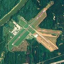 NAIP aerial image, 18 August 2006 | |||||||||||
| IATA: none – ICAO: KDYA – FAA LID: DYA | |||||||||||
| Summary | |||||||||||
| Airport type | Military | ||||||||||
| Owner | United States Army | ||||||||||
| Serves | Demopolis, Alabama | ||||||||||
| Location | Marengo County, Alabama | ||||||||||
| Elevation AMSL | 112 ft / 34 m | ||||||||||
| Coordinates | 32°27′50″N 087°57′15″W / 32.46389°N 87.95417°WCoordinates: 32°27′50″N 087°57′15″W / 32.46389°N 87.95417°W | ||||||||||
| Map | |||||||||||
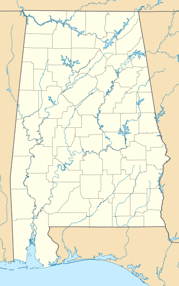 Demopolis AAF Location of airport in Alabama | |||||||||||
| Runways | |||||||||||
| |||||||||||
Demopolis Army Airfield is a former United States Army facility located six nautical miles (7 mi, 11 km) southwest of the central business district of Demopolis, a city in Marengo County, Alabama, United States.[1]
History
During World War II the airfield was built by the United States Army Air Forces and opened in October 1943. It was assigned to Third Air Force. It was used to train pilots as an axillary airfield to the group and replacement training center at Key Field, Mississippi. With the end of the war in September 1945, activities at Demopolis Army Airfield were diminished. The airfield was returned to civil control in 1946 and is now known as Demopolis Municipal Airport.[2]
See also
References
- 1 2 FAA Airport Master Record for DYA (Form 5010 PDF). Federal Aviation Administration. Effective 25 August 2011.
- ↑
 This article incorporates public domain material from the Air Force Historical Research Agency website http://www.afhra.af.mil/.
.svg.png)
This article is issued from Wikipedia - version of the 12/4/2016. The text is available under the Creative Commons Attribution/Share Alike but additional terms may apply for the media files.