Dereli
This article is about the Turkish town. For other uses, see Dereli (disambiguation).
| Dereli | |
|---|---|
| Town | |
|
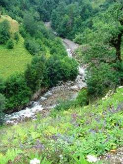
Dereli stream | |
 Dereli | |
| Coordinates: 40°44′N 38°26′E / 40.733°N 38.433°ECoordinates: 40°44′N 38°26′E / 40.733°N 38.433°E | |
| Country |
|
| Region | Black Sea |
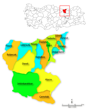
| Province | Giresun |
| Government | |
| • Mayor | Kazım Zeki Şenlikoğlu (AKP) |
| Area[1] | |
| • District | 845.24 km2 (326.35 sq mi) |
| Elevation | 346 m (1,135 ft) |
| Population (2012)[2] | |
| • Urban | 5,871 |
| • District | 20,875 |
| • District density | 25/km2 (64/sq mi) |
| Time zone | EET (UTC+2) |
| • Summer (DST) | EEST (UTC+3) |
| Postal code | 28950 |
| Area code(s) | 0454 |
| Licence plate | 28 |
| Climate | Cfb |
Dereli is a town and district of Giresun Province in the Black Sea region of Turkey. The mayor is Kazım Zeki Şenlikoğlu (AKP).
Dereli is a small town of 6,043 people in attractive countryside, in the valley of the Aksu Deresi and Akkaya River, inland 28 from Giresun on the road to Şebinkarahisar.
History
See Giresun for the history of this area, once occupied by the Hittites, Persians, Ancient Greek colonists from Miletos, Macedonians, Ancient Romans, Byzantines, Seljuk Turks, who settled in these valleys and arounds Muslim Kızılbaş, Turkmen Turks (Chepni) and finally the Ottoman Empire.
Places to see
References
- ↑ "Area of regions (including lakes), km²". Regional Statistics Database. Turkish Statistical Institute. 2002. Retrieved 2013-03-05.
- ↑ "Population of province/district centers and towns/villages by districts - 2012". Address Based Population Registration System (ABPRS) Database. Turkish Statistical Institute. Retrieved 2013-02-27.
District

Dereli District
This article is issued from Wikipedia - version of the 8/17/2015. The text is available under the Creative Commons Attribution/Share Alike but additional terms may apply for the media files.