Derwood, Maryland
Derwood is an unincorporated area and Census-designated place in east-central Montgomery County, Maryland. It lies just north of Rockville, south east of Gaithersburg, south west of Olney, and north west of the greater Silver Spring, Maryland area.[1] Derwood, originally "Deer Park" then "Deer Wood," is home to approximately 15,600 people.
Derwood includes the neighborhoods of Derwood Station, Mill Creek Towne, Needwood Estates, Muncaster Manor, Muncaster View, Hollybrooke, Granby Woods, Park Overlook, Redland Crossing, Candlewood Park, Cashell Estates, Avery Forest, Avery Lodge, Avery Village, Bowie Mill Estates, Bowie Mill Park, Winters Run, Redland Station, Rolling Knolls, Emory Grove, and Shady Grove Crossing.
Between 2009 and 2011, Maryland Route 200 (also known as the Inter-county Connector or ICC) was constructed directly through central Derwood affecting Cashell Estates and areas near Shady Grove Road.
History
Derwood was first recognized in the 1880s as a train stop on the B&O Railroad, which is now the intersection of Indianola Drive and Maryland Route 355 in Derwood Station.[2] A second, larger railroad station was built in Derwood from 1886-1889. In the early 1900s, a small community grew up around the station.
On January 7, 1954, Schwartz Mill caught fire and both it and the Derwood railroad station were destroyed. Derwood station was never rebuilt, since there were not enough passengers traveling through the area.
In 1965, the man-made Lake Needwood was created by impounding Rock Creek.
In 1974, the Derwood post office relocated to Redland Shopping Center. It kept the name "Derwood Branch," and designated the entire 20855 zip code area as Derwood, greatly increasing its size. The community's population expanded with the establishment of Shady Grove Metro station in 1984.
Public schools
Residents are zoned to Montgomery County Public Schools.
Students who are residents of Derwood are either in the Magruder or Richard Montgomery cluster and attend the following schools:
- Elementary Schools
- Washington Grove Elementary School
- Mill Creek Towne Elementary School
- Sequoyah Elementary School
- Candlewood Elementary School
- College Gardens Elementary School
- Middle Schools
- High Schools
Geography & Climate
Derwood is located in the north central part of Montgomery county, in the Atlantic coastal plane. The community is near the start of the Appalachian highlands. Derwood has a humid subtropical climate similar climate to nearby Washington D.C. It lies in hardiness zone 7a, with chilly winters, where the daily maximum is mostly above freezing, and the minimum is generally below freezing.
References
External links
Coordinates: 39°07′02″N 77°09′40″W / 39.11722°N 77.16111°W
Municipalities and communities of Montgomery County, Maryland, United States | ||
|---|---|---|
| Cities | 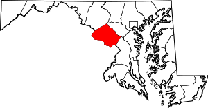 | |
| Towns | ||
| Villages & Special Tax Districts | ||
| CDPs |
| |
| Unincorporated communities | ||
| Footnotes | ‡This populated place also has portions in an adjacent county or counties | |