Kemp Mill, Maryland
| Kemp Mill, Maryland | |
|---|---|
| census-designated place | |
 Location of Kemp Mill, Maryland | |
| Coordinates: 39°2′2″N 77°1′28″W / 39.03389°N 77.02444°WCoordinates: 39°2′2″N 77°1′28″W / 39.03389°N 77.02444°W | |
| Country |
|
| State |
|
| County |
|
| Area | |
| • Total | 2.54 sq mi (6.2 km2) |
| • Land | 2.54 sq mi (6.2 km2) |
| • Water | 0.0 sq mi (0.0 km2) |
| Elevation | 335 ft (102 m) |
| Population (2010) | |
| • Total | 12,564 |
| • Density | 4,952.3/sq mi (1,593.2/km2) |
| Time zone | Eastern (EST) (UTC-5) |
| • Summer (DST) | EDT (UTC-4) |
| FIPS code | 24-43200 |
| GNIS feature ID | 1852594 |
Kemp Mill is a census-designated place and an unincorporated census area in Montgomery County, Maryland, United States. The population was 12,564 at the 2010 census.
Kemp Mill census area consists of the separate communities of Kemp Mill Estates and Kemp Mill Farms.
Geography
As an unincorporated area, Kemp Mill's boundaries are not officially defined. However, Kemp Mill is recognized by the United States Census Bureau as a census-designated place, and by the United States Geological Survey as a populated place located at 39°2′2″N 77°1′28″W / 39.03389°N 77.02444°W (39.033832, -77.024541).[1]
According to the United States Census Bureau, the neighborhood has a total area of 2.54 square miles (6.2 km²), all of it land.
Kemp Mill is considered by many of its residents, particularly those members of the Orthodox Jewish community, to be part of unincorporated Silver Spring, Maryland.[2] It is served by the Wheaton Post Office.
Culture
Kemp Mill hosts a number of synagogues serving Orthodox Jews (Modern Orthodox, Chassidic, and Yeshivish) including Young Israel Shomrai Emunah, Silver Spring Jewish Center, Kemp Mill Synagogue, the Yeshiva of Greater Washington, Chabad of Silver Spring, Kehillas Ohr Hatorah and Minchas Yitzhak. Additionally, there are many smaller orthodox Jewish minyanim (prayer groups) throughout the neighborhood including a Sephardic Minyan that meets at Shomrai Emunah and the Lower Lamberton Minyan. There are also many in the area that are served by Conservative synagogues, such as Har Tzeon Agudath Achim, and other branches of Judaism. Several Jewish and Catholic parochial schools are also located there including the boys division of the Yeshiva of Greater Washington, Silver Spring Learning Center, and the Jewish Montessori School. Two public schools are also situated in the area, including Kemp Mill Elementary and Col. E. Brooke Lee middle school. The former Spring Mill Elementary school is now an administrative office.
The Maryland-National Capital Park and Planning Commission's Kemp Mill Recreation Center offers users a baseball diamond, basketball and tennis courts, a meeting space, and a playground. Sligo Creek rises in Kemp Mill, and the hiker-biker trail that runs alongside the creek from Wheaton Regional Park to the Anacostia River passes through the community. The eastern end of Kemp Mill is bounded by the Northwest Branch, which also flows south to the Anacostia. Deer are a frequent sight in the neighborhood.
Kemp Mill Park, centrally located on Arcola Avenue, has long served as a popular meeting place and playground.
Commerce
Kemp Mill Shopping Center is the commerce hub of the neighborhood. It contains:
- SunTrust Bank
- Chinese restaurant
- Portuguese restaurant
- CVS pharmacy
- Nail salon, hair salon, and barber
- Little Gym
- Martial Arts training facility
- Ben Yehuda's, a vegetarian kosher pizzeria
- The Pastry Oven, a vegetarian kosher party shop and cafe
- Shalom Kosher, a kosher butcher and grocery store
- Dentist, optometrist, and doctor
The Giant Food grocery store that anchored the Kemp Mill Shopping Center for decades closed on September 27, 2007. Magruder's, a small local chain of grocery stores, renovated the former Giant and opened on November 7, 2007, and closed in July, 2012. In July 2012, Shalom Kosher, who currently has a kosher store in Wheaton, purchased Magruder's. On October 31, 2012, Shalom Kosher opened at 1361 Lamberton Drive.
Two private swimming pools, Parkland Pool and Kemp Mill Swim Club, serve the community.
Transportation
Kemp Mill is serviced by Ride On bus number 8, 9 and during rush hours, number 31. Washington Metro service is also available in nearby Silver Spring and Wheaton.
Education
Montgomery County Public Schools operates public schools.
Kemp Mill Elementary, Col. E. Brook Lee Middle School, and Northwood High School is within the Kemp Mill CDP.[3]
Demographics
| Historical population | |||
|---|---|---|---|
| Census | Pop. | %± | |
| 1970 | 10,037 | — | |
| 2000 | 9,956 | — | |
| 2010 | 12,564 | 26.2% | |
| source:[4][5] | |||
As of the census[6] of 2000, there were 9,956 people, 3,386 households, and 2,654 families residing in the area. The population density was 4,126.3 people per square mile (1,595.0/km²). There were 3,448 housing units at an average density of 1,429.0/sq mi (552.4/km²). The racial makeup of the area was 68.45% White, 15.30% African American, 0.23% Native American, 8.18% Asian, 0.09% Pacific Islander, 4.91% from other races, and 2.84% from two or more races. Hispanic or Latino of any race were 10.80% of the population.
There were 3,386 households out of which 33.9% had children under the age of 18 living with them, 65.3% were married couples living together, 9.6% had a female householder with no husband present, and 21.6% were non-families. 17.0% of all households were made up of individuals and 8.7% had someone living alone who was 65 years of age or older. The average household size was 2.89 and the average family size was 3.22. Twenty-seven percent of Kemp Mill residents hold a graduate degree.
In the area, the population was spread out with 25.1% under the age of 18, 5.6% from 18 to 24, 25.9% from 25 to 44, 24.7% from 45 to 64, and 18.7% who were 65 years of age or older. The median age was 41 years. For every 100 females there were 95.6 males. For every 100 females age 18 and over, there were 91.5 males.
The median income for a household in the CDP was $89,294, and the median income for a family was $111,985. Males had a median income of $52,244 versus $41,285 for females. The per capita income for the area was $34,570. About 2.3% of families and 4.1% of the population were below the poverty line, including 2.6% of those under age 18 and 1.7% of those age 65 or over.
References
- ↑ "US Gazetteer files: 2010, 2000, and 1990". United States Census Bureau. 2011-02-12. Retrieved 2011-04-23.
- ↑ "Jewish Silver Spring". Retrieved 6 June 2016.
- ↑ "2010 CENSUS - CENSUS BLOCK MAP: Kemp Mill CDP, MD" (Archive). U.S. Census Bureau. Retrieved on June 22, 2015.
- ↑ "CENSUS OF POPULATION AND HOUSING (1790-2000)". U.S. Census Bureau. Retrieved 2010-07-17.
- ↑ Community not enumerated separately in 1980 & 1990. Kemp Mill was part of Silver Spring's census area.
- ↑ "American FactFinder". United States Census Bureau. Retrieved 2008-01-31.
External links
- Kemp Mill Civic Association
- Churches:
- Synagogues:
- Schools:
- Pools:
- Commerce:
Municipalities and communities of Montgomery County, Maryland, United States | ||
|---|---|---|
| Cities | 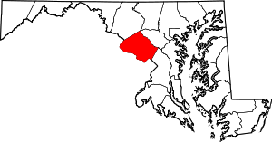 | |
| Towns | ||
| Villages & Special Tax Districts | ||
| CDPs |
| |
| Unincorporated communities | ||
| Footnotes | ‡This populated place also has portions in an adjacent county or counties | |