Dierrey-Saint-Julien
| Dierrey-Saint-Julien | ||
|---|---|---|
|
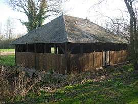
Lavoir (wash house) | ||
| ||
 Dierrey-Saint-Julien | ||
|
Location within Grand Est region  Dierrey-Saint-Julien | ||
| Coordinates: 48°18′46″N 3°49′49″E / 48.3128°N 3.8303°ECoordinates: 48°18′46″N 3°49′49″E / 48.3128°N 3.8303°E | ||
| Country | France | |
| Region | Grand Est | |
| Department | Aube | |
| Arrondissement | Nogent-sur-Seine | |
| Canton | Marcilly-le-Hayer | |
| Government | ||
| • Mayor (2008–2014) | Bruno Richard | |
| Area1 | 21.25 km2 (8.20 sq mi) | |
| Population (2008)2 | 262 | |
| • Density | 12/km2 (32/sq mi) | |
| Time zone | CET (UTC+1) | |
| • Summer (DST) | CEST (UTC+2) | |
| INSEE/Postal code | 10124 / 10190 | |
|
1 French Land Register data, which excludes lakes, ponds, glaciers > 1 km² (0.386 sq mi or 247 acres) and river estuaries. 2 Population without double counting: residents of multiple communes (e.g., students and military personnel) only counted once. | ||

Dierrey-Saint-Julien is a commune in the Aube department in north-central France.
Population
| Historical population | ||
|---|---|---|
| Year | Pop. | ±% |
| 1962 | 209 | — |
| 1968 | 242 | +15.8% |
| 1975 | 215 | −11.2% |
| 1982 | 222 | +3.3% |
| 1990 | 216 | −2.7% |
| 1999 | 225 | +4.2% |
| 2008 | 262 | +16.4% |
See also
References
| Wikimedia Commons has media related to Dierrey-Saint-Julien. |
This article is issued from Wikipedia - version of the 2/22/2013. The text is available under the Creative Commons Attribution/Share Alike but additional terms may apply for the media files.