Dunmore, Alberta
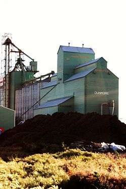
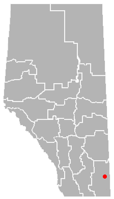
Dunmore is a hamlet in Alberta, Canada within Cypress County,[1] located 2.6 kilometres (1.6 mi) southeast of Medicine Hat's city limits on Highway 1 and the Canadian Pacific Railway mainline. A portion of the hamlet is recognized as a designated place by Statistics Canada.[2]
Dunmore is the administrative centre of Cypress County and Prairie Rose School Division No. 8.
The hamlet was named by the CPR after Charles Murray, the Earl of Dunmore.[3]
Demographics
Cypress County indicates that the population of the Hamlet of Dunmore was 1,025 in the 2011 Census.[4]
As a designated place in the 2011 Census, Dunmore had a population of 502 living in 182 of its 186 total dwellings, a -6% change from its 2006 population of 534. With a land area of 2.42 km2 (0.93 sq mi), it had a population density of 207.4/km2 (537.3/sq mi) in 2011.[5] The Dunmore designated place comprises only the portion of the hamlet.[6][7]
Education
Just south of the community is Eagle Butte High School, named after a geographic feature of the Cypress Hills. A one-room schoolhouse in the Cypress Hills was called "Eagle Butte School".[8]
Amenities and services
Located in the hamlet is Dunmore Park – which has a playground, outdoor hockey rink, baseball field, and a small BMX track. Dunmore has two gas stations, a community hall, a golf driving range, a storage unit business, a bar and various other small businesses.
See also
References
- ↑ Alberta Municipal Affairs (2010-04-01). "Specialized and Rural Municipalities and Their Communities" (PDF). Retrieved 2010-06-22.
- ↑ Statistics Canada. "Population and dwelling counts for designated places in Alberta, 2006 and 2001 censuses". Retrieved 2010-06-22.
- ↑ Sanders, Harry M. (2003). The Story Behind Alberta Names : How Cities, Towns, Villages and Hamlets Got Their Names. Calgary, Alberta: Red Deer Press. p. 121. ISBN 0-88995-256-6.
- ↑ "The Present: A Cypress County Snapshot". Cypress County. Retrieved January 26, 2013.
- ↑ "Population and dwelling counts, for Canada, provinces and territories, and designated places, 2011 and 2006 censuses (Alberta)". Statistics Canada. 2012-02-08. Retrieved 2012-04-07.
- ↑ "Census Profile: Dunmore, UNP (Designated Place), Alberta (map)". Statistics Canada. October 31, 2012. Retrieved January 26, 2013.
- ↑ "Land Use Bylaw No 2011/04". Cypress County. January 2011. p. PDF page 107 of 268. Retrieved January 26, 2013.
- ↑ Michael, Hope; Johnson, Hope (1981). Down The Years at Elkwater. Medicine Hat Museum and Art Gallery. Lethbridge, Alberta: Heinitz Printers & Stationers. pp. 30–34 & 75–76.
Coordinates: 49°58′13″N 110°35′03″W / 49.97028°N 110.58417°W