Eagle Ridge, Calgary
| Eagle Ridge | |
|---|---|
| Neighbourhood | |
 Eagle Ridge Location of Eagle Ridge in Calgary | |
| Coordinates: 50°59′06″N 114°05′51″W / 50.98500°N 114.09750°WCoordinates: 50°59′06″N 114°05′51″W / 50.98500°N 114.09750°W | |
| Country |
|
| Province |
|
| City |
|
| Quadrant | SW |
| Ward | 11 |
| Established | 1960 |
| Government[1] | |
| • Mayor | Naheed Nenshi |
| • Administrative body | Calgary City Council |
| • Councillor | Brian Pincott |
| Area | |
| • Total | 0.4 km2 (0.2 sq mi) |
| Elevation | 1,085 m (3,560 ft) |
| Population (2006)[2] | |
| • Total | 415 |
| • Average Income | $119,459 |
| Website | Eagle Ridge Community Association |
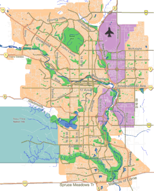
Eagle Ridge is a residential neighbourhood in the south-west quadrant of Calgary, Alberta, Canada. It is bounded by 14 Street W to the east, Heritage Drive to the south, Glenmore Trail to the north, and Glenmore Reservoir to the west. The Heritage Park Historical Village borders the community to the west, and the Rockyview General Hospital is located immediately north.
It is represented in the Calgary City Council by the Ward 11 councillor.
Demographics
In the City of Calgary's 2012 municipal census, Eagle Ridge had a population of 415 living in 110 dwellings, a -6.3% increase from its 2011 population of 443.[3] With a land area of 0.4 km2 (0.15 sq mi), it had a population density of 1,040/km2 (2,700/sq mi) in 2012.[4][3]
Residents in this community had a median household income of $271,710 in 2005, and there were 5.3% low income residents living in the neighbourhood.[5] As of 2006, 13.2% of the residents were immigrants. A proportion of 9.5% of the buildings were condominiums or apartments, and 9.1% of the housing was used for renting.[2]
Education
The community is served by Chinook Park Bilingual Elementary and Henry Wise Wood Senior High public schools, neither of which are physically located within Eagle Ridge itself.
See also
References
- ↑ "Calgary Elections". City of Calgary. October 21, 2013. Retrieved October 22, 2013.
- 1 2 City of Calgary (2006). "Eagle Ridge Community Statistics" (PDF). Retrieved 2007-05-14.
- 1 2 "2012 Civic Census Results" (PDF). City of Calgary. 2012. Retrieved February 4, 2013.
- ↑ "Community Boundaries" (Esri shapefile). City of Calgary. Retrieved February 5, 2013.
- ↑ City of Calgary (2004). "Ward 11 Profile" (PDF). Retrieved 2007-05-14.
 |
Glenmore Reservoir | Rockyview General Hospital | Kelvin Grove | |
| Heritage Park Historical Village | |
Chinook Park | ||
| ||||
| | ||||
| Bayview | Pump Hill | Haysboro |