Maple Ridge, Calgary
| Maple Ridge | |
|---|---|
| Neighbourhood | |
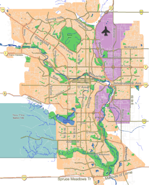 Maple Ridge Location of Maple Ridge in Calgary | |
| Coordinates: 50°57′27″N 114°02′30″W / 50.95750°N 114.04167°WCoordinates: 50°57′27″N 114°02′30″W / 50.95750°N 114.04167°W | |
| Country |
|
| Province |
|
| City |
|
| Quadrant | SE |
| Ward | 14 |
| Established | 1966 |
| Annexed | 1956 |
| Government[1] | |
| • Mayor | Naheed Nenshi |
| • Administrative body | Calgary City Council |
| • Councillor | Peter Demong |
| Area | |
| • Total | 1.4 km2 (0.5 sq mi) |
| Elevation | 1,035 m (3,396 ft) |
| Population (2006)[2] | |
| • Total | 2,066 |
| • Average Income | $72,317 |
| Website | WillowRidge Community Association |
Maple Ridge is a residential neighbourhood in the south-east quadrant of Calgary, Alberta. The community is bounded to the east by Deerfoot Trail, north by Southland Drive, west by Willow Park and south by Anderson Road. The Maple Ridge golf course, developed in the Bow River valley, lines the community to the south and east.
It is represented in the Calgary City Council by the Ward 14 councillor and, along with Willow Park, makes up the combined community of WillowRidge.
Maple Ridge is home to the popular Maple Ridge Golf Course, located at 1240 Mapleglade Drive.
Demographics
In the City of Calgary's 2014 municipal census, Maple Ridge had a population of 2,035 living in 810 dwellings.
With a land area of 2.8 km2 (1.1 sq mi), it had a population density of 682/km2 (1,770/sq mi) in 2012.[3][4]
Residents in this community had a median household income of $88,417 in 2010.
All buildings are single family detached homes, and in 2000 6.1% of the housing was used for renting.[2]
Schools in the neighborhood:
Maple Ridge Elementary (K-4)
St. William Elementary (K-6)
R.T. Alderman Junior High (5-9)
Willow Park Arts-Centered Learning (Middle School) (5-9)
Notre-Dame-de-la-Paix (French)
See also
References
- ↑ "Calgary Elections". City of Calgary. October 21, 2013. Retrieved October 22, 2013.
- 1 2 City of Calgary (2006). "Maple Ridge Community Statistics" (PDF). Retrieved 2007-05-09.
- ↑ "Community Boundaries" (Esri shapefile). City of Calgary. Retrieved February 5, 2013.
- ↑ "2012 Civic Census Results" (PDF). City of Calgary. 2012. Retrieved February 4, 2013.
External links
 |
Acadia | East Fairview Industrial | Riverbend Bow River |
|
| Willow Park | |
Douglas Glen | ||
| ||||
| | ||||
| Lake Bonavista | Bonavista Downs | Diamond Cove |