Martindale, Calgary
| Martindale | |
|---|---|
| Neighbourhood | |
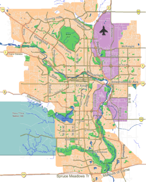 Martindale Location of Martindale in Calgary | |
| Coordinates: 51°07′04″N 113°57′33″W / 51.11778°N 113.95917°WCoordinates: 51°07′04″N 113°57′33″W / 51.11778°N 113.95917°W | |
| Country |
|
| Province |
|
| City |
|
| Quadrant | NE |
| Ward | 5 |
| Established | 1983 |
| Annexed | 1961 |
| Government[1] | |
| • Mayor | Naheed Nenshi |
| • Administrative body | Calgary City Council |
| • Councillor | Ray Jones |
| Area | |
| • Total | 2.7 km2 (1.0 sq mi) |
| Elevation | 1,095 m (3,593 ft) |
| Population (2011)[2] | |
| • Total | 12,987 |
| • Average Income | $65,185 |
| Website | Martindale Community Association |
Martindale is a residential neighbourhood in the north-east quadrant of Calgary, Alberta. It is bounded to the north by 80 Avenue N, to the east by Falconridge Boulevard, to the south by 64 Avenue N and to the west by 44 Street E. A LRT station is currently under construction in the area and is expected to open in fall of 2012.[3]
The area was annexed to the City of Calgary in 1961 and Martindale was established in 1983. It is represented in the Calgary City Council by the Ward 5 councillor.[1]
Demographics
In the City of Calgary's 2012 municipal census, Martindale had a population of 13,674 living in 3,912 dwellings, a 5.3% increase from its 2011 population of 12,987.[4] With a land area of 2.7 km2 (1.0 sq mi), it had a population density of 5,060/km2 (13,120/sq mi) in 2012.[5][4]
Residents in this community had a median household income of $65,185 in 2005, and there were 18.1% low income residents living in the neighbourhood. As of 2006, 39.4% of the residents were immigrants. A proportion of 3.0% of the buildings were condominiums or apartments, and 12.6% of the housing was used for renting.[2]
Education
The community is served by the Crossing Park public school.
See also
References
- 1 2 "Calgary Elections". City of Calgary. October 21, 2013. Retrieved October 22, 2013.
- 1 2 City of Calgary (April 2012). "Martindale Community Statistics" (PDF). Retrieved May 30, 2012.
- ↑ "Northeast LRT extension to Saddle Ridge". City of Calgary. Retrieved May 30, 2012.
- 1 2 "2012 Civic Census Results" (PDF). City of Calgary. 2012. Retrieved February 4, 2013.
- ↑ "Community Boundaries" (Esri shapefile). City of Calgary. Retrieved February 5, 2013.
External links
 |
Saddle Ridge Industrial Area | Saddle Ridge | | |
| Calgary International Airport | |
Taradale | ||
| ||||
| | ||||
| Westwinds Industrial Area | Castle Ridge | Falconridge |