Edwards, Illinois
| Edwards | |
|---|---|
| Unincorporated community | |
|
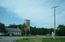
Taylor Road at IL 8, 2007 | |
 Edwards | |
| Coordinates: 40°44′45″N 89°44′39″W / 40.74583°N 89.74417°WCoordinates: 40°44′45″N 89°44′39″W / 40.74583°N 89.74417°W | |
| Country | United States |
| State | Illinois |
| County | Peoria |
| Civil township | Kickapoo |
| Elevation | 525 ft (160 m) |
| Time zone | Central (CST) (UTC-6) |
| • Summer (DST) | CDT (UTC-5) |
| ZIP code | 61528 |
| Area code(s) | 309 |
| GNIS feature ID | 407800[1] |
Edwards is an unincorporated community in Peoria County, Illinois, United States. Edwards is located on Illinois Route 8 northwest of downtown Peoria. Edwards has a post office with ZIP Code 61528;[2] the Post Office is now located on Dubois Road[3] just south of Interstate 74 exit 82, 2.1 miles (3.4 km) north of the original Edwards.
Edwards is in section 19 of Kickapoo Township, and was previously called Edwards Station, as a train station on the Peoria and Galesburg division of the Chicago, Burlington and Quincy Railroad,[4] originally the Peoria, Oquawka and Burlington Railroad in 1857 when the railroad was completed and the station opened.[5] The first settler, Isaac Jones, died in 1840.[4]
References
- ↑ "US Board on Geographic Names". United States Geological Survey. 2007-10-25. Retrieved 2008-01-31.
- ↑ ZIP Code Lookup
- ↑ "Post Office Locations in the Edwards, IL area". Post Office Locations. United States Postal Service. Retrieved 2012-03-05.
- 1 2 "Kickapoo Township". The History of Peoria County, Illinois. Chicago: Johnson & Company. 1880. Retrieved 2012-03-05.
- ↑ "Kickapoo Township". The History of Peoria County, Illinois. Chicago: Johnson & Company. 1880. Retrieved 2012-03-05.
Municipalities and communities of Peoria County, Illinois, United States | ||
|---|---|---|
| Cities | ||
| Villages | ||
| Townships | ||
| CDPs | ||
| Other unincorporated communities |
| |
| Footnotes | ‡This populated place also has portions in an adjacent county or counties | |
This article is issued from Wikipedia - version of the 4/27/2016. The text is available under the Creative Commons Attribution/Share Alike but additional terms may apply for the media files.