Elgin, Oklahoma
| Elgin, Oklahoma | |
|---|---|
| City | |
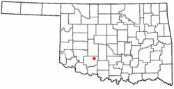 Location of Elgin, Oklahoma | |
| Coordinates: 34°46′51″N 98°17′34″W / 34.78083°N 98.29278°WCoordinates: 34°46′51″N 98°17′34″W / 34.78083°N 98.29278°W | |
| Country | United States |
| State | Oklahoma |
| County | Comanche |
| Area | |
| • Total | 3.72 sq mi (9.63 km2) |
| • Land | 3.70 sq mi (9.59 km2) |
| • Water | 0.02 sq mi (.04 km2) |
| Elevation | 1,293 ft (394 m) |
| Population (2010) | |
| • Total | 2,156 |
| • Density | 582.27/sq mi (224.82/km2) |
| Time zone | Central (CST) (UTC-6) |
| • Summer (DST) | CDT (UTC-5) |
| ZIP code | 73538 |
| Area code(s) | 580 |
| FIPS code | 40-23450[1] |
| GNIS feature ID | 1092522[2] |
Elgin is a city in Comanche County, Oklahoma, United States. The population was 2,156 at the 2010 census, a 78 percent increase from 1,210 at the 2000 census.[3] It is included in the Lawton, Oklahoma Metropolitan Statistical Area. It is the site of Fort Sill National Cemetery.
Geography
Elgin is located at 34°46′51″N 98°17′34″W / 34.78083°N 98.29278°W (34.780906, -98.292862).[4]
According to the United States Census Bureau, the city has a total area of 3.718 square miles (9.63 km2), all of it land.
Climate
Climate is characterized by relatively high temperatures and evenly distributed precipitation throughout the year. The Köppen Climate Classification subtype for this climate is "Cfa" (Humid Subtropical Climate).[5]
| Climate data for Elgin, Oklahoma | |||||||||||||
|---|---|---|---|---|---|---|---|---|---|---|---|---|---|
| Month | Jan | Feb | Mar | Apr | May | Jun | Jul | Aug | Sep | Oct | Nov | Dec | Year |
| Record high °F (°C) | 83 (28) |
85 (29) |
101 (38) |
99 (37) |
105 (41) |
112 (44) |
111 (44) |
109 (43) |
108 (42) |
100 (38) |
87 (31) |
87 (31) |
112 (44) |
| Average high °F (°C) | 49 (9) |
54 (12) |
63 (17) |
73 (23) |
80 (27) |
89 (32) |
94 (34) |
94 (34) |
86 (30) |
75 (24) |
62 (17) |
52 (11) |
72.6 (22.5) |
| Average low °F (°C) | 28 (−2) |
33 (1) |
40 (4) |
51 (11) |
59 (15) |
68 (20) |
72 (22) |
71 (22) |
64 (18) |
53 (12) |
40 (4) |
31 (−1) |
50.8 (10.5) |
| Record low °F (°C) | −6 (−21) |
2 (−17) |
1 (−17) |
24 (−4) |
35 (2) |
46 (8) |
57 (14) |
54 (12) |
37 (3) |
26 (−3) |
13 (−11) |
−5 (−21) |
−6 (−21) |
| Average precipitation inches (mm) | 1.2 (30) |
1.5 (38) |
2 (50) |
2.6 (66) |
5.4 (137) |
3.8 (97) |
2.5 (64) |
2.3 (58) |
3.3 (84) |
3.4 (86) |
1.7 (43) |
1.3 (33) |
31 (790) |
| Average snowfall inches (cm) | 2.6 (6.6) |
2.0 (5.1) |
0.8 (2) |
0.2 (0.5) |
1.2 (3) |
— | — | — | — | — | — | — | 6.9 (17.5) |
| Average rainy days | 5 | 5 | 6 | 7 | 9 | 7 | 6 | 6 | 6 | 6 | 5 | 5 | 73 |
| Source #1: weather.com | |||||||||||||
| Source #2: Weatherbase.com [6] | |||||||||||||
Demographics
| Historical population | |||
|---|---|---|---|
| Census | Pop. | %± | |
| 1910 | 178 | — | |
| 1920 | 181 | 1.7% | |
| 1930 | 335 | 85.1% | |
| 1940 | 381 | 13.7% | |
| 1950 | 428 | 12.3% | |
| 1960 | 540 | 26.2% | |
| 1970 | 840 | 55.6% | |
| 1980 | 1,003 | 19.4% | |
| 1990 | 975 | −2.8% | |
| 2000 | 1,210 | 24.1% | |
| 2010 | 2,156 | 78.2% | |
| Est. 2015 | 2,969 | [7] | 37.7% |
As of the census of 2010, there were 2,156 people, 759 households, and 619 families residing in the city. The population density was 582.3 people per square mile (224.5/km²). There were 759 housing units at an average density of 205.1 per square mile (79.1/km²). The racial makeup of the city was 78.8% White, 4.7% African American, 8.6% Native American, 1.3% Asian, 0.3% Pacific Islander, 1.2% from other races, and 5.2% from two or more races. Hispanic or Latino of any race were 8.5% of the population.
There were 759 households out of which 44.0% had children under the age of 18 living with them, 63.4% were married couples living together, 13.7% had a female householder with no husband present, and 18.4% were non-families. 16.2% of all households were made up of individuals and 16.2% had someone living alone who was 65 years of age or older. The average household size was 2.84 and the average family size was 3.16.
In the city the population was spread out with 32.0% under the age of 18, 7.1% from 18 to 24, 31.5% from 25 to 44, 19.5% from 45 to 64, and 9.9% who were 65 years of age or older. The median age was 32.6 years. For every 100 females there were 95.5 males. For every 100 females age 18 and over, there were 107.2 males.
According to the 2000 census, the median income for a household in the city was $36,324, and the median income for a family was $44,125. Males had a median income of $32,019 versus $22,614 for females. The per capita income for the city was $14,264. About 7.4% of families and 9.7% of the population were below the poverty line, including 11.2% of those under age 18 and 12.6% of those age 65 or over.
Utilities
- Digital cable TV service, high-speed internet and digital telephone is provided by Southern Plains Cable Company.
- Wireless high-speed Internet is provided by Wichita Online.
- Elgin's public works authority provides water, sewer, and sanitation services to the town.
- Electric service is provided by American Electric Power Public Service Company of Oklahoma.
- Natural gas service is provided by Arkla Gas.
See also
- Elgin Public Schools
- Elgin news is covered online at http://www.fletcher-news.com.
References
- ↑ "American FactFinder". United States Census Bureau. Retrieved 2008-01-31.
- ↑ "US Board on Geographic Names". United States Geological Survey. 2007-10-25. Retrieved 2008-01-31.
- ↑ CensusViewer:Elgin, Oklahoma Population.
- ↑ "US Gazetteer files: 2010, 2000, and 1990". United States Census Bureau. 2011-02-12. Retrieved 2011-04-23.
- ↑ [Climate Summary for Elgin, Oklahoma]
- ↑ "Historical Weather for Elgin, Oklahoma, United States".
- ↑ "Annual Estimates of the Resident Population for Incorporated Places: April 1, 2010 to July 1, 2015". Retrieved July 2, 2016.
- ↑ "Census of Population and Housing". Census.gov. Retrieved June 4, 2015.
External links
Municipalities and communities of Comanche County, Oklahoma, United States | ||
|---|---|---|
| Cities | 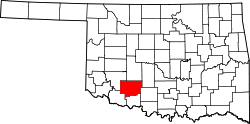 | |
| Towns | ||
| Unincorporated communities | ||
| Footnotes | ‡This populated place also has portions in an adjacent county or counties | |