Elizabeth Lake, California
| Elizabeth Lake | |
|---|---|
| census-designated place | |
 Elizabeth Lake Position in California. | |
| Coordinates: 34°39′23″N 118°22′46″W / 34.65639°N 118.37944°WCoordinates: 34°39′23″N 118°22′46″W / 34.65639°N 118.37944°W | |
| Country |
|
| State |
|
| County | Los Angeles |
| Area[1] | |
| • Total | 6.543 sq mi (16.947 km2) |
| • Land | 6.246 sq mi (16.178 km2) |
| • Water | 0.297 sq mi (0.769 km2) 4.54% |
| Elevation[2] | 3,389 ft (1,033 m) |
| Population (2010) | |
| • Total | 1,756 |
| • Density | 270/sq mi (100/km2) |
| Time zone | Pacific (PST) (UTC-8) |
| • Summer (DST) | PDT (UTC-7) |
| GNIS feature ID | 2583006 |
| U.S. Geological Survey Geographic Names Information System: Elizabeth Lake, California | |
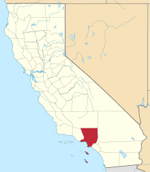
Elizabeth Lake is a census-designated place (CDP) and town on Elizabeth Lake (lake), in northwestern Los Angeles County, California.
Geography
The community of Elizabeth Lake neighbors the unincorporated community of Lake Hughes, sharing the same zip code. It is located in the northern Sierra Pelona Mountains, at the edge of the western Antelope Valley and Mojave Desert. The community is at an elevation of 3,389 feet (1,033 m), and surrounded by the Angeles National Forest.
Elizabeth Lake and Hughes Lake are in canyons along the San Andreas Fault.[3] Both lakes dry up periodically depending on rainfall cycles.
According to the United States Census Bureau, the CDP has a total area of 6.5 square miles (16.9 km²), over 95% of which is land.
History
Known then as La Laguna de Chico Lopez, Elizabeth Lake was a watering locale on Spanish colonial and Mexican El Camino Viejo in Alta California and the Gold Rush era Stockton - Los Angeles Road. From 1858 to 1861 it was between the Widow Smith's Station and Mud Spring stage stops of the Butterfield Overland Mail. The lake area was to the west of Rancho La Liebre, an 1846 Mexican land grant now part of Tejon Ranch.
In 1907 William Mulholland, superintendent of the Los Angeles Department of Water and Power, started work on the Elizabeth Lake Tunnel for transporting water in the Los Angeles Aqueduct from Owens Valley to Los Angeles. The five-mile (8 km)-long tunnel is 285 feet (87 m) under the valley floor. The tunnel was driven from both ends. The north portal is at Fairmont Reservoir and the south in Bear Canyon (now Portal Canyon) just off of Green Valley. This 11-foot (3.4 m)-wide tunnel was driven 27,000 ft (8,200 m) through solid rock and met in the center within 1½ inches in line and 5/8 inches in depth. Work was around the clock and averaged about 11 feet (3.4 m) per day. The Elizabeth Lake tunnel was the largest single construction project on the Los Angeles Aqueduct and set speed records in its day.
Demographics
The 2010 United States Census[4] reported that Elizabeth Lake had a population of 1,756. The population density was 268.4 people per square mile (103.6/km²). The racial makeup of Elizabeth Lake was 1,591 (90.6%) White (81.2% Non-Hispanic White),[5] 21 (1.2%) African American, 9 (0.5%) Native American, 23 (1.3%) Asian, 1 (0.1%) Pacific Islander, 47 (2.7%) from other races, and 64 (3.6%) from two or more races. Hispanic or Latino of any race were 231 persons (13.2%).
The Census reported that 1,756 people (100% of the population) lived in households, 0 (0%) lived in non-institutionalized group quarters, and 0 (0%) were institutionalized.
There were 674 households, out of which 223 (33.1%) had children under the age of 18 living in them, 399 (59.2%) were opposite-sex married couples living together, 54 (8.0%) had a female householder with no husband present, 36 (5.3%) had a male householder with no wife present. There were 26 (3.9%) unmarried opposite-sex partnerships, and 7 (1.0%) same-sex married couples or partnerships. 151 households (22.4%) were made up of individuals and 38 (5.6%) had someone living alone who was 65 years of age or older. The average household size was 2.61. There were 489 families (72.6% of all households); the average family size was 3.05.
The population was spread out with 403 people (22.9%) under the age of 18, 155 people (8.8%) aged 18 to 24, 407 people (23.2%) aged 25 to 44, 643 people (36.6%) aged 45 to 64, and 148 people (8.4%) who were 65 years of age or older. The median age was 42.4 years. For every 100 females there were 109.3 males. For every 100 females age 18 and over, there were 108.8 males.
There were 745 housing units at an average density of 113.9 per square mile (44.0/km²), of which 561 (83.2%) were owner-occupied, and 113 (16.8%) were occupied by renters. The homeowner vacancy rate was 3.1%; the rental vacancy rate was 5.8%. 1,466 people (83.5% of the population) lived in owner-occupied housing units and 290 people (16.5%) lived in rental housing units.
According to the 2010 United States Census, Elizabeth Lake had a median household income of $67,614, with 6.0% of the population living below the federal poverty line.[6]
See also
- Elizabeth Lake (Los Angeles County, California)
- Hughes Lake (California)
- Lake Hughes, California — town.
- Angeles National Forest — surrounding Elizabeth Lake.
- Sierra Pelona Mountains-related topics
References
- ↑ U.S. Census
- ↑ U.S. Geological Survey Geographic Names Information System: Elizabeth Lake, California
- ↑ Harold Wellman Fairbanks (1906). "Lower Lake Elizabeth on the Line of the Rift". The Bancroft Library, University of California, Berkeley. Retrieved 2009-03-22.
- ↑ "2010 US Census: Elizabeth Lake CDP population map". U.S. Census Bureau. Retrieved July 12, 2014.
- ↑ "2010 US Census: Elizabeth Lake CDP population demographics".
- ↑ "2010 US Census: Elizabeth Lake CDP community facts".
External links
| Wikimedia Commons has media related to Elizabeth Lake, California. |
