Elkton, Oregon
| Elkton, Oregon | |
|---|---|
| City | |
 | |
| Nickname(s): Bass Capitol of Oregon | |
| Motto: "A Community Invested in it's [sic] Natural Resources" | |
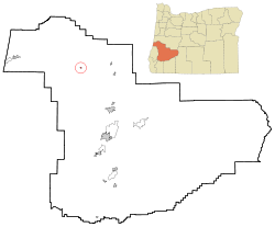 Location in Oregon | |
| Coordinates: 43°38′15″N 123°34′05″W / 43.63750°N 123.56806°WCoordinates: 43°38′15″N 123°34′05″W / 43.63750°N 123.56806°W | |
| Country | United States |
| State | Oregon |
| County | Douglas |
| Incorporated | 1948 |
| Government | |
| • Mayor | Rebecca Swearingen |
| Area[1] | |
| • Total | 0.26 sq mi (0.67 km2) |
| • Land | 0.23 sq mi (0.60 km2) |
| • Water | 0.03 sq mi (0.08 km2) |
| Elevation[2] | 141 ft (43 m) |
| Population (2010)[3] | |
| • Total | 195 |
| • Estimate (2012[4]) | 194 |
| • Density | 847.8/sq mi (327.3/km2) |
| Time zone | Pacific (UTC-8) |
| • Summer (DST) | Pacific (UTC-7) |
| ZIP code | 97436 |
| Area code(s) | 541 |
| FIPS code | 41-22800[5] |
| GNIS feature ID | 1120478[2] |
| Website | www.elkton-oregon.com |
Elkton is a city in Douglas County, Oregon, United States. It is located on the lower Umpqua River, at the junction of Oregon Route 38 and Oregon Route 138, about 20 miles (32 km) west of Interstate 5 and about 14 miles (23 km) west of Drain.[2] The population was 195 at the 2010 census,[3] an increase from 147 people in 2000.[5]
History
The Klamath Exploring Expedition founded Elkton around Fort Umpqua, at the mouth of Elk Creek on the Umpqua River, in August 1850. A post office was established at Elkton on September 26, 1851.[6][7] The settlement became an incorporated city on November 4, 1948.[8]
Geography
According to the United States Census Bureau, the city has a total area of 0.26 square miles (0.67 km2), of which, 0.23 square miles (0.60 km2) is land and 0.03 square miles (0.08 km2) is water.[1] The elevation is 141 feet (43 m).[2]
Climate
This region experiences warm (but not hot) and dry summers, with no average monthly temperatures above 71.6 °F (22.0 °C). According to the Köppen Climate Classification system, Elkton has a warm-summer Mediterranean climate, abbreviated "Csb" on climate maps.[9]
| Climate data for Elkton | |||||||||||||
|---|---|---|---|---|---|---|---|---|---|---|---|---|---|
| Month | Jan | Feb | Mar | Apr | May | Jun | Jul | Aug | Sep | Oct | Nov | Dec | Year |
| Record high °F (°C) | 70 (21) |
76 (24) |
81 (27) |
93 (34) |
102 (39) |
105 (41) |
108 (42) |
107 (42) |
103 (39) |
96 (36) |
79 (26) |
73 (23) |
108 (42) |
| Average high °F (°C) | 48.8 (9.3) |
54 (12) |
58.7 (14.8) |
63.9 (17.7) |
70.6 (21.4) |
76.2 (24.6) |
84 (29) |
84 (29) |
79.5 (26.4) |
67.1 (19.5) |
54.4 (12.4) |
48.9 (9.4) |
65.8 (18.8) |
| Average low °F (°C) | 35.9 (2.2) |
37.7 (3.2) |
38.8 (3.8) |
40.8 (4.9) |
44.7 (7.1) |
48.7 (9.3) |
51.4 (10.8) |
51.2 (10.7) |
48.1 (8.9) |
44.8 (7.1) |
40.8 (4.9) |
37.3 (2.9) |
43.3 (6.3) |
| Record low °F (°C) | 5 (−15) |
4 (−16) |
24 (−4) |
27 (−3) |
27 (−3) |
23 (−5) |
38 (3) |
39 (4) |
30 (−1) |
25 (−4) |
16 (−9) |
0 (−18) |
0 (−18) |
| Average precipitation inches (mm) | 8.53 (216.7) |
6.73 (170.9) |
5.85 (148.6) |
3.57 (90.7) |
2.25 (57.2) |
1.17 (29.7) |
0.29 (7.4) |
0.52 (13.2) |
1.28 (32.5) |
3.78 (96) |
8.28 (210.3) |
9.82 (249.4) |
52.08 (1,322.8) |
| Average snowfall inches (cm) | 2.1 (5.3) |
0.3 (0.8) |
0.4 (1) |
0 (0) |
0 (0) |
0 (0) |
0 (0) |
0 (0) |
0 (0) |
0 (0) |
0.2 (0.5) |
0.3 (0.8) |
3.3 (8.4) |
| Average precipitation days | 20 | 17 | 18 | 14 | 10 | 7 | 2 | 3 | 5 | 11 | 17 | 19 | 143 |
| Source: [10] | |||||||||||||
Demographics
| Historical population | |||
|---|---|---|---|
| Census | Pop. | %± | |
| 1950 | 201 | — | |
| 1960 | 146 | −27.4% | |
| 1970 | 176 | 20.5% | |
| 1980 | 155 | −11.9% | |
| 1990 | 172 | 11.0% | |
| 2000 | 149 | −13.4% | |
| 2010 | 195 | 30.9% | |
| Est. 2015 | 199 | [11] | 2.1% |
As of the census[3] of 2010, there were 195 people, 85 households, and 58 families residing in the city. The population density was about 848 inhabitants per square mile (327.4/km2). There were 110 housing units at an average density of about 478 per square mile (184.6/km2). The racial makeup of the city was 92.3% White, 1% Native American, 2.1% from other races, and 4.6% from two or more races. Hispanic or Latino of any race were 8.7% of the population.
There were 85 households of which about 24% had children under the age of 18 living with them, 53% were married couples living together, 12% had a female householder with no husband present, 3.5% had a male householder with no wife present, and about 32% were non-families. About 27% of all households were made up of individuals and 15% had someone living alone who was 65 years of age or older. The average household size was 2.29 and the average family size was 2.78.
The median age in the city was about 52 years. About 22% of residents were under the age of 18; 1% were between the ages of 18 and 24; 19% were from 25 to 44; 30% were from 45 to 64; and 27% were 65 years of age or older. The gender makeup of the city was about 48% male and 52% female.
References
- 1 2 "US Gazetteer files 2010". United States Census Bureau. Retrieved 2012-12-21.
- 1 2 3 4 "Elkton". Geographic Names Information System. United States Geological Survey. November 28, 1980. Retrieved May 18, 2013.
- 1 2 3 "Profile of General Population and Housing Characteristics: 2010 Demographic Profile Data (DP-1): Elkton city, Oregon". U.S. Census Bureau, American Factfinder. Retrieved February 10, 2012.
- ↑ "Population Estimates". United States Census Bureau. Retrieved 2013-06-02.
- 1 2 "Oregon: 2000 Population and Housing Unit Counts" (PDF). U.S. Census Bureau. September 2003. p. 6. Retrieved May 18, 2013.
- ↑ McArthur, Lewis A.; McArthur, Lewis L. (2003) [1928]. Oregon Geographic Names (7th ed.). Portland, Oregon: Oregon Historical Society Press. p. 326. ISBN 978-0875952772.
- ↑ Scholfield, Socrates (December 1916). "The Klamath Exploring Expedition, 1850: Settlement of the Umpqua Valley—Its Outcome". Oregon Historical Quarterly. Portland, Oregon: Oregon Historical Society. 17 (4): 341–357.
- ↑ "Incorporated Cities: Elkton". Oregon Blue Book. Oregon Secretary of State. Retrieved May 18, 2013.
- ↑ "Elkton, Oregon". Weatherbase. CantyMedia. Retrieved May 13, 2015.
- ↑ "ELKTON, OR (352633)". Western Regional Climate Center. Retrieved November 23, 2015.
- ↑ "Annual Estimates of the Resident Population for Incorporated Places: April 1, 2010 to July 1, 2015". Retrieved July 2, 2016.
- ↑ "Census of Population and Housing". Census.gov. Retrieved June 4, 2015.
External links
- Entry for Elkton in the Oregon Blue Book
Municipalities and communities of Douglas County, Oregon, United States | ||
|---|---|---|
| Cities | 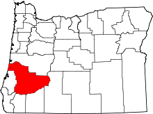 | |
| CDPs | ||
| Unincorporated communities | ||