Erris
| Erris Iorras | |
|---|---|
| Barony | |
|
Barony of Erris shown in green colour top left | |
 Erris Location in Ireland | |
| Coordinates: 54°16′00″N 9°47′00″W / 54.26667°N 9.783333°WCoordinates: 54°16′00″N 9°47′00″W / 54.26667°N 9.783333°W | |
| Country | Ireland |
| Province | Connacht |
| County | County Mayo |
| Elevation | 0 - 730 m (−2,400 ft) |
| Time zone | WET (UTC+0) |
| • Summer (DST) | IST (WEST) (UTC-1) |
| Irish Grid Reference | F820374 |

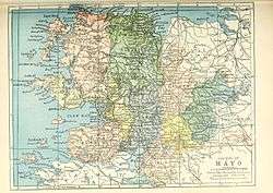
Erris is a barony in northwestern County Mayo in Ireland consisting of over 210,000 acres (850 km2), much of which is mountainous blanket bog.[1] It has extensive sea coasts along its west and north boundaries. The main towns are Belmullet and Bangor Erris. The name Erris derives from the Irish 'Iar Ros' meaning 'western promontory'. To its north is the wild Atlantic Ocean and the bays of Broadhaven and Sruth Fada Conn and to its west is Blacksod Bay. Its main promontories are the Doohoma Peninsula, Mullet Peninsula, Erris Head, the Dún Chiortáin and Dún Chaocháin peninsulas and Benwee Head.[2]
There are five Catholic parishes in Erris: Kilcommon, Kilmore, Kiltane, Belmullet and Ballycroy.
Gaeltacht
.jpg)
Parts of Erris are in a Gaeltacht area, with first-language speakers of Irish in the following areas of the barony: An Fál Mór, Tamhaiin na hUltaí, Glais, Eachléim, Tearmann, Tránn, An Mullach Rua, Cartúr, An Baile Úr, Cill Ghallagáin, Corrán Buí, Ceathrú na gCloch, Port a' Chluaidh, Ros Dumhach and Ceathrú Thaidhg. The area with the most Irish speakers is Ceathrú Thaidhg.[3] There are between 3,500-5,000 native Irish speakers in Erris.
Topography and geology

Much of inland Erris is covered with blanket bog. A triangle between Ballycroy, Bellacorick and Bangor Erris consists of little else over its surface. Blanket bog, unlike raised bog, grows slowly across the landscape like a blanket covering the ground, due to a continuous supply of water from rainfall, maintaining waterlogged conditions on the ground. The bog is acidic with a pH of between 3.5 and 4.2. This is Atlantic blanket bog and it provides a suitable habitat for many species of flora, particularly small species of mosses, bryophytes, carnivorous plants and delicate flowers such as the scarlet pimpernel. Species of fauna found on Atlantic blanket bog, include smaller varieties such as frogs and insects as well as many bird varieties, not common elsewhere.[4][5]
Several areas of the blanket bog are protected under European legislation such as Special Areas of Conservation, Special Protection Areas (Birds Directive) and Natural Heritage Areas. These include the Glenamoy Bog Complex, Ballycroy National Park and Bellacorick.
Erris has a large range of habitats including blanket bogs, estuaries, salt marshes, fresh water lakes, coasts, cliffs, machair, sand dunes, sandy beaches and rocky shores. It is an important area for bird watchers as the largely treeless landscape allows relatively easy access for birdwatching. Species such as the corncrake and the rare red-necked phalarope are found in the area. Brent geese overwinter here feeding along the estuaries and kestrels, goldfinches and herons are commonly seen.[5]
The oldest rocks in Ireland, some 1.8 billion years old, are to be found on the west coasts of Erris.[6] Pink or orange striped gneisses are found along the beaches of Elly Bay and Annagh Head where they have become separated from the same rocks on the east coast of Northern Canada over hundreds of millions of years by the separation of tectonic plates in the mid Atlantic Ocean.[7][8][9] "Erris Head" (Irish: Ceann Iorrais) is a promontory at the northernmost tip of the Mullet Peninsula. It is a landmark known well by mariners and is one of the sea areas cited by Met Éireann's weather forecasters.[10] The coastline of Erris has some of "the grandest sea cliffs in Ireland"[11] over the Atlantic Ocean from where the next stop is the east coast of America. Erris Head is not served by any road and can only be reached by crossing a number of fields from the hamlet of Glenlara where the road ends.
Towns, villages and places of interest
Islands
Along the coast there are several uninhabited islands. These include the Inishkea Islands,[12][13] Inishglora,[14] Duvillaun,[15] the Stags of Broadhaven Bay and many smaller islands.

Archaeology/history

Erris, in common with most of inland Ireland, became covered in extensive native woodland a few thousand years after the last Ice Age retreated (approx 15,000 years ago) but its northern and western shores remained relatively lightly afforested. Across inland Erris, the remains of these forests can be seen across the blanket bog landscape in the form of fossilised greying tree stumps which are mainly the remains of ancient Scots pine trees. These become most obvious where there has been harvesting of turf (peat) for fuel. The odd petrified bog oak can be found too.
During the Neolithic period, starting about 6,000 years ago, the first people living in Ireland whose ancestors had hunted and gathered along the coastlines of Erris from about 9,000 years ago, began to cut down the forestry to clear land for growing crops and grazing livestock. Because the underlying rock type was ancient and heavily weathered schists the soil was thin and easily eroded by inclement weather. After a couple of years the crops began to fail and the Neolithic people had to clear the native woodlands further and further inland to clear more land for their crops.[16] With minor changes in climate and high rainfall levels the land became blanketed by the bog and remains that way to the current day. When present day turf cutters harvest the bog for fuel, archaeological remains, mainly from the Neolithic and early Bronze Age, which have become buried under the bog often come to light.[17] Some archaeological sites are marked on Ordnance Survey maps.
The period of Early Christianity saw several small churches set up but no major religious houses came to the area. During the Plantations of Ireland, there were two major landlords in the area - the Binghams and the Carters. Oliver Cromwell's policy (mid 17th century) of sending the native Irish who refused to bow down to him "to hell or to Connaught" saw a large influx of population into Erris where the disinherited native Irish tried to eke a living from very poor quality agricultural land under the tenancy of the landlords and their agents. During the Irish Famine of 1845 - '47 many died in Erris despite the close proximity of the sea, because they could not raise the cash to fund a passage to America.
Some 19th and early 20th century antiquarians and surveyors visited the Erris area and wrote about their experiences and thoughts on the area at that time. These include works by Patrick Knight (Erris in the Irish Highlands), Caesar Otway (Sketches in Erris and Tyrawley) and Thomas Johnson Westropp (The Promontory Forts and Early Remains of the Coast of Mayo).[18] The Ulster Cycle legend of the Táin Bó Flidhais concerns the Barony of Erris in the time period of approx the 1st century AD.
Legend and folklore
Folklore has always been and still remains an important part of the culture of Erris.[19][20] Much folklore dates from Iron Age tales and legends.
Many well known folklore tales have their origins here. The Children of Lir, according to tradition, are buried on the island of Inisglora. The children were turned into swans by their jealous stepmother and doomed to spend the next 900 years on lakes and waters in Ireland. When they finally reclaimed their human form on Inisglora, they were so old that they died and were buried there.
Táin Bó Flidhais is the tale of a cattle raid in which raiders came to Erris from the Royal site at Cruachán (Rathcroghan) at Tulsk, Co. Roscommon to Rathmorgan Fort (Iorras Domhnann) at the south end of Carrowmore Lake in the centre of the Barony. The remains of Rathmorgan fort on top of the mountain can be seen from the road below.[21]
Brian Rua U'Cearbhain from Inver is remembered in folklore as the prophet of Erris.
The small village of Glencastle has some large mounds in the narrow valley that are not naturally occurring. They can be seen on the right hand side, close to the roadside on the approach to Belmullet from the east. These have never been archaeologically investigated but folklore legends recall that this was the old gateway into the Mullet and a toll had to be paid for each traveller who passed through or the traveller may never be seen again. There were no roads through this area of Mayo until less than two hundred years ago. In recent years the Glencastle Valley has been drastically altered by extensive quarrying.[22]
Water sports

Erris is a popular location for many types of watersports ranging through fishing, sailing, surfing, swimming, wind surfing, kiteboarding and kite surfing.[23][23]
Walking trails
There are many walking trails in Erris - cliff walks above the Atlantic at Broadhaven Bay along Benwee Head, Glinsk and the North Mayo coastline - details from Comhar Dún Chaocháin Teo in Carrowteige, remote mountain walks across miles of uninhabited natural wilderness, and long distance walks such as the Bangor Trail and the Western Way.[24][25]
Tír Sáile Sculpture Trail
In 1993 the Tír Sáile Sculpture Trail project was carried out to commemorate 5,000 years of habitation in Co. Mayo. This trail extends through many areas of Erris from the tip of the Mullet Peninsula, through Kilcommon, Belderrig and Ballycastle.
It is the largest public arts project ever undertaken in Ireland and entailed putting in place site specific sculptures along the North Mayo coast.
The first lot of sculptures were erected in 1993 and since then there have been several more added. The Children of Lir sculpture pictured on this page is one of the later pieces. The sculptures incorporate the physical landscape and the cultural heritage of the area and the artists came from all corners of the globe.
The tasks involved in creating the sculpture trail took the form of the Meitheal, a traditional method of working where a group of workers come together to achieve a common objective. The Meitheeal pervaded all aspects of the sculpture symposium, community involvement, donation of sites and the hosting of the artists in the local community.
A fundamental requirement was that the artists used natural materials in sympathy with their surroundings. The North Mayo coastline allowed for the exploration of a variety of many different possibilities. All sorts of sites were incorporated from disused quarries and sand dunes, cliff tops and waste land at crossroads and the sculptures varied from the stone sheep gathered at the roadside near Bellanaboy to the one eyed giant Dun Chaocháin sculpture on the hillside of Cill Ghallagáin, close to Carrowteige, the Children of Lir sculpture near Benwee Head and the mirrored monument created at Claggan Island.
The interaction of artist with the natural environment by way of imagination and physical endeavour, achieved the primary aim of Tir Sáile which was to celebrate the past, relish the present and embrace the future.
Natural resources
Erris has considerable potential for ocean energy[26] in terms of its location next to the Atlantic Ocean and constant winds from the sea.[27] These resources have been earmarked for development.[28] There are opportunities for the development of ocean wave power projects, tidal power, hydroelectric schemes, and, wind farms amongst other clean, alternative energy generation opportunities for which the area is eminently suitable.[29][30]
Corrib gas field
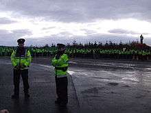
The discovery of the Corrib gas field in the Atlantic Ocean some 85 km off Broadhaven Bay has led to the Corrib gas project and ensuing controversy. Raw, unodourised natural gas from fields under the Atlantic Ocean is planned to be piped at high pressure at Glengad and through the townlands of Kilcommon, to a refinery 10 km inland. Documentaries have been made on the subject .[31] A documentary film, The Pipe by local film-maker, Richard O'Donnell, had its first showing at the Galway Film Festival on Thursday 8 July 2010, went on general release in cinemas nationwide from 3 December 2010.

References
- ↑ "From Ireland Genealogy & Family History". from-ireland.net. Retrieved 2010-07-28.
- ↑ Ireland's History in Maps - Baronies page 3
- ↑ "School of Celtic Studies - The Irish of Erris, Co. Mayo: a phonemic study". Celt.dias.ie. Retrieved 2010-06-05.
- ↑ "IPCC information sheets - Blanket Bogs". Ipcc.ie. 1919-06-15. Retrieved 2010-06-05.
- 1 2 "BirdWatch Mayo". BirdWatch Mayo. Retrieved 2010-06-05.
- ↑ "Irish Geological Association". Geology.ie. 2008-06-22. Retrieved 2010-06-05.
- ↑ "U-Pb zircon geochronology from the Precambrian Annagh Division gneisses and the Termon Granite, NW County Mayo, Ireland - AFTALION and MAX 144 (3): 401 - Journal of the Geological Society". Jgs.geoscienceworld.org. doi:10.1144/gsjgs.144.3.0401. Retrieved 2010-06-05.
- ↑ A revised correlation of Precambrian ... Retrieved 2010-06-05.
- ↑ "Pre-Caledonian History of the Annagh Gneiss Complex North-Western Ireland, and Correlation with Laurentia-Baltica". JSTOR 30002311.
- ↑ "Sea Area Forecast - Met Éireann - The Irish Meteorological Service Online". Met.ie. 2010-05-06. Retrieved 2010-06-05.
- ↑ "Mayo". Libraryireland.com. Retrieved 2010-06-05.
- ↑ "Insihkea Islands". Irishislands.info. 1927-10-28. Retrieved 2010-06-05.
- ↑ "Beautiful isles". Mayonews.ie. 2008-08-05. Retrieved 2010-06-05.
- ↑ "Inishglora". Irishislands.info. Retrieved 2010-06-05.
- ↑ "Duvillaun". Irishislands.info. Retrieved 2010-06-05.
- ↑ "IPCC information sheets - Pollen History Preserved in Bogs". Ipcc.ie. Retrieved 2010-06-05.
- ↑ For information on the archaeology of Kilcommon parish, see Comhar Dún Chaocháin Teo in Carrowteige.
- ↑ "The Promontory Forts and Early Remains of the Coasts of County Mayo". JSTOR 25514241.
- ↑ http://www.epa.ie/licences/lic_eDMS/090151b28015abf0.pdf
- ↑ "Irish Press Releases » Island Culture and Arts 24–26 July 2008 Belmullet". Irishpressreleases.ie. Retrieved 2010-06-05.
- ↑ "The Driving of Flidais' Cattle". Corona.edu. Retrieved 2010-06-05.
- ↑ "About". Lennonquarries.com. Retrieved 2010-06-05.
- 1 2 "Erris Beo". Errisbeo.ie. Retrieved 2010-06-05.
- ↑ "Mayo Walks - Erris Head Loop Walk". Mayowalks.ie. Retrieved 2010-06-05.
- ↑ "Walking book from Dun Chaochain area of North Mayo, Ireland". Mayo-ireland.ie. Retrieved 2010-06-05.
- ↑ "Wave power has potential to light up Ireland". Mayonews.ie. 2008-12-09. Retrieved 2010-06-05.
- ↑ "Mayo Renewable Energy Strategy is launched". MayoToday.ie. 2010-04-19. Retrieved 2010-06-05.
- ↑ Western People - Wave farm in pipeline for Erris - October 2009
- ↑ "SEAI - Sustainable Energy Ireland Commences Wave Energy Monitoring". Seai.ie. 2010-02-23. Retrieved 2010-06-05.
- ↑ Archived April 17, 2010, at the Wayback Machine.
- ↑ "Prime Time". RTÉ News. 2001-07-05.
- Bird Watch Mayo
- Cronin, Phil. Traditional Cures and Gifted People (2000) Crossmolina
- Erris Beo
- Erris Islands: moduvill, glora, inishkea
- Irish Peatland Conservation Council (2005)
- Nolan, R. Within the Mullet (1997) Kildare
- Noone, Fr. S. Where the Sun Sets (1991) Erris
- The Pipe documentary
- Pipe Down - An hour long documentary which won best feature documentary award at the Waterford Film Festival 2009
- The policy makers!/the energy options seai.ie
External links
 | ||
| ||