Esperanza, Masbate
| Esperanza | |
|---|---|
| Municipality | |
|
Gawas beach, Esperanza | |
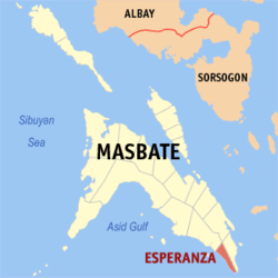 Map of Masbate with Esperanza highlighted | |
.svg.png) Esperanza Location within the Philippines | |
| Coordinates: 11°44′N 124°03′E / 11.733°N 124.050°ECoordinates: 11°44′N 124°03′E / 11.733°N 124.050°E | |
| Country | Philippines |
| Region | Bicol (Region V) |
| Province | Masbate |
| District | 3rd district |
| Barangays | 20 |
| Government[1] | |
| • Mayor | Ian Peter S. Sepulveda |
| Area[2] | |
| • Total | 67.49 km2 (26.06 sq mi) |
| Population (2010)[3] | |
| • Total | 17,357 |
| • Density | 260/km2 (670/sq mi) |
| Time zone | PST (UTC+8) |
| Zip Code | 5407 |
| Dialing code | 56 |

Esperanza is a municipality in Masbate Province, the Philippines, with a population of 17,357 people in the 2010 census.[3] About 60% of the population lives along the coastline, most of whom are fishermen. It is about 4 hours travel south of Masbate City with some roads and highways still undeveloped.
Esperanza has several beaches, among them Gamay Na Baybay Beach, Talisay (Punta) Beach and Manok Manok Beach.
Barangays
Esperanza is politically subdivided into 20 barangays.[2]
- Agoho
- Almero
- Baras
- Domorog
- Guadalupe
- Iligan
- Labangtaytay
- Labrador
- Libertad
- Magsaysay
- Masbaranon
- Poblacion
- Potingbato
- Rizal
- San Roque
- Santiago
- Sorosimbajan
- Tawad
- Tunga
- Villa
History
People in the 1970s to early 1990s were heavily dependent on the water resources in the so-called Kapayawan, which means "deep well". It is the only safe water source for the majority of the people living in the area. In 2000, Esperanza was finally connected to the electricity grid supplied by MASELCO which benefited 80% of the households in the area.
In 2006, President Gloria Arroyo defined Esperanza to be the most accessible town in Masbate going to Samar, Leyte and Cebu. That is the primary reason why the National Government constructed the port to serve as a roll-on/roll-off (RORO) gateway.
Esperanza is about Four (4) hours land travel South from Masbate City, the last municipality in the south located between Placer in north-west and Pio V Corpus in southeast and considered as among the smallest in the island. In early days, Esperanza was a former one of the barangay in Placer.
Early 1915, the migrants [Conag, Arabis, Pelayo and Serafin families] sailed from northern Cebu using their paddled banca and settled the place. The settlers actively cultivated the area into a productive agricultural community, developing the place until eventually called “Halabangbaybay”. Halabangbaybay means [Long Beach], due to its elongated shoreline and white fine sand. Halabangbaybay at that era was a green-mountainous forest community. It was not recognized as a barrio or even a mere sitio.
In the 1940s, Halabangbaybay became a Sitio of barrio Alegria, Cataingan, Masbate and converted into a barrio named Esperanza as component barangay of Placer and Pablo M. Conag served as the “Tiniente del Barrio”. [ESPERANZA which means “HOPE”, PAGLA-UM in vernacular and PAG-ASA in Tagalog]
In the mid 1950s, Lawyer Alfonso E. Conag [One of the sons of Felimon Serafin Conag] initiated vigorously and pursued for the conversion of Barrio Esperanza into an Independent Town.
On July 2, 1959 - the set of Municipca Officials starts hold office and Santos Edem Conag, the eldest son of Felimo Serafin Conag became the 1st elected Mayor..
Esperanza has a total population of 16,834 according to the National Statistic Office data as of August 1, 2007 and composed of twenty (20) barangays that includes the following; Agoho, Almero, Baras, Domorog, Guadalupe, Iligan, Labangtaytay, Labrador, Libertad, Magsaysay, Masbaranon, Poblacion, Potingbato, Rizal, San Roque, Santiago, Sorosimbajan, Tawad, Tunga & Villa.
Esperanza had eleven (11) barangays located along the coastal line and nine (9) in farm areas with an estimated of seventy 70% of the population belongs to the fisher folks.
Climate
Weather in Esperanza is generally divided into two seasonal weather patterns known locally as the Amihan and Habagat seasons. In the Tagalog language, Amihan means a cool north-east wind, and Habagat means west or south-west wind; south-west monsoon. Amihan and Habagat seasons are generally associated respectively with the El Niño and La Niña global weather patterns. The Amihan season is characterized by moderate temperatures, little or no rainfall, and a prevailing wind from the east. The Habagat season is characterized by hot and humid weather, frequent heavy rainfall, and a prevailing wind from the west.
On Esperanza, the main indicator of the switch between the Amihan and Habagat seasonal patterns is the switch in wind direction. In most years this transition is abrupt and occurs overnight. In some years there is a period of perhaps a week or two where the wind will switch between Amihan and Habagat patterns several times before settling into the pattern for the new season. As a rule of thumb, Labangtatay will be in the Habagat weather pattern from sometime in September or October to sometime in May or June and in the Amihan weather pattern for the remainder of the year. These dates can vary in individual years, though.
Daytime temperatures on Esperanza generally range from 77-90 °F (25-32 °C) from the beginning of the Amihan season into February or March, increase to the 82-100 °F (28-38 °C) range until the onset of the Habagat season, and moderate back to the 77-90 °F (25-32 °C) range with the return of the Amihan season.[8] During Tropical Storm periods, temperatures can fall below 68 °F (20 °C). Tropical Storms can impact Esperanza at any time of year, but are most likely to be seen during the Habagat season.
Demographics
| Population census of Esperanza | ||
|---|---|---|
| Year | Pop. | ±% p.a. |
| 1990 | 14,674 | — |
| 1995 | 17,023 | +2.82% |
| 2000 | 16,209 | −1.04% |
| 2007 | 16,834 | +0.52% |
| 2010 | 17,357 | +1.12% |
| Source: National Statistics Office[3][4] | ||
Transportation
In Esperanza, the two main modes of transport are via motor-tricycles along the main road or by walking along the beaches. Pedicabs are also available for transport along the Beach front Path. Other means of transportation include mountain bikes, quadbikes and motorbikes, all of which can be rented.
To explore around the island's coast, motorized bancas and sailing paraws are available for rent. These are outrigger canoes and are common sight in waters around the island. The sailing paraw is a narrow hulled boat with outriggers either side and with passengers sometimes seated on a trampoline platform between the outrigger supports. These are extremely fast off the wind, but can be unwieldy for inexperienced sailors.
References
- ↑ "Municipalities". Quezon City, Philippines: Department of the Interior and Local Government. Retrieved 28 January 2013.
- 1 2 "Province: MASBATE". PSGC Interactive. Makati City, Philippines: National Statistical Coordination Board. Retrieved 28 January 2013.
- 1 2 3 "Total Population by Province, City, Municipality and Barangay: as of May 1, 2010" (PDF). 2010 Census of Population and Housing. National Statistics Office. Retrieved 28 January 2013.
- ↑ "Province of Masbate". Municipality Population Data. LWUA Research Division. Retrieved 23 July 2013.
External links
| Wikimedia Commons has media related to Esperanza, Masbate. |
- Philippine Standard Geographic Code
- Philippine Census Information
- Local Governance Performance Management System
 |
Placer | Cataingan | Pio V. Corpuz | |
| |
||||
| ||||
| | ||||
| Visayan Sea | |
Visayan Sea |
Masbate City (capital) | |
| Municipalities | |
| Component city | |