Exhibition, Saskatoon
| Exhibition | |
|---|---|
| Neighbourhood | |
|
Welcome to Prairieland Park | |
| Coordinates: 52°6′13″N 106°40′24″W / 52.10361°N 106.67333°W | |
| Country |
|
| Province |
|
| City | Saskatoon |
| Suburban Development Area | Nutana |
| Neighbourhood | Exhibition |
| Construction | 1921-1945 |
| Government | |
| • Type | Municipal (Ward 7) |
| • Administrative body | Saskatoon City Council |
| • Councillor | Mairin Loewen |
| Population (2006) | |
| • Total | 2,480 |
| • Average Income | $44,487 |
| Time zone | UTC (UTC-6) |
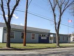
| Public Education | Thornton School |
| Separate Education |
Seventh Day Adventist Christian School St. Frances School |
| Website | Exhibition Community Association |
| List of neighbourhoods in Saskatoon | |
The Exhibition subdivision of Saskatoon, Saskatchewan, Canada, is located on the banks of the South Saskatchewan River and was developed between the two major World Wars. To the west is the Diefenbaker Management Area which boasts the Diefenbaker park and Pioneer Cemetery. The park includes a medium-sized hill which is used for tobogganing and snowboarding, and the park itself is a frequently-used venue for picnics and public events and performances. The Exhibition community is also known as Thornton, after a (now-decommissioned) elementary school that formerly served the area and early in its history also went by the name Bellevue.
History
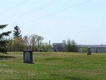
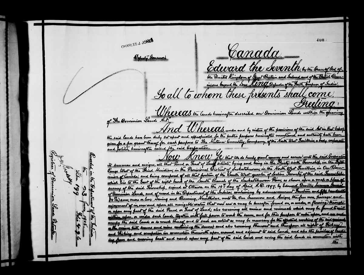
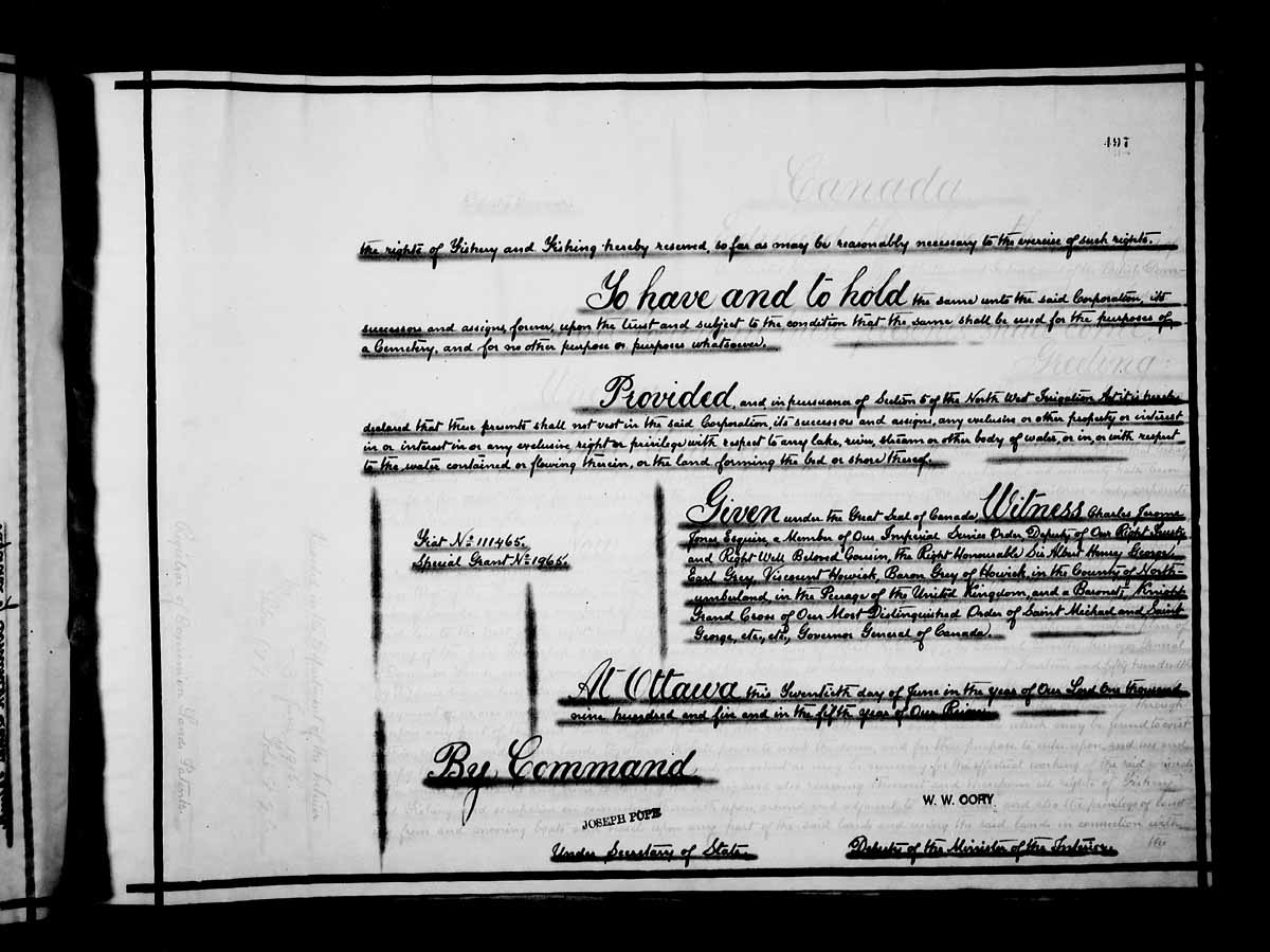
The Pioneer Cemetery received its first interment in 1884. On June 20, 1905, the Nutana Cemetery Co was awarded a special grant at SW Section 20 Township 36 Range 5 W of the 3rd Meridian. The Pioneer Cemetery was also called the Nutana Cemetery, and was the first municipal cemetery for the City of Saskatoon until 1910 when Woodlawn Cemetery became the city cemetery. The Pioneer Cemetery was declared a heritage site in 1982. [1]
Exhibition, Saskatoon, Saskatchewan is at coordinates 52°06′13″N 106°40′24″W / 52.103611°N 106.673333°WCoordinates: 52°06′13″N 106°40′24″W / 52.103611°N 106.673333°W[2][3]
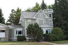
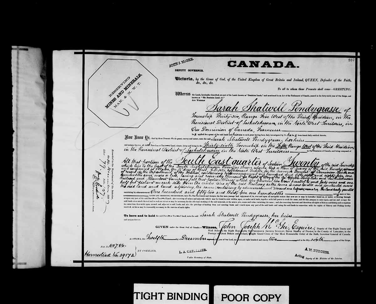
Sarah Shatwell Pendygrasse arrived from England in 1887 and was awarded a dominion land grant patent at SE section 20 township 36 range 5 W of the 3rd meridian, Saskatchewan provisional district, North West Territories, on December 12, 1892.[4] Her son Harold L. S. Pendygrasse homestead at NE Section 20 township 35 Range 3 W of the 3rd meridian. At 1919 St. Henry Avenue, Exhibition subdivision the Pendygrasse Home built by Harold Pendygrasse in 1910 has been declared a municipal heritage site. It is built on the banks of the South Saskatchewan river east side of Saskatoon.[5]
For many years, the community was known by the name Bellevue, and this is how it was listed in the Henderson's Directory up until as late as the 1940s. Construction of the Idylwyld Freeway in the 1960s resulted in the Exhibition community being physically bisected, with several streets and what was at one time the city's main CN Rail line being removed. Only two east-west streets provide access to the western section of the community: Taylor Street West and Ruth Street West. In the 1980s, the city attempted to relocate the Exhibition Grounds to the north end of the city, opening the Exhibition Grounds up for residential development; voters defeated this plan in a plebiscite.
Public services
Saskatoon Light and Power provides electrical utilities to all Saskatoon neighbourhoods which existed prior to 1958.[6] Water is treated and supplied by the City of Saskatoon Water and Wastewater Treatment Branch.[7] The exhibition neighbourhood is a part of the east division of the Saskatoon Police Services patrol system. This division services east of the South Saskatchewan River which encompasses the thirty one neighbourhoods, two industrial areas.[8] The three Saskatoon hospitals are located in other nearby neighbourhoods. St. Paul's Hospital i The Central Division oversees the Central Business District, the Riversdale Business District, SIAST and nine other residential areas.[9] The exhibition neighbourhood is served by the City of Saskatoon Saskatoon Fire & Protective Services.[10]
Demographics
I-neighbor sets the neighbourhood population at 31,474 consists of 12,567 residences.[11] Family size is about 2.2 people, with an average family income of $46,242. The city of Saskatoon sets the 2007 population count at 2,767 with homeownership at 56.7%.[12] According to MLS data, the average sale price of a home as of 2013 was $256,670.[13]
Governance
The exhibition exists within the federal electoral district of Blackstrap. It is currently represented by Member of Parliament Lynne Yelich of the Conservative Party of Canada, first elected in 2000 and re-elected in 2004 and 2006.[14]
Provincially, the area is within the constituency of Saskatoon Southeast. It is currently represented by Member of the Legislative Assembly Don Morgan of the Saskatchewan Party, first elected in 2003.
In Saskatoon's non-partisan municipal politics, the Exhibition neighbourhood lies within ward 7. It is currently represented by Councillor Bob Pringle.[15]
The Exhibition Community Association is formed of volunteers in the community and may petition the councillor, MLA or MP regarding infrastructure or public services for the neighbourhood.

Geography
The exhibition area is at an elevation of 305 m (1,000 ft 8 in) and is located on the east river bank of the South Saskatchewan River.[11] Located just 2.65 miles (4.26 km) from Down Town Saskatoon.[16]
The northern boundary is Taylor Street, and as previously mentioned, the western boundary is the South Saskatchewan River. The eastern edge is Melrose Avenue, and to the south is Ruth Street, the Prairieland Park and WDM
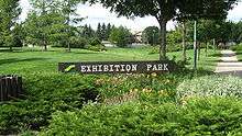
Achs Park, 1.82 acres (7,400 m2); Exhibition Park, 3.13 acres (12,700 m2) and Thornton Park, 2.00 acres (8,100 m2) are the three main parks in the neighbourhood. The Meewasin Valley Authority is developing parks and walk ways along the South Saskatchewan River. Along the west boundary of the exhibition neighbourhood is Gabriel Dumont park as well as trails at the top and base of the riverbank.
Education
| Saskatoon Seventh-day Adventist Christian School | |
|---|---|
 | |
| Address | |
|
2228 Herman Avenue Saskatoon, Saskatchewan, S7M 0N3 Canada | |
| Information | |
| Religious affiliation(s) | Seventh-day Adventist |
| Principal | Corinne Lindberg |
| Grades | Kindergarten to Grade 10 |
| Education system | Private |
| Language | English |
| Website | Saskatoon Seventh-day Adventist Christian School |
| St. Frances School | |
|---|---|
.jpg) | |
| Address | |
|
2141 McPherson Avenue Saskatoon, Saskatchewan, S7J 0S8 Canada | |
| Information | |
| Type | Elementary |
| Religious affiliation(s) | Catholic |
| Opened | 1953[17] |
| School board | Greater Saskatoon Catholic Schools |
| Principal | Darren Fradette |
| Vice Principal | Theresa Laroque |
| Grades | Pre-Kindergarten to Grade 8 |
| Enrollment | 495[18] (2016) |
| Education system | Separate |
| Language | English, Cree Immersion |
| Feeder to | Holy Cross High School |
| Website | St. Frances School |
- Saskatoon Seventh-day Adventist Christian School - private elementary, part of the Saskatoon Public School Division[19]
- St. Frances School - separate (Catholic) elementary, part of Greater Saskatoon Catholic Schools[20]
The area's public elementary school, Thornton School, was decommissioned in 1986 and demolished in 1997.
Commercial
Commercial development includes a service station at the corner of Ruth Street and Lorne Avenue, commercial development at Lorne Avenue and Taylor Street, and a number of light-industrial businesses on St. George Avenue and Isabella Street West.
Arts and culture
- Exhibition Community Association addresses concerns of the community and provides recreational events and activities year round for all ages.[21]
- Saskatchewan Western Development Museum is also located south of Ruth Street.
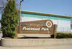
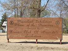
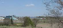
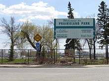
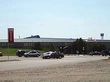
- Prairieland Park or Saskatoon Exhibition Grounds are located south of Ruth Street.[22][23][24]
Location
| Buena Vista | |||
| Diefenbaker MA / South Saskatchewan River | |
Avalon / Queen Elizabeth / CN MA | |
| |||
| | |||
| Corman Park No. 344 |
References
- ↑ Saskatoon Heritage Society - PIONEER CEMETERY URL accessed March 3, 2007
- ↑ SW 20 36 5 W3 URL accessed March 3, 2007
- ↑ Nutana Cemetery Co The URL accessed March 3, 2007
- ↑ Sarah Shatwell Pendygrasse URL accessed March 3, 2007
- ↑ Exploring The Wonder City - Driving Tour URL accessed March 3, 2007
- ↑ "Saskatoon Light & Power". City of Saskatoon. Retrieved 2008-05-11.
- ↑ "City of Saskatoon Departments Utility Services Water Treatment". Retrieved 2008-05-11.
- ↑ "Saskatoon Police Service". Retrieved 2008-05-11.
- ↑ "Saskatoon Police Service". Retrieved 2008-05-11.
- ↑ "Fire and Protective Services". City of Saskatoon. Archived from the original on 2008-03-21. Retrieved 2008-05-11.
- 1 2 "i-neighbors". Retrieved 2008-05-11.
- ↑ "Exhibition Map & Profile (PDF)" (PDF). City of Saskatoon. Archived from the original (PDF) on October 20, 2007. Retrieved 2008-05-11.
- ↑ "Exhibition". Saskatoon Realty. Retrieved 2014-01-08.
- ↑ "CBC - Canada Votes 2006 - Candidates and Ridings". Archived from the original on 2008-04-18. Retrieved 2008-05-11.
- ↑ "City of Saskatoon · City Hall · Ward Councillors". City of Saskatoon. Archived from the original on 2008-03-05. Retrieved 2008-05-11.
- ↑ "Mapquest". Retrieved 2008-05-11.
- ↑ Celebrating a Century of Faith and Learning - A History of Saskatoon's Catholic Schools. Greater Saskatoon Catholic Schools. 2015. p. 200. ISBN 978-0-9947443-0-2.
- ↑ Active List of Saskatchewan Schools/Programs (PDF), retrieved 2016-11-28
- ↑ "Saskatoon Seventh-day Adventist Christian School". Retrieved 2015-07-04.
- ↑ "St. Frances School". Greater Saskatoon Catholic Schools. Retrieved 2015-07-04.
- ↑ City of Saskatoon · Departments · Community Services · Community ... URL accessed March 4, 2007
- ↑ Saskatoon Exhibition URL accessed March 4, 2007
- ↑ Prairieland Park URL accessed March 4, 2007
- ↑ Saskatoon tourism URL accessed March 4, 2007
- ↑ Selling an Idea or a Product URL accessed January 27, 2007
External links
| Wikimedia Commons has media related to Exhibition, Saskatoon. |
- Saskatoon Neighbourhoods Word Search Puzzle
- City of Saskatoon · Departments · Community Services · Community ...
- City of Saskatoon City of Saskatoon · Departments · Community Services · City Planning · ZAM Maps
- Populace Spring 2006