Farmer, South Dakota
| Farmer, South Dakota | |
|---|---|
| Town | |
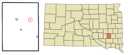 Location in Hanson County and the state of South Dakota | |
| Coordinates: 43°43′29″N 97°41′19″W / 43.72472°N 97.68861°WCoordinates: 43°43′29″N 97°41′19″W / 43.72472°N 97.68861°W | |
| Country | United States |
| State | South Dakota |
| County | Hanson |
| Incorporated | 1920[1] |
| Area[2] | |
| • Total | 0.08 sq mi (0.21 km2) |
| • Land | 0.08 sq mi (0.21 km2) |
| • Water | 0 sq mi (0 km2) |
| Elevation | 1,394 ft (425 m) |
| Population (2010)[3] | |
| • Total | 10 |
| • Estimate (2012[4]) | 10 |
| • Density | 125.0/sq mi (48.3/km2) |
| Time zone | Central (CST) (UTC-6) |
| • Summer (DST) | CDT (UTC-5) |
| ZIP code | 57311 |
| Area code(s) | 605 |
| FIPS code | 46-21060[5] |
| GNIS feature ID | 1255013[6] |
Farmer is a town in Hanson County, South Dakota, United States. It is part of the Mitchell, South Dakota Micropolitan Statistical Area. The population was 10 at the 2010 census.
History
A post office called Farmer was established in 1890, and remained in operation until it was discontinued in 1992.[7] A majority of the early settlers being farmers caused the name to be selected.[8]
Geography
Farmer is located at 43°43′29″N 97°41′19″W / 43.72472°N 97.68861°W (43.724747, -97.688492).[9]
According to the United States Census Bureau, the town has a total area of 0.08 square miles (0.21 km2), all of it land.[2]
Demographics
| Historical population | |||
|---|---|---|---|
| Census | Pop. | %± | |
| 1930 | 132 | — | |
| 1940 | 130 | −1.5% | |
| 1950 | 114 | −12.3% | |
| 1960 | 95 | −16.7% | |
| 1970 | 58 | −38.9% | |
| 1980 | 27 | −53.4% | |
| 1990 | 23 | −14.8% | |
| 2000 | 18 | −21.7% | |
| 2010 | 10 | −44.4% | |
| Est. 2015 | 10 | [10] | 0.0% |
| U.S. Decennial Census | |||
2010 census
As of the census[3] of 2010, there were 10 people, 4 households, and 3 families residing in the town. The population density was 125.0 inhabitants per square mile (48.3/km2). There were 9 housing units at an average density of 112.5 per square mile (43.4/km2). The racial makeup of the town was 100.0% White.
There were 4 households of which 50.0% had children under the age of 18 living with them, 75.0% were married couples living together, and 25.0% were non-families. 25.0% of all households were made up of individuals. The average household size was 2.50 and the average family size was 3.00.
The median age in the town was 46 years. 30% of residents were under the age of 18; 0.0% were between the ages of 18 and 24; 20% were from 25 to 44; 30% were from 45 to 64; and 20% were 65 years of age or older. The gender makeup of the town was 50.0% male and 50.0% female.
2000 census
As of the census[5] of 2000, there were 18 people, 7 households, and 4 families residing in the town. The population density was 282.5 people per square mile (115.8/km²). There were 10 housing units at an average density of 156.9 per square mile (64.4/km²). The racial makeup of the town was 94.44% White and 5.56% Native American.
There were 7 households out of which 28.6% had children under the age of 18 living with them, 57.1% were married couples living together, 14.3% had a female householder with no husband present, and 28.6% were non-families. 28.6% of all households were made up of individuals and 14.3% had someone living alone who was 65 years of age or older. The average household size was 2.57 and the average family size was 3.20.
In the town the population was spread out with 33.3% under the age of 18, 27.8% from 25 to 44, 22.2% from 45 to 64, and 16.7% who were 65 years of age or older. The median age was 39 years. For every 100 females there were 100.0 males. For every 100 females age 18 and over, there were 100.0 males.
The median income for a household in the town was $14,375, and the median income for a family was $55,417. Males had a median income of $26,250 versus $21,250 for females. The per capita income for the town was $10,976. None of the population or families were below the poverty line.
References
- ↑ "SD Towns" (PDF). South Dakota State Historical Society. Retrieved 2010-02-12.
- 1 2 "US Gazetteer files 2010". United States Census Bureau. Retrieved 2012-06-21.
- 1 2 "American FactFinder". United States Census Bureau. Retrieved 2012-06-21.
- ↑ "Population Estimates". United States Census Bureau. Retrieved 2013-05-29.
- 1 2 "American FactFinder". United States Census Bureau. Retrieved 2008-01-31.
- ↑ "US Board on Geographic Names". United States Geological Survey. 2007-10-25. Retrieved 2008-01-31.
- ↑ "Hanson County". Jim Forte Postal History. Retrieved 4 April 2015.
- ↑ Chicago and North Western Railway Company (1908). A History of the Origin of the Place Names Connected with the Chicago & North Western and Chicago, St. Paul, Minneapolis & Omaha Railways. p. 176.
- ↑ "US Gazetteer files: 2010, 2000, and 1990". United States Census Bureau. 2011-02-12. Retrieved 2011-04-23.
- ↑ "Annual Estimates of the Resident Population for Incorporated Places: April 1, 2010 to July 1, 2015". Retrieved July 2, 2016.
Municipalities and communities of Hanson County, South Dakota, United States | ||
|---|---|---|
| Cities | 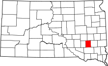 | |
| Towns | ||
| Unincorporated communities | ||