Farrington Township, Jefferson County, Illinois
| Farrington Township | |
|---|---|
| Township | |
 Location in Jefferson County | |
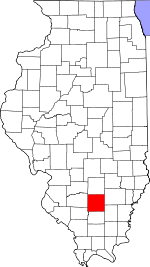 Jefferson County's location in Illinois | |
| Coordinates: 38°26′N 88°45′W / 38.433°N 88.750°WCoordinates: 38°26′N 88°45′W / 38.433°N 88.750°W | |
| Country | United States |
| State | Illinois |
| County | Jefferson |
| Area | |
| • Total | 36.76 sq mi (95.2 km2) |
| • Land | 36.69 sq mi (95.0 km2) |
| • Water | 0.07 sq mi (0.2 km2) 0.19% |
| Elevation | 472 ft (144 m) |
| Population (2010) | |
| • Total | 567 |
| • Density | 15.5/sq mi (6.0/km2) |
| Time zone | CST (UTC-6) |
| • Summer (DST) | CDT (UTC-5) |
| ZIP codes | 62814, 62851, 62864, 62889 |
| GNIS feature ID | 0428995 |
Farrington Township is one of sixteen townships in Jefferson County, Illinois, USA. As of the 2010 census, its population was 567 and it contained 246 housing units.[1]
Geography
According to the 2010 census, the township has a total area of 36.76 square miles (95.2 km2), of which 36.69 square miles (95.0 km2) (or 99.81%) is land and 0.07 square miles (0.18 km2) (or 0.19%) is water.[1] The township is centered at 38°26'N 88°45′W (38.429,-88.757).
Unincorporated towns
- Harmony at 38°24′25″N 88°47′35″W / 38.407°N 88.793°W
- Shields at 38°28′05″N 88°42′47″W / 38.468°N 88.713°W
- Stratton at 38°26′46″N 88°42′47″W / 38.446°N 88.713°W
(This list is based on USGS data and may include former settlements.)
Extinct towns
(These towns are listed as "historical" by the USGS.)
Adjacent townships
- Romine Township, Marion County (north)
- Orchard Township, Wayne County (northeast)
- Hickory Hill Township, Wayne County (east)
- Webber Township (south)
- Mount Vernon Township (southwest)
- Field Township (west)
- Haines Township, Marion County (northwest)
Cemeteries
The township contains these eight cemeteries: Falley, Greenwalt, Harmony, Lowery, McConnaughhay, Mifflin, Mount Zion and Wells Chapel.
School districts
- Farrington Grade School
Political districts
- Illinois' 19th congressional district
- State House District 107
- State Senate District 54
References
- "Farrington Township, Jefferson County, Illinois". Geographic Names Information System. United States Geological Survey. Retrieved 2010-01-17.
- United States Census Bureau 2007 TIGER/Line Shapefiles
- United States National Atlas
- 1 2 "Population, Housing Units, Area, and Density: 2010 - County -- County Subdivision and Place -- 2010 Census Summary File 1". United States Census. Retrieved 2013-05-28.
External links
Municipalities and communities of Jefferson County, Illinois, United States | ||
|---|---|---|
| Cities | ||
| Villages | ||
| Townships | ||
| CDP | ||
| Other unincorporated communities |
| |
| Footnotes | ‡This populated place also has portions in an adjacent county or counties | |
This article is issued from Wikipedia - version of the 12/1/2013. The text is available under the Creative Commons Attribution/Share Alike but additional terms may apply for the media files.