McClellan Township, Jefferson County, Illinois
| McClellan Township | |
|---|---|
| Township | |
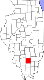
 Location in Jefferson County | |
 Jefferson County's location in Illinois | |
| Coordinates: 38°15′N 88°59′W / 38.250°N 88.983°WCoordinates: 38°15′N 88°59′W / 38.250°N 88.983°W | |
| Country | United States |
| State | Illinois |
| County | Jefferson |
| Area | |
| • Total | 35.69 sq mi (92.4 km2) |
| • Land | 35.64 sq mi (92.3 km2) |
| • Water | 0.05 sq mi (0.1 km2) 0.14% |
| Elevation | 430 ft (131 m) |
| Population (2010) | |
| • Total | 1,255 |
| • Density | 35.2/sq mi (13.6/km2) |
| Time zone | CST (UTC-6) |
| • Summer (DST) | CDT (UTC-5) |
| ZIP codes | 62816, 62864, 62894, 62898 |
| GNIS feature ID | 0429299 |
McClellan Township is one of sixteen townships in Jefferson County, Illinois, USA. As of the 2010 census, its population was 1,255 and it contained 534 housing units.[1]
Geography
According to the 2010 census, the township has a total area of 35.69 square miles (92.4 km2), of which 35.64 square miles (92.3 km2) (or 99.86%) is land and 0.05 square miles (0.13 km2) (or 0.14%) is water.[1] The township is centered at 38°15'N 88°59'W (38.258,-89.986). It is traversed north-south by Interstate Route 57, from it to the east by Interstate 64 and from I-57 to the southwest by State Route 148.
Cities, towns, villages
- Mount Vernon (southwest edge)
- Waltonville (northeast quarter)
Unincorporated towns
(This list is based on USGS data and may include former settlements.)
Adjacent townships
- Shiloh Township (north)
- Dodds Township (east)
- Elk Prairie Township (south)
- Bald Hill Township (southwest)
- Blissville Township (west)
- Casner Township (northwest)
Cemeteries
The township contains these four cemeteries: Black, Rightnower, South Hickory Hill and Wolf Prairie.
Churches
The township contains several churches including:
- South Hickory Hill Christian Church
- West Long Prairie Christian Church
- Marcoe Church
- Antioch Missionary Baptist Church
Major highways
School districts
- Waltonville Community Unit School District 1
- McClellan Community Consolidated School District 12
- Mt. Vernon Township High School
- Rend Lake Junior College
Political districts
- Illinois' 19th congressional district
- State House District 107
- State Senate District 54
References
- "McClellan Township, Jefferson County, Illinois". Geographic Names Information System. United States Geological Survey. Retrieved 2010-01-17.
- United States Census Bureau 2007 TIGER/Line Shapefiles
- United States National Atlas
- 1 2 "Population, Housing Units, Area, and Density: 2010 - County -- County Subdivision and Place -- 2010 Census Summary File 1". United States Census. Retrieved 2013-05-28.
External links
Municipalities and communities of Jefferson County, Illinois, United States | ||
|---|---|---|
| Cities | ||
| Villages | ||
| Townships | ||
| CDP | ||
| Other unincorporated communities |
| |
| Footnotes | ‡This populated place also has portions in an adjacent county or counties | |