Flora, Apayao
| Flora | ||
|---|---|---|
| Municipality | ||
| ||
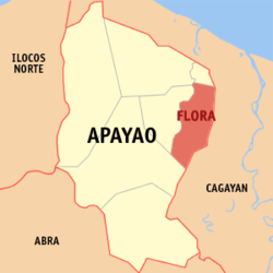 Location within Apayao province | ||
.svg.png) Flora Location within the Philippines | ||
| Coordinates: 18°07′N 121°24′E / 18.12°N 121.4°ECoordinates: 18°07′N 121°24′E / 18.12°N 121.4°E | ||
| Country | Philippines | |
| Region | Cordillera Administrative Region (CAR) | |
| Province | Apayao | |
| District | Lone District | |
| Barangays | 16 (see Barangays) | |
| Government [1] | ||
| • Type | Sangguniang Bayan | |
| • Mayor | Richard U. De San Jose | |
| Area[2] | ||
| • Total | 324.4 km2 (125.3 sq mi) | |
| Population (2015 census)[3] | ||
| • Total | 17,391 | |
| • Density | 54/km2 (140/sq mi) | |
| • Voter (2016)[4] | 9,490 | |
| Time zone | PST (UTC+8) | |
| ZIP code | 3810 | |
| IDD : area code | +63 (0)74 | |
| Income class | 3rd class | |
| PSGC | 148103000 | |

Flora, officially the Municipality of Flora (Filipino: Bayan ng Flora), is a municipality in the province of Apayao in the Cordillera Administrative Region (CAR) of the Philippines. The population was 17,391 at the 2015 census.[3] In the 2016 election, it had 9,490 registered voters.[4]
Flora was created into a municipality on June 22, 1963 when several barrios and sitios of Pudtol were constituted into the newly created town.[5]
Geography
Flora is located at 18°07′N 121°24′E / 18.12°N 121.4°E.
According to the Philippine Statistics Authority, the municipality has a land area of 324.4 square kilometres (125.3 sq mi)[2] constituting 7.35% of the 4,413.35-square-kilometre- (1,704.00 sq mi) total area of Apayao.
Barangays
Flora is politically subdivided into 16 barangays.[6]
| PSGC | Barangay | Population | ±% p.a. | ||
|---|---|---|---|---|---|
| 2015[3] | 2010[7] | ||||
| 148103001 | Allig | 9.4% | 1,635 | 1,507 | +1.56% |
| 148103002 | Anninipan | 6.0% | 1,047 | 930 | +2.28% |
| 148103003 | Atok | 3.7% | 642 | 584 | +1.82% |
| 148103004 | Bagutong | 7.8% | 1,365 | 1,384 | −0.26% |
| 148103005 | Balasi | 1.4% | 243 | 238 | +0.40% |
| 148103006 | Balluyan | 8.2% | 1,429 | 1,501 | −0.93% |
| 148103008 | Malayugan | 7.4% | 1,294 | 1,290 | +0.06% |
| 148103012 | Mallig | 3.2% | 564 | 538 | +0.90% |
| 148103009 | Malubibit Norte | 5.8% | 1,008 | 1,005 | +0.06% |
| 148103013 | Malubibit Sur | 3.4% | 588 | 459 | +4.83% |
| 148103010 | Poblacion East | 15.6% | 2,717 | 2,598 | +0.86% |
| 148103014 | Poblacion West | 11.4% | 1,990 | 2,120 | −1.20% |
| 148103015 | San Jose | 4.1% | 714 | 690 | +0.65% |
| 148103016 | Santa Maria | 5.7% | 998 | 817 | +3.88% |
| 148103011 | Tamalunog | 5.3% | 921 | 837 | +1.84% |
| 148103017 | Upper Atok (Coliman) | 1.4% | 236 | 245 | −0.71% |
| Total | 17,391 | 16,743 | +0.73% | ||
Demographics
| Population census of Flora | |||||||||||||||||||||||||
|---|---|---|---|---|---|---|---|---|---|---|---|---|---|---|---|---|---|---|---|---|---|---|---|---|---|
|
| ||||||||||||||||||||||||
| Source: PSA[3][7][8] | |||||||||||||||||||||||||
In the 2015 census, Flora had a population of 17,391.[3] The population density was 54 inhabitants per square kilometre (140/sq mi).
In the 2016 election, it had 9,490 registered voters.[4]
References
- ↑ "Municipality". Quezon City, Philippines: Department of the Interior and Local Government. Retrieved 31 May 2013.
- 1 2 "Province: Apayao". PSGC Interactive. Makati City, Philippines: Philippine Statistics Authority. Retrieved 4 November 2016.
- 1 2 3 4 5 "CORDILLERA ADMINISTRATIVE REGION (CAR)". Census of Population (2015): Total Population by Province, City, Municipality and Barangay (Report). PSA. Retrieved 20 June 2016.
- 1 2 3 "2016 National and Local Elections Statistics". Commission on Elections. 2016.
- ↑ "Republic Act No. 3672 - An Act Creating the Municipality of Flora in the Subprovince of Apayao, Mountain Province". Chan Robles Virtual Law Library. 22 June 1963. Archived from the original on 26 September 2016. Retrieved 4 November 2016.
- ↑ "Municipal: Flora, Apayao". PSA. Philippines: National Statistical Coordination Board. Retrieved 8 January 2016.
- 1 2 "CORDILLERA ADMINISTRATIVE REGION (CAR)". Census of Population and Housing (2010): Total Population by Province, City, Municipality and Barangay (Report). NSO. Retrieved 29 June 2016.
- ↑ "CORDILLERA ADMINISTRATIVE REGION (CAR)". Census of Population (1995, 2000 and 2007): Total Population by Province, City and Municipality (Report). NSO. Archived from the original on 24 June 2011.
External links
| Wikimedia Commons has media related to Flora, Apayao. |
 |
Luna | Santa Marcela | | |
| Pudtol | |
Allacapan, Cagayan Lasam, Cagayan | ||
| ||||
| | ||||
| Kabugao | |
Santo Niño, Cagayan |