Flying Fish Cove
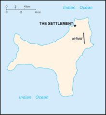
Map of Christmas Island showing the location of Flying Fish Cove 'The Settlement'
Flying Fish Cove is the main settlement of Australia's Christmas Island. Although it was originally named after British survey-ship Flying-Fish, many maps simply label it “The Settlement”.[1] It was the first British settlement on the island, established in 1888.
About a third of the territory's total population of 1,600 lives in Flying Fish Cove, which lies near the north-eastern tip of the island. There is a small harbour which serves tourists with yachts. It is possible to dive at the settlement's beach.[2]
References
- ↑ Christmas Island settlement [electronic resource] / produced by the Royal Australian Survey Corps under the direction of the Chief of the General Staff. Ed. 2-AAS. Canberra : Royal Australian Survey Corps, 1983. Scale 1:10 000 transverse Mercator proj. “Series R911”
- ↑ Western Mail (Perth, WA : 1885 - 1954). 19 January 1917. See page 24, article and photo
Further reading
| Wikimedia Commons has media related to Flying Fish Cove. |
- Golder Associates.(1995) Landslide risk assessment, Flying Fish Cove, Christmas Island, Indian Ocean : submitted to Australian Construction Services. Leederville, W.A. : Golder Associates. "October 1995"
Coordinates: 10°25′18″S 105°40′41″E / 10.42167°S 105.67806°E
This article is issued from Wikipedia - version of the 8/7/2016. The text is available under the Creative Commons Attribution/Share Alike but additional terms may apply for the media files.