Fordsville, Kentucky
| Fordsville, Kentucky | |
|---|---|
| City | |
 Location of Fordsville, Kentucky | |
| Coordinates: 37°38′5″N 86°43′0″W / 37.63472°N 86.71667°WCoordinates: 37°38′5″N 86°43′0″W / 37.63472°N 86.71667°W | |
| Country | United States |
| State | Kentucky |
| County | Ohio |
| Area | |
| • Total | 0.5 sq mi (1.2 km2) |
| • Land | 0.5 sq mi (1.2 km2) |
| • Water | 0.0 sq mi (0.0 km2) |
| Elevation | 499 ft (152 m) |
| Population (2000) | |
| • Total | 531 |
| • Density | 1,111.5/sq mi (429.2/km2) |
| Time zone | Central (CST) (UTC-6) |
| • Summer (DST) | CDT (UTC-5) |
| ZIP code | 42343 |
| Area code(s) | 270 |
| FIPS code | 21-28270 |
| GNIS feature ID | 0492316 |
Fordsville is a 6th-class city in Ohio County, Kentucky, in the United States. The population was 531 at the 2000 census.
History
Settled c. 1830, the town is named for early merchant and probable founder Elisha Ford.[1][2] It was formally incorporated by the state assembly in 1886.[3]
Geography
According to the United States Census Bureau, the city has a total area of 0.5 square miles (1.3 km2), all land.
Demographics
| Historical population | |||
|---|---|---|---|
| Census | Pop. | %± | |
| 1880 | 85 | — | |
| 1890 | 281 | 230.6% | |
| 1900 | 586 | 108.5% | |
| 1910 | 649 | 10.8% | |
| 1920 | 612 | −5.7% | |
| 1930 | 573 | −6.4% | |
| 1940 | 587 | 2.4% | |
| 1950 | 533 | −9.2% | |
| 1960 | 524 | −1.7% | |
| 1970 | 489 | −6.7% | |
| 1980 | 561 | 14.7% | |
| 1990 | 522 | −7.0% | |
| 2000 | 531 | 1.7% | |
| 2010 | 524 | −1.3% | |
| Est. 2015 | 530 | [4] | 1.1% |
As of the census[6] of 2000, there were 531 people, 200 households, and 121 families residing in the city. The population density was 1,111.5 people per square mile (427.1/km²). There were 227 housing units at an average density of 475.2 per square mile (182.6/km²). The racial makeup of the city was 99.62% White, 0.19% African American, and 0.19% from two or more races.
There were 200 households out of which 29.0% had children under the age of 18 living with them, 43.0% were married couples living together, 14.5% had a female householder with no husband present, and 39.5% were non-families. 36.0% of all households were made up of individuals and 22.5% had someone living alone who was 65 years of age or older. The average household size was 2.31 and the average family size was 3.04.
In the city the population was spread out with 22.2% under the age of 18, 8.5% from 18 to 24, 21.3% from 25 to 44, 18.6% from 45 to 64, and 29.4% who were 65 years of age or older. The median age was 43 years. For every 100 females there were 81.2 males. For every 100 females age 18 and over, there were 74.3 males.
The median income for a household in the city was $17,273, and the median income for a family was $22,917. Males had a median income of $27,679 versus $17,917 for females. The per capita income for the city was $14,740. About 25.2% of families and 25.6% of the population were below the poverty line, including 29.6% of those under age 18 and 20.9% of those age 65 or over.
Event of interest
- The Fordsville Tug-of-War Championship - Kentucky's official tug-of-war championship[7]
Notable natives
- Damon E. Allen (1921–2009), a three-term president of the Kentucky Optometric Association who led the lobbying campaign to convince the Kentucky State Legislature to permit optometrists to prescribe medication to their patients, was born in Fordsville but later moved to Campbellsville.
References
- ↑ "Dictionary of Places: Fordsville". Encyclopedia of Kentucky. New York, New York: Somerset Publishers. 1987. ISBN 0-403-09981-1.
- ↑ Rennick, Robert M. (1987). Kentucky Place Names. University Press of Kentucky. p. 105. Retrieved 28 Apr 2013.
- ↑ Commonwealth of Kentucky. Office of the Secretary of State. Land Office. "Fordsville, Kentucky". Accessed 26 Jul 2013.
- ↑ "Annual Estimates of the Resident Population for Incorporated Places: April 1, 2010 to July 1, 2015". Retrieved July 2, 2016.
- ↑ "Census of Population and Housing". Census.gov. Retrieved June 4, 2015.
- ↑ "American FactFinder". United States Census Bureau. Retrieved 2008-01-31.
- ↑ "Kentucky State Symbols". Kentucky Department of Libraries and Archives. Retrieved 2007-02-16.
Municipalities and communities of Ohio County, Kentucky, United States | ||
|---|---|---|
| Cities | 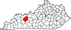 | |
| CDP | ||
| Other unincorporated communities | ||