Grade II* listed buildings in Runnymede (district)
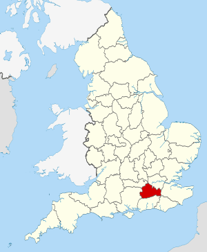
Surrey shown within England

There are over 20,000 Grade II* listed buildings in England. This page is a list of these buildings in the district of Runnymede in Surrey. For links to similar articles in relation to the other 10 districts of Surrey see Grade II* listed buildings in Surrey.

Name Location Type Completed [note 1]Date designated Grid ref.[note 2]
Geo-coordinates
Entry number [note 3]Image
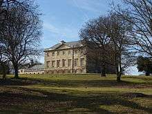
Botleys Park Mansion Chertsey, Runnymede Great House Modern 9 June 1972 TQ0214264884
51°22′26″N 0°32′02″W / 51.373835°N 0.533927°W / 51.373835; -0.533927 (Botleys Park Mansion)
1029181
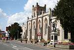
Church of Saint John the Baptist Egham, Runnymede Church 1817-1820 11 July 1951 TQ0130871367
51°25′56″N 0°32′39″W / 51.432258°N 0.544056°W / 51.432258; -0.544056 (Church of Saint John the Baptist)
1189321
Lychgate of the Church of Saint John the Baptist Egham, Runnymede Lych Gate 1744 11 July 1951 TQ0127771405
51°25′57″N 0°32′40″W / 51.432605°N 0.544491°W / 51.432605; -0.544491 (Lychgate of the Church of Saint John the Baptist)
1028978
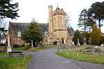
Church of Saint Simon and Saint Jude Englefield Green, Runnymede Church 1859 17 November 1986 SU9928270838
51°25′40″N 0°34′24″W / 51.427861°N 0.573338°W / 51.427861; -0.573338 (Church of Saint Simon and Saint Jude)
1028958
Pair of Mausolea Englefield Green, Runnymede Chest Tomb Dated 1862 17 August 1989 SU9931170807
51°25′39″N 0°34′23″W / 51.427578°N 0.57293°W / 51.427578; -0.57293 (Pair of Mausolea)
1242772
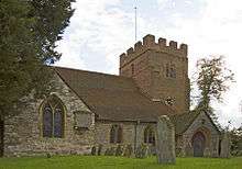
Church of St Mary Thorpe, Runnymede Church 12th century 17 November 1986 TQ0238468642
51°24′27″N 0°31′46″W / 51.407571°N 0.529369°W / 51.407571; -0.529369 (Church of St Mary)
1189962
Church of St Peter Chertsey, Runnymede Parish Church 13th century 26 September 1951 TQ0420266995
51°23′33″N 0°30′13″W / 51.392436°N 0.503723°W / 51.392436; -0.503723 (Church of St Peter)
1029167
Curfew House Chertsey, Runnymede House 18th century 26 September 1951 TQ0414567018
51°23′34″N 0°30′16″W / 51.392653°N 0.504536°W / 51.392653; -0.504536 (Curfew House)
1242226
Englefield Green House Englefield Green, Runnymede House 18th century or earlier 17 November 1986 SU9927371689
51°26′08″N 0°34′24″W / 51.435512°N 0.573229°W / 51.435512; -0.573229 (Englefield Green House)
1378020
Fort Belvedere Egham, Runnymede Country house c.1828 17 November 1986 SU9663668184
51°24′16″N 0°36′44″W / 51.404462°N 0.612108°W / 51.404462; -0.612108 (Fort Belvedere)
1294245
Pyrcroft House Chertsey, Runnymede House Mid 18th century 26 September 1951 TQ0334666818
51°23′28″N 0°30′58″W / 51.391002°N 0.516073°W / 51.391002; -0.516073 (Pyrcroft House)
1377926
Royal Air Force Memorial Runnymede War Memorial 1953 25 September 1998 SU9983771942
51°26′16″N 0°33′54″W / 51.437688°N 0.565047°W / 51.437688; -0.565047 (Royal Air Force Memorial)
1376599
St Ann's Court Chertsey, Runnymede Villa 1936-37 15 January 1986 TQ0279067333
51°23′45″N 0°31′26″W / 51.395732°N 0.523913°W / 51.395732; -0.523913 (St Ann's Court)
1260122
Teahouse and Grotto in Grounds of St Ann's Hill House Chertsey, Runnymede Grotto 18th century 9 June 1972 TQ0246667117
51°23′38″N 0°31′43″W / 51.393849°N 0.52863°W / 51.393849; -0.52863 (Teahouse and Grotto in Grounds of St Ann's Hill House)
1029160
The chapel at former Holloway Sanatorium Virginia Water, Runnymede Chapel 1882-1884 17 November 1986 TQ0026068257
51°24′16″N 0°33′36″W / 51.404489°N 0.560005°W / 51.404489; -0.560005 (The chapel at former Holloway Sanatorium)
1119659
The Cottage Thorpe, Runnymede House 18th century 11 July 1951 TQ0215468789
51°24′32″N 0°31′57″W / 51.408934°N 0.532632°W / 51.408934; -0.532632 (The Cottage)
1378051
The Temple of Augustus (Leptis Magna) Virginia Water, Runnymede Wall Roman 17 November 1986 SU9746568622
51°24′30″N 0°36′00″W / 51.408257°N 0.600074°W / 51.408257; -0.600074 (The Temple of Augustus (Leptis Magna))
1378028
Thorpe House Thorpe, Runnymede House 17th century 11 July 1951 TQ0231168781
51°24′32″N 0°31′49″W / 51.408834°N 0.530378°W / 51.408834; -0.530378 (Thorpe House)
1190067
25 Windsor Street Chertsey, Runnymede House Early 18th century 26 September 1951 TQ0411867004
51°23′33″N 0°30′18″W / 51.392532°N 0.504928°W / 51.392532; -0.504928 (25 Windsor Street)
1377931

Notes

  1. The date given is the date used by Historic England as significant for the initial building or that of an important part in the structure's description.
  2. Sometimes known as OSGB36, the grid reference is based on the British national grid reference system used by the Ordnance Survey.
  3. The "List Entry Number" is a unique number assigned to each listed building and scheduled monument by Historic England.

References

English Heritage Images of England

Media related to Grade II* listed buildings in Surrey at Wikimedia Commons

This article is issued from Wikipedia - version of the 3/18/2015. The text is available under the Creative Commons Attribution/Share Alike but additional terms may apply for the media files.