Grade II* listed buildings in Sedgemoor

Sedgemoor shown within the ceremonial county of Somerset

Sedgemoor is a local government district in the English county of Somerset. In the United Kingdom, the term listed building refers to a building or other structure officially designated as being of special architectural, historical or cultural significance; Grade II* structures are those considered to be "particularly significant buildings of more than local interest".[1] Listing was begun by a provision in the Town and Country Planning Act 1947. Once listed, severe restrictions are imposed on the modifications allowed to a building's structure or its fittings. In England, the authority for listing under the Planning (Listed Buildings and Conservation Areas) Act 1990[2] rests with Historic England, a non-departmental public body sponsored by the Department for Culture, Media and Sport; local authorities have a responsibility to regulate and enforce the planning regulations.

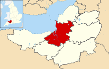
Sedgemoor is a low-lying area of land close to sea level between the Quantock and Mendip hills, historically largely marsh (or moor). It contains the bulk of the area also known as the Somerset Levels, including Europe's oldest known engineered roadway, the Sweet Track.[3]

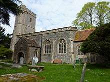
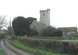
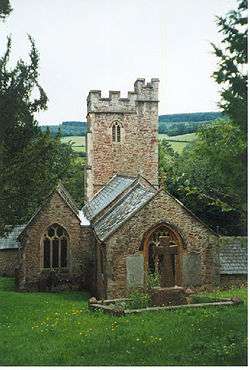
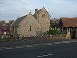
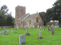
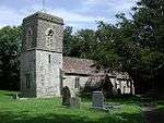
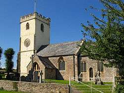
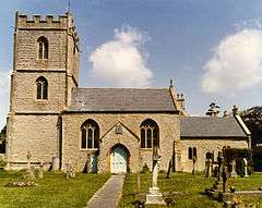
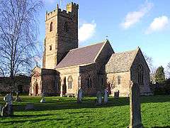
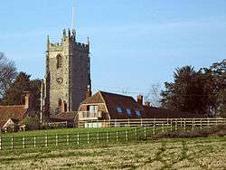
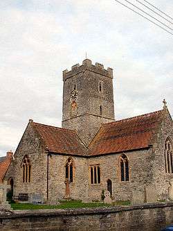
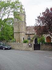
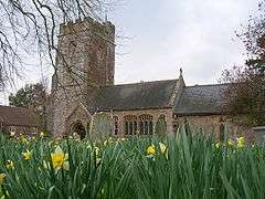
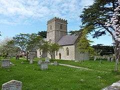
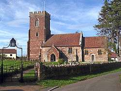
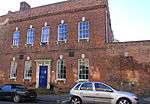
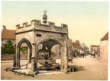
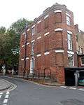
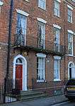
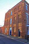
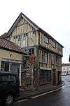
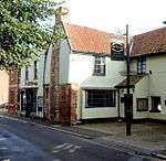
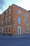
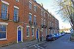
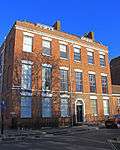
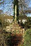
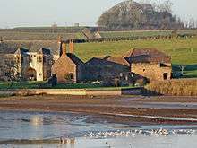
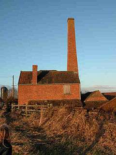
There are 88 Grade II* listed buildings in Sedgemoor.

Buildings

Name Location Type Completed [note 1] Grid ref.[note 2]
Geo-coordinates
Entry number [note 3]ImageRef.
Ashton Windmill Chapel Allerton Windmill Medieval Establishment ST4146150296
51°14′56″N 2°50′24″W / 51.248816°N 2.840109°W / 51.248816; -2.840109 (Ashton Windmill)
1173522
[4]
King John's Hunting Lodge (Axbridge Museum) Axbridge Early 16th century ST4307854540
51°17′14″N 2°49′03″W / 51.287137°N 2.817621°W / 51.287137; -2.817621 (King John's Hunting Lodge (Axbridge Museum))
1059142
[5]
Baptist Church Bridgwater c. 1837 ST2979936912
51°07′38″N 3°00′16″W / 51.127167°N 3.004552°W / 51.127167; -3.004552 (Baptist Church)
1298798
[6]
Barford House and outbuilding wing at rear Enmore Farmhouse c. 1710 ST2335035883
51°07′02″N 3°05′47″W / 51.117088°N 3.096472°W / 51.117088; -3.096472 (Barford House and outbuilding wing at rear)
1058941
[7]
Beere Manor Farmhouse and attached barn Cannington Cross Passage House 16th or 17th century ST2406241425
51°10′01″N 3°05′15″W / 51.167008°N 3.087472°W / 51.167008; -3.087472 (Beere Manor Farmhouse and attached barn)
1059062 [8]
Blake Statue Bridgwater Statue 1898 ST2986937045
51°07′42″N 3°00′13″W / 51.128372°N 3.003578°W / 51.128372; -3.003578 (Blake Statue)
1205747
[9]
Boomer Farmhouse North Petherton Farmhouse 1681 ST2774132890
51°05′27″N 3°01′59″W / 51.090751°N 3.033149°W / 51.090751; -3.033149 (Boomer Farmhouse)
1344987
[10]
Brick Kiln Bridgwater Kiln 19th century ST2999537635
51°08′01″N 3°00′07″W / 51.133692°N 3.001893°W / 51.133692; -3.001893 (Brick Kiln)
1206110
[11]
Bridgwater Railway Station Bridgwater Bridge 1841 ST3079336973
51°07′40″N 2°59′25″W / 51.127837°N 2.990362°W / 51.127837; -2.990362 (Bridgwater Railway Station)
1187364
[12]
Castle House Bridgwater House 1851 ST2998037121
51°07′45″N 3°00′07″W / 51.129069°N 3.002007°W / 51.129069; -3.002007 (Castle House)
1355168
[13]
Castle House with adjoining wings & Gate Cottage Enmore House 18th century ST2438634897
51°06′30″N 3°04′53″W / 51.108362°N 3.081467°W / 51.108362; -3.081467 (Castle House with adjoining wings & Gate Cottage)
1177302
[14]
Castle wall, watergate and undercroft Bridgwater Curtain Wall 13th century ST2998237236
51°07′48″N 3°00′07″W / 51.130103°N 3.002001°W / 51.130103; -3.002001 (Castle wall, watergate and undercroft)
1207427 [15]
Christ Church Unitarian Chapel Bridgwater Schoolroom 19th century ST2996136928
51°07′38″N 3°00′08″W / 51.127331°N 3.002241°W / 51.127331; -3.002241 (Christ Church Unitarian Chapel)
1197371
[16]
Church Cross in churchyard, 10 metres south of Church of St Andrew Compton Bishop Cross 15th century ST3959855377
51°17′39″N 2°52′04″W / 51.294303°N 2.867658°W / 51.294303; -2.867658 (Church Cross in churchyard, 10 metres south of Church of St Andrew)
1344903
[17]
Church Farm House and Church Farmhouse Cheddar Farmhouse 15th century ST4602353010
51°16′25″N 2°46′31″W / 51.273668°N 2.775163°W / 51.273668; -2.775163 (Church Farm House and Church Farmhouse)
1344877 [18]
Church of All Saints Ashcott Anglican Church 15th century ST4371637149
51°07′51″N 2°48′21″W / 51.130838°N 2.805739°W / 51.130838; -2.805739 (Church of All Saints)
1058957
[19]
Church of All Saints Otterhampton Parish Church 12th century ST2463543197
51°10′59″N 3°04′47″W / 51.183015°N 3.079651°W / 51.183015; -3.079651 (Church of All Saints)
1344927
[20]
Church of All Saints Aisholt Church 14th century ST1937135632
51°06′51″N 3°09′12″W / 51.114285°N 3.153252°W / 51.114285; -3.153252 (Church of All Saints)
1178112
[21]
Church of St Bridget Brean Church 13th century ST2968055951
51°17′54″N 3°00′36″W / 51.298323°N 3.009992°W / 51.298323; -3.009992 (Church of St Bridget)
1262963
[22]
Church of St Giles Thurloxton Anglican Church 14th and 15th century ST2745830425
51°04′07″N 3°02′12″W / 51.068553°N 3.036694°W / 51.068553; -3.036694 (Church of St Giles)
1295089
[23]
Church of St John the Baptist Biddisham Parish Church 13th century ST3818653440
51°16′36″N 2°53′15″W / 51.276736°N 2.887571°W / 51.276736; -2.887571 (Church of St John the Baptist)
1059138
[24]
Church of St John the Baptist Bridgwater Church Hall 1843 ST3033837345
51°07′52″N 2°59′49″W / 51.131126°N 2.996935°W / 51.131126; -2.996935 (Church of St John the Baptist)
1197354 [25]
Church of St Martin Fiddington Parish Church 11th century ST2156840590
51°09′33″N 3°07′23″W / 51.159164°N 3.122953°W / 51.159164; -3.122953 (Church of St Martin)
1264213
[26]
Church of St Mary Cossington Sundial 13th century ST3565340276
51°09′29″N 2°55′17″W / 51.158101°N 2.921513°W / 51.158101; -2.921513 (Church of St Mary)
1344698
[27]
Church of St Mary the Virgin Nether Stowey Parish Church 15th century ST1967439636
51°09′01″N 3°08′59″W / 51.150324°N 3.149818°W / 51.150324; -3.149818 (Church of St Mary the Virgin)
1344922
[28]
Church of St Michael Enmore Anglican Church 19th century ST2397935206
51°06′40″N 3°05′14″W / 51.111086°N 3.087345°W / 51.111086; -3.087345 (Church of St Michael)
1177223
[29]
Church of St Michael and All Angels Bawdrip Anglican Church 19th century ST3414639586
51°09′06″N 2°56′35″W / 51.151726°N 2.942933°W / 51.151726; -2.942933 (Church of St Michael and All Angels)
1060158
[30]
Church of St Michael and All Angels Rowberrow Church 14th century ST4494158624
51°19′27″N 2°47′30″W / 51.324039°N 2.791541°W / 51.324039; -2.791541 (Church of St Michael and All Angels)
1296019
[31]
Church of St Peter North Newton Anglican church Saxon ST3010731136
51°04′31″N 2°59′57″W / 51.075275°N 2.999032°W / 51.075275; -2.999032 (Church of St Peter)
1058917
[32]
Church of St Peter and St Paul, Over Stowey Over Stowey Anglican Church 1840 ST1855938510
51°08′24″N 3°09′56″W / 51.140044°N 3.165501°W / 51.140044; -3.165501 (Church of St Peter and St Paul, Over Stowey)
1060177
[33]
Church of the Blessed Virgin Mary Shapwick Anglican Church 1331 ST4177438244
51°08′26″N 2°50′01″W / 51.140488°N 2.833667°W / 51.140488; -2.833667 (Church of the Blessed Virgin Mary)
1058962
[34]
Church of the Holy Trinity Chilton Trinity Parish Church 13th century ST2964639170
51°08′51″N 3°00′26″W / 51.147449°N 3.00718°W / 51.147449; -3.00718 (Church of the Holy Trinity)
1264231
[35]
Churchyard Cross in churchyard approximately 10 metres south of nave, Church of St Gregory Weare Cross 15th century ST4140952670
51°16′13″N 2°50′28″W / 51.270155°N 2.841244°W / 51.270155; -2.841244 (Churchyard Cross in churchyard approximately 10 metres south of nave, Church of St Gregory)
1059090
[36]
Churchyard Cross in churchyard, 30 metres east of East End, Church of St Mary Wedmore Cross 15th century ST4351347936
51°13′40″N 2°48′37″W / 51.227804°N 2.810339°W / 51.227804; -2.810339 (Churchyard Cross in churchyard, 30 metres east of East End, Church of St Mary)
1252634
[37]
Churchyard Cross Broomfield Cross 13th century ST2243432011
51°04′56″N 3°06′31″W / 51.082154°N 3.108723°W / 51.082154; -3.108723 (Churchyard Cross)
1058938
[38]
Churchyard Cross in churchyard, Church of St Michael Enmore Cross 15th century ST2398835193
51°06′39″N 3°05′14″W / 51.11097°N 3.087213°W / 51.11097; -3.087213 (Churchyard Cross in churchyard, Church of St Michael)
1344998
[39]
Churchyard Cross, in churchyard, 5 metres south of South Porch, Church of St John the Baptist Biddisham Cross Late 14th century ST3819353429
51°16′36″N 2°53′15″W / 51.276638°N 2.887468°W / 51.276638; -2.887468 (Churchyard Cross, in churchyard, 5 metres south of South Porch, Church of St John the Baptist)
1173427
[40]
Clerks Cottage Spaxton House 16th or 17th century ST2310836104
51°07′09″N 3°06′00″W / 51.119043°N 3.099976°W / 51.119043; -3.099976 (Clerks Cottage)
1344669 [41]
Coleridge's Cottage Nether Stowey House 17th century ST1910739857
51°09′08″N 3°09′29″W / 51.152231°N 3.157973°W / 51.152231; -3.157973 (Coleridge's Cottage)
1344921
[42]
Compton House and Forecourt Railings Axbridge Manor House Early 17th century ST4263954619
51°17′16″N 2°49′26″W / 51.287803°N 2.823928°W / 51.287803; -2.823928 (Compton House and Forecourt Railings)
1173405
[43]
County Court Office Bridgwater Steps 1824 ST2995637142
51°07′45″N 3°00′08″W / 51.129254°N 3.002354°W / 51.129254; -3.002354 (County Court Office)
1197407
[44]
Court House Farmhouse Spaxton Farmhouse 15th or 16th century ST2251737084
51°07′40″N 3°06′31″W / 51.127773°N 3.10863°W / 51.127773; -3.10863 (Court House Farmhouse)
1344667
[45]
Crosse Family Monument in churchyard about 1 metre south of nave, Church of St Mary and All Saints Broomfield Chest Tomb 1653 ST2243032012
51°04′56″N 3°06′32″W / 51.082162°N 3.108781°W / 51.082162; -3.108781 (Crosse Family Monument in churchyard about 1 metre south of nave, Church of St Mary and All Saints)
1344997 [46]
Dovecote in grounds of Shapwick Manor Shapwick Dovecote Medieval ST4177338395
51°08′31″N 2°50′01″W / 51.141846°N 2.833705°W / 51.141846; -2.833705 (Dovecote in grounds of Shapwick Manor)
1190558 [47]
Durleigh Church Durleigh Parish Church 11th century ST2748536139
51°07′12″N 3°02′15″W / 51.119929°N 3.037458°W / 51.119929; -3.037458 (Durleigh Church)
1177147
[48]
Edington House Edington Farmhouse c. 1640 ST3853839610
51°09′09″N 2°52′49″W / 51.152431°N 2.88015°W / 51.152431; -2.88015 (Edington House)
1344661 [49]
Farm Estate Farmhouse Fiddington Farmhouse 16th century ST2230641774
51°10′12″N 3°06′46″W / 51.169909°N 3.112658°W / 51.169909; -3.112658 (Farm Estate Farmhouse)
1237276 [50]
Former Market Cross in churchyard, Church of St Mark Mark Market Cross 15th century ST3804947838
51°13′35″N 2°53′19″W / 51.226355°N 2.888563°W / 51.226355; -2.888563 (Former Market Cross in churchyard, Church of St Mark)
1252188
[51]
Gazebo and attached walling bounding grounds of Stowey Court Nether Stowey Gate Early 18th century ST1954539607
51°09′00″N 3°09′06″W / 51.150045°N 3.151655°W / 51.150045; -3.151655 (Gazebo and attached walling bounding grounds of Stowey Court)
1264119
[52]
Great House Farmhouse and flanking walls Wedmore Farmhouse 1670 ST4538746449
51°12′53″N 2°47′00″W / 51.214617°N 2.783277°W / 51.214617; -2.783277 (Great House Farmhouse and flanking walls)
1252915 [53]
Legion House and attached wall to right Bridgwater Terrace Mid 18th century ST2991637143
51°07′45″N 3°00′11″W / 51.129259°N 3.002926°W / 51.129259; -3.002926 (Legion House and attached wall to right)
1280623
[54]
Manor House Lympsham Manor House Mid 18th century ST3344954220
51°17′00″N 2°57′20″W / 51.283214°N 2.955618°W / 51.283214; -2.955618 (Manor House)
1262680 [55]
Market Cross Cheddar Market Cross 15th century ST4592153202
51°16′31″N 2°46′36″W / 51.275385°N 2.776655°W / 51.275385; -2.776655 (Market Cross)
1173642
[56]
Maunsel House North Petherton House Later 15th century ST3044530036
51°03′56″N 2°59′38″W / 51.065426°N 2.993996°W / 51.065426; -2.993996 (Maunsel House)
1177930
[57]
No 10 and attached railings Bridgwater House Late 18th or early 19th century ST2987937181
51°07′47″N 3°00′12″W / 51.129596°N 3.003462°W / 51.129596; -3.003462 (No 10 and attached railings)
1297163
[58]
No 13 and attached railings Bridgwater House c. 1770-1800 ST2987337198
51°07′47″N 3°00′13″W / 51.129748°N 3.003551°W / 51.129748; -3.003551 (No 13 and attached railings)
1197394
[59]
No 14 and attached railings Bridgwater House c. 1770-1800 ST2987437206
51°07′47″N 3°00′13″W / 51.12982°N 3.003538°W / 51.12982; -3.003538 (No 14 and attached railings)
1280095
[60]
No 15 and attached front railings and rear garden walls Bridgwater Town House c. 1700 ST2986936866
51°07′36″N 3°00′13″W / 51.126762°N 3.003543°W / 51.126762; -3.003543 (No 15 and attached front railings and rear garden walls)
1297157 [61]
9 High Street Axbridge Timber Framed House 15th or 16th century ST4305154532
51°17′13″N 2°49′05″W / 51.287062°N 2.818007°W / 51.287062; -2.818007 (9 High Street)
1344893
[62]
45 and 47 St Mary Street Bridgwater House 14th century ST2977036938
51°07′39″N 3°00′18″W / 51.127398°N 3.004972°W / 51.127398; -3.004972 (45 and 47 St Mary Street)
1052245
[63]
1 King Square Bridgwater House c. 1770-1800 ST2984537144
51°07′45″N 3°00′14″W / 51.129259°N 3.00394°W / 51.129259; -3.00394 (1 King Square)
1197393
[64]
10 and 11, West Quay Bridgwater House Early/mid 18th century ST2998737203
51°07′47″N 3°00′07″W / 51.129807°N 3.001923°W / 51.129807; -3.001923 (10 and 11, West Quay)
1197421
[65]
3-9 Chandos Street Bridgwater Terrace Early 18th century ST2992737240
51°07′48″N 3°00′10″W / 51.130132°N 3.002788°W / 51.130132; -3.002788 (3-9 Chandos Street)
1205624
[66]
8 and 9 King Square Bridgwater Terrace c. 1770-1800 ST2987237155
51°07′46″N 3°00′13″W / 51.129361°N 3.003557°W / 51.129361; -3.003557 (8 and 9 King Square)
1206644
[67]
2-7 King Square Bridgwater Terrace c. 1770-1800 ST2985937150
51°07′46″N 3°00′13″W / 51.129315°N 3.003742°W / 51.129315; -3.003742 (2-7 King Square)
1280107
[68]
Nos 11 and 12 and attached railings Bridgwater Terrace c. 1770-1800 ST2987837187
51°07′47″N 3°00′13″W / 51.129649°N 3.003477°W / 51.129649; -3.003477 (Nos 11 and 12 and attached railings)
1206669
[69]
Nos 16 and 17 and attached railings Bridgwater House c. 1770-1800 ST2981137206
51°07′47″N 3°00′16″W / 51.129812°N 3.004438°W / 51.129812; -3.004438 (Nos 16 and 17 and attached railings)
1297164
[70]
Old Manor House Axbridge Manor House Early 17th century ST4300854553
51°17′14″N 2°49′07″W / 51.287247°N 2.818627°W / 51.287247; -2.818627 (Old Manor House)
1059147
[71]
Patcombe Farmhouse including chimney stack adjoining south east Broomfield House 1771 ST2479933368
51°05′41″N 3°04′31″W / 51.094669°N 3.07525°W / 51.094669; -3.07525 (Patcombe Farmhouse including chimney stack adjoining south east)
1060152 [72]
Paulet House (formerly known as Church Close) Goathurst House 15th century ST2567434376
51°06′14″N 3°03′47″W / 51.103846°N 3.062965°W / 51.103846; -3.062965 (Paulet House (formerly known as Church Close))
1058949 [73]
Rail Bridge over the River Parrett Bridgwater Railway Bridge 1871 ST2999737420
51°07′54″N 3°00′07″W / 51.131759°N 3.001822°W / 51.131759; -3.001822 (Rail Bridge over the River Parrett)
1297139
[74]
Remains of Churchyard Cross in churchyard, about 23 metres north of North Aisle, Church of St Mary North Petherton Cross 15th century ST2903033049
51°05′32″N 3°00′53″W / 51.092342°N 3.014779°W / 51.092342; -3.014779 (Remains of Churchyard Cross in churchyard, about 23 metres north of North Aisle, Church of St Mary)
1344990 [75]
Roadside Cross at Ngr St 4248 4966 (Stoughton Cross) Wedmore Wayside Cross 15th century ST4247849658
51°14′35″N 2°49′32″W / 51.243183°N 2.825437°W / 51.243183; -2.825437 (Roadside Cross at Ngr St 4248 4966 (Stoughton Cross))
1252914
[76]
Robin Hood's Hut Goathurst Kitchen 1765 ST2544733327
51°05′40″N 3°03′58″W / 51.094386°N 3.065989°W / 51.094386; -3.065989 (Robin Hood's Hut)
1060155
[77]
Shapwick House Hotel: The Granary Shapwick House 1630 ST4167238772
51°08′43″N 2°50′07″W / 51.145225°N 2.83521°W / 51.145225; -2.83521 (Shapwick House Hotel: The Granary)
1190480 [78]
Shapwick Manor Shapwick Manor House Medieval ST4174438439
51°08′32″N 2°50′03″W / 51.142239°N 2.834127°W / 51.142239; -2.834127 (Shapwick Manor)
1190512 [79]
St Judes Axbridge House Late 15th century ST4302254544
51°17′14″N 2°49′06″W / 51.287167°N 2.818424°W / 51.287167; -2.818424 (St Judes)
1344894
[80]
Stable block with coach house to Shapwick Manor Shapwick Stable Mid 17th century ST4179538452
51°08′32″N 2°50′00″W / 51.142361°N 2.8334°W / 51.142361; -2.8334 (Stable block with coach house to Shapwick Manor)
1344994 [81]
Stawell Church Stawell Anglican Church 13th century ST3680738296
51°08′26″N 2°54′17″W / 51.140428°N 2.904665°W / 51.140428; -2.904665 (Stawell Church)
1174228
[82]
Stone screen and flanking sections of walling enclosing former parterre on frontage of Shapwick Manor Shapwick Gate 17th century ST4176238447
51°08′32″N 2°50′02″W / 51.142312°N 2.833871°W / 51.142312; -2.833871 (Stone screen and flanking sections of walling enclosing former parterre on frontage of Shapwick Manor)
1293774 [83]
Temple of Harmony Goathurst Garden Temple 1767 ST2514534213
51°06′08″N 3°04′14″W / 51.102312°N 3.070485°W / 51.102312; -3.070485 (Temple of Harmony)
1058952
[84]
Blake Museum Bridgwater House Late 15th or early 16th century ST3000736898
51°07′37″N 3°00′06″W / 51.127067°N 3.001578°W / 51.127067; -3.001578 (Blake Museum)
1205363
[85]
The Old Angel Axbridge House c. 1550 ST4310454577
51°17′15″N 2°49′02″W / 51.287472°N 2.817254°W / 51.287472; -2.817254 (The Old Angel)
1344883
[86]
Tirelands Farmhouse Enmore Farmhouse 15th century ST2414834554
51°06′19″N 3°05′05″W / 51.105246°N 3.084794°W / 51.105246; -3.084794 (Tirelands Farmhouse)
1177211 [87]
West Bower Manor with barn Durleigh Farmhouse 15th century ST2656136412
51°07′20″N 3°03′03″W / 51.122265°N 3.050713°W / 51.122265; -3.050713 (West Bower Manor with barn)
1058940
[88]
West Newton Manor with barn North Petherton Farmhouse c. 1346 ST2889729140
51°03′26″N 3°00′57″W / 51.05718°N 3.015907°W / 51.05718; -3.015907 (West Newton Manor with barn)
1344642 [89]
Westonzoyland Engine Trust Old Pumping Station Westonzoyland Engine House Early 19th century ST3395032830
51°05′27″N 2°56′40″W / 51.090961°N 2.944495°W / 51.090961; -2.944495 (Westonzoyland Engine Trust Old Pumping Station)
1174295
[90]
World War Memorial Bridgwater Square 1920s ST2984337180
51°07′46″N 3°00′14″W / 51.129582°N 3.003976°W / 51.129582; -3.003976 (World War Memorial)
1197395
[91]

See also

Notes

  1. The date given is the date used by Historic England as significant for the initial building or that of an important part in the structure's description.
  2. Sometimes known as OSGB36, the grid reference is based on the British national grid reference system used by the Ordnance Survey.
  3. The "List Entry Number" is a unique number assigned to each listed building and scheduled monument by Historic England.

References

  1. "What is a listed building?". Manchester City Council. Retrieved 2007-12-08.
  2. "Planning (Listed Buildings and Conservation Areas) Act 1990 (c. 9)". Ministry of Justice. Retrieved 2007-12-17.
  3. "The day the Sweet Track was built". New Scientist, 16 June 1990. Retrieved 26 October 2007.
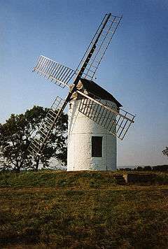
  4. Historic England. "Ashton Windmill (1173522)". National Heritage List for England. Retrieved 3 April 2015.
  5. Historic England. "King John's Hunting Lodge (Axbridge Museum) (1059142)". National Heritage List for England. Retrieved 7 July 2015.
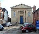
  6. Historic England. "Baptist Church (1298798)". National Heritage List for England. Retrieved 3 April 2015.
  7. Historic England. "Barford House And Outbuilding Wing At Rear (1058941)". National Heritage List for England. Retrieved 3 April 2015.
  8. Historic England. "Beere Manor Farmhouse And Attached Barn (1059062)". National Heritage List for England. Retrieved 3 April 2015.
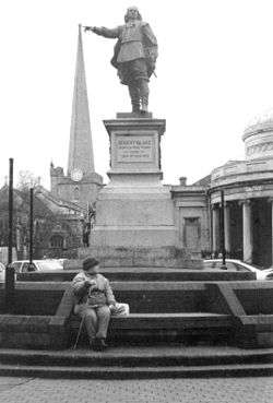
  9. Historic England. "Blake Statue (1205747)". National Heritage List for England. Retrieved 3 April 2015.
  10. Historic England. "Boomer Farmhouse (1344987)". National Heritage List for England. Retrieved 3 April 2015.
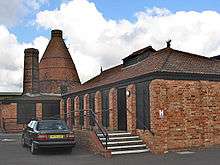
  11. Historic England. "Brick Kiln (1206110)". National Heritage List for England. Retrieved 3 April 2015.
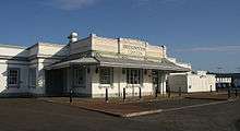
  12. Historic England. "Bridgwater Railway Station (1187364)". National Heritage List for England. Retrieved 3 April 2015.
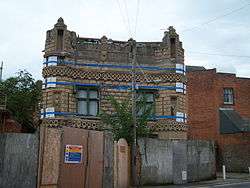
  13. Historic England. "Castle House (1355168)". National Heritage List for England. Retrieved 3 April 2015.
  14. Historic England. "Castle House With Adjoining Wings Gate Cottage (1177302)". National Heritage List for England. Retrieved 3 April 2015.
  15. Historic England. "Castle Wall, Watergate And Undercroft (1207427)". National Heritage List for England. Retrieved 3 April 2015.
  16. Historic England. "Christ Church Unitarian Chapel (1197371)". National Heritage List for England. Retrieved 3 April 2015.
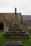
  17. Historic England. "Church Cross, In Churchyard, 10 Metres South Of Church Of St Andrew (1344903)". National Heritage List for England. Retrieved 3 April 2015.
  18. Historic England. "Church Farm House And Church Farmhouse (1344877)". National Heritage List for England. Retrieved 3 April 2015.
  19. Historic England. "Church Of All Saints (1058957)". National Heritage List for England. Retrieved 3 April 2015.
  20. Historic England. "Church Of All Saints (1344927)". National Heritage List for England. Retrieved 3 April 2015.
  21. Historic England. "Church Of All Saints (1178112)". National Heritage List for England. Retrieved 3 April 2015.
  22. Historic England. "Church Of St Bridget (1262963)". National Heritage List for England. Retrieved 3 April 2015.
  23. Historic England. "Church Of St Giles (1295089)". National Heritage List for England. Retrieved 3 April 2015.
  24. Historic England. "Church Of St John The Baptist (1059138)". National Heritage List for England. Retrieved 3 April 2015.
  25. Historic England. "Church Of St John The Baptist (1197354)". National Heritage List for England. Retrieved 3 April 2015.
  26. Historic England. "Church Of St Martin (1264213)". National Heritage List for England. Retrieved 3 April 2015.
  27. Historic England. "Church Of St Mary (1344698)". National Heritage List for England. Retrieved 3 April 2015.
  28. Historic England. "Church Of St Mary The Virgin (1344922)". National Heritage List for England. Retrieved 3 April 2015.
  29. Historic England. "Church Of St Michael (1177223)". National Heritage List for England. Retrieved 3 April 2015.
  30. Historic England. "Church Of St Michael And All Angels (1060158)". National Heritage List for England. Retrieved 3 April 2015.
  31. Historic England. "Church Of St Michael And All Angels (1296019)". National Heritage List for England. Retrieved 3 April 2015.
  32. Historic England. "Church of St Peter (1058917)". National Heritage List for England. Retrieved 3 April 2015.
  33. Historic England. "Church Of St Peter And St Paul (1060177)". National Heritage List for England. Retrieved 3 April 2015.
  34. Historic England. "Church Of The Blessed Virgin Mary (1058962)". National Heritage List for England. Retrieved 3 April 2015.
  35. Historic England. "Church Of The Holy Trinity (1264231)". National Heritage List for England. Retrieved 3 April 2015.
  36. Historic England. "Churchyard Cross In Churchyard Approximately 10 Metres South Of Nave, Church Of St Gregory (1059090)". National Heritage List for England. Retrieved 3 April 2015.
  37. Historic England. "Churchyard Cross In Churchyard, 30 Metres East Of East End, Church Of St Mary (1252634)". National Heritage List for England. Retrieved 3 April 2015.
  38. Historic England. "Churchyard Cross (1058938)". National Heritage List for England. Retrieved 3 April 2015.
  39. Historic England. "Churchyard Cross In Churchyard, Church Of St Michael (1344998)". National Heritage List for England. Retrieved 3 April 2015.
  40. Historic England. "Churchyard Cross, In The Churchyard, 5 Metres South Of South Porch, Church Of St John The Baptist (1173427)". National Heritage List for England. Retrieved 3 April 2015.
  41. Historic England. "Clerks Cottage (1344669)". National Heritage List for England. Retrieved 3 April 2015.
  42. Historic England. "Coleridge's Cottage (1344921)". National Heritage List for England. Retrieved 7 July 2015.
  43. Historic England. "Compton House And Forecourt Railings (1173405)". National Heritage List for England. Retrieved 3 April 2015.
  44. Historic England. "County Court Office (1197407)". National Heritage List for England. Retrieved 3 April 2015.
  45. Historic England. "Court House Farmhouse (1344667)". National Heritage List for England. Retrieved 3 April 2015.
  46. Historic England. "Crosse Family Monument In Churchyard About 1 Metre South Of Nave, Church Of St Mary And All Saints (1344997)". National Heritage List for England. Retrieved 3 April 2015.
  47. Historic England. "Dovecote In Grounds Of Shapwick Manor (1190558)". National Heritage List for England. Retrieved 3 April 2015.
  48. Historic England. "Durleigh Church (1177147)". National Heritage List for England. Retrieved 3 April 2015.
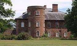
  49. Historic England. "Edington House (1344661)". National Heritage List for England. Retrieved 3 April 2015.
  50. Historic England. "Farm Estate Farmhouse (1237276)". National Heritage List for England. Retrieved 3 April 2015.
  51. Historic England. "Former Market Cross In Churchyard, Church Of St Mark (1252188)". National Heritage List for England. Retrieved 3 April 2015.
  52. Historic England. "Gazebo And Attached Walling Bounding Grounds Of Stowey Court (1264119)". National Heritage List for England. Retrieved 3 April 2015.
  53. Historic England. "Great House Farmhouse And Flanking Walls (1252915)". National Heritage List for England. Retrieved 3 April 2015.
  54. Historic England. "Legion House And Attached Wall To Right (1280623)". National Heritage List for England. Retrieved 3 April 2015.
  55. Historic England. "Manor House (1262680)". National Heritage List for England. Retrieved 3 April 2015.
  56. Historic England. "Market Cross (1173642)". National Heritage List for England. Retrieved 3 April 2015.
  57. Historic England. "Maunsel House (1177930)". National Heritage List for England. Retrieved 3 April 2015.
  58. Historic England. "No 10 And Attached Railings (1297163)". National Heritage List for England. Retrieved 3 April 2015.
  59. Historic England. "No 13 And Attached Railings (1297163)". National Heritage List for England. Retrieved 3 April 2015.
  60. Historic England. "No 14 And Attached Railings (1280095)". National Heritage List for England. Retrieved 3 April 2015.
  61. Historic England. "No 15 And Attached Front Railings And Rear Garden Walls (1297157)". National Heritage List for England. Retrieved 3 April 2015.
  62. Historic England. "9, High Street (1344893)". National Heritage List for England. Retrieved 3 April 2015.
  63. Historic England. "45 and 47 St Mary Street (1052245)". National Heritage List for England. Retrieved 3 April 2015.
  64. Historic England. "1 King Square (1197393)". National Heritage List for England. Retrieved 3 April 2015.
  65. Historic England. "10 And 11, West Quay (1197421)". National Heritage List for England. Retrieved 3 April 2015.
  66. Historic England. "3-9, Chandos Street (1205624)". National Heritage List for England. Retrieved 3 April 2015.
  67. Historic England. "8 And 9, King Square (1206644)". National Heritage List for England. Retrieved 3 April 2015.
  68. Historic England. "2-7, King Square (1280107)". National Heritage List for England. Retrieved 3 April 2015.
  69. Historic England. "Nos 11 And 12 And Attached Railings (1206669)". National Heritage List for England. Retrieved 3 April 2015.
  70. Historic England. "Nos 16 And 17 And Attached Railings (1297164)". National Heritage List for England. Retrieved 3 April 2015.
  71. Historic England. "Old Manor House (1059147)". National Heritage List for England. Retrieved 3 April 2015.
  72. Historic England. "Patcombe Farmhouse Including Chimney Stack Adjoining South East (1060152)". National Heritage List for England. Retrieved 3 April 2015.
  73. Historic England. "Paulet House (Formerly Known As Church Close) (1058949)". National Heritage List for England. Retrieved 3 April 2015.
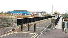
  74. Historic England. "Rail Bridge Over The River Parrett (1297139)". National Heritage List for England. Retrieved 3 April 2015.
  75. Historic England. "Remains Of Churchyard Cross In Churchyard, About 23 Metres North Of North Aisle, Church Of St Mary (1344990)". National Heritage List for England. Retrieved 3 April 2015.
  76. Historic England. "Roadside Cross At Ngr St 4248 4966 (1252914)". National Heritage List for England. Retrieved 3 April 2015.
  77. Historic England. "Robin Hood's Hut (1060155)". National Heritage List for England. Retrieved 7 July 2015.
  78. Historic England. "Shapwick House Hotel The Granary (1190480)". National Heritage List for England. Retrieved 3 April 2015.
  79. Historic England. "Shapwick Manor (1190512)". National Heritage List for England. Retrieved 3 April 2015.
  80. Historic England. "St Judes (1344894)". National Heritage List for England. Retrieved 3 April 2015.
  81. Historic England. "Stable Block With Coach House To Shapwick Manor (1344894)". National Heritage List for England. Retrieved 3 April 2015.
  82. Historic England. "Stawell Church (1174228)". National Heritage List for England. Retrieved 3 April 2015.
  83. Historic England. "Stone Screen And Flanking Sections Of Walling Enclosing Former Parterre On Frontage Of Shapwick Manor (1293774)". National Heritage List for England. Retrieved 3 April 2015.
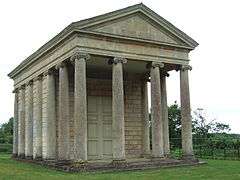
  84. Historic England. "Temple of Harmony (1058952)". National Heritage List for England. Retrieved 3 April 2015.
  85. Historic England. "The Admiral Blake Museum (1205363)". National Heritage List for England. Retrieved 3 April 2015.
  86. Historic England. "The Old Angel (1344883)". National Heritage List for England. Retrieved 3 April 2015.
  87. Historic England. "Tirelands Farmhouse (1177211)". National Heritage List for England. Retrieved 3 April 2015.
  88. Historic England. "West Bower Manor with barn (1058940)". National Heritage List for England. Retrieved 3 April 2015.
  89. Historic England. "West Newton Manor (1344642)". National Heritage List for England. Retrieved 3 April 2015.
  90. Historic England. "Westonzoyland Engine Trust Old Pumping Station (1174295)". National Heritage List for England. Retrieved 3 April 2015.
  91. Historic England. "World War Memorial (1197395)". National Heritage List for England. Retrieved 3 April 2015.

Media related to Grade II* listed buildings in Somerset at Wikimedia Commons

This article is issued from Wikipedia - version of the 8/24/2016. The text is available under the Creative Commons Attribution/Share Alike but additional terms may apply for the media files.