Grade II* listed buildings in Lancashire

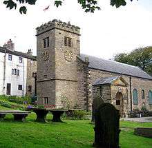
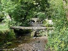
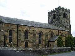
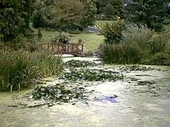
This is a list of Grade II* listed buildings in Lancashire, England.

Blackburn with Darwen

Name Location Type Completed [note 1]Date designated Grid ref.[note 2]
Geo-coordinates
Entry number [note 3]Image
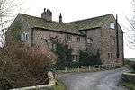
Brandwood Fold Edgworth, North Turton Farmhouse 17th century 27 January 1967 SD7401816378
53°38′36″N 2°23′40″W / 53.643261°N 2.394484°W / 53.643261; -2.394484 (Brandwood Fold)
1241554
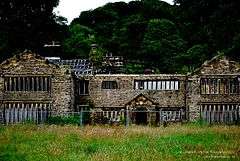
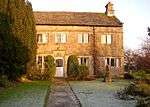
Entwistle Hall Entwistle, North Turton Farmhouse 16th century 27 January 1967 SD7287217496
53°39′12″N 2°24′43″W / 53.653251°N 2.411916°W / 53.653251; -2.411916 (Entwistle Hall)
1260432
Horrocks Fold Farmhouse (Thimble Hall) Edgworth, North Turton Farmhouse 17th century 27 January 1967 SD7382316936
53°38′54″N 2°23′51″W / 53.648267°N 2.39748°W / 53.648267; -2.39748 (Horrocks Fold Farmhouse (Thimble Hall))
1260435
New Hall, Including Cottage at Rear Entwistle, North Turton House 1742 15 March 1974 SD7268817740
53°39′20″N 2°24′53″W / 53.655435°N 2.414721°W / 53.655435; -2.414721 (New Hall, Including Cottage at Rear)
1241559
Summerhouse circa 100 Metres East of Turton Tower North Turton Prospect Tower 17th century 27 September 1984 SD7315015246
53°37′59″N 2°24′27″W / 53.633043°N 2.407515°W / 53.633043; -2.407515 (Summerhouse circa 100 Metres East of Turton Tower)
1241997
Old Hall Farmhouse Pleasington Farmhouse 1587 27 August 1952 SD6460226967
53°44′16″N 2°32′17″W / 53.737878°N 2.538119°W / 53.737878; -2.538119 (Old Hall Farmhouse)
1072418
Higher Hill Farmhouse Tockholes Farmhouse 17th century 24 November 1966 SD6576922585
53°41′55″N 2°31′12″W / 53.698572°N 2.519941°W / 53.698572; -2.519941 (Higher Hill Farmhouse)
1241536
Lower Hill Tockholes Farmhouse Early 17th century 27 August 1952 SD6562022888
53°42′05″N 2°31′20″W / 53.701286°N 2.522232°W / 53.701286; -2.522232 (Lower Hill)
1260460
Ryal Farmhouse Ryal Fold, Tockholes Farmhouse 17th century 27 September 1984 SD6660421704
53°41′27″N 2°30′26″W / 53.690708°N 2.5072°W / 53.690708; -2.5072 (Ryal Farmhouse)
1241544
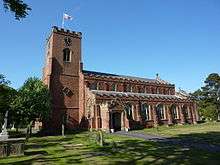
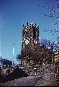
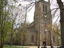
Church of St Peter Darwen Church 1827-1829 27 September 1984 SD6943222223
53°41′44″N 2°27′52″W / 53.695547°N 2.464428°W / 53.695547; -2.464428 (Church of St Peter)
1163042
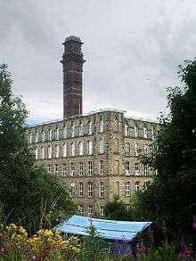
India Mill Chimney Darwen Mill 1867 27 September 1984 SD6937921710
53°41′27″N 2°27′55″W / 53.690933°N 2.465179°W / 53.690933; -2.465179 (India Mill Chimney)
1362166
Cathedral Church of St Mary the Virgin Blackburn Cathedral 1926 28 November 1951 SD6836027988
53°44′50″N 2°28′53″W / 53.747297°N 2.481254°W / 53.747297; -2.481254 (Cathedral Church of St Mary the Virgin)
1239147
Church of St Mark Witton, Blackburn Church 1836-1838 19 April 1974 SD6658227626
53°44′38″N 2°30′29″W / 53.743932°N 2.508174°W / 53.743932; -2.508174 (Church of St Mark)
1239292
Church of St Silas, Blackburn Blackburn Church Designed 1878 19 April 1974 SD6664828482
53°45′06″N 2°30′26″W / 53.75163°N 2.507266°W / 53.75163; -2.507266 (Church of St Silas, Blackburn)
1239161
Eddy Holes, Stable and Shippons to Eddy Holes Bank Hey, Blackburn House 16th century 28 November 1951 SD6957930956
53°46′27″N 2°27′47″W / 53.774045°N 2.463064°W / 53.774045; -2.463064 (Eddy Holes, Stable and Shippons to Eddy Holes)
1222890
Myles Wife Hey Bank Hey, Blackburn House 1543 28 November 1951 SD6940330375
53°46′08″N 2°27′56″W / 53.768813°N 2.465676°W / 53.768813; -2.465676 (Myles Wife Hey)
1273854

Blackpool

Name Location Type Completed [note 1]Date designated Grid ref.[note 2]
Geo-coordinates
Entry number [note 3]Image
Church of the Sacred Heart Blackpool Church 1857 20 October 1983 SD3072636433
53°49′10″N 3°03′13″W / 53.819537°N 3.053742°W / 53.819537; -3.053742 (Church of the Sacred Heart)
1072015
Blackpool Grand Theatre Blackpool Theatre 1894 26 January 1972 SD3074936175
53°49′02″N 3°03′12″W / 53.817222°N 3.053334°W / 53.817222; -3.053334 (Blackpool Grand Theatre)
1280615
Thanksgiving Shrine of Our Lady of Lourdes Blackpool Chapel 1955/1957 30 June 1999 SD3318436774
53°49′23″N 3°00′59″W / 53.822924°N 3.016486°W / 53.822924; -3.016486 (Thanksgiving Shrine of Our Lady of Lourdes)
1387319
The Winter Gardens Blackpool Conservatory 1875-8 10 October 1973 SD3089236162
53°49′02″N 3°03′04″W / 53.817124°N 3.05116°W / 53.817124; -3.05116 (The Winter Gardens)
1072007

Burnley

Name Location Type Completed [note 1]Date designated Grid ref.[note 2]
Geo-coordinates
Entry number [note 3]Image
Burwains Briercliffe Farmhouse 1642 1 April 1953 SD8873535779
53°49′05″N 2°10′21″W / 53.818165°N 2.172587°W / 53.818165; -2.172587 (Burwains)
1072659
Extwistle Hall and Attached Garden Wall Briercliffe Farmhouse 16th to 17th Century 1 April 1953 SD8760533800
53°48′01″N 2°11′23″W / 53.800352°N 2.18967°W / 53.800352; -2.18967 (Extwistle Hall and Attached Garden Wall)
1072655
Barcroft Hall with Attached Garden Wall and Entrance Gateway Cliviger House 16th to 17th Century 1 April 1953 SD8656230417
53°46′12″N 2°12′19″W / 53.76992°N 2.205357°W / 53.76992; -2.205357 (Barcroft Hall with Attached Garden Wall and Entrance Gateway)
1072668
The Holme Cliviger House Early 17th century 1 April 1953 SD8782428361
53°45′05″N 2°11′10″W / 53.751472°N 2.186128°W / 53.751472; -2.186128 (The Holme)
1362053
Arched Gateway and Garden Wall Attached to South Front of Shuttleworth Hall Hapton Gate 17th century 12 February 1985 SD7838032229
53°47′09″N 2°19′47″W / 53.785928°N 2.329617°W / 53.785928; -2.329617 (Arched Gateway and Garden Wall Attached to South Front of Shuttleworth Hall)
1222599
Hargrove Farmhouse Padiham Farmhouse Early to Mid 17th century 28 August 1953 SD7967234845
53°48′34″N 2°18′37″W / 53.809493°N 2.310182°W / 53.809493; -2.310182 (Hargrove Farmhouse)
1237631
Stockbridge House Padiham House Mid 17th century 28 August 1953 SD7984633574
53°47′53″N 2°18′27″W / 53.798076°N 2.307456°W / 53.798076; -2.307456 (Stockbridge House)
1274125
The Great Barn Hurstwood, Worsthorne-with-Hurstwood Aisled Barn Late 16th century 17 December 1968 SD8814531368
53°46′43″N 2°10′53″W / 53.778506°N 2.181377°W / 53.778506; -2.181377 (The Great Barn)
1072638
Hurstwood Hall Hurstwood, Worsthorne-with-Hurstwood Farmhouse Post 1579 1 April 1953 SD8812031340
53°46′42″N 2°10′54″W / 53.778254°N 2.181755°W / 53.778254; -2.181755 (Hurstwood Hall)
1205736
Jackson's Farmhouse and Cottage Adjoining Jackson's Farmhouse and Attached Garden Wall Worsthorne-with-Hurstwood Farmhouse c.1600 1 April 1953 SD8765932442
53°47′17″N 2°11′20″W / 53.788148°N 2.188795°W / 53.788148; -2.188795 (Jackson's Farmhouse and Cottage Adjoining Jackson's Farmhouse and Attached Garden Wall)
1280581
Spenser House Worsthorne-with-Hurstwood Farmhouse Mid 16th century 1 April 1952 SD8808531352
53°46′42″N 2°10′56″W / 53.778361°N 2.182287°W / 53.778361; -2.182287 (Spenser House)
1280543
Burnley Mechanics Burnley Mechanics Institute 1854-1855 29 September 1977 SD8398932409
53°47′16″N 2°14′40″W / 53.78775°N 2.244497°W / 53.78775; -2.244497 (Burnley Mechanics)
1244905
Church of St Peter Burnley Church 1791 10 November 1951 SD8429632957
53°47′34″N 2°14′24″W / 53.792685°N 2.239866°W / 53.792685; -2.239866 (Church of St Peter)
1022640

Chorley

Name Location Type Completed [note 1]Date designated Grid ref.[note 2]
Geo-coordinates
Entry number [note 3]Image
Bank Hall Bretherton House 1832-1833 22 October 1952 SD4625620215
53°40′32″N 2°48′54″W / 53.675625°N 2.815047°W / 53.675625; -2.815047 (Bank Hall)
1362113
Carr House Bretherton Farmhouse Dated 1613; Later Alterations 22 October 1952 SD4627021474
53°41′13″N 2°48′54″W / 53.686941°N 2.815054°W / 53.686941; -2.815054 (Carr House)
1163160
Brindle Lodge Brindle House c.1808 22 October 1952 SD6031026651
53°44′05″N 2°36′11″W / 53.734728°N 2.603142°W / 53.734728; -2.603142 (Brindle Lodge)
1072574
Head O'th' Marsh Farmhouse Brindle Farmhouse 1692 17 April 1967 SD6136024885
53°43′08″N 2°35′13″W / 53.718935°N 2.587004°W / 53.718935; -2.587004 (Head O'th' Marsh Farmhouse)
1072572
Bolton Green Farmhouse Charnock Richard Farmhouse 1612 17 April 1967 SD5513017760
53°39′16″N 2°40′49″W / 53.654399°N 2.68037°W / 53.654399; -2.68037 (Bolton Green Farmhouse)
1203550
Lower House Farmhouse Charnock Richard Farmhouse 1654 17 April 1967 SD5593716268
53°38′28″N 2°40′05″W / 53.641059°N 2.667948°W / 53.641059; -2.667948 (Lower House Farmhouse)
1203643
Crow Trees Walton-le-Dale, Clayton-le-Woods Farmhouse Earlier than 1600 27 November 1972 SD5803524463
53°42′54″N 2°38′14″W / 53.714885°N 2.637329°W / 53.714885; -2.637329 (Crow Trees)
1211203
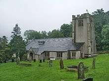
Church of St Michael Croston Parish Church Pre 16th century 17 April 1967 SD4900918394
53°39′34″N 2°46′23″W / 53.659535°N 2.773077°W / 53.659535; -2.773077 (Church of St Michael)
1163631
Cuerden Hall Cuerden Country House Early 18th century 21 February 1984 SD5639423929
53°42′36″N 2°39′44″W / 53.709951°N 2.662116°W / 53.709951; -2.662116 (Cuerden Hall)
1362174
Church of the Blessed Virgin Mary Eccleston Church 14th century 17 April 1967 SD5163717848
53°39′18″N 2°44′00″W / 53.654878°N 2.733229°W / 53.654878; -2.733229 (Church of the Blessed Virgin Mary)
1362129
Re-used Calvary Cross Slab, Churchyard of the Church of the Blessed Virgin Mary Eccleston Gravestone C13-C15 24 June 2010 SD5162117832
53°39′17″N 2°44′00″W / 53.654733°N 2.733468°W / 53.654733; -2.733468 (Re-used Calvary Cross Slab, Churchyard of the Church of the Blessed Virgin Mary)
1393860
Re-used Elizabethan Ledger Slab in the Churchyard of Church of the Blessed Virgin Mary Eccleston Gravestone 1584 24 June 2010 SD5166317853
53°39′18″N 2°43′58″W / 53.654926°N 2.732836°W / 53.654926; -2.732836 (Re-used Elizabethan Ledger Slab in the Churchyard of Church of the Blessed Virgin Mary)
1393858
Buckshaw Hall Euxton House 1885 11 July 1975 SD5629920123
53°40′33″N 2°39′47″W / 53.675736°N 2.663017°W / 53.675736; -2.663017 (Buckshaw Hall)
1362139
Euxton Parish Church Euxton Church Early 18th century 17 April 1967 SD5554318944
53°39′54″N 2°40′27″W / 53.665076°N 2.674291°W / 53.665076; -2.674291 (Euxton Parish Church)
1362144
Morris Farmhouse Heapey Farmhouse 1693 17 April 1967 SD6110818886
53°39′54″N 2°35′24″W / 53.664999°N 2.590068°W / 53.664999; -2.590068 (Morris Farmhouse)
1164224
Hall O' Th' Hill Heath Charnock House Early to Mid 17th century 22 October 1952 SD6031415030
53°37′49″N 2°36′06″W / 53.630283°N 2.60159°W / 53.630283; -2.60159 (Hall O' Th' Hill)
1072473
Howe Brook House Farmhouse Heskin Farmhouse 17th century or Earlier 17 April 1967 SD5217815301
53°37′55″N 2°43′29″W / 53.632037°N 2.724651°W / 53.632037; -2.724651 (Howe Brook House Farmhouse)
1072527
Lane Ends House Mawdesley House Early 17th century 17 April 1967 SD4878114876
53°37′40″N 2°46′33″W / 53.627895°N 2.775946°W / 53.627895; -2.775946 (Lane Ends House)
1072504
Rivington Hall Rivington Courtyard House Late 15th century 22 October 1952 SD6331014439
53°37′31″N 2°33′22″W / 53.62519°N 2.556218°W / 53.62519; -2.556218 (Rivington Hall)
1165012
Unitarian Chapel Rivington Unitarian Chapel 1703 17 April 1967 SD6268814517
53°37′33″N 2°33′56″W / 53.625847°N 2.565632°W / 53.625847; -2.565632 (Unitarian Chapel)
1362126
Moss Lane Farmhouse Whittle-le-Woods Farmhouse Later 17th century 21 May 1986 SD5877520399
53°40′42″N 2°37′32″W / 53.678418°N 2.625575°W / 53.678418; -2.625575 (Moss Lane Farmhouse)
1247763
Church of St George Chorley Church 1822-1825 21 December 1966 SD5850917474
53°39′08″N 2°37′45″W / 53.652109°N 2.62921°W / 53.652109; -2.62921 (Church of St George)
1072441
Church of St Laurence Chorley Church 1824 21 December 1966 SD5829817765
53°39′17″N 2°37′57″W / 53.654707°N 2.632441°W / 53.654707; -2.632441 (Church of St Laurence)
1072631
Gillibrand Hall Barn Chorley Dwelling 1669 21 December 1966 SD5737516882
53°38′48″N 2°38′47″W / 53.646696°N 2.646284°W / 53.646696; -2.646284 (Gillibrand Hall Barn)
1362045
Higher Healey Farm House Chorley Farmhouse 1612 21 December 1966 SD6062218799
53°39′51″N 2°35′51″W / 53.664181°N 2.597412°W / 53.664181; -2.597412 (Higher Healey Farm House)
1203835
Lower Burgh Hall Chorley Farmhouse Early 17th century or Earlier 4 January 1977 SD5714615691
53°38′10″N 2°38′58″W / 53.635973°N 2.649583°W / 53.635973; -2.649583 (Lower Burgh Hall)
1072644

Fylde

Name Location Type Completed [note 1]Date designated Grid ref.[note 2]
Geo-coordinates
Entry number [note 3]Image
Church of St Michael Kirkham Anglican Church 1823 20 September 1985 SD4270932356
53°47′04″N 2°52′16″W / 53.784359°N 2.870988°W / 53.784359; -2.870988 (Church of St Michael)
1362357
Church of St Cuthbert Lytham St Annes Parish Church 1834 13 January 1971 SD3570227222
53°44′15″N 2°58′34″W / 53.737401°N 2.976246°W / 53.737401; -2.976246 (Church of St Cuthbert)
1196361
Church of St John Lytham St Annes Church 1848-9 13 January 1971 SD3711027151
49°46′01″N 7°33′26″W / 49.766806°N 7.55716°W / 49.766806; -7.55716 (Church of St John)
1196368
Dovecote to North West of Lytham Hall (in woods behind stables) Lytham St Annes Dovecote Later 18th century 13 January 1971 SD3558028062
53°44′42″N 2°58′42″W / 53.744935°N 2.978271°W / 53.744935; -2.978271 (Dovecote to North West of Lytham Hall (in woods behind stables))
1219120
Fairhaven United Reformed Church Fairhaven Congregational Chapel 1904 22 February 1991 SD3474527358
53°44′19″N 2°59′27″W / 53.738504°N 2.990781°W / 53.738504; -2.990781 (Fairhaven United Reformed Church)
1196364

Hyndburn

Name Location Type Completed [note 1]Date designated Grid ref.[note 2]
Geo-coordinates
Entry number [note 3]Image
Church of St James Altham Church 1870 17 December 1968 SD7717033079
53°47′37″N 2°20′53″W / 53.793516°N 2.348045°W / 53.793516; -2.348045 (Church of St James)
1072721
Church of St Bartholomew Great Harwood Church 15th century 11 July 1966 SD7338732716
53°47′24″N 2°24′20″W / 53.790073°N 2.405438°W / 53.790073; -2.405438 (Church of St Bartholomew)
1362006
Church of St James Church, Hyndburn Church Late Medieval 9 March 1984 SD7412329097
53°45′27″N 2°23′38″W / 53.757584°N 2.393962°W / 53.757584; -2.393962 (Church of St James)
1072728
Gatehouse at Martholme Hyndburn Gatehouse 1561 11 July 1966 SD7527133777
53°47′59″N 2°22′37″W / 53.799702°N 2.376928°W / 53.799702; -2.376928 (Gatehouse at Martholme)
1072735
Outer Archway at Martholme Hyndburn Gate 1607 11 July 1966 SD7526833755
53°47′58″N 2°22′37″W / 53.799505°N 2.376971°W / 53.799505; -2.376971 (Outer Archway at Martholme)
1280458
Parker's Farmhouse Hyndburn Farmhouse c.1600 23 June 1965 SD7200228961
53°45′23″N 2°25′34″W / 53.756251°N 2.426119°W / 53.756251; -2.426119 (Parker's Farmhouse)
1206115
Roman Catholic Church of Our Lady and St Hubert, and Attached Presbytery Great Harwood Roman Catholic Church 1857-9 9 March 1984 SD7369932177
53°47′07″N 2°24′02″W / 53.785245°N 2.400657°W / 53.785245; -2.400657 (Roman Catholic Church of Our Lady and St Hubert, and Attached Presbytery)
1280421
Sparth Manor Hyndburn Farmhouse Later than mid 17th century 11 July 1966 SD7462831461
53°46′44″N 2°23′11″W / 53.778856°N 2.386498°W / 53.778856; -2.386498 (Sparth Manor)
1205946
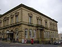
Town Hall Accrington Town Hall 1858 9 March 1984 SD7601528606
53°45′12″N 2°21′55″W / 53.753261°N 2.365228°W / 53.753261; -2.365228 (Town Hall)
1362011

Lancaster

Name Location Type Completed [note 1]Date designated Grid ref.[note 2]
Geo-coordinates
Entry number [note 3]Image
Church of St John the Baptist Arkholme, Arkholme-with-Cawood Church Late Perpendicular 4 October 1967 SD5890971825
54°08′26″N 2°37′50″W / 54.140607°N 2.630472°W / 54.140607; -2.630472 (Church of St John the Baptist)
1071728
Holy Trinity church
formerly Church of St Michael
Bolton-le-Sands Church Late 15th century 2 May 1968 SD4832967720
54°06′10″N 2°47′30″W / 54.10276°N 2.7917°W / 54.10276; -2.7917 (Holy Trinity church
formerly Church of St Michael
)
1071944
Hawkshead Farmhouse Bolton-le-Sands Farmhouse 1665 1 August 1952 SD4844067730
54°06′10″N 2°47′24″W / 54.102861°N 2.790004°W / 54.102861; -2.790004 (Hawkshead Farmhouse)
1362399
Stable Block North of Burrow Hall Burrow-with-Burrow Stable c.1740 4 October 1967 SD6165975959
54°10′41″N 2°35′20″W / 54.177972°N 2.588908°W / 54.177972; -2.588908 (Stable Block North of Burrow Hall)
1164344
Thurland Castle Cantsfield House 14th century 4 October 1967 SD6109173078
54°09′07″N 2°35′50″W / 54.152038°N 2.597236°W / 54.152038; -2.597236 (Thurland Castle)
1164439
Church of St Paul Brookhouse, Caton-with-Littledale Church Norman 4 October 1967 SD5421764607
54°04′31″N 2°42′04″W / 54.075343°N 2.70119°W / 54.075343; -2.70119 (Church of St Paul)
1163957
Gresgarth Hall Caton-with-Littledale House 4 October 1967 SD5325363324
54°03′49″N 2°42′57″W / 54.063726°N 2.715723°W / 54.063726; -2.715723 (Gresgarth Hall)
1071812
Claughton Hall Farmhouse Claughton House 15th century 4 October 1967 SD5665066518
54°05′34″N 2°39′51″W / 54.092728°N 2.664284°W / 54.092728; -2.664284 (Claughton Hall Farmhouse)
1071677
Church of St Michael Cockerham Church 16th century 2 May 1968 SD4625651864
53°57′36″N 2°49′14″W / 53.960054°N 2.820587°W / 53.960054; -2.820587 (Church of St Michael)
1317937
Shepherd's Farmhouse Cockerham House 1705 2 May 1968 SD4537251496
53°57′24″N 2°50′02″W / 53.956655°N 2.833992°W / 53.956655; -2.833992 (Shepherd's Farmhouse)
1071795
Church of St Mary Ellel Church (disused) 1873 7 June 1979 SD4817053585
53°58′33″N 2°47′30″W / 53.975717°N 2.791713°W / 53.975717; -2.791713 (Church of St Mary)
1317926
Gressingham Hall and Former Stables Adjoining Gressingham House Late 17th century 4 October 1967 SD5729869908
54°07′24″N 2°39′17″W / 54.123248°N 2.654858°W / 54.123248; -2.654858 (Gressingham Hall and Former Stables Adjoining)
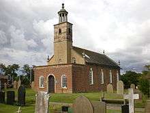
1164615
Loyne Bridge Gressingham Bridge Late Medieval 4 October 1967 SD5817169732
54°07′18″N 2°38′29″W / 54.121738°N 2.641477°W / 54.121738; -2.641477 (Loyne Bridge)
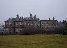
1071682
Halton Green East Farmhouse Halton-with-Aughton House Early 17th century 4 October 1967 SD5160965366
54°04′55″N 2°44′28″W / 54.081925°N 2.741166°W / 54.081925; -2.741166 (Halton Green East Farmhouse)
1071891
Halton Green West Farmhouse Halton-with-Aughton Farmhouse Late 17th century 4 October 1967 SD5157765334
54°04′54″N 2°44′30″W / 54.081634°N 2.74165°W / 54.081634; -2.74165 (Halton Green West Farmhouse)
1362450
Manor House Halton-with-Aughton House 1695 4 October 1967 SD5033264877
54°04′39″N 2°45′38″W / 54.077408°N 2.760603°W / 54.077408; -2.760603 (Manor House)
1164390
Cross Base South of Church of St.Margaret Hornby-with-Farleton Cross Pre-Conquest 4 December 1985 SD5851468568
54°06′41″N 2°38′10″W / 54.111305°N 2.636069°W / 54.111305; -2.636069 (Cross Base South of Church of St.Margaret)
1071658
Over Hall Ireby House Early 17th century 4 October 1967 SD6586975822
54°10′37″N 2°31′28″W / 54.177039°N 2.524395°W / 54.177039; -2.524395 (Over Hall)
1164939
Stables West of over Hall Ireby Stable 1690 4 October 1967 SD6582975809
54°10′37″N 2°31′30″W / 54.17692°N 2.525007°W / 54.17692; -2.525007 (Stables West of over Hall)
1071662
The Old Malt House Melling-with-Wrayton House 1684 4 October 1967 SD5964770990
54°07′59″N 2°37′09″W / 54.133162°N 2.619064°W / 54.133162; -2.619064 (The Old Malt House)
1071637
Midland Hotel Morecambe Restaurant 1932-1933 8 October 1976 SD4281564380
54°04′20″N 2°52′31″W / 54.072161°N 2.875383°W / 54.072161; -2.875383 (Midland Hotel)
1208988
The Winter Gardens Morecambe Theatre 1896 7 October 1977 SD4309864383
54°04′20″N 2°52′16″W / 54.072219°N 2.871059°W / 54.072219; -2.871059 (The Winter Gardens)
1025280
Capernwray Hall Over Kellet Country House 1844 7 November 1983 SD5460672201
54°08′37″N 2°41′47″W / 54.143623°N 2.696389°W / 54.143623; -2.696389 (Capernwray Hall)
1071908
Church of St. Cuthbert Over Kellet Church 13th century 4 October 1967 SD5225969550
54°07′11″N 2°43′55″W / 54.119586°N 2.731894°W / 54.119586; -2.731894 (Church of St. Cuthbert)
1071877
Higher Lee Over Wyresdale House 1671 2 May 1968 SD5632355726
53°59′45″N 2°40′04″W / 53.995713°N 2.667726°W / 53.995713; -2.667726 (Higher Lee)
1164115
Church of St. Helen Overton Church 12th century 2 May 1968 SD4404657576
54°00′40″N 2°51′19″W / 54.011151°N 2.855317°W / 54.011151; -2.855317 (Church of St. Helen)
1071774
Lune Aqueduct Quernmore Aqueduct 1797 4 October 1967 SD4845263886
54°04′06″N 2°47′21″W / 54.068317°N 2.789165°W / 54.068317; -2.789165 (Lune Aqueduct)
1071748
Quernmore Park Quernmore Country House 1795-8 4 October 1967 SD5165262767
54°03′31″N 2°44′24″W / 54.058572°N 2.740093°W / 54.058572; -2.740093 (Quernmore Park)
1317735
Church of St. John Silverdale Church 1885-6 2 May 1968 SD4632175401
54°10′18″N 2°49′26″W / 54.171579°N 2.823774°W / 54.171579; -2.823774 (Church of St. John)
1362446
Slackwood Farmhouse Silverdale House Late 17th century 2 May 1968 SD4744774569
54°09′51″N 2°48′23″W / 54.164219°N 2.806382°W / 54.164219; -2.806382 (Slackwood Farmhouse)
1362468
Manor House Slyne-with-Hest House 1861 1 August 1952 SD4776066005
54°05′14″N 2°48′00″W / 54.08729°N 2.800104°W / 54.08729; -2.800104 (Manor House)
1071858
Church of St James Tatham Church Norman 4 October 1967 SD6059469421
54°07′09″N 2°36′16″W / 54.119135°N 2.604367°W / 54.119135; -2.604367 (Church of St James)
1317663
Robert Hall Farmhouse and Farm Building Adjoining to East in Same Range Tatham Farmhouse Late 16th century 4 October 1967 SD6370269191
54°07′02″N 2°33′24″W / 54.117297°N 2.556792°W / 54.117297; -2.556792 (Robert Hall Farmhouse and Farm Building Adjoining to East in Same Range)
1071577
Ashton Hall Gatehouse Thurnham Gatehouse c.1600 1 August 1952 SD4613557290
54°00′32″N 2°49′24″W / 54.008804°N 2.823393°W / 54.008804; -2.823393 (Ashton Hall Gatehouse)
1164553
Former Stable Block West of Ashton Hall Thurnham House 17th century 1 August 1952 SD4610757314
54°00′32″N 2°49′26″W / 54.009017°N 2.823824°W / 54.009017; -2.823824 (Former Stable Block West of Ashton Hall)
1071715
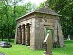
Gillow Mausoleum, North of Church of St. Thomas and St. Elizabeth Thurnham Mausoleum c.1830 7 March 1985 SD4655854321
53°58′56″N 2°48′59″W / 53.982166°N 2.816417°W / 53.982166; -2.816417 (Gillow Mausoleum, North of Church of St. Thomas and St. Elizabeth)
1164592
Church of St Michael Whittington Church Early 16th century 4 October 1967 SD5996876284
54°10′51″N 2°36′53″W / 54.180764°N 2.614857°W / 54.180764; -2.614857 (Church of St Michael)
1071615
Sellet Hall Whittington House c.1600 4 October 1967 SD6003877415
54°11′27″N 2°36′50″W / 54.190933°N 2.613935°W / 54.190933; -2.613935 (Sellet Hall)
1071649
Whittington Hall Whittington Country House 1831-36 4 October 1967 SD5962976250
54°10′50″N 2°37′12″W / 54.180431°N 2.620046°W / 54.180431; -2.620046 (Whittington Hall)
1362568
Leighton Hall Yealand Conyers Country House 1765 2 May 1968 SD4944274416
54°09′47″N 2°46′33″W / 54.163045°N 2.775804°W / 54.163045; -2.775804 (Leighton Hall)
1071836
Quaker Meeting House Yealand Conyers Friends Meeting House 1692 2 May 1968 SD5038474425
54°09′48″N 2°45′41″W / 54.163218°N 2.76138°W / 54.163218; -2.76138 (Quaker Meeting House)
1308669
The Castle Yealand Redmayne House Late 17th century 1 August 1952 SD5018475530
54°10′23″N 2°45′53″W / 54.173129°N 2.764626°W / 54.173129; -2.764626 (The Castle)
1308587
Cathedral Church of St Peter Lancaster Parish Church 1857-59 10 November 1994 SD4810461511
54°02′49″N 2°47′39″W / 54.046939°N 2.794074°W / 54.046939; -2.794074 (Cathedral Church of St Peter)
1214397
Chapel of Ripley St Thomas School Lancaster School 1888 18 February 1970 49°46′01″N 7°33′26″W / 49.766806°N 7.55716°W / 49.766806; -7.55716 (Chapel of Ripley St Thomas School) 1194928
Church of St John Lancaster Church Consecrated 1755 22 December 1953 SD4778461907
54°03′02″N 2°47′57″W / 54.050465°N 2.799029°W / 54.050465; -2.799029 (Church of St John)
1289679
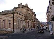
City Museum, the Old Town Hall Lancaster Prison 1781-3 22 December 1953 SD4760661728
54°02′56″N 2°48′06″W / 54.048839°N 2.801717°W / 54.048839; -2.801717 (City Museum, the Old Town Hall)
1194971
Conservative Club and Attached Railings Lancaster House 1637 22 December 1953 SD4754761870
54°03′00″N 2°48′10″W / 54.050109°N 2.802642°W / 54.050109; -2.802642 (Conservative Club and Attached Railings)
1290518
Friends Meeting House Lancaster House 1852 22 December 1953 SD4729861681
54°02′54″N 2°48′23″W / 54.048385°N 2.806412°W / 54.048385; -2.806412 (Friends Meeting House)
1211515
Maritime Museum Lancaster Steps 1884-c1930 22 December 1953 SD4735762274
54°03′13″N 2°48′20″W / 54.05372°N 2.805614°W / 54.05372; -2.805614 (Maritime Museum)
1289088
Moor Hospital, Blocks 40,41,42,44 and 46 Lancaster Psychiatric Hospital 1816 24 January 1994 SD4925661503
54°02′49″N 2°46′35″W / 54.046982°N 2.776481°W / 54.046982; -2.776481 (Moor Hospital, Blocks 40,41,42,44 and 46)
1289436
Music Room Lancaster Apartment 1953 22 December 1953 SD4752361763
54°02′57″N 2°48′11″W / 54.049145°N 2.80299°W / 54.049145; -2.80299 (Music Room)
1298332
National Westminster Bank Lancaster Bank 1870 13 March 1995 SD4760561858
54°03′00″N 2°48′06″W / 54.050007°N 2.801755°W / 54.050007; -2.801755 (National Westminster Bank)
1290544
Numbers 18 and 18a, Castle Park, including Attached Privy House Lancaster Apartment Early 18th Century; Altered c.1975 22 December 1953 SD4736861762
54°02′57″N 2°48′19″W / 54.04912°N 2.805357°W / 54.04912; -2.805357 (Numbers 18 and 18a, Castle Park, including Attached Privy House)
1194942
Pebble Forecourt to Numbers 18, 18a, 20 and 22, Castle Park. Lancaster Forecourt 18th century or Early 19th century 18 February 1970 SD4737961765
54°02′57″N 2°48′19″W / 54.049148°N 2.80519°W / 54.049148; -2.80519 (Pebble Forecourt to Numbers 18, 18a, 20 and 22, Castle Park.)
1194944
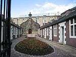
Penny's Almshouses Including Chapel and Screen Wall Lancaster Almshouses 1720 22 December 1953 SD4754261625
54°02′52″N 2°48′10″W / 54.047907°N 2.802676°W / 54.047907; -2.802676 (Penny's Almshouses Including Chapel and Screen Wall)
1195001
Queen Victoria Memorial Lancaster Statue 1906 18 February 1970 SD4786761615
54°02′52″N 2°47′52″W / 54.04785°N 2.797712°W / 54.04785; -2.797712 (Queen Victoria Memorial)
1290440
Ring O' Bells Public House Lancaster House Mid 18th century 22 December 1953 SD4761461502
54°02′49″N 2°48′06″W / 54.046809°N 2.801556°W / 54.046809; -2.801556 (Ring O' Bells Public House)
1194999
Royal Albert Hospital (original Part Only) Lancaster Hospital 1888 30 November 1970 SD4766060082
54°02′03″N 2°48′02″W / 54.03405°N 2.800608°W / 54.03405; -2.800608 (Royal Albert Hospital (original Part Only))
1194930
Skerton Bridge Lancaster Road Bridge 1788 18 February 1970 SD4795662355
54°03′16″N 2°47′47″W / 54.054509°N 2.79648°W / 54.054509; -2.79648 (Skerton Bridge)
1212253
The Old Hall Inn Lancaster Cross Wing House 1598 29 December 1950 SD4147861158
54°02′35″N 2°53′43″W / 54.043056°N 2.895189°W / 54.043056; -2.895189 (The Old Hall Inn)
1207212
Town Hall Lancaster Banqueting House 1906-9 22 December 1953 49°46′01″N 7°33′26″W / 49.766806°N 7.55716°W / 49.766806; -7.55716 (Town Hall) 1194923
42 and 44 Church Street Lancaster House Early 18th century 18 February 1970 SD4767261839
54°02′59″N 2°48′03″W / 54.049843°N 2.800728°W / 54.049843; -2.800728 (42 and 44 Church Street)
1210232
22 Castle Park Lancaster House Early 18th century 22 December 1953 SD4739361753
54°02′57″N 2°48′18″W / 54.049042°N 2.804974°W / 54.049042; -2.804974 (22 Castle Park)
1290779
20 Castle Park Lancaster House 1720 22 December 1953 SD4738361756
54°02′57″N 2°48′18″W / 54.049068°N 2.805127°W / 54.049068; -2.805127 (20 Castle Park)
1194943
38–42 Parliament Street Lancaster Toll House c.1787 22 December 1953 SD4805662279
54°03′14″N 2°47′42″W / 54.053836°N 2.794939°W / 54.053836; -2.794939 (38–42 Parliament Street)
1194984
78 and 80 Church Street Lancaster House 1775 22 December 1953 SD4753761875
54°03′01″N 2°48′10″W / 54.050153°N 2.802796°W / 54.050153; -2.802796 (78 and 80 Church Street)
1298413

Pendle

Name Location Type Completed [note 1]Date designated Grid ref.[note 2]
Geo-coordinates
Entry number [note 3]Image
Coates Hall Barnoldswick Apartment Early 18th Century 5 July 1950 SD8845647409
53°55′22″N 2°10′38″W / 53.922687°N 2.177267°W / 53.922687; -2.177267 (Coates Hall)
1258915
Independent Methodist Church Including Steps and Railings to Street Barnoldswick Gate 1892 29 January 1988 SD8759146519
53°54′53″N 2°11′25″W / 53.914668°N 2.190402°W / 53.914668; -2.190402 (Independent Methodist Church Including Steps and Railings to Street)
1273192
Higherford Old Bridge Barrowford Packhorse Bridge C16-C17 6 June 1952 SD8625240182
53°51′28″N 2°12′38″W / 53.857678°N 2.2105°W / 53.857678; -2.2105 (Higherford Old Bridge)
1273194
Lamb Working Men's Club Barrowford House 1696 6 June 1952 SD8586139620
53°51′09″N 2°12′59″W / 53.852616°N 2.216418°W / 53.852616; -2.216418 (Lamb Working Men's Club)
1073429
Garden Entrance to Hobstones Farmhouse Colne Wall 1704 29 January 1988 SD8821441682
53°52′16″N 2°10′51″W / 53.871208°N 2.180729°W / 53.871208; -2.180729 (Garden Entrance to Hobstones Farmhouse)
1361721
Hobstones Cottages, Hobstones Farmhouse Colne Farmhouse Early 18th century 29 January 1953 SD8819541695
53°52′17″N 2°10′52″W / 53.871325°N 2.181019°W / 53.871325; -2.181019 (Hobstones Cottages, Hobstones Farmhouse)
1272929
The Grammar School Earby School 17th century 18 May 1950 SD9068546968
53°55′08″N 2°08′36″W / 53.918769°N 2.143312°W / 53.918769; -2.143312 (The Grammar School)
1272938
Accornlee Hall Farmhouse Foulridge House Late 17th century 1 April 1953 SD8942643011
53°52′59″N 2°09′44″W / 53.88318°N 2.162343°W / 53.88318; -2.162343 (Accornlee Hall Farmhouse)
1361742
Ball House Foulridge House 1627 1 April 1953 SD8784142364
53°52′38″N 2°11′11″W / 53.877329°N 2.186429°W / 53.877329; -2.186429 (Ball House)
1073357
Church of St Mary, Newchurch in Pendle Goldshaw Booth Church 1718 29 January 1988 SD8230439373
53°51′01″N 2°16′14″W / 53.850286°N 2.270475°W / 53.850286; -2.270475 (Church of St Mary, Newchurch in Pendle)
1361745
Sabden Great Hall Goldshaw Booth House Early 17th Century 1 April 1953 SD8105738352
53°50′28″N 2°17′22″W / 53.841066°N 2.289367°W / 53.841066; -2.289367 (Sabden Great Hall)
1361707
Ashlar Cottage, Ashlar House Higham-with-West Close Booth House 1594 29 January 1988 SD8217736995
53°49′44″N 2°16′20″W / 53.828909°N 2.272267°W / 53.828909; -2.272267 (Ashlar Cottage, Ashlar House)
1243453
Lower Town House Nelson House 17th century 5 March 1952 SD8777037457
53°50′00″N 2°11′14″W / 53.833224°N 2.187312°W / 53.833224; -2.187312 (Lower Town House)
1073369
Greenhead Farmhouse Reedley Hallows House Mid 17th century 1 April 1953 SD8292036059
53°49′14″N 2°15′39″W / 53.820522°N 2.260926°W / 53.820522; -2.260926 (Greenhead Farmhouse)
1272792
Wood End Farmhouse Salterforth Farmhouse 1686 29 January 1988 SD8817543786
53°53′24″N 2°10′53″W / 53.890118°N 2.181404°W / 53.890118; -2.181404 (Wood End Farmhouse)
1073353
Bank House Bridge Trawden Forest Clapper Bridge 26 October 1964 SD9359038905
53°50′47″N 2°05′56″W / 53.846345°N 2.098911°W / 53.846345; -2.098911 (Bank House Bridge)
1243830
Clapper Bridge Wycoller, Trawden Forest Bridge 23 April 1952 SD9323739198
53°50′56″N 2°06′15″W / 53.848973°N 2.104282°W / 53.848973; -2.104282 (Clapper Bridge)
1243829
Grain Kiln with Stable to Rear of Number 39 Winewall, Trawden Forest Corn Drying Kiln c.1700 25 February 1970 SD9121639969
53°51′21″N 2°08′06″W / 53.855872°N 2.135024°W / 53.855872; -2.135024 (Grain Kiln with Stable to Rear of Number 39)
1243705
Pack Horse Bridge Wycoller, Trawden Forest Packhorse Bridge 17th century or earlier 23 April 1952 SD9323439248
53°50′58″N 2°06′16″W / 53.849423°N 2.104329°W / 53.849423; -2.104329 (Pack Horse Bridge)
1243828
Pierson's Farmhouse Trawden Forest Farmhouse Late 17th century 23 April 1952 SD9318639271
53°50′59″N 2°06′18″W / 53.849629°N 2.105059°W / 53.849629; -2.105059 (Pierson's Farmhouse)
1073327
Remains of Wycoller Hall, Including Boundary Wall to River Trawden Forest House 1596 23 April 1952 SD9327039207
53°50′57″N 2°06′14″W / 53.849055°N 2.103781°W / 53.849055; -2.103781 (Remains of Wycoller Hall, Including Boundary Wall to River)
1073331

Preston

Name Location Type Completed [note 1]Date designated Grid ref.[note 2]
Geo-coordinates
Entry number [note 3]Image
Wing of Former Barton Old Hall, Circa 20 Metres South of Old Hall Farmhouse Barton Bungalow Pre 16th century 11 November 1966 SD5305138199
53°50′16″N 2°42′54″W / 53.837909°N 2.714935°W / 53.837909; -2.714935 (Wing of Former Barton Old Hall, Circa 20 Metres South of Old Hall Farmhouse)
1073560
Parish Church of St John the Baptist Broughton Parish Church 1533 11 November 1966 SD5289934373
53°48′13″N 2°43′00″W / 53.80351°N 2.716658°W / 53.80351; -2.716658 (Parish Church of St John the Baptist)
1164208
Barn Circa 75 Metres North of Whinneyclough Farmhouse Goosnargh Farm Building 1639 11 November 1966 SD5692739278
53°50′53″N 2°39′22″W / 53.847942°N 2.656191°W / 53.847942; -2.656191 (Barn Circa 75 Metres North of Whinneyclough Farmhouse)
1317617
Bushells Hospital Goosnargh House 1722 25 July 1952 SD5600836862
53°49′34″N 2°40′11″W / 53.826152°N 2.669812°W / 53.826152; -2.669812 (Bushells Hospital)
1073535
Church of St Mary Goosnargh Church Late Medieval 11 November 1966 SD5595136922
53°49′36″N 2°40′14″W / 53.826686°N 2.670686°W / 53.826686; -2.670686 (Church of St Mary)
1361634
Scotch Green Farmhouse with Integral Shippon and Stable and Attached Granary Goosnargh Farmhouse Early 17th century 11 November 1966 SD5405540560
53°51′33″N 2°42′00″W / 53.859217°N 2.700034°W / 53.859217; -2.700034 (Scotch Green Farmhouse with Integral Shippon and Stable and Attached Granary)
1073544
Ashes Farmhouse with Wall Surrounding Front Garden Whittingham Farmhouse 1683 11 November 1966 SD5944637490
53°49′55″N 2°37′04″W / 53.832076°N 2.617668°W / 53.832076; -2.617668 (Ashes Farmhouse with Wall Surrounding Front Garden)
1073517
Church of St Anne Woodplumpton Church Medieval 11 November 1966 SD4993434445
53°48′14″N 2°45′42″W / 53.803879°N 2.761686°W / 53.803879; -2.761686 (Church of St Anne)
1073482
Arkwright House Preston House 19th century 12 June 1950 SD5429729269
53°45′28″N 2°41′41″W / 53.757763°N 2.694674°W / 53.757763; -2.694674 (Arkwright House)
1279775
Avenham Park Preston Park 1861 20 August 2013 SD5397428746
53°45′11″N 2°42′04″W / 53.753°N 2.701°W / 53.753; -2.701 (Avenham Park)
1000944
Church of St George the Martyr Preston Church 1799 27 September 1979 SD5377429441
53°45′33″N 2°42′09″W / 53.759263°N 2.702632°W / 53.759263; -2.702632 (Church of St George the Martyr)
1217949
Church of St Ignatius Preston Baptistery 1912 27 September 1979 SD5416929933
53°45′49″N 2°41′48″W / 53.76372°N 2.696714°W / 53.76372; -2.696714 (Church of St Ignatius)
1218482
Church of St John the Divine Preston Parish Church 1853-5 27 September 1979 SD5420029353
53°45′31″N 2°41′46″W / 53.75851°N 2.696158°W / 53.75851; -2.696158 (Church of St John the Divine)
1292457
Church of St Michael Preston Church Hall 1908 27 September 1979 SD5186830109
53°45′54″N 2°43′54″W / 53.765094°N 2.731644°W / 53.765094; -2.731644 (Church of St Michael)
1207268
Church of St Wilfrid Preston Roman Catholic Church 1793 27 September 1979 SD5376529221
53°45′26″N 2°42′10″W / 53.757285°N 2.702735°W / 53.757285; -2.702735 (Church of St Wilfrid)
1207254
Former Church of St Mark Preston Church 1862-3 27 September 1979 SD5270729871
53°45′47″N 2°43′08″W / 53.763032°N 2.718881°W / 53.763032; -2.718881 (Former Church of St Mark)
1291672
Harris Institute Preston Art School 1979 27 September 1979 SD5400028932
53°45′17″N 2°41′57″W / 53.754708°N 2.699128°W / 53.754708; -2.699128 (Harris Institute)
1207231
Miller Park Preston Park 1864 20 August 2013 SD5363828627
53°45′07″N 2°42′14″W / 53.752°N 2.704°W / 53.752; -2.704 (Miller Park)
1001450
Moor Park Preston Park 1867 20 August 2013 SD5405230969
53°46′26″N 2°41′53″W / 53.774°N 2.698°W / 53.774; -2.698 (Moor Park)
1001309
Sessions House Preston Court House 1900-3 27 September 1979 SD5404529476
53°45′35″N 2°41′55″W / 53.759602°N 2.698527°W / 53.759602; -2.698527 (Sessions House)
1279796
St Peter's Arts Centre, University of Central Lancashire Preston University 1950 12 June 1950 SD5341929925
53°45′49″N 2°42′29″W / 53.763581°N 2.708089°W / 53.763581; -2.708089 (St Peter's Arts Centre, University of Central Lancashire)
1219062
The Bull and Royal Hotel Preston Assembly Rooms Mid 18th Century 12 June 1950 SD5414229340
53°45′30″N 2°41′49″W / 53.758388°N 2.697036°W / 53.758388; -2.697036 (The Bull and Royal Hotel)
1207263

Ribble Valley

Name Location Type Completed [note 1]Date designated Grid ref.[note 2]
Geo-coordinates
Entry number [note 3]Image
Barn on North-west Side of Farmyard Hall Barns, Aighton, Bailey and Chaigley Barn 16th century 13 February 1967 SD6928338805
53°50′40″N 2°28′06″W / 53.844572°N 2.468341°W / 53.844572; -2.468341 (Barn on North-west Side of Farmyard)
1072302
Greengore Aighton, Bailey and Chaigley House c.1600 13 February 1967 SD6737038915
53°50′44″N 2°29′51″W / 53.845443°N 2.497427°W / 53.845443; -2.497427 (Greengore)
1308723
Old Bridge Aighton, Bailey and Chaigley Bridge 1562 29 December 1952 SD7040039164
53°50′52″N 2°27′05″W / 53.847863°N 2.451399°W / 53.847863; -2.451399 (Old Bridge)
1362197
Shireburn Cottages Aighton, Bailey and Chaigley Almshouse 1706 29 December 1952 SD6844238250
53°50′22″N 2°28′52″W / 53.839533°N 2.481065°W / 53.839533; -2.481065 (Shireburn Cottages)
1308779
Bashall Hall Bashall Eaves Hall House c.1600 16 November 1954 SD7108042347
53°52′35″N 2°26′29″W / 53.876509°N 2.441365°W / 53.876509; -2.441365 (Bashall Hall)
1072193
Farm Building 12 Metres North of Bashall Hall Bashall Eaves Farm Building 1984 16 November 1954 SD7109042378
53°52′36″N 2°26′28″W / 53.876789°N 2.441216°W / 53.876789; -2.441216 (Farm Building 12 Metres North of Bashall Hall)
1362282
Garden Pavilion, Approximately 90 Metres South of Bashall Hall Bashall Eaves Garden House Early 18th century 16 November 1954 SD7105242247
53°52′32″N 2°26′30″W / 53.875609°N 2.441781°W / 53.875609; -2.441781 (Garden Pavilion, Approximately 90 Metres South of Bashall Hall)
1072195
Hacking Barn Billington and Langho Cruck Barn c.1600 13 March 1986 SD7114337052
53°49′44″N 2°26′24″W / 53.828924°N 2.439907°W / 53.828924; -2.439907 (Hacking Barn)
1072064
Alder House Bolton-by-Bowland House 1708 16 November 1954 SD7658050451
53°56′59″N 2°21′30″W / 53.949624°N 2.358334°W / 53.949624; -2.358334 (Alder House)
1072207
Bolton Peel Farmhouse Bolton-by-Bowland House 17th century 16 November 1954 SD7765748656
53°56′01″N 2°20′30″W / 53.933539°N 2.341792°W / 53.933539; -2.341792 (Bolton Peel Farmhouse)
1362310
Fooden Hall Bolton-by-Bowland House Late 17th century 16 November 1954 SD8000048958
53°56′11″N 2°18′22″W / 53.936349°N 2.306127°W / 53.936349; -2.306127 (Fooden Hall)
1072201
Stakes Bowland Forest Low House Early 17th century 16 November 1983 SD6464343672
53°53′17″N 2°32′22″W / 53.888018°N 2.539422°W / 53.888018; -2.539422 (Stakes)
1163248
Laneside Farmhouse Chatburn House 1677 29 December 1952 SD7732745226
53°54′10″N 2°20′48″W / 53.902697°N 2.346563°W / 53.902697; -2.346563 (Laneside Farmhouse)
1362326
Church of St Bartholomew Chipping Church Early 16th century 13 February 1967 SD6221043323
53°53′05″N 2°34′35″W / 53.884709°N 2.576394°W / 53.884709; -2.576394 (Church of St Bartholomew)
1072279
Old Vicarage Chipping House 16th century 13 February 1967 SD6087141961
53°52′21″N 2°35′48″W / 53.872369°N 2.596589°W / 53.872369; -2.596589 (Old Vicarage)
1147251
Post Office and John Brabin's House Chipping House 1668 29 December 1952 SD6231443325
53°53′05″N 2°34′29″W / 53.884734°N 2.574812°W / 53.884734; -2.574812 (Post Office and John Brabin's House)
1362244
New Hall Clayton-le-Dale House 1665 27 August 1952 SD6620935418
53°48′50″N 2°30′53″W / 53.813939°N 2.514686°W / 53.813939; -2.514686 (New Hall)
1164471
Parish Church of St Mary Magdalene Clitheroe Church C14-C15 19 May 1950 SD7443342072
53°52′27″N 2°23′25″W / 53.874215°N 2.390343°W / 53.874215; -2.390343 (Parish Church of St Mary Magdalene)
1362179
Dinckley Hall Dinckley House c.1600 24 November 1966 SD6887636635
53°49′30″N 2°28′28″W / 53.825044°N 2.474306°W / 53.825044; -2.474306 (Dinckley Hall)
1072070
Church of St Leonard Downham Church Late 15th century 13 February 1967 SD7843344304
53°53′40″N 2°19′47″W / 53.894458°N 2.329665°W / 53.894458; -2.329665 (Church of St Leonard)
1164023
Downham Hall Downham Country House c.1600 13 December 1977 SD7829844309
53°53′40″N 2°19′54″W / 53.894497°N 2.331719°W / 53.894497; -2.331719 (Downham Hall)
1072125
Old Well Hall Downham House 17th century 27 April 1984 SD7857444159
53°53′35″N 2°19′39″W / 53.89316°N 2.327509°W / 53.89316; -2.327509 (Old Well Hall)
1318034
Dutton Hall Dutton House c.1600 25 July 1952 SD6620736795
53°49′35″N 2°30′54″W / 53.826315°N 2.514868°W / 53.826315; -2.514868 (Dutton Hall)
1308566
Huntingdon Hall Dutton House Early 17th century 25 July 1952 SD6607538884
53°50′42″N 2°31′02″W / 53.845081°N 2.517105°W / 53.845081; -2.517105 (Huntingdon Hall)
1147370
Hammerton Hall Easington House c.1600 16 November 1954 SD7188053761
53°58′45″N 2°25′49″W / 53.979137°N 2.430251°W / 53.979137; -2.430251 (Hammerton Hall)
1362269
Church of St Mary Gisburn Church 12th century 16 November 1954 SD8299048862
53°56′08″N 2°15′38″W / 53.935594°N 2.260578°W / 53.935594; -2.260578 (Church of St Mary)
1164472
Pair of Lodges at Southern Entrance to Gisburne Park with 6 Stone Piers and Linking Railings and Gates Gisburn Gate Pier c.1800 16 November 1954 SD8276448933
53°56′10″N 2°15′50″W / 53.936225°N 2.264024°W / 53.936225; -2.264024 (Pair of Lodges at Southern Entrance to Gisburne Park with 6 Stone Piers and Linking Railings and Gates)
1362297
Old Bridge, Lower Hodder (that Part in the Former Bowland Rural District) Great Mitton Bridge 1562 16 November 1954 SD7041339155
53°50′52″N 2°27′04″W / 53.847783°N 2.451201°W / 53.847783; -2.451201 (Old Bridge, Lower Hodder (that Part in the Former Bowland Rural District))
1163514
Horton Hall and Barn Adjoining to South West Horton House Early 18th century 16 November 1954 SD8521250467
53°57′00″N 2°13′37″W / 53.950088°N 2.226812°W / 53.950088; -2.226812 (Horton Hall and Barn Adjoining to South West)
1317730
Mitton Hall Little Mitton House c.1844 29 December 1952 SD7168638516
53°50′32″N 2°25′54″W / 53.842111°N 2.431793°W / 53.842111; -2.431793 (Mitton Hall)
1362324
Alston Old Hall Longridge House Early 15th century 8 November 1949 SD6116133535
53°47′48″N 2°35′28″W / 53.796662°N 2.591111°W / 53.796662; -2.591111 (Alston Old Hall)
1072296
Little Mearley Hall Mearley House Late 16th century 29 December 1952 SD7753241617
53°52′13″N 2°20′35″W / 53.870269°N 2.343177°W / 53.870269; -2.343177 (Little Mearley Hall)
1164780
Stanley House Mellor House 1640 24 August 1952 SD6456429933
53°45′52″N 2°32′21″W / 53.764533°N 2.539036°W / 53.764533; -2.539036 (Stanley House)
1164519
Newton Hall Newton House Mid to Late 18th century 16 November 1954 SD6976850401
53°56′56″N 2°27′44″W / 53.94882°N 2.462119°W / 53.94882; -2.462119 (Newton Hall)
1072246
Barn at Oxendale Hall Farm, South West of Oxendale Hall Osbaldeston Barn c.1600 13 March 1986 SD6505833401
53°47′45″N 2°31′55″W / 53.795735°N 2.531937°W / 53.795735; -2.531937 (Barn at Oxendale Hall Farm, South West of Oxendale Hall)
1317727
Osbaldeston Hall Osbaldeston House 16th century 27 August 1952 SD6441134422
53°48′18″N 2°32′31″W / 53.804868°N 2.541877°W / 53.804868; -2.541877 (Osbaldeston Hall)
1072072
Oxendale Hall Osbaldeston Cross Wing House 1656 27 August 1952 SD6510433429
53°47′46″N 2°31′52″W / 53.79599°N 2.531242°W / 53.79599; -2.531242 (Oxendale Hall)
1072075
Park House Paythorne House 17th century 16 November 1954 SD8100549699
53°56′35″N 2°17′27″W / 53.943047°N 2.290865°W / 53.943047; -2.290865 (Park House)
1362345
Standen Hall Pendleton Country House 1757 29 December 1952 SD7473640275
53°51′29″N 2°23′08″W / 53.858079°N 2.385586°W / 53.858079; -2.385586 (Standen Hall)
1072085
Read Hall Read House 1825 1 April 1953 SD7573834815
53°48′33″N 2°22′12″W / 53.809054°N 2.36992°W / 53.809054; -2.36992 (Read Hall)
1164581
Almshouses Stydd, Ribchester Almshouse 1726 25 July 1952 SD6538235805
53°49′03″N 2°31′38″W / 53.817363°N 2.527289°W / 53.817363; -2.527289 (Almshouses)
1308488
Brennand's Endowed School Slaidburn School Early 18th century 16 November 1954 SD7102752141
53°57′52″N 2°26′35″W / 53.96453°N 2.443103°W / 53.96453; -2.443103 (Brennand's Endowed School)
1072224
Townhead Slaidburn House 19th century 16 November 1954 SD7102652631
53°58′08″N 2°26′35″W / 53.968934°N 2.443165°W / 53.968934; -2.443165 (Townhead)
1072190
Church of St Helen Waddington Church c.1500 16 November 1954 SD7286643822
53°53′24″N 2°24′52″W / 53.889863°N 2.414331°W / 53.889863; -2.414331 (Church of St Helen)
1163679
Sands Cottage Whalley Timber Framed House 15th century 13 February 1967 SD7297436212
53°49′17″N 2°24′43″W / 53.821473°N 2.412015°W / 53.821473; -2.412015 (Sands Cottage)
1164758

Rossendale

Name Location Type Completed [note 1]Date designated Grid ref.[note 2]
Geo-coordinates
Entry number [note 3]Image
Carter Place Hall Rossendale House Late 18th century 20 June 1967 SD7847624834
53°43′10″N 2°19′40″W / 53.719467°N 2.327642°W / 53.719467; -2.327642 (Carter Place Hall)
1163485
Church of St John the Evangelist Crawshawbooth Church 1890-1892 7 June 1971 SD8101425174
53°43′21″N 2°17′21″W / 53.722622°N 2.289204°W / 53.722622; -2.289204 (Church of St John the Evangelist)
1163934
Church of St Nicholas with St John Newchurch Church 1561 7 June 1971 SD8342822339
53°41′50″N 2°15′09″W / 53.697224°N 2.252468°W / 53.697224; -2.252468 (Church of St Nicholas with St John)
1072799
Crawshaw Hall Crawshawbooth House 1831 7 June 1971 SD8091924948
53°43′14″N 2°17′26″W / 53.720587°N 2.29063°W / 53.720587; -2.29063 (Crawshaw Hall)
1163900
Edenfield Parish Church Edenfield Church 1826 9 August 1966 SD7985819809
53°40′28″N 2°18′23″W / 53.674358°N 2.306372°W / 53.674358; -2.306372 (Edenfield Parish Church)
1318084
Ewood Hall Rossendale Farmhouse 1641 23 November 1979 SD7948320851
53°41′01″N 2°18′44″W / 53.683709°N 2.312118°W / 53.683709; -2.312118 (Ewood Hall)
1072806
Forest House Rossendale House c.1828 19 June 1968 SD8674322768
53°42′04″N 2°12′08″W / 53.701175°N 2.20228°W / 53.701175; -2.20228 (Forest House)
1072857
Friends' Meeting House Crawshawbooth House 1739 7 June 1971 SD8107925366
53°43′28″N 2°17′18″W / 53.72435°N 2.288231°W / 53.72435; -2.288231 (Friends' Meeting House)
1361998
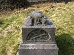
Harrier Hound Monument to Methuselah Yates in Churchyard to South of Church of St. Nicholas with St. John Newchurch Commemorative Monument 1864 9 May 2003 SD8342022290
53°41′48″N 2°15′09″W / 53.696783°N 2.252587°W / 53.696783; -2.252587 (Harrier Hound Monument to Methuselah Yates in Churchyard to South of Church of St. Nicholas with St. John)
1390506
Old Baptist Chapel Goodshaw Baptist Chapel 1760 7 June 1971 SD8153226303
53°43′58″N 2°16′53″W / 53.732788°N 2.281422°W / 53.732788; -2.281422 (Old Baptist Chapel)
1072764
Waggoner Tunstead Farmhouse Stacksteads Farmhouse 1632 19 June 1968 SD8533922176
53°41′45″N 2°13′25″W / 53.695816°N 2.223518°W / 53.695816; -2.223518 (Waggoner Tunstead Farmhouse)
1072843

South Ribble

Name Location Type Completed [note 1]Date designated Grid ref.[note 2]
Geo-coordinates
Entry number [note 3]Image
Church of St Michael Much Hoole Church 1875 11 November 1966 SD4630322321
53°41′40″N 2°48′53″W / 53.694557°N 2.814701°W / 53.694557; -2.814701 (Church of St Michael)
1361870
Church of St Mary Penwortham Church 14th century 11 November 1966 SD5240029001
53°45′19″N 2°43′24″W / 53.755185°N 2.723403°W / 53.755185; -2.723403 (Church of St Mary)
1073058
Arrowsmith House Walton-le-Dale House Earlier than 1700 24 March 1950 SD5930526532
53°44′01″N 2°37′06″W / 53.733581°N 2.61836°W / 53.733581; -2.61836 (Arrowsmith House)
1074106
Church of St Andrew Leyland Church 14th century 26 July 1951 SD5411121591
53°41′19″N 2°41′47″W / 53.688742°N 2.696354°W / 53.688742; -2.696354 (Church of St Andrew)
1073036
Church of St Leonard Walton-le-Dale Church Late medieval 24 March 1950 SD5614128121
53°44′51″N 2°40′00″W / 53.747605°N 2.666544°W / 53.747605; -2.666544 (Church of St Leonard)
1074102
Osbaldeston House Walton-le-Dale Farmhouse 1661 1 September 1960 SD5724627950
53°44′46″N 2°38′59″W / 53.74616°N 2.649766°W / 53.74616; -2.649766 (Osbaldeston House)
1290091
Seed Lee Farmhouse Walton-le-Dale Farmhouse 17th century 27 February 1984 SD5835724965
53°43′10″N 2°37′57″W / 53.719422°N 2.632518°W / 53.719422; -2.632518 (Seed Lee Farmhouse)
1361353
Todd Hall Walton-le-Dale House 1630 24 March 1950 SD5518226022
53°43′43″N 2°40′51″W / 53.728658°N 2.68078°W / 53.728658; -2.68078 (Todd Hall)
1074111
Walker Monument Approximately 20 Metres South of Chancel of Church of St Andrew South Ribble Grave Slab 1588 27 February 1984 SD5413621564
53°41′19″N 2°41′45″W / 53.688501°N 2.695971°W / 53.688501; -2.695971 (Walker Monument Approximately 20 Metres South of Chancel of Church of St Andrew)
1290442
Worden Old Hall Buckshaw Village Manor House Late 16th century 4 August 1975 SD5619720899
53°40′58″N 2°39′53″W / 53.682702°N 2.664671°W / 53.682702; -2.664671 (Worden Old Hall)
1361900

West Lancashire

Name Location Type Completed [note 1]Date designated Grid ref.[note 2]
Geo-coordinates
Entry number [note 3]Image
Moor Hall Aughton House Early 19th century 11 October 1968 SD4114805366
53°32′30″N 2°53′22″W / 53.541623°N 2.889552°W / 53.541623; -2.889552 (Moor Hall)
1361828
Barn about 100m south-west of Martin Hall Farmhouse (not included) Burscough Barn 17th century 11 August 1972 SD4257012264
53°36′14″N 2°52′10″W / 53.603775°N 2.869368°W / 53.603775; -2.869368 (Barn about 100m south-west of Martin Hall Farmhouse (not included))
1196636
Church of St John Burscough Church 1829-32 11 August 1972 SD4449912328
53°36′16″N 2°50′25″W / 53.604558°N 2.840231°W / 53.604558; -2.840231 (Church of St John)
1220393
Stone Hall Dalton House Early 18th century 22 April 1967 SD5089007738
53°33′50″N 2°44′35″W / 53.563945°N 2.742933°W / 53.563945; -2.742933 (Stone Hall)
1278390
Church of St Michael Great Altcar Church 1879 11 October 1968 SD3197106520
53°33′03″N 3°01′42″W / 53.550884°N 3.028262°W / 53.550884; -3.028262 (Church of St Michael)
1230934
Lathom House, former West Wing Lathom Country House c.1730 11 August 1972 SD4596009147
53°34′34″N 2°49′03″W / 53.576123°N 2.817602°W / 53.576123; -2.817602 (Lathom House, former West Wing)
1290908
Woodcock Hall Newburgh House Rebuilt 1719 11 May 1953 SD4831009828
53°34′57″N 2°46′56″W / 53.58248°N 2.782228°W / 53.58248; -2.782228 (Woodcock Hall)
1221001
Barn about 30m south of Fairhurst Hall Parbold Barn Early 18th century 19 August 1988 SD4902611634
53°35′56″N 2°46′18″W / 53.598782°N 2.77171°W / 53.598782; -2.77171 (Barn about 30m south of Fairhurst Hall)
1361842
Parbold Hall Parbold House 17th century 19 November 1951 SD5116410718
53°35′27″N 2°44′21″W / 53.590753°N 2.739264°W / 53.590753; -2.739264 (Parbold Hall)
1278311
Simonswood Hall Simonswood House 1687 11 October 1968 SD4169501129
53°30′13″N 2°52′50″W / 53.503605°N 2.880509°W / 53.503605; -2.880509 (Simonswood Hall)
1343471
Church of St Mary Tarleton Church 1719 11 October 1968 SD4567020128
53°40′29″N 2°49′26″W / 53.674782°N 2.823902°W / 53.674782; -2.823902 (Church of St Mary)
1073122
Johnson's Farmhouse Upholland Farmhouse 1647 7 January 1952 SD5226406937
53°33′25″N 2°43′19″W / 53.556873°N 2.722067°W / 53.556873; -2.722067 (Johnson's Farmhouse)
1219837
Manor House Crawford, Upholland Manor House 1718 7 January 1952 SD5008103107
53°31′20″N 2°45′16″W / 53.522247°N 2.754405°W / 53.522247; -2.754405 (Manor House)
1201667
Newgate Farmhouse Upholland Farmhouse Earlier than 1707 7 January 1952 SD5089805238
53°32′29″N 2°44′33″W / 53.541477°N 2.742419°W / 53.541477; -2.742419 (Newgate Farmhouse)
1219813
Old Grammar School, to rear of Nos 8-14 (nos 8-14 not included) Upholland Workshop 19th century or C20 7 January 1952 SD5248505155
53°32′27″N 2°43′06″W / 53.540877°N 2.71846°W / 53.540877; -2.71846 (Old Grammar School, to rear of Nos 8-14 (nos 8-14 not included))
1220218
Aspinalls Farmhouse Wrightington Farmhouse 1663 7 January 1952 SD5220608453
53°34′14″N 2°43′23″W / 53.570493°N 2.723175°W / 53.570493; -2.723175 (Aspinalls Farmhouse)
1240748
Halliwell Farmhouse Wrightington Farmhouse 18th century 7 January 1952 SD5180908596
53°34′18″N 2°43′45″W / 53.571742°N 2.729192°W / 53.571742; -2.729192 (Halliwell Farmhouse)
1073026
Harrock Hall Wrightington House Early 17th century 19 November 1951 SD5077212440
53°36′22″N 2°44′44″W / 53.606193°N 2.745458°W / 53.606193; -2.745458 (Harrock Hall)
1231056
Wrightington Hall Wrightington Country House c.1700 4 October 1972 SD5314610636
53°35′25″N 2°42′34″W / 53.590198°N 2.709311°W / 53.590198; -2.709311 (Wrightington Hall)
1361885
Bath Lodge Ormskirk Hunting Lodge Early-mid 18th century 11 August 1972 SD4254909229
53°34′35″N 2°52′09″W / 53.576496°N 2.869125°W / 53.576496; -2.869125 (Bath Lodge)
1221197
Church of St Peter and St Paul, Ormskirk Ormskirk Parish Church 12th century 11 May 1953 SD4130608436
53°34′09″N 2°53′16″W / 53.569232°N 2.887746°W / 53.569232; -2.887746 (Church of St Peter and St Paul, Ormskirk)
1221160
Water Tower on Tower Hill Ormskirk Water Tower 1853-4 22 March 1976 SD4231908453
53°34′10″N 2°52′21″W / 53.569497°N 2.872455°W / 53.569497; -2.872455 (Water Tower on Tower Hill)
1197069

Wyre

Name Location Type Completed [note 1]Date designated Grid ref.[note 2]
Geo-coordinates
Entry number [note 3]Image
Nos 1 & 2 The Street Claughton House 1689 17 April 1967 SD5131742777
53°52′44″N 2°44′31″W / 53.878892°N 2.742011°W / 53.878892; -2.742011 (Nos 1 & 2 The Street)
1361927
Kirkland Hall Kirkland House 16th century 16 December 1952 SD4802043561
53°53′08″N 2°47′32″W / 53.885617°N 2.792291°W / 53.885617; -2.792291 (Kirkland Hall)
1361955
Church of St John the Baptist Pilling Church 1886-7 17 April 1967 SD4030548626
53°55′49″N 2°54′38″W / 53.930302°N 2.910639°W / 53.930302; -2.910639 (Church of St John the Baptist)
1073081
Old Church of St John Baptist Pilling Church 1766 17 April 1967 SD4027348477
53°55′44″N 2°54′40″W / 53.928959°N 2.911097°W / 53.928959; -2.911097 (Old Church of St John Baptist)
1073080
Parrox Hall Preesall House Early 17th century 8 November 1949 SD3601747843
53°55′22″N 2°58′33″W / 53.922753°N 2.97577°W / 53.922753; -2.97577 (Parrox Hall)
1073082
Church of St Chad Poulton-le-Fylde Church Early 17th century 23 September 1950 SD3482739455
53°50′50″N 2°59′32″W / 53.847226°N 2.992101°W / 53.847226; -2.992101 (Church of St Chad)
1072401
Marsh Mill Thornton Drying Kiln 1794 24 March 1950 SD3356242553
53°52′30″N 3°00′43″W / 53.874905°N 3.011997°W / 53.874905; -3.011997 (Marsh Mill)
1073150

See also

Notes

  1. 1 2 3 4 5 6 7 8 9 10 11 12 13 14 The date given is the date used by Historic England as significant for the initial building or that of an important part in the structure's description.
  2. 1 2 3 4 5 6 7 8 9 10 11 12 13 14 Sometimes known as OSGB36, the grid reference is based on the British national grid reference system used by the Ordnance Survey.
  3. 1 2 3 4 5 6 7 8 9 10 11 12 13 14 The "List Entry Number" is a unique number assigned to each listed building and scheduled monument by Historic England.

References

English Heritage Images of England

Media related to Grade II* listed buildings in Lancashire at Wikimedia Commons

This article is issued from Wikipedia - version of the 10/24/2016. The text is available under the Creative Commons Attribution/Share Alike but additional terms may apply for the media files.