Grade II* listed buildings in Woking (district)
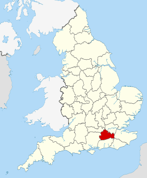
Surrey shown within England

There are over 20,000 Grade II* listed buildings in England. This page is a list of these buildings in the district of Woking in Surrey. For links to similar articles in relation to the other 10 districts of Surrey see Grade II* listed buildings in Surrey.

Name Location Type Completed [note 1]Date designated Grid ref.[note 2]
Geo-coordinates
Entry number [note 3]Image
Manor House and Manorside West Byfleet, Woking House Earlier-Pre 1686 22 July 1953 TQ0711660280
51°19′54″N 0°27′50″W / 51.331537°N 0.463878°W / 51.331537; -0.463878 (Manor House and Manorside West)
1236613
Watermill 10m from the Mill House Byfleet, Woking Watermill Mid 18th century 22 July 1953 TQ0728860684
51°20′06″N 0°27′41″W / 51.335136°N 0.461288°W / 51.335136; -0.461288 (Watermill 10m from the Mill House)
1236612
Chapel of the Former
Convent of St Peter
Woking Chapel 1898-1900 25 October 1990 TQ0199058918
51°19′13″N 0°32′16″W / 51.320235°N 0.537818°W / 51.320235; -0.537818 (Chapel of the Former
Convent of St Peter
)
1264347
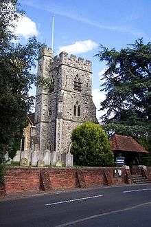
Church of St Mary the Virgin Horsell
Woking
Church 15th century 22 July 1953 SU9971459154
51°19′22″N 0°34′13″W / 51.32276°N 0.570402°W / 51.32276; -0.570402 (Church of St Mary the Virgin)
1044720
Fishers Farm House Woking Farmhouse 15th century 6 January 1984 TQ0136655915
51°17′36″N 0°32′51″W / 51.293353°N 0.547621°W / 51.293353; -0.547621 (Fishers Farm House)
1044716
Hoe Place Old Woking, Woking House Early 18th century 22 July 1953 TQ0207757572
51°18′29″N 0°32′13″W / 51.308121°N 0.536955°W / 51.308121; -0.536955 (Hoe Place)
1044695
Littlecourt Woking House 1902 29 April 1980 TQ0302459376
51°19′27″N 0°31′22″W / 51.324166°N 0.522853°W / 51.324166; -0.522853 (Littlecourt)
1236744
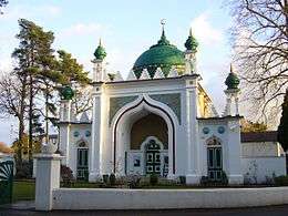
Shah Jehan Mosque Woking Mosque 1889 6 January 1984 TQ0151659178
51°19′22″N 0°32′40″W / 51.322657°N 0.544543°W / 51.322657; -0.544543 (Shah Jehan Mosque)
1264438
The Old Manor House Old Woking, Woking House 17th century 22 July 1953 TQ0182456906
51°18′08″N 0°32′27″W / 51.30218°N 0.540773°W / 51.30218; -0.540773 (The Old Manor House)
1044692
Tomb of Lord
Edward Pelham-Clinton (1836–1907)
Brookwood Cemetery, Woking Tomb 1892 23 July 2004 SU9596256477
51°17′58″N 0°37′30″W / 51.299341°N 0.624949°W / 51.299341; -0.624949 (Tomb of Lord
Edward Pelham-Clinton (1836–1907)
)
1391044
Whitfield Court Woking House 18th century 30 March 1979 SU9713959280
51°19′28″N 0°36′26″W / 51.324338°N 0.607309°W / 51.324338; -0.607309 (Whitfield Court)
1236585

Notes

  1. The date given is the date used by Historic England as significant for the initial building or that of an important part in the structure's description.
  2. Sometimes known as OSGB36, the grid reference is based on the British national grid reference system used by the Ordnance Survey.
  3. The "List Entry Number" is a unique number assigned to each listed building and scheduled monument by Historic England.

References

English Heritage Images of England

Media related to Grade II* listed buildings in Surrey at Wikimedia Commons

This article is issued from Wikipedia - version of the 1/13/2016. The text is available under the Creative Commons Attribution/Share Alike but additional terms may apply for the media files.