Grand Rivers, Kentucky
| Grand Rivers, Kentucky | |
|---|---|
| City | |
|
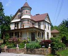
Downtown Grand Rivers, Kentucky | |
 Location of Grand Rivers, Kentucky | |
| Coordinates: 37°0′17″N 88°13′54″W / 37.00472°N 88.23167°WCoordinates: 37°0′17″N 88°13′54″W / 37.00472°N 88.23167°W | |
| Country | United States |
| State | Kentucky |
| County | Livingston |
| Named for | the nearby Cumberland, Tennessee, and Ohio rivers |
| Area | |
| • Total | 1.9 sq mi (4.9 km2) |
| • Land | 1.8 sq mi (4.8 km2) |
| • Water | 0.0 sq mi (0.1 km2) |
| Elevation | 387 ft (118 m) |
| Population (2010) | |
| • Total | 382 |
| • Density | 186.1/sq mi (71.9/km2) |
| Time zone | Central (CST) (UTC-6) |
| • Summer (DST) | CDT (UTC-5) |
| ZIP code | 42045 |
| Area code(s) | 270 & 364 |
| FIPS code | 21-32212 |
| GNIS feature ID | 0493092 |

Grand Rivers is a 5th-class city in Livingston County, Kentucky, in the United States. The population was 382 at the 2010 census, up from 343 in 2000. It is part of the Paducah micropolitan area.
Geography
Grand Rivers is located at 37°0′17″N 88°13′54″W / 37.00472°N 88.23167°W (37.004732, -88.231773).[1] According to the United States Census Bureau, the city has a total area of 1.9 square miles (4.9 km2), of which 1.8 square miles (4.8 km²) is land and 0.04 square miles (0.10 km2) (2.13%) is water.
The town was formerly located at the narrowest point between the Cumberland River and the Tennessee. Both were dammed and artificial lakes created by the Tennessee Valley Authority in the early 20th century; the town now lies on an isthmus of land between Kentucky Lake and Lake Barkley.
History
Grand Rivers may have originally been known as Narrows from its position between the Cumberland and Tennessee Rivers. The local post office was established in 1879 as Otisville; changed its name in 1882 to Bernard; and was then changed again to Nickells the next year after the name of a new Illinois Central station.[2]
The settlement was formally incorporated by the state assembly in 1890 as Grand Rivers.[3] This newly expanded community was part of local businessman Thomas W. Lawson's attempt to develop local iron deposits into a major steel industry. (The enterprise failed within a few years.) The name refers the Cumberland and Tennessee rivers which previously met near the site,[2] prior to the TVA's creation of Kentucky Lake and Lake Barkley. The Tennessee's confluence with the Ohio is located within 40 miles of the town as well.
Demographics
| Historical population | |||
|---|---|---|---|
| Census | Pop. | %± | |
| 1920 | 478 | — | |
| 1930 | 452 | −5.4% | |
| 1940 | 499 | 10.4% | |
| 1950 | 234 | −53.1% | |
| 1960 | 378 | 61.5% | |
| 1970 | 438 | 15.9% | |
| 1980 | 428 | −2.3% | |
| 1990 | 351 | −18.0% | |
| 2000 | 343 | −2.3% | |
| 2010 | 382 | 11.4% | |
| Est. 2015 | 374 | [4] | −2.1% |
As of the census[6] of 2000, there were 343 people, 165 households, and 103 families residing in the city. The population density was 186.1 people per square mile (72.0/km²). There were 201 housing units at an average density of 109.1 per square mile (42.2/km²). The racial makeup of the city was 97.08% White, 0.29% Native American, 0.29% Pacific Islander, 1.17% from other races, and 1.17% from two or more races. Hispanic or Latino of any race were 1.17% of the population.
There were 165 households out of which 17.6% had children under the age of 18 living with them, 53.3% were married couples living together, 4.8% had a female householder with no husband present, and 37.0% were non-families. 33.9% of all households were made up of individuals and 17.6% had someone living alone who was 65 years of age or older. The average household size was 2.07 and the average family size was 2.63.
In the city the population was spread out with 16.6% under the age of 18, 5.2% from 18 to 24, 21.3% from 25 to 44, 35.9% from 45 to 64, and 21.0% who were 65 years of age or older. The median age was 50 years. For every 100 females there were 101.8 males. For every 100 females age 18 and over, there were 98.6 males.
The median income for a household in the city was $33,250, and the median income for a family was $42,917. Males had a median income of $28,750 versus $15,521 for females. The per capita income for the city was $21,642. About 8.7% of families and 10.1% of the population were below the poverty line, including 14.3% of those under age 18 and 9.0% of those age 65 or over.
References
- ↑ "US Gazetteer files: 2010, 2000, and 1990". United States Census Bureau. 2011-02-12. Retrieved 2011-04-23.
- 1 2 Rennick, Robert M. (1987). Kentucky Place Names. University Press of Kentucky. p. 121. Retrieved 28 Apr 2013.
- ↑ Commonwealth of Kentucky. Office of the Secretary of State. Land Office. "Grand Rivers, Kentucky". Accessed 28 Jul 2013.
- ↑ "Annual Estimates of the Resident Population for Incorporated Places: April 1, 2010 to July 1, 2015". Retrieved July 2, 2016.
- ↑ "Census of Population and Housing". Census.gov. Retrieved June 4, 2015.
- ↑ "American FactFinder". United States Census Bureau. Retrieved 2008-01-31.
External links
Municipalities and communities of Livingston County, Kentucky, United States | ||
|---|---|---|
| Cities |  | |
| CDP | ||
| Unincorporated community | ||