Greenpoint Historic District
|
Greenpoint Historic District | |
|
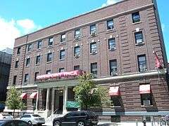
Greenpoint YMCA | |
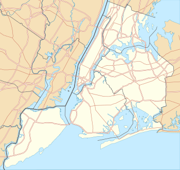   | |
| Location | Roughly bounded by Kent, Calyer, Noble, and Franklin Sts., Clifford Pl. and Manhattan Ave., New York, New York |
|---|---|
| Coordinates | 40°43′45″N 73°57′20″W / 40.72917°N 73.95556°WCoordinates: 40°43′45″N 73°57′20″W / 40.72917°N 73.95556°W |
| Area | 43 acres (17 ha) |
| Built | 1850 |
| Architect | Multiple |
| Architectural style | Late Victorian, Italianate |
| NRHP Reference # | [1] |
| Added to NRHP | September 26, 1983 |
Greenpoint Historic District is a national historic district in Greenpoint, Brooklyn, New York, New York. It consists of 363 contributing commercial and residential buildings built between 1850 and 1900. It includes both substantial and modest row houses, numerous walk-up apartment buildings, as well as a variety of commercial buildings including the former Eberhard Faber factory, six churches, and two banks.[2]
It was listed on the National Register of Historic Places in 1983.[1]
References
- 1 2 National Park Service (2009-03-13). "National Register Information System". National Register of Historic Places. National Park Service.
- ↑ Larry Gobrecht (August 1983). "National Register of Historic Places Registration:Greenpoint Historic District". New York State Office of Parks, Recreation and Historic Preservation. Retrieved 2011-03-12. See also: "Accompanying 40 photos". and "photo captions".
| Topics |  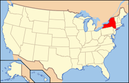 | |
|---|---|---|
| Lists by county |
| |
| Lists by city | ||
| Other lists | ||
| ||
This article is issued from Wikipedia - version of the 11/28/2016. The text is available under the Creative Commons Attribution/Share Alike but additional terms may apply for the media files.