| [3] |
Name on the Register |
Image |
Date listed[4] |
Location |
City or town |
Description |
|---|
| 1 |
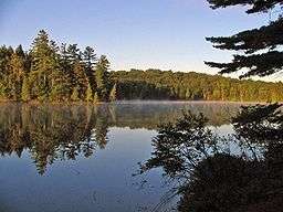
Adirondack Forest Preserve |
|
000000001966-10-15-0000October 15, 1966
(#66000891) |
Northeast New York State
43°58′43″N 74°18′42″W / 43.978611°N 74.311667°W / 43.978611; -74.311667 (Adirondack Forest Preserve) |
Clinton County |
|
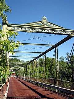
| 2 |
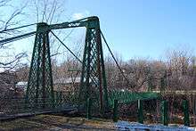
AuSable Chasm Bridge |
|
000000001999-11-12-0000November 12, 1999
(#99001320) |
US 9 over Ausable River
44°31′29″N 73°27′48″W / 44.524722°N 73.463333°W / 44.524722; -73.463333 (AuSable Chasm Bridge) |
Ausable Chasm (Chesterfield) |
part of the AuSable River Valley Bridges Multiple Property Submission (MPS)
|
| 3 |
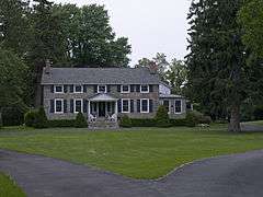
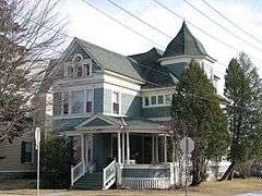
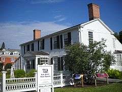
William Bailey House |
|
000000001982-11-12-0000November 12, 1982
(#82001098) |
176 Cornelia St.
44°42′03″N 73°27′53″W / 44.700833°N 73.464722°W / 44.700833; -73.464722 (William Bailey House) |
Plattsburgh |
part of the Plattsburgh City Multiple Resource Area (MRA)
|
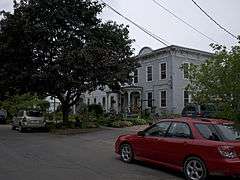
| 4 |
Brinkerhoff Street Historic District |
|
000000001982-11-12-0000November 12, 1982
(#82001099) |
Brinkerhoff St. between Oak and N. Catherine Sts.
44°41′49″N 73°27′25″W / 44.696944°N 73.456944°W / 44.696944; -73.456944 (Brinkerhoff Street Historic District) |
Plattsburgh |
part of the Plattsburgh City MRA
|
| 5 |
Carpenter's Flats Bridge |
|
000000001999-11-12-0000November 12, 1999
(#99001321) |
NY 9 over AuSable R.
44°33′32″N 73°26′57″W / 44.558889°N 73.449167°W / 44.558889; -73.449167 (Carpenter's Flats Bridge) |
AuSable and Peru |
part of the AuSable River Valley Bridges MPS
|
| 6 |
John B. Carpenter House |
Upload image |
000000001982-11-12-0000November 12, 1982
(#82001100) |
42 Prospect Ave.
44°42′02″N 73°28′24″W / 44.700556°N 73.473333°W / 44.700556; -73.473333 (John B. Carpenter House) |
Plattsburgh |
part of the Plattsburgh City MRA
|
| 7 |
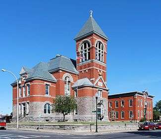
Church of St. Dismas, the Good Thief |
Upload image |
000000001991-11-21-0000November 21, 1991
(#91001673) |
Clinton Correctional Facility, Cook St.
44°43′29″N 73°43′21″W / 44.724722°N 73.7225°W / 44.724722; -73.7225 (Church of St. Dismas, the Good Thief) |
Dannemora |
|
| 8 |
City Hall |
|
000000001973-12-12-0000December 12, 1973
(#73001170) |
City Hall Pl.
44°41′57″N 73°27′09″W / 44.699167°N 73.4525°W / 44.699167; -73.4525 (City Hall) |
Plattsburgh |
|
| 9 |
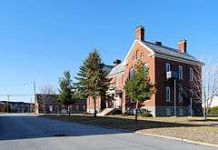
Clinton County Courthouse Complex |
|
000000001982-11-12-0000November 12, 1982
(#82001101) |
135 Margaret St.
44°41′56″N 73°27′13″W / 44.698889°N 73.453611°W / 44.698889; -73.453611 (Clinton County Courthouse Complex) |
Plattsburgh |
part of the Plattsburgh City MRA
|
| 10 |
Court Street Historic District |
|
000000001983-02-24-0000February 24, 1983
(#83001664) |
Court St. between Oak and Beekman Sts.
44°41′53″N 73°27′32″W / 44.698056°N 73.458889°W / 44.698056; -73.458889 (Court Street Historic District) |
Plattsburgh |
part of the Plattsburgh City MRA
|
| 11 |
D & H Railroad Complex |
|
000000001982-11-12-0000November 12, 1982
(#82001102) |
Bridge St.
44°41′51″N 73°26′43″W / 44.6975°N 73.445278°W / 44.6975; -73.445278 (D & H Railroad Complex) |
Plattsburgh |
part of the Plattsburgh City MRA
|
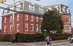
| 12 |
D'Youville Academy |
|
000000001982-11-12-0000November 12, 1982
(#82001103) |
100 Cornelia St.
44°41′58″N 73°27′28″W / 44.699444°N 73.457778°W / 44.699444; -73.457778 (D'Youville Academy) |
Plattsburgh |
part of the Plattsburgh City MRA
|
| 13 |
Delaware and Hudson Railroad Bridge |
Upload image |
000000001999-11-12-0000November 12, 1999
(#99001317) |
Over AuSable River northeast of Lakeside Rd.
44°33′20″N 73°26′05″W / 44.555556°N 73.434722°W / 44.555556; -73.434722 (Delaware and Hudson Railroad Bridge) |
AuSable and Peru |
part of the AuSable River Valley Bridges MPS
|
| 14 |
Double-Span Metal Pratt Truss Bridge |
|
000000001983-05-20-0000May 20, 1983
(#83001665) |
AuSable St.
44°30′01″N 73°29′07″W / 44.500278°N 73.485278°W / 44.500278; -73.485278 (Double-Span Metal Pratt Truss Bridge) |
Keeseville |
part of the Keeseville Village MRA
|
| 15 |
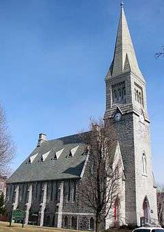
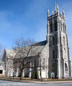
First Presbyterian Church |
|
000000001982-11-12-0000November 12, 1982
(#82001104) |
34 Brinkerhoff St.
44°41′50″N 73°27′16″W / 44.697222°N 73.454444°W / 44.697222; -73.454444 (First Presbyterian Church) |
Plattsburgh |
part of the Plattsburgh City MRA
|
| 16 |
Fort Brown Site |
Upload image |
000000001978-12-15-0000December 15, 1978
(#78001846) |
Northwest of the intersection of Elizabeth St. and State Route 9
44°41′19″N 73°27′01″W / 44.688611°N 73.450278°W / 44.688611; -73.450278 (Fort Brown Site) |
Plattsburgh |
|
| 17 |
Fort Montgomery |
|
000000001977-08-22-0000August 22, 1977
(#77000937) |
Address Restricted
|
Rouses Point |
Site of American fort built on Lake Champlain, accidentally located over the border in Canada
|
| 18 |
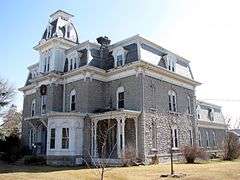
W. W. Hartwell House & Dependencies |
|
000000001982-11-12-0000November 12, 1982
(#82001105) |
77 Brinkerhoff St.
44°41′47″N 73°27′32″W / 44.696389°N 73.458889°W / 44.696389; -73.458889 (W. W. Hartwell House & Dependencies) |
Plattsburgh |
part of the Plattsburgh City MRA
|
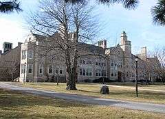
| 19 |
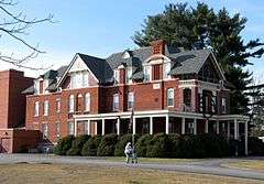
Hawkins Hall |
|
000000001982-11-12-0000November 12, 1982
(#82001106) |
Beekman St.
44°41′50″N 73°28′04″W / 44.697222°N 73.467778°W / 44.697222; -73.467778 (Hawkins Hall) |
Plattsburgh |
part of the Plattsburgh City MRA
|
| 20 |
Heyworth–Mason Industrial Building |
Upload image |
000000002011-05-06-0000May 6, 2011
(#11000250) |
Mason Hill Road
44°34′44″N 73°31′28″W / 44.578889°N 73.524444°W / 44.578889; -73.524444 (Heyworth–Mason Industrial Building) |
Peru |
|
| 21 |
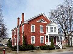
House at 56 Cornelia Street |
|
000000001982-11-12-0000November 12, 1982
(#82001107) |
56 Cornelia St.
44°41′58″N 73°27′09″W / 44.699444°N 73.4525°W / 44.699444; -73.4525 (House at 56 Cornelia Street) |
Plattsburgh |
part of the Plattsburgh City MRA
|
| 22 |
Keeseville Historic District |
|
000000001983-05-20-0000May 20, 1983
(#83001666) |
Roughly bounded by Vine, Chesterfield, Clinton, Hill, Pleasant, Front, and Beech Sts.
44°30′16″N 73°28′58″W / 44.504444°N 73.482778°W / 44.504444; -73.482778 (Keeseville Historic District) |
Keeseville |
part of the Keeseville Village MRA
|
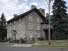
| 23 |
Kent-Delord House |
|
000000001971-02-18-0000February 18, 1971
(#71000532) |
17 Cumberland Ave.
44°42′12″N 73°27′08″W / 44.703333°N 73.452222°W / 44.703333; -73.452222 (Kent-Delord House) |
Plattsburgh |
|
| 24 |
Lyon Mountain Railroad Station |
|
000000002002-02-14-0000February 14, 2002
(#02000005) |
2914 First St.
44°43′35″N 73°54′39″W / 44.726389°N 73.910833°W / 44.726389; -73.910833 (Lyon Mountain Railroad Station) |
Lyon Mountain |
|
| 25 |
Lyon Street School |
Upload image |
000000002013-05-22-0000May 22, 2013
(#13000304) |
Rock & Lyons Rds.
44°36′25″N 73°27′41″W / 44.6070449°N 73.4614996°W / 44.6070449; -73.4614996 (Lyon Street School) |
Peru |
|
| 26 |
Paul Marshall House |
|
000000001982-11-12-0000November 12, 1982
(#82001108) |
24-26 Cornelia St.
44°41′59″N 73°27′09″W / 44.699722°N 73.4525°W / 44.699722; -73.4525 (Paul Marshall House) |
Plattsburgh |
part of the Plattsburgh City MRA
|
| 27 |
Miller Homestead |
Upload image |
000000001999-07-28-0000July 28, 1999
(#99000910) |
664 Hallock Hill Rd.
44°31′26″N 73°33′40″W / 44.523889°N 73.561111°W / 44.523889; -73.561111 (Miller Homestead) |
Au Sable |
|
| 28 |
Alice T. Miner Colonial Collection |
|
000000002010-09-24-0000September 24, 2010
(#10000799) |
9618 State Road Route 9
44°53′10″N 73°26′08″W / 44.886111°N 73.435556°W / 44.886111; -73.435556 (Alice T. Miner Colonial Collection) |
Chazy |
|
| 29 |
Old State Road Bridge |
Upload image |
000000001999-11-12-0000November 12, 1999
(#99001319) |
Co. Rt. 17B over AuSable R.
44°31′25″N 73°27′37″W / 44.523611°N 73.460278°W / 44.523611; -73.460278 (Old State Road Bridge) |
AuSable Chasm |
part of the AuSable River Valley Bridges MPS
|
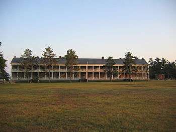
| 30 |
Old Stone Barracks |
|
000000001971-02-18-0000February 18, 1971
(#71000533) |
Rhode Island Ave., Plattsburgh Air Force Base
44°40′51″N 73°26′42″W / 44.680833°N 73.445°W / 44.680833; -73.445 (Old Stone Barracks) |
Plattsburgh |
|
| 31 |
Palmer Brook Bridge |
Upload image |
000000001999-11-12-0000November 12, 1999
(#99001318) |
Golf Course Rd. over Palmer Brook
44°26′37″N 73°40′29″W / 44.443611°N 73.674722°W / 44.443611; -73.674722 (Palmer Brook Bridge) |
AuSable Forks |
part of the AuSable River Valley Bridges MPS
|
| 32 |
Peru Community Church |
Upload image |
000000002001-02-02-0000February 2, 2001
(#01000054) |
12 Elm St.
44°34′43″N 73°31′40″W / 44.578611°N 73.527778°W / 44.578611; -73.527778 (Peru Community Church) |
Peru |
|
| 33 |
Pike's Cantonment Site |
Upload image |
000000002012-08-14-0000August 14, 2012
(#12000508) |
Address Restricted
|
Plattsburgh |
|
| 34 |
Charles C. Platt Homestead |
|
000000001982-11-12-0000November 12, 1982
(#82001109) |
96-98 Boynton Ave.
44°42′30″N 73°27′40″W / 44.708333°N 73.461111°W / 44.708333; -73.461111 (Charles C. Platt Homestead) |
Plattsburgh |
part of the Plattsburgh City MRA
|
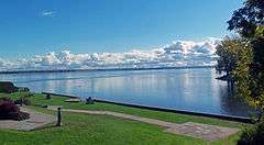
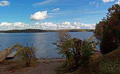
| 35 |
Plattsburgh Bay |
|
000000001966-10-15-0000October 15, 1966
(#66000507) |
Cumberland Bay, east of Plattsburgh
44°41′17″N 73°24′58″W / 44.688056°N 73.416111°W / 44.688056; -73.416111 (Plattsburgh Bay) |
Plattsburgh |
Site of naval Battle of Plattsburgh, last British attempt to invade northern states during War of 1812
|
| 36 |
The Point Historic District |
|
000000001982-11-12-0000November 12, 1982
(#82001110) |
Roughly bounded by Jay, Hamilton, Peru, and Bridge Sts.
44°41′54″N 73°26′46″W / 44.698333°N 73.446111°W / 44.698333; -73.446111 (The Point Historic District) |
Plattsburgh |
part of the Plattsburgh City MRA
|
| 37 |
Z. Ritchie House |
Upload image |
000000001982-11-12-0000November 12, 1982
(#82001111) |
26 S. Catherine St.
44°42′02″N 73°27′27″W / 44.700556°N 73.4575°W / 44.700556; -73.4575 (Z. Ritchie House) |
Plattsburgh |
part of the Plattsburgh City MRA
|
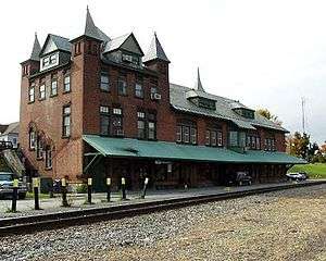
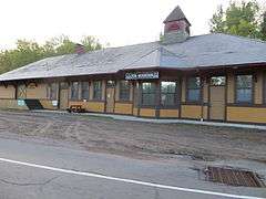
| 38 |
Rouses Point Railroad Station |
|
000000002005-01-05-0000January 5, 2005
(#04001454) |
68 Pratt St.
44°59′42″N 73°22′18″W / 44.995°N 73.371667°W / 44.995; -73.371667 (Rouses Point Railroad Station) |
Rouses Point |
|
| 39 |
St. John the Baptist Roman Catholic Church and Rectory |
|
000000001982-11-12-0000November 12, 1982
(#82001112) |
20 Broad St.
44°41′44″N 73°27′17″W / 44.695556°N 73.454722°W / 44.695556; -73.454722 (St. John the Baptist Roman Catholic Church and Rectory) |
Plattsburgh |
part of the Plattsburgh City MRA
|
| 40 |
Stone Arch Bridge |
|
000000001999-11-12-0000November 12, 1999
(#99001323) |
Main St. over AuSable R.
44°30′19″N 73°28′52″W / 44.505278°N 73.481111°W / 44.505278; -73.481111 (Stone Arch Bridge) |
Keeseville |
part of the AuSable River Valley Bridges MPS
|
| 41 |
SPITFIRE (gunboat) |
Upload image |
000000002008-07-24-0000July 24, 2008
(#08000694) |
At the bottom of Lake Champlain
Coordinates missing |
Lake Champlain |
Shared with Essex County; Revolutionary War shipwreck
|
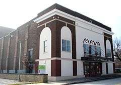
| 42 |
Strand Theater |
|
000000002008-09-15-0000September 15, 2008
(#08000922) |
25 Brinkerhoff St.
44°30′13″N 73°28′58″W / 44.503611°N 73.482778°W / 44.503611; -73.482778 (Strand Theater) |
Plattsburgh |
|
| 43 |
Swing Bridge |
|
000000001999-11-12-0000November 12, 1999
(#99001322) |
Over AuSable R. between Clinton and S. AuSable Sts.
44°30′13″N 73°28′58″W / 44.503611°N 73.482778°W / 44.503611; -73.482778 (Swing Bridge) |
Keeseville |
part of the AuSable River Valley Bridges MPS
|
| 44 |
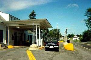
U.S. Inspection Station-Mooers, New York |
|
000000002014-09-14-0000September 14, 2014
(#14000572) |
NY 22
45°00′16″N 73°36′11″W / 45.004459°N 73.602991°W / 45.004459; -73.602991 (U.S. Inspection Station-Mooers, New York) |
Mooers |
U.S. Border Inspection Stations MPS
|
| 45 |
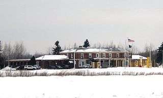
U.S. Inspection Station-Rouses Point (Overton Corners), New York |
Upload image |
000000002014-09-14-0000September 14, 2014
(#14000573) |
NY 276
45°00′36″N 73°24′01″W / 45.009886°N 73.400195°W / 45.009886; -73.400195 (U.S. Inspection Station-Rouses Point (Overton Corners), New York) |
Rouses Point |
U.S. Border Inspection Stations MPS
|
| 46 |
U.S. Inspection Station-Rouses Point (St. John's Highway), New York |
|
000000002014-09-14-0000September 14, 2014
(#14000574) |
NY 9B
45°00′37″N 73°22′15″W / 45.010235°N 73.370819°W / 45.010235; -73.370819 (U.S. Inspection Station-Rouses Point (St. John's Highway), New York) |
Rouses Point |
U.S. Border Inspection Stations MPS
|
| 47 |
United States Oval Historic District |
|
000000001989-08-30-0000August 30, 1989
(#85003766) |
Plattsburgh Air Force Base
44°41′11″N 73°26′53″W / 44.686389°N 73.448056°W / 44.686389; -73.448056 (United States Oval Historic District) |
Plattsburgh |
part of the Plattsburgh City MRA
|
| 48 |
Valcour Bay |
|
000000001966-10-15-0000October 15, 1966
(#66000508) |
7 miles (11 km) south of Plattsburgh on the west shore of Lake Champlain
44°38′05″N 73°25′47″W / 44.634722°N 73.429722°W / 44.634722; -73.429722 (Valcour Bay) |
Plattsburgh |
Site of Battle of Valcour Island during Revolutionary War
|
| 49 |
Valcour Island Lighthouse |
|
000000001993-08-26-0000August 26, 1993
(#93000873) |
Valcour Island, Lake Champlain
44°37′24″N 73°25′55″W / 44.623333°N 73.431944°W / 44.623333; -73.431944 (Valcour Island Lighthouse) |
Peru |
A.K.A. Point Bluff Light
|
| 50 |
S. F. Vilas Home for Aged & Infirmed Ladies |
|
000000001982-11-12-0000November 12, 1982
(#82001113) |
Beekman and Cornelia Sts.
44°41′56″N 73°28′02″W / 44.698889°N 73.467222°W / 44.698889; -73.467222 (S. F. Vilas Home for Aged & Infirmed Ladies) |
Plattsburgh |
part of the Plattsburgh City MRA
|
| 51 |
W. G. Wilcox House |
|
000000001983-02-24-0000February 24, 1983
(#83001667) |
45-51 Lorraine St.
44°42′08″N 73°26′52″W / 44.702222°N 73.447778°W / 44.702222; -73.447778 (W. G. Wilcox House) |
Plattsburgh |
part of the Plattsburgh City MRA
|
| 52 |
Werrenrath Camp |
Upload image |
000000002010-11-29-0000November 29, 2010
(#10000943) |
55 Island Dr.
44°45′19″N 73°48′05″W / 44.755278°N 73.801389°W / 44.755278; -73.801389 (Werrenrath Camp) |
Dannemora |
|
| 53 |
Winslow-Turner Carriage House |
Upload image |
000000001982-11-12-0000November 12, 1982
(#82001114) |
210 Cornelia St.
44°41′56″N 73°28′28″W / 44.698889°N 73.474444°W / 44.698889; -73.474444 (Winslow-Turner Carriage House) |
Plattsburgh |
part of the Plattsburgh City MRA |