Gresford
- For the small towns of Gresford and East Gresford in New South Wales, Australia, see East Gresford, New South Wales.
| Gresford | |
 The tower of Gresford church |
|
 Gresford |
|
| Population | 5,010 (2011 Census)[1] |
|---|---|
| OS grid reference | SJ353549 |
| Community | Gresford |
| Principal area | Wrexham |
| Ceremonial county | Clwyd |
| Country | Wales |
| Sovereign state | United Kingdom |
| Post town | WREXHAM |
| Postcode district | LL12 |
| Dialling code | 01978 |
| Police | North Wales |
| Fire | North Wales |
| Ambulance | Welsh |
| EU Parliament | Wales |
| UK Parliament | Wrexham |
| Welsh Assembly | Wrexham |
Coordinates: 53°05′13″N 2°57′58″W / 53.087°N 2.966°W
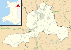
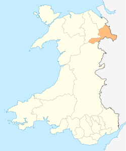
Gresford (/ˈɡrɛsfərd/; Welsh: Gresffordd Welsh pronunciation: [ˈɡrɛsfɔrð]) is a village and a local government community, the lowest tier of local government, part of Wrexham County Borough in Wales.
According to the 2001 Census, the population of the community, which also includes the village of Marford, was 5,334,[2] reducing to 5,010 at the 2011 census.
The former Gresford Colliery was the site of the Gresford disaster, one of Britain's worst coal mining disasters, when 266 men died in an underground explosion on 22 September 1934.
History
Located close to the England–Wales border, the settlement existed at the time of the compilation of the Domesday book, when it was recorded as "Gretford"[3] within the Cheshire Hundred of Duddestan. The name, having an English origin, was later recorded as "Gresworth", "Cresford" and "Grefford", but documentary evidence shows that the place was clearly locally referred to as "Gresford" throughout its history, even under Welsh administration, and the other names merely represent alternative spellings.[4] The Welsh form "Gresffordd", from y groesffordd ("the crossroads"), seems to have been the creation of imaginative Welsh genealogists of the 15th century and later, naturally giving the village a name in the native language of their country. The Welsh name has been in common use since at least the 19th century.[5] "Gresffordd" is the recognised standard name in Welsh.[6][7][8] Although largely unused by the mainly non-Welsh speakers of the village itself, "Gresffordd" is widely used amongst Welsh speakers and by Welsh press, media and authorities.[9][10]
In common with many of the towns and villages of the border lands, or Marches, Gresford has gone through periods of both English and Welsh dominance. The whole area was resettled by Welsh aligned to Owain Gwynedd in 1170-1203. At this time the bishopric was transferred from that of St. Werburgh's Chester to St. Asaph, and the vicars of the village were Welsh with patronymic names (for example, Morud ap Gwarius, who became vicar in 1284). It is possible, however, that settlement existed on the site from quite an early date, as a Roman altar was found within the church in 1908. The altar is likely to depict Nemesis; this and the unearthing of a Roman coin hoard nearby-dating 150-300, is possible evidence of a settlement. There is also a stand of yew trees in the churchyard, the oldest dating to A.D. 500 — long before Anglo-Saxon settlement.
Approaching Gresford from the Wrexham direction, on the left hand side of the road, there was a tree known as the 'Cross Tree', and alongside this there is the base of an ancient stone cross. This tree was removed after 1984, and has since been replaced with a young tree.

Until the late 19th century, the parish boundary encompassed a large area, including the townships of Burton, Llay, Rossett and Gwersyllt, as well as several townships later included in Isycoed. The bells of the parish church, All Saints' Church are one of the traditional Seven Wonders of Wales. Gresford Church dates to 1492 and is a large building considering the size of what the population would have been in the present day boundaries of the parish. The base of the church tower has earlier remnants of a previous building and an earlier roofline of a former transept can be detected in the tower. The colour of the stone is quite distinctive, and is typical of the Wrexham area. It is a sandy brown Millstone Grit, locally referred to as "Cefn" stone.
Pant Iocyn (later Pant-yr-Ochain) house was built in the 1550s alongside the road from Gresford to Wrexham by Edward Almer, MP and three times High Sheriff of the county. It was one of the chief houses in east Denbighshire and descended in the Almer family until it was bought and enlarged by Sir Foster Cunliffe, 3rd Baronet in 1785. The 18th century addition now serves as a gastro pub.[11]
Gresford Colliery
Henry Dennis and his son, Henry Dyke Dennis, began sinking a coal mine near Gresford in 1888,[12] taking four years for the 3,280 ft deep shafts to be completed. The coalmine was located on the edge of the Alyn Valley, between the Shrewsbury and Chester Railway (later the GWR Birkenhead-Paddington line) and the old main road between Wrexham and Chester. The first coal was produced from June, 1911, with full production reached before the outbreak of the First World War. The coal was renowned in the area as being of very good quality and hot burning.
Gresford Colliery was the site of one of Britain's worst coal mining disasters. The Gresford Disaster occurred on 22 September 1934, when 266 men died following an underground explosion. The bodies of only 11 of the miners underground at the time of the explosion were recovered. The headgear wheel is preserved and forms part of the Gresford Disaster Memorial, along with a plaque. The disaster is commemorated in the hymn tune "Gresford", which is also known as "the Miners' Hymn", written by Robert Saint of Hebburn, himself also a miner.[13] This tune has been played regularly by many colliery brass bands over the years and is found on a number of recordings, and is also played at the annual Miners' Picnics around the North of England, especially at the Durham Miners' Gala.
The colliery lasted until 1973 when it was closed due to geological problems.
Transport
The stone-built Gresford railway station, on the Shrewsbury and Chester Railway was midway up the notorious Gresford Bank. The bank was so steep that a refuge siding was required at the station in the event of engines having to leave some of their load behind to get up the hill. Banking engines were also used on occasions. Gresford railway station was demoted to Gresford Halt, for Llay, from 1956 and was closed altogether from 1964.
See also
- Gresford Disaster
- List of United Kingdom disasters by death toll
- East Gresford, New South Wales is a village in New South Wales, Australia.
References
- ↑ "Community population 2011". Retrieved 18 November 2015.
- ↑ "2001 Census: Gresford (Parish)". Office for National Statistics. Retrieved 10 November 2008.
- ↑ Palmer, A. N. A History of Ancient Tenures of Land in North Wales and the Marches, 1910, p.238
- ↑ Palmer, p.239
- ↑ "Crefyddol". Cymro (Lerpwl a'r Wyddgrug). 18 June 1891. p. 7. Retrieved 3 February 2015.
- ↑ "Cyfrifiad 2011: Canlyniadau yn ôl Cymuned". Welsh Language Commissioner. Retrieved 3 February 2015.
- ↑ Elwyn Davies (1967). Rhestr o Enwau Lleoedd Cymru / A Gazateer of Welsh Place-names. University of Wales Press. p. 51.
- ↑ John Davies, Menna Baines, Nigel Jenkins, Peredur I. Lynch (2008). Gwyddoniadur Cymru - Yr Academi Gymreig. Cardiff: University of Wales Press. p. 392.
- ↑ "Canlyniadau am "Gresffordd"". Golwg360. Retrieved 3 February 2015.
- ↑ "Chwilio "Gresffordd" - Canlyniadau Cymraeg". BBC Cymru Wales. Retrieved 3 February 2015.
- ↑ "Pant-yr-Ochain: the chief house in Gresford by CHRISTOPHER J. WILLIAMS" (PDF). Retrieved 17 July 2013.
- ↑ "Gresford Colliery". BBC. 2006-12-12. Retrieved 2009-09-20.
- ↑ "Moving anthem to tragic miners". Jarrow and Hebburn Gazette. 27 May 2010. Retrieved 1 August 2012.
External links
| Wikimedia Commons has media related to Gresford. |
- Wrexham County Borough Council: Gresford Colliery Disaster
- More on Gresford colliery disaster
- Gresford Athletic
- www.geograph.co.uk: photos of Gresford and surrounding area
- Welsh Coal Mines website: research the history of the local pit
- Gresford Sailing Club
