Hanmer, Wales
| Hanmer | |
 Hanmer Village sign |
|
 Hanmer |
|
| Population | 665 (2011 Census)[1] |
|---|---|
| OS grid reference | SJ455396 |
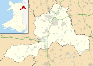
| Community | Hanmer |
| Principal area | Wrexham |
| Ceremonial county | Clwyd |
| Country | Wales |
| Sovereign state | United Kingdom |
| Post town | WHITCHURCH |
| Postcode district | SY13 |
| Dialling code | 01948 |
| Police | North Wales |
| Fire | North Wales |
| Ambulance | Welsh |
| EU Parliament | Wales |
| UK Parliament | Clwyd South |
| Welsh Assembly | Clwyd South |
Coordinates: 52°57′04″N 2°48′43″W / 52.951°N 2.812°W
Hanmer is a village and a local government community, the lowest tier of local government, part of Wrexham County Borough in Wales. At the 2001 Census the population of the Hanmer community area, which includes Hanmer village itself, Horseman's Green and Arowry along with a number of small hamlets, was recorded at 726,[2] reducing to 665 at the 2011 Census.
History
The village of Hanmer lies at the northern end of Hanmer Mere, part of the 'Shropshire lake district' of meres which was formed during the last ice-age. By the time of the Roman invasion (47 AD), the area was part of the lands occupied by the Cornovii, one of the tribes of ancient Britain who had their principal settlement at the Wrekin. It later became part of the Mercian region known as Wreocansaete. The name is thought to have either originally been "Handmere",[3] or "Hagenamere", taking its name from a Mercian lord.[4]
At the time of the Norman invasion the area was part of ancient Cheshire, within the Hundred of Duddeston,[5] and it later became the estate of (and gave its name to) the prominent Hanmer family, who were descended from Sir Thomas de Macclesfield, an officer of Edward I.[6] Sir Thomas settled in English Maelor (Welsh: Maelor Saesneg) and his family consolidated their possessions in the area through a series of marriages to heiresses of important Welsh families.
The oldest recorded reference to a church in Hanmer dates from 1110, though this building was destroyed in 1463 during the Wars of the Roses.[3] It was rebuilt in 1490, destroyed again by fire in 1889 along with many irreplaceable architectural features, and rebuilt between 1892 and 1936, when the chancel was finally reconstructed. It is dedicated to St Chad.
Until the reorganisation of Welsh local government on 1 April 1974, Hanmer was in the detached part of the historic county of Flintshire known as the Maelor Saesneg (English Maelor). Its local speech was recorded in depth in the Survey of English Dialects; Hanmer was the only site in North Wales to be included in the survey, so it was grouped together with the sites in Cheshire.
Important buildings
_(St_Chad's_church).jpg)

- Haighton Hall - a grade I listed house [7]
- Saint Chad's Church - a Grade II* listed building,[8] as are the churchyard gates and the churchyard cross.
- Bettisfield Park - a grade II* listed country house.[9]
- Hanmer War Memorial - grade II* listed.[10]
- Magpie Cottage - grade II listed.[11]
Notable residents
- Dafydd ab Edmwnd (fl. c. 1450–97), one of the most prominent Welsh poets of the later Middle Ages, was born in Hanmer.
- Margaret Hanmer (d. of Sir David Hanmer), who married Owain Glyndŵr circa 1383.
- Lorna Sage, the author of Bad Blood (winner of the 2000 Whitbread Biography Award) grew up in Hanmer during the 1940s and 1950s and the book is about her grandfather's tenure as vicar of St. Chad's parish church.
- R. S. Thomas (1913–2000), the poet, was briefly curate 1940–42.[12]
References
- ↑ "Community population 2011". Retrieved 19 November 2015.
- ↑ "2001 Census: Hanmer". Office for National Statistics. Retrieved 19 October 2008.
- 1 2 Hanmer, Flintshire, GENUKI
- ↑ Hanmer, BBC North East Wales]
- ↑ Palmer, J. "Open Domesday". University of Hull. Retrieved 21 May 2014.
- ↑ Hanmer family, Dictionary of Welsh Biography, National Library of Wales
- ↑ "Halghton Hall, Hanmer". British Listed Buildings. Retrieved 13 January 2014.
- ↑ "Church of St Chad, Hanmer". British Listed Buildings. Retrieved 13 January 2014.
- ↑ "Bettisfield Park, including attached garden walls, Hanmer". British Listed Buildings. Retrieved 13 January 2014.
- ↑ "Hanmer war memorial, Hanmer". British Listed Buildings. Retrieved 13 January 2014.
- ↑ "Magpie Cottage, Hanmer". British Listed Buildings. Retrieved 13 January 2014.
- ↑ Byron Rogers,The Man who went West: The Life of R. S Thomas. ( London: Aurum Press, 2006), pp. 120–122.
External links
| Wikimedia Commons has media related to Hanmer. |
| Principal settlements | 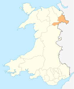 | |
|---|---|---|
| Communities |
| |
| Other villages and areas |
| |
| Castles | ||
| Buildings and structures | ||
| Rivers | ||
| Geographical features | ||
| Topics | ||