Gueydan, Louisiana
| Town of Gueydan | |
| Town | |
 | |
| Motto: "Duck Capital of America"[1] | |
| Country | United States |
|---|---|
| State | Louisiana |
| Parish | Vermilion |
| Elevation | 7 ft (2.1 m) |
| Coordinates | 30°01′38″N 92°30′27″W / 30.02722°N 92.50750°WCoordinates: 30°01′38″N 92°30′27″W / 30.02722°N 92.50750°W |
| Area | 0.9 sq mi (2.3 km2) |
| - land | 0.9 sq mi (2 km2) |
| - water | 0.0 sq mi (0 km2), 0% |
| Population | 1,598 (2000) |
| Density | 1,784.9/sq mi (689.2/km2) |
| Timezone | CST (UTC-6) |
| - summer (DST) | CDT (UTC-5) |
| Area code | 337 |
 Location of Gueydan in Louisiana | |
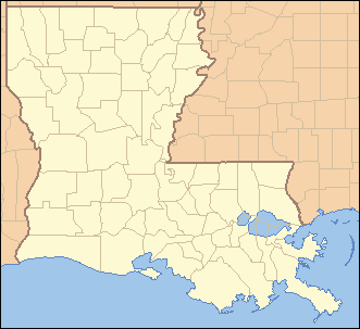
 Location of Louisiana in the United States | |
| Website: The Town of Gueydan, Louisiana | |
Gueydan is a town in Vermilion Parish, Louisiana, United States. The population was 1,598 at the 2000 census. It is part of the Abbeville Micropolitan Statistical Area.
History

For thousands of years, indigenous peoples lived along the waterways of Louisiana. They were able to hunt plentiful game and harvest fish from the rivers. In historic times, this area was inhabited by the Attakapa and Chitimacha.
In the early 1860s, Jean Pierre Gueydan, the founder of the European-American town, lived in Abbeville, Louisiana, about 30 miles east of present-day Gueydan. As had the Attapaka and earlier American Indian tribes, he often came to the future town site to hunt deer, ducks, geese, pheasant, cache-cache (jack snipe), papabottes, and other game. The area was a hunter's paradise. Game and fish were boundless.
In 1884 the brothers Jean-Pierre and François Gueydan purchased forty thousand acres (160 km2) of land described by surveyors as "sea marsh, unfit for cultivation", for twelve and one-half cents per acre. By 1896 a small portion of their purchase became known as the "Gueydan Pasture". It was chartered as a village when the population reached 250. Jean Pierre was the official founder of Gueydan, as by then he had purchased his brother's landholdings. In 1902, the settlement became the town of Gueydan.
Realizing the importance of a railroad to the rice farmers, Gueydan donated a section of land and extensive right-of-way to induce the Southern Pacific Railroad to build a branch line from Midland, Louisiana. Shortly after, he offered the first property lots for sale. Settlers began to arrive from other parts of the state and the rest of the country.
The first irrigation pump in the state of Louisiana was built nearby at Primeaux Landing. This enabled water to be pumped to irrigate thousands of acres of rice. With the pump, the area grew as a producer of rice. In the late 19th century, farmers recruited Italian immigrants as laborers, but they quickly left the role of farm workers. Some established local businesses, such as groceries, barber shops and tailors, in small towns across Louisiana.
The founder Jean Pierre Gueydan lived at his plantation, St. Bennette, about two miles south of the community. In 1894 the plantation house was used to house the town's first school, which opened with 10 students.
The town of Gueydan suffered numerous near catastrophes. Fires in 1901, 1903, 1910, and 1927 caused extensive damage. The worst tragedy was the Flood of 1940. After near-record rainfalls in August 1940, the entire town was inundated. Locals still vividly recall the disaster. The area had extensive flooding because it is nearly flat prairie, with an average elevation of only nine feet above the Gulf of Mexico. The elevation tends to be in the range of 5 to 12 feet.
The whole area was once low marshy land, now called wetlands, subject to overflow by the waters of the nearby Mermentau River. Developers created a modern system of canals for drainage purposes and irrigation as early as 1901, but it interfered with the natural processes of the wetlands. Development of the town and rice culture further reduced the natural capacity of the wetlands to absorb flooding, and created a built-up area where flooding was a threat.
Geography
Gueydan is located at 30°1′38″N 92°30′27″W / 30.02722°N 92.50750°W (30.027123, -92.507449).[2]
According to the United States Census Bureau, the town has a total area of 0.9 square miles (2.3 km2), all of it land.
Demographics
| Historical population | |||
|---|---|---|---|
| Census | Pop. | %± | |
| 1900 | 376 | — | |
| 1910 | 1,081 | 187.5% | |
| 1920 | 1,233 | 14.1% | |
| 1930 | 1,313 | 6.5% | |
| 1940 | 1,506 | 14.7% | |
| 1950 | 2,041 | 35.5% | |
| 1960 | 2,156 | 5.6% | |
| 1970 | 1,984 | −8.0% | |
| 1980 | 1,695 | −14.6% | |
| 1990 | 1,611 | −5.0% | |
| 2000 | 1,598 | −0.8% | |
| 2010 | 1,398 | −12.5% | |
| Est. 2015 | 1,396 | [3] | −0.1% |
As of the census[5] of 2000, there were 1,598 people, 644 households, and 416 families residing in the town. The population density was 1,874.9 people per square mile (725.9/km2). There were 724 housing units at an average density of 849.5 per square mile (328.9/km2). The racial makeup of the town was 86.61% White, 12.83% African American, 0.13% Native American, 0.31% from other races, and 0.13% from two or more races. Hispanic or Latino of any race were 1.25% of the population.
There were 644 households out of which 31.2% had children under the age of 18 living with them, 46.3% were married couples living together, 15.1% had a female householder with no husband present, and 35.4% were non-families. 31.1% of all households were made up of individuals and 15.5% had someone living alone who was 65 years of age or older. The average household size was 2.38 and the average family size was 2.99.
In the town the population was spread out with 25.0% under the age of 18, 10.0% from 18 to 24, 23.5% from 25 to 44, 20.7% from 45 to 64, and 20.8% who were 65 years of age or older. The median age was 39 years. For every 100 females there were 82.6 males. For every 100 females age 18 and over, there were 76.4 males.
The median income for a household in the town was $22,165, and the median income for a family was $32,039. Males had a median income of $25,682 versus $13,500 for females. The per capita income for the town was $13,738. About 16.1% of families and 21.0% of the population were below the poverty line, including 26.6% of those under age 18 and 21.9% of those age 65 or over.
Arts and culture
Duck festival
The town is the site of the annual Duck Festival,which is held the weekend before Labor Day, and is officially recognized as the Duck Capital of America.[6] The Louisiana state championships for duck and goose calling are held in conjunction with the festival.
Notable people
- Iron Eyes Cody grew up here. (Of Sicilian descent, he was born Espera de Corti, but portrayed Native Americans as a film actor in more than 200 films)
- Bob Hensgens, the former mayor of Gueydan, is the Republican state representative from Vermilion and Cameron parishes.
- Jeannette Knoll, associate justice of the Louisiana Supreme Court, reared in Gueydan prior to high school[7]
- Rod Melancon, recording artist for Medina River Records, grew up in the farming community of Wright, just outside Gueydan. Many of the songs on his album Parish Lines are stories about growing up in the area.[8]
Climate
The climate in this area is characterized by hot, humid summers and generally mild to cool winters. According to the Köppen Climate Classification system, Gueydan has a humid subtropical climate, abbreviated "Cfa" on climate maps.[9]
References
- ↑ "The Town of Gueydan, Louisiana". The Town of Gueydan, Louisiana. Retrieved August 26, 2012.
- ↑ "US Gazetteer files: 2010, 2000, and 1990". United States Census Bureau. 2011-02-12. Retrieved 2011-04-23.
- ↑ "Annual Estimates of the Resident Population for Incorporated Places: April 1, 2010 to July 1, 2015". Retrieved July 2, 2016.
- ↑ "Census of Population and Housing". Census.gov. Retrieved June 4, 2015.
- ↑ "American FactFinder". United States Census Bureau. Retrieved 2008-01-31.
- ↑ "Community slogans about birds". Retrieved 2011-08-23.
- ↑ "Justice Jeannett Theriot Knoll". lasc.org. October 18, 2013.
- ↑ from an interview on episode 199 of the Americana Music Show, published July 7, 2014.
- ↑ Climate Summary for Gueydan, Louisiana
External links
Municipalities and communities of Vermilion Parish, Louisiana, United States | ||
|---|---|---|
| Cities | 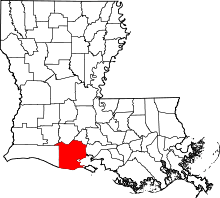 | |
| Town | ||
| Village | ||
| Unincorporated communities | ||
| Footnotes | ‡This populated place also has portions in an adjacent parish or parishes | |