Cameron Parish, Louisiana
| Cameron Parish, Louisiana | |
|---|---|
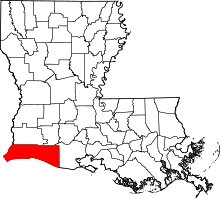 Location in the U.S. state of Louisiana | |
 Louisiana's location in the U.S. | |
| Founded | 1870 |
| Named for | Simon Cameron |
| Seat | Cameron |
| Largest community | Cameron |
| Area | |
| • Total | 1,937 sq mi (5,017 km2) |
| • Land | 1,285 sq mi (3,328 km2) |
| • Water | 652 sq mi (1,689 km2), 34% |
| Population | |
| • (2010) | 6,839 |
| • Density | 5/sq mi (2/km²) |
| Congressional district | 3rd |
| Time zone | Central: UTC-6/-5 |
| Website |
www |
Cameron Parish (French: Paroisse de Cameron) is a parish in the southwestern section of the U.S. state of Louisiana. As of the 2010 census, the population was 6,839.[1] The parish seat is Cameron.[2] Although it is the third-largest parish by land area in Louisiana, it has the second-smallest population.
Cameron Parish is part of the Lake Charles, LA Metropolitan Statistical Area.
On November 9th 2016, following the 2016 US presidential election Cameron Parish was deemed the "Reddest" place in the United States of America, USA Today discovered this GOP stronghold . On November 8th 2016, Cameron Parish voted by the largest margin in the nation for Donald J. Trump with 88.2% in favor, giving the small village of Hackberry, LA in Cameron Parish the nickname of "Trump Town USA".
History
Organized in 1870 from parts of Calcasieu and Vermillion Parishes, Cameron Parish is named for Simon Cameron, a Pennsylvanian who was President Abraham Lincoln's first secretary of war. It is among the largest civil parishes in Louisiana, yet the least populated, owing to the high proportion of land area devoted to marsh. Cameron Parish comprises a large portion of the Louisiana Chenier Plain, and thus is home to numerous cheniers, elevated ridges that occur in certain coastal regions, particularly in Louisiana. Early settlers include John M. Smith, Millege McCall, John William Sweeney, George W. Wakefield, William Doxey, James Hale, James Root, and John M. Miller.[3]
The western half of Cameron Parish was part of the colorful No Man’s Land or 1806 Neutral Ground agreement to solve a boundary dispute between the governments of the United States and Spain after the Louisiana Purchase. The Calcasieu River (at the time the Arroyo Hondo) and the Sabine River became the eastern and western boundaries. Devoid of law enforcement, the area became a hotbed of outlaws, pirates, and other nefarious characters for many years.
The American Civil War, and numerous hurricanes, such as Audrey, Rita, and Ike were defining events that shaped the trajectory of the region. Loyalties were split in the coastal area at the onset of the Civil War, setting the stage for additional conflict. Block[4] chronicled activities of the Unionist Mermentau Jayhawkers and their vigilante nemesis the Mermentau Regulators during the fall of 1863 in and around Grand Chenier.
Cameron Parish was devastated by Hurricane Audrey on June 27, 1957, causing over 390 deaths. Authors Nola Mae Ross and Susan McFillen Goodson chronicled the stories of many Audrey survivors in Hurricane Audrey,[5] published 40 years after the storm. Tales of tragedy and heroism emerged with the heavy press coverage following the devastation.[6] The American Medical Association named a local Cameron physician, Cecil Clark, the General Practitioner of the Year in recognition of dedicated service despite great personal loss.[7] Audrey defined Cameron Parish for nearly 50 years, with local history being divided into before and after Audrey periods until much of the parish was destroyed again by Hurricane Rita on September 24, 2005. The movie Little Chenier was filmed in Southwest Louisiana just prior to Hurricane Rita and contains some of the only accessible moving images of the area before it was destroyed.
In 2008, three years after Rita, Hurricane Ike came ashore and brought a 22-foot (6.7 m) storm surge, which was far worse than Rita's 10-foot (3.0 m) surge.[8] Nearly all of the coastline in that area was flooded heavily, with surge and floodwaters reaching 60 miles inland,[9] as far north as Lake Charles.[10] In Cameron Parish the communities of Cameron, Holly Beach, Hackberry, Creole, and Grand Chenier were essentially destroyed.
Geography
According to the U.S. Census Bureau, the parish has a total area of 1,937 square miles (5,020 km2), of which 1,285 square miles (3,330 km2) is land and 652 square miles (1,690 km2) (34%) is water.[11] It is the third-largest parish in Louisiana by land area and fourth-largest by total area. Most of its water is due to the Gulf of Mexico.
Major highways
Adjacent counties and parishes
- Calcasieu Parish (northwest)
- Jefferson Davis Parish (northeast)
- Vermilion Parish (east)
- Jefferson County, Texas (southwest)
- Orange County, Texas (west)
National protected areas
- Cameron Prairie National Wildlife Refuge
- East Cove National Wildlife Refuge
- Lacassine National Wildlife Refuge (part)
- Sabine National Wildlife Refuge
Demographics
| Historical population | |||
|---|---|---|---|
| Census | Pop. | %± | |
| 1870 | 1,591 | — | |
| 1880 | 2,416 | 51.9% | |
| 1890 | 2,828 | 17.1% | |
| 1900 | 3,952 | 39.7% | |
| 1910 | 4,288 | 8.5% | |
| 1920 | 3,952 | −7.8% | |
| 1930 | 6,054 | 53.2% | |
| 1940 | 7,203 | 19.0% | |
| 1950 | 6,244 | −13.3% | |
| 1960 | 6,909 | 10.7% | |
| 1970 | 8,194 | 18.6% | |
| 1980 | 9,336 | 13.9% | |
| 1990 | 9,260 | −0.8% | |
| 2000 | 9,991 | 7.9% | |
| 2010 | 6,839 | −31.5% | |
| Est. 2015 | 6,817 | [12] | −0.3% |
| U.S. Decennial Census[13] 1790-1960[14] 1900-1990[15] 1990-2000[16] 2010-2013[1] | |||
As of the 2010 United States Census, there were 6,839 people residing in the parish. 95.7% were White, 1.7% Black or African American, 0.5% Native American, 0.1% Asian, 0.8% of some other race and 1.1% of two or more races. 2.3% were Hispanic or Latino (of any race). 46.5% were of French, French Canadian or Cajun, 18.7% American, 5.8% English and 5.0% Irish ancestry.[17]
As of the census[18] of 2000, there were 9,991 people, 3,592 households, and 2,704 families residing in the parish. The population density was 8 people per square mile (3/km²). There were 5,336 housing units at an average density of 4 per square mile (2/km²). The racial makeup of the parish was 93.65% White, 3.88% Black or African American, 0.37% Native American, 0.44% Asian, 0.02% Pacific Islander, 0.94% from other races, and 0.69% from two or more races. 2.15% of the population were Hispanic or Latino of any race. 11.57% reported speaking French or Cajun French at home, while 1.83% speak Spanish.[19]
There were 3,592 households out of which 39.00% had children under the age of 18 living with them, 62.20% were married couples living together, 9.00% had a female householder with no husband present, and 24.70% were non-families. 20.90% of all households were made up of individuals and 8.60% had someone living alone who was 65 years of age or older. The average household size was 2.76 and the average family size was 3.21.
In the parish the population was spread out with 28.40% under the age of 18, 9.40% from 18 to 24, 29.60% from 25 to 44, 21.90% from 45 to 64, and 10.60% who were 65 years of age or older. The median age was 35 years. For every 100 females there were 100.90 males. For every 100 females age 18 and over, there were 99.40 males.
The median income for a household in the parish was $34,232, and the median income for a family was $39,663. Males had a median income of $31,167 versus $19,113 for females. The per capita income for the parish was $15,348. About 9.10% of families and 12.30% of the population were below the poverty line, including 13.10% of those under age 18 and 14.80% of those age 65 or over.
Education
Cameron Parish School Board operates local public schools.
Cameron Parish Public Library is a public library system in Cameron Parish. All of the libraries are located in unincorporated areas.
The main Cameron Parish Library is at 469 Marshall Street in the Cameron CDP.[20]
The system operates six branches:[21]
- Creole Branch at 184C East Creole Highway in the Creole area
- Grand Chenier Branch at 2867 Grand Chenier Highway in the Grand Chenier area
- Grand Lake Branch at 10200 Highway 384 in the Grand Lake area
- Hackberry Branch at 983 Main Street in the Hackberry CDP
- Johnson Bayou Branch at 4586 Gulf Beach Highway in the Johnson Bayou area
- Lowry Branch at 460 Lowry Highway in the Lowry area
Communities
Census-designated places
Unincorporated communities
Notable residents
- Gilbert Franklin Hennigan, represented Cameron Parish in the Louisiana State Senate from 1944 to 1956; he resided at the time in DeRidder in Beauregard Parish.
- Bob Hensgens, Republican state representative from Cameron and Vermilion parishes.
- Doug Kershaw, musician, was born in Cameron Parish on January 24, 1936.
- Conway LeBleu, Lake Charles native, represented Calcasieu and Cameron parishes in the Louisiana House from 1964 to 1988[22]
- Samuel Ducote of Hackberry, LA was elected to represent Louisiana's 3rd congressional district as a Delegate during the 2016 Republican National Convention in Cleveland, OH. Ducote was the youngest Delegate at the 2016 Republican National Convention at the age of 20.
See also
References
- 1 2 "State & County QuickFacts". United States Census Bureau. Retrieved August 20, 2013.
- ↑ "Find a County". National Association of Counties. Archived from the original on 2011-05-31. Retrieved 2011-06-07.
- ↑ Perrin, W.H. 1891. Southwest Louisiana biographical and historical. Reprinted 1971. Claitor's Publishing Division, Baton Rouge, Louisiana.
- ↑ http://www.wtblock.com/wtblockjr/
- ↑ Ross, N.M. and S.M. Goodson. 1997. Hurricane Audrey. Wise Publications, Sulphur, Louisiana. ISBN 1-887144-08-0.
- ↑ Life Magazine. 1957. Hurricane season starts early - and it's deadly. Life 43(2):8-13.
- ↑ The General Practitioner's Award. 1957. J Am Med Assoc. 165(16):2089.
- ↑ Margaret Saizan. "A Visual Story of Hurricane Rita". Archived from the original on August 14, 2007. Retrieved June 26, 2007.
- ↑ Mega Surge
- ↑ Surge floodwaters
- ↑ "2010 Census Gazetteer Files". United States Census Bureau. August 22, 2012. Retrieved August 27, 2014.
- ↑ "County Totals Dataset: Population, Population Change and Estimated Components of Population Change: April 1, 2010 to July 1, 2015". Retrieved July 2, 2016.
- ↑ "U.S. Decennial Census". United States Census Bureau. Archived from the original on May 11, 2015. Retrieved August 27, 2014.
- ↑ "Historical Census Browser". University of Virginia Library. Retrieved August 27, 2014.
- ↑ "Population of Counties by Decennial Census: 1900 to 1990". United States Census Bureau. Retrieved August 27, 2014.
- ↑ "Census 2000 PHC-T-4. Ranking Tables for Counties: 1990 and 2000" (PDF). United States Census Bureau. Retrieved August 27, 2014.
- ↑ "American FactFinder"
- ↑ "American FactFinder". United States Census Bureau. Archived from the original on 2013-09-11. Retrieved 2008-01-31.
- ↑ http://www.mla.org/map_data_results&state_id=22&county_id=23&mode=geographic&zip=&place_id=&cty_id=&ll=&a=&ea=&order=r
- ↑ "Louisiana Library Directory." State Library of Louisiana. Accessed September 22, 2008.
- ↑ ""CAMERON PARISH LIBRARY BRANCHES."". Archived from the original on 2005-04-06. Retrieved 2008-09-22. Cameron Parish Public Library. April 6, 2005.
- ↑ "Biographical Sketch". Retrieved July 13, 2015.
External links
| Wikimedia Commons has media related to Cameron Parish, Louisiana. |
Geology
- Heinrich, P. V., 2005, Lake Charles 30 x 60 minute geologic quadrangle. Louisiana Geological Survey, Baton Rouge, Louisiana.
- Heinrich, P. V., 2006, White Lake 30 x 60 minute geologic quadrangle. Louisiana Geological Survey, Baton Rouge, Louisiana.
- Heinrich, P. V., J. Snead, and R. P. McCulloh, 2002, Lake Charles 30 x 60 minute geologic quadrangle. Louisiana Geological Survey, Baton Rouge, Louisiana.
- Heinrich, P. V., J. Snead, and R. P. McCulloh, 2003, Crowley 30 x 60 minute geologic quadrangle. Louisiana Geological Survey, Baton Rouge, Louisiana.
 |
Calcasieu Parish | Jefferson Davis Parish | | |
| Orange County, Texas | |
Vermilion Parish | ||
| ||||
| | ||||
| Jefferson County, Texas | Gulf of Mexico |
Municipalities and communities of Cameron Parish, Louisiana, United States | ||
|---|---|---|
| CDPs | | |
| Unincorporated communities | ||
Coordinates: 29°51′N 93°12′W / 29.85°N 93.20°W