Hague, North Dakota
| Hague, North Dakota | |
|---|---|
| City | |
|
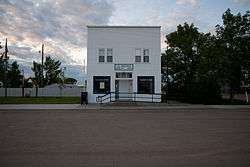
Post office in Hague | |
 Location of Hague, North Dakota | |
| Coordinates: 46°1′42″N 99°59′55″W / 46.02833°N 99.99861°WCoordinates: 46°1′42″N 99°59′55″W / 46.02833°N 99.99861°W | |
| Country | United States |
| State | North Dakota |
| County | Emmons |
| Area[1] | |
| • Total | 0.27 sq mi (0.70 km2) |
| • Land | 0.27 sq mi (0.70 km2) |
| • Water | 0 sq mi (0 km2) |
| Elevation | 1,900 ft (579 m) |
| Population (2010)[2] | |
| • Total | 71 |
| • Estimate (2014)[3] | 67 |
| • Density | 263.0/sq mi (101.5/km2) |
| Time zone | Central (CST) (UTC-6) |
| • Summer (DST) | CDT (UTC-5) |
| ZIP code | 58542 |
| Area code(s) | 701 |
| FIPS code | 38-34180 |
| GNIS feature ID | 1035603[4] |
Hague is a city in Emmons County, North Dakota, United States. The population was 71 at the 2010 census.[5] Hague was founded in 1902.
History
Hague was laid out in 1902 when the railroad was extended to that point.[6] The community took its name from The Hague, in the Netherlands.[7] A post office has been in operation at Hague since 1902.[8]
Historic sites
Several historic sites in or near Hague are listed on the National Register of Historic Places: Old St. Mary's Cemetery, Wrought-Iron Cross Site, Wrought-iron cross sites of St. Aloysius Cemetery (Hague, North Dakota), and Wrought-iron cross sites of St. Mary's Cemetery (Hague, North Dakota). St. Mary's Catholic Church in Hague features works by artist Count Berthold von Imhoff.[9]
Geography
Hague is located at 46°1′42″N 99°59′55″W / 46.02833°N 99.99861°W (46.028313, -99.998640).[10]
According to the United States Census Bureau, the city has a total area of 0.27 square miles (0.70 km2), all of it land.[1]
Demographics
| Historical population | |||
|---|---|---|---|
| Census | Pop. | %± | |
| 1910 | 183 | — | |
| 1920 | 315 | 72.1% | |
| 1930 | 364 | 15.6% | |
| 1940 | 442 | 21.4% | |
| 1950 | 328 | −25.8% | |
| 1960 | 197 | −39.9% | |
| 1970 | 146 | −25.9% | |
| 1980 | 127 | −13.0% | |
| 1990 | 109 | −14.2% | |
| 2000 | 91 | −16.5% | |
| 2010 | 71 | −22.0% | |
| Est. 2015 | 67 | [11] | −5.6% |
| U.S. Decennial Census[12] 2014 Estimate[3] | |||
2010 census
As of the census[2] of 2010, there were 71 people, 35 households, and 22 families residing in the city. The population density was 263.0 inhabitants per square mile (101.5/km2). There were 51 housing units at an average density of 188.9 per square mile (72.9/km2). The racial makeup of the city was 100.0% White. Hispanic or Latino of any race were 1.4% of the population.
There were 35 households of which 20.0% had children under the age of 18 living with them, 54.3% were married couples living together, 2.9% had a female householder with no husband present, 5.7% had a male householder with no wife present, and 37.1% were non-families. 28.6% of all households were made up of individuals and 25.7% had someone living alone who was 65 years of age or older. The average household size was 2.03 and the average family size was 2.45.
The median age in the city was 60.5 years. 16.9% of residents were under the age of 18; 0.0% were between the ages of 18 and 24; 18.2% were from 25 to 44; 23.9% were from 45 to 64; and 40.8% were 65 years of age or older. The gender makeup of the city was 52.1% male and 47.9% female.
2000 census
As of the census of 2000, there were 91 people, 43 households, and 28 families residing in the city. The population density was 330.4 people per square mile (125.5/km²). There were 53 housing units at an average density of 192.4 per square mile (73.1/km²). The racial makeup of the city was 96.70% White, 1.10% African American and 2.20% Native American. Hispanic or Latino of any race were 1.10% of the population.
There were 43 households out of which 16.3% had children under the age of 18 living with them, 53.5% were married couples living together, 9.3% had a female householder with no husband present, and 32.6% were non-families. 32.6% of all households were made up of individuals and 16.3% had someone living alone who was 65 years of age or older. The average household size was 2.12 and the average family size was 2.59.
In the city the population was spread out with 17.6% under the age of 18, 25.3% from 25 to 44, 14.3% from 45 to 64, and 42.9% who were 65 years of age or older. The median age was 56 years. For every 100 females there were 85.7 males. For every 100 females age 18 and over, there were 87.5 males.
The median income for a household in the city was $24,688, and the median income for a family was $27,500. Males had a median income of $20,417 versus $10,625 for females. The per capita income for the city was $13,048. There were 5.9% of families and 14.4% of the population living below the poverty line, including 40.0% of under eighteens and 7.7% of those over 64.
Climate
This climatic region is typified by large seasonal temperature differences, with warm to hot (and often humid) summers and cold (sometimes severely cold) winters. According to the Köppen Climate Classification system, Hague has a humid continental climate, abbreviated "Dfb" on climate maps.[13]
References
- 1 2 "US Gazetteer files 2010". United States Census Bureau. Retrieved 2012-06-14.
- 1 2 "American FactFinder". United States Census Bureau. Retrieved 2012-06-14.
- 1 2 "Population Estimates". United States Census Bureau. Retrieved July 10, 2015.
- ↑ "US Board on Geographic Names". United States Geological Survey. 2007-10-25. Retrieved 2008-01-31.
- ↑ "2010 Census Redistricting Data (Public Law 94-171) Summary File". American FactFinder. United States Census Bureau. Retrieved 2 May 2011.
- ↑ "Emmons County". GenWeb. Archived from the original on October 25, 2015. Retrieved 25 October 2015.
- ↑ Federal Writers' Project (1938). North Dakota, a Guide to the Northern Prairie State,. WPA. p. 211. ISBN 978-1-62376-033-5.
- ↑ "Emmons County". Jim Forte Postal History. Retrieved 25 October 2015.
- ↑ "St. Mary's Catholic Church". Retrieved 2012-12-08.
- ↑ "US Gazetteer files: 2010, 2000, and 1990". United States Census Bureau. 2011-02-12. Retrieved 2011-04-23.
- ↑ "Annual Estimates of the Resident Population for Incorporated Places: April 1, 2010 to July 1, 2015". Retrieved July 2, 2016.
- ↑ United States Census Bureau. "Census of Population and Housing". Retrieved January 21, 2014.
- ↑ Climate Summary for Hague, North Dakota
Municipalities and communities of Emmons County, North Dakota, United States | ||
|---|---|---|
| Cities | 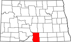 | |
| Township | ||
| Unorganized territories |
| |
| Unincorporated communities | ||