Harahan, Louisiana
| Harahan, Louisiana | ||
| City | ||
 Welcome sign on Jefferson Highway | ||
|
||
| Country | ||
|---|---|---|
| State | ||
| Parish | Jefferson | |
| Elevation | 7 ft (2.1 m) [1] | |
| Coordinates | 29°56′28″N 90°12′07″W / 29.94111°N 90.20194°WCoordinates: 29°56′28″N 90°12′07″W / 29.94111°N 90.20194°W | |
| Area | 2.5 sq mi (6.5 km2) | |
| - land | 2.0 sq mi (5 km2) | |
| - water | 0.5 sq mi (1 km2), 20% | |
| Population | 9,277 (2010) | |
| Density | 4,613.1/sq mi (1,781.1/km2) | |
| Mayor | Tina Miceli | |
| Timezone | CST (UTC-6) | |
| - summer (DST) | CDT (UTC-5) | |
| ZIP code | 70123 | |
| Area code | 504 | |
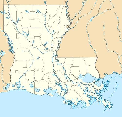
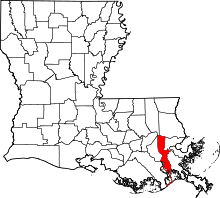
 Location of Harahan in Louisiana | ||
 Location of Louisiana in the United States | ||
| Website: http://www.cityofharahan.com | ||
Harahan is a small city in Jefferson Parish, Louisiana, United States, and a suburb of New Orleans. The population was 9,277 at the 2010 census.
Harahan was named in honor of James Theodore Harahan, president of the Illinois Central Railroad from 1906-1911. The Illinois Central track runs parallel to Airline Highway.
History
One of Harahan's more notable structures is Harahan Elementary, located along Jefferson Highway. Its current structure was opened to students in January, 1926. In 1983, it was added to the Department of the Interior's National Register of Historic Places.
Geography
Harahan is located along a heavily-wooded area along a curve in the Mississippi River, between River Ridge to the west and Elmwood to the east. Harahan's main road is Jefferson Highway which changes from Claiborne Avenue as it enters Jefferson Parish and dead ends in Kenner at the intersection of Williams Blvd.
Harahan is located at 29°56′28″N 90°12′7″W / 29.94111°N 90.20194°W (29.941085, -90.202020)[2] and has an elevation of 7 feet (2.1 m).[3] According to the United States Census Bureau, the city has a total area of 2.5 square miles (6.5 km2), of which 2.0 square miles (5.2 km2) is land and 0.5 square miles (1.3 km2) (19.59%) is water.
Harahan was largely spared by water damage during Hurricane Katrina, although wind damage played a significant role in its impact by the storm.
Demographics
| Historical population | |||
|---|---|---|---|
| Census | Pop. | %± | |
| 1930 | 892 | — | |
| 1940 | 1,082 | 21.3% | |
| 1950 | 3,394 | 213.7% | |
| 1960 | 9,275 | 173.3% | |
| 1970 | 13,037 | 40.6% | |
| 1980 | 11,384 | −12.7% | |
| 1990 | 9,927 | −12.8% | |
| 2000 | 9,885 | −0.4% | |
| 2010 | 9,277 | −6.2% | |
| Est. 2015 | 9,350 | [4] | 0.8% |
As of the census[6] of 2000, there were 9,885 people, 3,994 households, and 2,799 families residing in the city. The population density was 5,023.5 inhabitants per square mile (1,937.4/km²). There were 4,129 housing units at an average density of 2,098.3 per square mile (809.2/km²). The racial makeup of the city was 97.06% White, 0.62% African American, 0.45% Native American, 0.37% Asian, 0.03% Pacific Islander, 0.37% from other races, and 1.10% from two or more races. 2.46% of the population were Hispanic or Latino of any race.
There were 3,994 households out of which 28.2% had children under the age of 18 living with them, 55.2% were married couples living together, 11.1% had a female householder with no husband present, and 29.9% were non-families. 25.3% of all households were made up of individuals and 11.4% had someone living alone who was 65 years of age or older. The average household size was 2.42 and the average family size was 2.91.
In the city the population was spread out with 20.8% under the age of 18, 6.9% from 18 to 24, 28.5% from 25 to 44, 24.0% from 45 to 64, and 19.8% who were 65 years of age or older. The median age was 41 years. For every 100 females there were 90.1 males. For every 100 females age 18 and over, there were 86.9 males.
The median income for a household in the city was $44,702, and the median income for a family was $55,319. Males had a median income of $37,995 versus $27,921 for females. The per capita income for the city was $23,448. 4.7% of the population and 3.1% of families were below the poverty line. 3.7% of those under the age of 18 and 8.2% of those 65 and older were living below the poverty line.
Culture
Harahan is home to Colonial Golf and Country Club, one of only three golf courses located in East Jefferson (the East Bank of Jefferson Parish). It was closed down in early 2012.
Education
Harahan's public schools are operated by the Jefferson Parish Public School System (JPPSS).[7][8] The city is zoned to Harahan Elementary School (Harahan),[9] Riverdale Middle School (Jefferson),[10] and Riverdale High School (Jefferson).[11] In regards to the advanced studies academies, students are zoned to Airline Park Academy.[12]
In 2012 the Jefferson Parish campus of the International School of Louisiana (ISL) charter school opened in a leased JPPPS building on South Clearview Parkway in Elmwood. near Harahan.[13][14] The JPPPS board later arranged for the charter school to move from the Elmwood facility to the former Ralph J. Bunche Academy in Metairie.[14]
Private Schools in Harahan include St. Rita, a Catholic Elementary and Middle School, and Faith Lutheran, a K-12 Private Lutheran School.
Jefferson Parish Library operates the Harahan Library.[15]
Notable people
References
- ↑ "Harahan, Louisiana". Geographic Names Information System. United States Geological Survey. June 4, 1980. Retrieved 2007-12-12.
- ↑ "US Gazetteer files: 2010, 2000, and 1990". United States Census Bureau. 2011-02-12. Retrieved 2011-04-23.
- ↑ "US Board on Geographic Names". United States Geological Survey. 2007-10-25. Retrieved 2008-01-31.
- ↑ "Annual Estimates of the Resident Population for Incorporated Places: April 1, 2010 to July 1, 2015". Retrieved July 2, 2016.
- ↑ "Census of Population and Housing". Census.gov. Retrieved June 4, 2015.
- ↑ "American FactFinder". United States Census Bureau. Retrieved 2008-01-31.
- ↑ "Garbage Collection." City of Harahan. Retrieved on May 18, 2014.
- ↑ "2010 CENSUS - CENSUS BLOCK MAP (INDEX): Harahan city, LA" (Archive). U.S. Census Bureau. Retrieved on May 18, 2014.
- ↑ "Elementary School Districts 2012-2013 East Bank of Jefferson Parish Louisiana" (Archive). Jefferson Parish Public School System. Retrieved on May 18, 2014.
- ↑ "Middle School Districts 2012-2013 East Bank of Jefferson Parish Louisiana" (Archive) Jefferson Parish Public School System. Retrieved on May 18, 2014.
- ↑ "High School Districts 2012-2013 East Bank of Jefferson Parish Louisiana." (Archive) Jefferson Parish Public School System. Retrieved on May 18, 2014.
- ↑ "East Bank Advanced Studies Attendance Zones" (Archive). Jefferson Parish Public School System. Retrieved on May 18, 2014.
- ↑ Tan, Sarah. "The International School of Louisiana opens in Harahan." Times Picayune. November 23, 2012. Retrieved on May 18, 2014.
- 1 2 "Jefferson Parish" (Archive) International School of Louisiana. December 18, 2012. Retrieved on May 18, 2014. "822 S. Clearview Parkway Harahan, LA 70123 (Located in Elmwood)"
- ↑ "Harahan Library." Jefferson Parish Library. Retrieved on September 29, 2010.
External links
| Wikimedia Commons has media related to Harahan, Louisiana. |

