Estelle, Louisiana
| Estelle | |
| Census-designated place | |
| Country | United States |
|---|---|
| State | Louisiana |
| Parish | Jefferson |
| Elevation | 0 ft (0.0 m) |
| Coordinates | 29°50′51″N 90°06′29″W / 29.84750°N 90.10806°WCoordinates: 29°50′51″N 90°06′29″W / 29.84750°N 90.10806°W |
| Area | 5.1 sq mi (13.2 km2) |
| - land | 5.1 sq mi (13 km2) |
| - water | 0.0 sq mi (0 km2), 0% |
| Population | 16,377 (2010) |
| Density | 3,266.9/sq mi (1,261.4/km2) |
| Timezone | CST (UTC-6) |
| - summer (DST) | CDT (UTC-5) |
| Area code | 504 |
 Location of Estelle in Louisiana | |
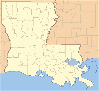
 Location of Louisiana in the United States | |
Estelle is a census-designated place (CDP) in Jefferson Parish, Louisiana, United States. The population was 16,377 at the 2010 census.[1] It is part of the New Orleans–Metairie–Kenner Metropolitan Statistical Area.
Estelle is south of Marrero, Louisiana; the urbanized areas of the communities meet, and some businesses in Estelle list their addresses as "Marrero".
The Jean Lafitte National Park Barataria Preserve is adjacent to Estelle.
History
Part of the colonial era Isleño Barataria Settlement was in the southern part of what is now Estelle.
Estelle is the location of the WWL-AM transmitter.
Geography
Estelle is located at 29°50′51″N 90°6′29″W / 29.84750°N 90.10806°W (29.847527, -90.108117).[1]
According to the United States Census Bureau, the CDP has a total area of 5.1 square miles (13 km2), all of it land.
Demographics
As of the census[2] of 2000, there were 15,880 people, 5,012 households, and 4,360 families residing in the CDP. The population density was 3,141.6 people per square mile (1,214.1/km²). There were 5,124 housing units at an average density of 1,013.7 per square mile (391.8/km²). The racial makeup of the CDP was 75.33% White, 16.79% African American, 0.82% Native American, 3.31% Asian, 0.04% Pacific Islander, 1.90% from other races, and 1.80% from two or more races. Hispanic or Latino of any race were 7.20% of the population.
There were 5,012 households out of which 48.3% had children under the age of 18 living with them, 68.4% were married couples living together, 13.4% had a female householder with no husband present, and 13.0% were non-families. 10.1% of all households were made up of individuals and 2.3% had someone living alone who was 65 years of age or older. The average household size was 3.17 and the average family size was 3.37.
In the CDP the population was spread out with 30.9% under the age of 18, 9.6% from 18 to 24, 32.7% from 25 to 44, 21.8% from 45 to 64, and 5.0% who were 65 years of age or older. The median age was 32 years. For every 100 females there were 96.1 males. For every 100 females age 18 and over, there were 92.3 males.
The median income for a household in the CDP was $45,293, and the median income for a family was $47,500. Males had a median income of $34,476 versus $21,880 for females. The per capita income for the CDP was $16,586. About 8.2% of families and 10.9% of the population were below the poverty line, including 16.7% of those under age 18 and 6.7% of those age 65 or over.
Education
Residents are assigned to schools in the Jefferson Parish Public Schools system.[3]
Schools that serve Estelle for elementary school are Estelle Elementary, Allen Ellender PK-8, and Congetta Trippe Janet in Estelle, as well as Miller Wall Elementary in Marrero.[4] Schools that serve Estelle for middle school are Ellender PK-8, Truman Middle in Estelle, and Worley Middle in Harvey.[5] Most residents are zoned to John Ehret High School, while some are zoned to L.W. Higgins High School in Marrero.[6] In regards to advanced studies academies, residents are zoned to the Marrero Academy.[7]
Previously Ellender was solely a middle school, and Estelle was divided between Ellender and Truman at the middle school level.[8] Therefore, Ellender did not serve any portions of Estelle at the elementary level.[9]
References
- 1 2 "US Gazetteer files: 2010, 2000, and 1990". United States Census Bureau. 2011-02-12. Retrieved 2011-04-23.
- ↑ "American FactFinder". United States Census Bureau. Retrieved 2008-01-31.
- ↑ "2010 CENSUS - CENSUS BLOCK MAP: Estelle CDP, LA" (Archive). U.S. Census Bureau. Retrieved on May 18, 2014.
- ↑ "Elementary School Districts 2012-2013 West Bank of Jefferson Parish Louisiana" (Archive). Jefferson Parish Public Schools. Retrieved on May 18, 2014.
- ↑ "Middle School Districts 2012-2013 West Bank of Jefferson Parish Louisiana" (Archive). Jefferson Parish Public Schools. Retrieved on May 18, 2014.
- ↑ "High School Districts 2012-2013 West Bank of Jefferson Parish Louisiana" (Archive). Jefferson Parish Public Schools. Retrieved on May 18, 2014.
- ↑ "Westbank Advanced Studies Academies Attendance Zones" (Archive). Jefferson Parish Public Schools. Retrieved on May 18, 2014.
- ↑ "Middle School Districts 2009-2010 West Bank of Jefferson Parish Louisiana (Archive). Jefferson Parish Public Schools. Retrieved on May 18, 2014.
- ↑ "Elementary School Districts 2009-2010 West Bank of Jefferson Parish Louisiana." (Archive) Jefferson Parish Public School System. Retrieved on September 26, 2010.
Municipalities and communities of Jefferson Parish, Louisiana, United States | ||
|---|---|---|
| Cities | 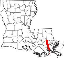 | |
| Towns | ||
| CDPs | ||
| Others Unincorporated communities | ||