Nepean Bay
| Nepean Bay | |
|---|---|
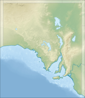 Nepean Bay Location in South Australia | |
| Location | Kangaroo Island, South Australia |
| Coordinates | 35°40′57″S 137°44′43″E / 35.68250°S 137.74528°ECoordinates: 35°40′57″S 137°44′43″E / 35.68250°S 137.74528°E[1] |
| Type | Bay |
| Basin countries | Australia |
| Max. length | 30 kilometres (19 mi).[2] |
| Max. width | 30 kilometres (19 mi)[2] |
| Max. depth | 13.4 metres (44 ft)[2] |
| Islands | Busby Islet, Beatrice Islets |
| Settlements |
Kingscote Cygnet River Brownlow KI Nepean Bay American River Baudin Beach Island Beach |
Nepean Bay is a bay located on the north-east coast of Kangaroo Island in the Australian state of South Australia about 130 kilometres (81 mi) south-south-west of Adelaide. It was named by the British navigator, Matthew Flinders, after Sir Evan Nepean on 21 March 1802.
Extent & description
Nepean Bay lies between Point Marsden and Kangaroo Head on the north-east coast of Kangaroo Island facing into Investigator Strait. Nepean Bay itself includes the following coastal inlets from west to east - Bay of Shoals, Western Cove and Eastern Cove. Eastern Cove itself includes an inlet consisting of a channel known as American River and a lagoon system known as Pelican Lagoon.[3]
Bay of Shoals
The Bay of Shoals is a body of water which is located immediately north of the settlement of Kingscote and whose mouth is located between Cape Rouge in the north and Beatrice Point in the south over a distance of about 5 kilometres (3.1 mi). The bay has a maximum charted depth of 2.7 metres (8 ft 10 in). Its mouth is bounded by a spit known as 'The Spit' which extends from Cape Rouge to within 0.5 nautical miles (0.93 km; 0.58 mi) of Beatrice Point, includes the islets of Busby and Beatrice and is reported as being exposed during local tides, i.e. ‘drying.’ Access for watercraft into the bay is via a natural channel at its southern end near Beatrice Point.[4][5][2]
Western Cove
Western Cove is a body of water whose mouth is located between Beare Point in the west and Morrison Point in the east separated by a distance of about 8 nautical miles (15 km; 9.2 mi). The cove has a maximum depth of about 10 metres (33 ft) at its mouth. Its shoreline is described as (distances in nautical miles):[4][2][6]
The S(outh) shore, between Morrison Point and a red cliffy point about 3 miles W, is high and rocky. A range of wooded hills along the S(outh) shore falls gradually to the W(est). Red cliffs extend about 1.5 miles W(est) from the red cliffy point, and from there to the head of the cove is a continuous sandy beach. The land at the head of the cove is low and swampy and continues so to Beare Point…
Eastern Cove
Eastern Cove is the body of water whose mouth is located between Morrison Point in the west and Kangaroo Head in the east separated by a distance of about 6 nautical miles (11 km; 6.9 mi). The cove has a maximum depth of 14 metres (46 ft) at its mouth. Its shoreline is described as (distances in nautical miles): [3][2][6]
The shore of Eastern Cove, between Kangaroo Head and American Beach, 2.5 miles S(outh), is rugged and rocky. Between the SW end of American Beach and Rocky Point, it consists of alternate beaches and low, rocky points. A sandy beach forms the S(outh) shore between Rocky Point and Strawbridge Point, 2.75 miles WNW. The S(outh) side of the cove is low with wooded hills at the back.
European discovery
Matthew Flinders named Nepean Bay after Sir Evan Nepean, First Secretary to the Admiralty, on 21 March 1802.[7]
Ports and other settlements
Settlements on its shores include Kingscote, Brownlow KI and Nepean Bay on the shores of Western Cove, and American River, Baudin Beach and Island Beach on the shores of Eastern Cove.[8]
Protected areas
Protected areas located within and adjoining the bay’s extent include:
- Aquatic reserves - American River.[9]
- Conservation parks - Beatrice Islet, Busby Islet, Cygnet Estuary, Nepean Bay and Pelican Lagoon.[10]
- Marine parks - Encounter Marine Park[11]
See also
Citations and references
- Citations
- ↑ "Nepean Bay (SA)". Gazetteer of Australia online. Geoscience Australia, Australian Government.
- 1 2 3 4 5 6 DMH, 1985, chart 11
- 1 2 NGA, 2010, page 203
- 1 2 NGA, 2010, page 204
- ↑ BIA, 2005, page 185
- 1 2 DMH, 1985, chart 13
- ↑ Flinders, 1814 (1966), page 250
- ↑ BIA, 2005, pages 184-186
- ↑ PIRSA, 2014
- ↑ DEP, 1987, pages 25, 26, 54 & 64
- ↑ DEWNR, 2012, page 2 of 6
- References
- Boating Industry Association of South Australia (BIA); South Australia. Department for Environment and Heritage (2005), South Australia's waters an atlas & guide, Boating Industry Association of South Australia, ISBN 978-1-86254-680-6
- Anon (1987). Conservation Parks of Kangaroo Island Management Plan (PDF). Adelaide: Department of Environment and Planning, South Australia (DEP). ISBN 0-7243-8983-0.
- "Encounter Marine Park Management plan summary" (PDF). Department of Environment, Water and Natural Resources (DEWNR). Retrieved 17 June 2014.
- South Australia. Department of Marine and Harbors (DMH) (1985), The Waters of South Australia a series of charts, sailing notes and coastal photographs, Dept. of Marine and Harbors, South Australia, ISBN 978-0-7243-7603-2
- Flinders, Matthew (1966) [1814]. A Voyage to Terra Australis : undertaken for the purpose of completing the discovery of that vast country, and prosecuted in the years 1801, 1802, and 1803 in His Majesty's ship the Investigator, and subsequently in the armed vessel Porpoise and Cumberland Schooner; with an account of the shipwreck of the Porpoise, arrival of the Cumberland at Mauritius, and imprisonment of the commander during six years and a half in that island. (Facsimile ed.). Adelaide; Facsimile reprint of: London : G. and W. Nicol, 1814 ed. In two volumes, with an Atlas (3 volumes): Libraries Board of South Australia. Retrieved 27 March 2013.
- National Geospatial-Intelligence Agency (NGA) (2010). Pub175, Sailing directions (enroute) north, west, and south coast of Australia (PDF) (10th ed.). National Geospatial-Intelligence Agency. Retrieved 16 May 2014.
- "American River Aquatic Reserve" (PDF). Primary Industries and Regions SA (PIRSA). Retrieved 6 January 2014.
| Major townships | |||||||||||||||
|---|---|---|---|---|---|---|---|---|---|---|---|---|---|---|---|
| Beaches | |||||||||||||||
| Coastal features |
| ||||||||||||||
| Protected areas |
| ||||||||||||||
| Islands adjacent to Kangaroo Island coast | |||||||||||||||
| Related and uncategorised | |||||||||||||||
| |||||||||||||||