Turkistan (city)
| Turkistan Түркістан | |
|---|---|
|
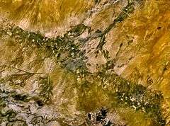
Mausoleum of Khwaja Ahmad Yasavi | |
 Turkistan Location in Kazakhstan | |
| Coordinates: 43°17′N 68°16′E / 43.283°N 68.267°E | |
| Country | Kazakhstan |
| Region | South Kazakhstan Region |
| Government | |
| • Akim (mayor) | Ashirbekov Bakitzhan Aydarhanovich |
| Population (2009) | |
| • City | 227,098 |
| • Urban | 142,899 |

Coordinates: 43°17′N 68°16′E / 43.283°N 68.267°E
Turkistan (Kazakh: Түркістан/Türkistan, تٷركئستان), formerly known as Turkestan (Russian: Туркестан; Uzbek: 'Turkiston', Туркистон, توركىستان), is a city in the South Kazakhstan Region of Kazakhstan, near the Syr Darya river. It is situated 160 km (100 mi) north-west of Shymkent on the Trans-Aral Railway between Kyzylorda to the north and Tashkent to the south. Its population has increased within ten years from 102,505 (1999 Census results)[1] to 142,899 (2009 Census results).[1]
History
Turkistan is one of Kazakhstan's historic cities with an archaeological record dating back to the 4th century.[2]
During the Han dynasty it may even have been Beitan, the summer capital of ancient Kangju (康居), which is mentioned in the Hanshu.[3][4]
It became a commercial centre after the final demise of Otrar, the medieval city whose ruins lie near the Syr Darya to the southeast. Throughout most of the medieval and early-modern period it was known as Yasi or Shavgar and after the 16th-17th centuries as Turkistan or Hazrat, both of which names derive from the title 'Hazrat-i Turkistan', which literally means "the Saint (or Blessed One) of Turkistan" and refers to Khoja Akhmet Yassawi, the Sufi Sheikh of Turkistan, who lived here during the 11th century CE and is buried in the town.
Because of his influence and in his memory the city became an important centre of spirituality and Islamic learning for the peoples of the Kazakh steppes. In the 1390s Timur (Tamerlane) erected a magnificent domed Mazar or tomb over his grave, which remains the most significant architectural monument in the Republic of Kazakhstan, was pictured on the back of the banknotes of the national currency until 2006.
Other important historical sites in the city include a medieval bath-house and four other mausoleums, one dedicated to Timur's granddaughter and three to Kazakh khans (rulers).
Before the Russians came in the 19th century, Turkistan lay on the frontier of the settled Perso-Islamic oasis culture of Transoxiana to the south, and the world of the Kazakh steppe to the north. In the 16th to 18th centuries Turkestan became the capital of the Kazakh Khanate.[5] It became the political center of the Kazakh steppe, but after advancing conquest expeditions of the Russian Empire and the associated weakening of the Kazakh Khanate benefited small southern states that he was captured. Finally, this city was conquered in Kokand khanate by Russian General Veryovkin in 1864. When Turkistan fell to the Russian Empire it was incorporated into the Syr-Darya Oblast of the Governor-Generalship of Russian Turkestan. When the Tsarist regime fell in 1917-18 it was briefly part of the Turkestan Autonomous Soviet Socialist Republic before being returned Kazakhs as a city of Kazakh SSR in 1924.
Pilgrimage
The city attracts thousands of pilgrims. According to a regional tradition, three pilgrimages to Turkistan are equivalent to one hajj to Mecca (such local piety is known also in relation to other religious monuments in the Muslim world). The Saint was held in such reverence that the city was known as the Second Mecca of the East, a vision which has helped shape the spiritual identity of Muslims in Kazakhstan.[6]
Demographics
Modern-day Turkistan has a population of 85,600 (1999 census). The population rose by 10% from 1989 to 99, making it the second fastest-growing town in Kazakhstan, after the new capital Astana.
The ethnic composition of the city:
The ethnic composition of the city according to the 1897 census:[7]
- total – 11,253
- Uzbeks – 8,940 (79.4%)
- Kazakhs – 1,415 (12.5%)
- Tatars – 506 (4.4%)
- Russians – 312 (2.7%)
At the same time the ethnic composition of the Chimkent uyezd (Chimkent district) which included the city of Turkestan according to the 1897 census should be noted:[8]
- total – 285,059
- Kazakhs – 224,704 (78.8%)
- Sart – 32 043 (11.2%)
- Uzbeks – 20 709 (7.2%)
- Russians – 6 443(2.2%)
- Tatars – 646 (0.2%)
Geography and climate
Turkistan may be reached by train from Almaty, in a journey of nearly 20 hours. The road trip from the nearest airport at Shymkent takes about two hours.
Turkestan experiences a desert climate (Köppen BWk) with short, cold winters and long, dry, very hot summers. The vast majority of the annual precipitation falls between late autumn and late spring.
| Climate data for Turkestan | |||||||||||||
|---|---|---|---|---|---|---|---|---|---|---|---|---|---|
| Month | Jan | Feb | Mar | Apr | May | Jun | Jul | Aug | Sep | Oct | Nov | Dec | Year |
| Record high °C (°F) | 18.7 (65.7) |
26.4 (79.5) |
30.7 (87.3) |
36.3 (97.3) |
40.5 (104.9) |
46.9 (116.4) |
49.1 (120.4) |
46.5 (115.7) |
41.9 (107.4) |
35.3 (95.5) |
27.9 (82.2) |
21.6 (70.9) |
49.1 (120.4) |
| Average high °C (°F) | 1.6 (34.9) |
5.3 (41.5) |
13.5 (56.3) |
21.9 (71.4) |
28.3 (82.9) |
34.3 (93.7) |
36.3 (97.3) |
35.0 (95) |
28.8 (83.8) |
20.3 (68.5) |
11.4 (52.5) |
3.4 (38.1) |
20.0 (68) |
| Daily mean °C (°F) | −3.1 (26.4) |
−0.2 (31.6) |
6.9 (44.4) |
14.8 (58.6) |
21.0 (69.8) |
26.8 (80.2) |
28.7 (83.7) |
27.0 (80.6) |
20.4 (68.7) |
11.9 (53.4) |
4.9 (40.8) |
−1.7 (28.9) |
13.1 (55.6) |
| Average low °C (°F) | −7.2 (19) |
−4.6 (23.7) |
1.3 (34.3) |
8.1 (46.6) |
13.6 (56.5) |
18.2 (64.8) |
20.1 (68.2) |
18.2 (64.8) |
11.7 (53.1) |
4.4 (39.9) |
−0.4 (31.3) |
−5.7 (21.7) |
6.5 (43.7) |
| Record low °C (°F) | −33.6 (−28.5) |
−38.6 (−37.5) |
−28.3 (−18.9) |
−8.4 (16.9) |
−4.3 (24.3) |
3.1 (37.6) |
6.4 (43.5) |
3.4 (38.1) |
−5.5 (22.1) |
−14.3 (6.3) |
−31.8 (−25.2) |
−33.0 (−27.4) |
−38.6 (−37.5) |
| Average precipitation mm (inches) | 22 (0.87) |
26 (1.02) |
28 (1.1) |
23 (0.91) |
24 (0.94) |
5 (0.2) |
6 (0.24) |
3 (0.12) |
3 (0.12) |
10 (0.39) |
26 (1.02) |
27 (1.06) |
203 (7.99) |
| Average rainy days | 5 | 6 | 8 | 8 | 7 | 4 | 2 | 1 | 2 | 4 | 7 | 6 | 60 |
| Average snowy days | 7 | 6 | 2 | 0.3 | 0 | 0 | 0 | 0 | 0 | 0.3 | 2 | 5 | 23 |
| Average relative humidity (%) | 79 | 73 | 63 | 50 | 43 | 33 | 34 | 32 | 36 | 51 | 69 | 79 | 54 |
| Mean monthly sunshine hours | 138 | 155 | 199 | 247 | 337 | 382 | 401 | 383 | 315 | 248 | 167 | 122 | 3,094 |
| Source #1: Погода и Климат (Weather and Climate)[9] | |||||||||||||
| Source #2: NOAA (sun, 1961–1990)[10] | |||||||||||||
See also
Footnotes
- 1 2 "Население Республики Казахстан" (in Russian). Департамент социальной и демографической статистики. Retrieved 8 December 2013.
- ↑ "Archeological monuments of Turkistan". Natcom.unesco.kz. Retrieved 2012-04-22.
- ↑ Hill (2009), p. 177.
- ↑ Hulsewé (1979), pp. 124-125 and n. 199.
- ↑ Туркестан — столица Казахского ханства
- ↑ Privatsky (2001)
- ↑ Демоскоп Weekly — Приложение. Справочник статистических показателей
- ↑ Демоскоп Weekly — Приложение. Справочник статистических показателей
- ↑ "Weather and Climate - The Climate of Turkestan (Turkistan)" (in Russian). Weather and Climate (Погода и климат). Archived from the original on 25 November 2016. Retrieved 25 November 2016.
- ↑ "Turkestan Climate Normals 1961-1990". National Oceanic and Atmospheric Administration. Retrieved 25 November 2016.
References
| Wikimedia Commons has media related to Hazrat-e Turkestan. |
- Hill, John E. (2009) Through the Jade Gate to Rome: A Study of the Silk Routes during the Later Han Dynasty, 1st to 2nd Centuries CE. BookSurge, Charleston, South Carolina. ISBN 978-1-4392-2134-1.
- Hulsewé, A. F. P. and Loewe, M. A. N. 1979. China in Central Asia: The Early Stage 125 BC – AD 23: an annotated translation of chapters 61 and 96 of the History of the Former Han Dynasty. E. J. Brill, Leiden. ISBN 90-04-05884-2.
- Privratsky, Bruce G. (2001). Muslim Turkistan: Kazak Religion and Collective Memory Curzon Press, Richmond, Surrey UK.
External links
| Wikisource has the text of a 1911 Encyclopædia Britannica article about Turkistan. |
Capital: Shymkent | ||
| Districts |  | |
| Major cities | ||
| Capital |  | |
|---|---|---|
| Other cities | ||