Hebron, North Dakota
| Hebron, North Dakota | |
|---|---|
| City | |
|
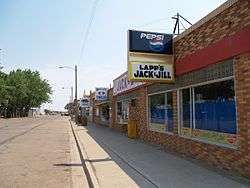
Storefronts in Hebron, North Dakota | |
 Location of Hebron, North Dakota | |
| Coordinates: 46°54′7″N 102°2′37″W / 46.90194°N 102.04361°WCoordinates: 46°54′7″N 102°2′37″W / 46.90194°N 102.04361°W | |
| Country | United States |
| State | North Dakota |
| County | Morton |
| Area[1] | |
| • Total | 1.49 sq mi (3.86 km2) |
| • Land | 1.49 sq mi (3.86 km2) |
| • Water | 0 sq mi (0 km2) |
| Elevation | 2,165 ft (660 m) |
| Population (2010)[2] | |
| • Total | 747 |
| • Estimate (2015)[3] | 691 |
| • Density | 501.3/sq mi (193.6/km2) |
| Time zone | Central (CST) (UTC-6) |
| • Summer (DST) | CDT (UTC-5) |
| ZIP code | 58638 |
| Area code(s) | 701 |
| FIPS code | 38-36860 |
| GNIS feature ID | 1029380[4] |
| Website | http://www.hebronnd.org/ |
Hebron (/ˈhiːbrən/ HEE-brən) is a city in Morton County, North Dakota, United States. It is part of the "Bismarck, ND Metropolitan Statistical Area" or "Bismarck-Mandan". The population was 747 at the 2010 census.[5]
Hebron was founded in 1885 and named after the West Bank city of Hebron. The first influx of settlers came from Johannestal, Crimea, in what was then South Russia.[6]
The city is home to the Hebron Brick Company.
Geography
Hebron is located at 46°54′7″N 102°2′37″W / 46.90194°N 102.04361°W (46.901835, -102.043642).[7]
According to the United States Census Bureau, the city has a total area of 1.49 square miles (3.86 km2), all of it land.[1]
Demographics
| Historical population | |||
|---|---|---|---|
| Census | Pop. | %± | |
| 1910 | 597 | — | |
| 1920 | 1,374 | 130.2% | |
| 1930 | 1,348 | −1.9% | |
| 1940 | 1,267 | −6.0% | |
| 1950 | 1,412 | 11.4% | |
| 1960 | 1,340 | −5.1% | |
| 1970 | 1,103 | −17.7% | |
| 1980 | 1,078 | −2.3% | |
| 1990 | 888 | −17.6% | |
| 2000 | 803 | −9.6% | |
| 2010 | 747 | −7.0% | |
| Est. 2015 | 691 | [8] | −7.5% |
| U.S. Decennial Census[9] 2015 Estimate[3] | |||
2010 census
As of the census[2] of 2010, there were 747 people, 330 households, and 211 families residing in the city. The population density was 501.3 inhabitants per square mile (193.6/km2). There were 396 housing units at an average density of 265.8 per square mile (102.6/km2). The racial makeup of the city was 96.5% White, 0.7% Native American, 0.1% Asian, 0.1% Pacific Islander, 0.1% from other races, and 2.4% from two or more races. Hispanic or Latino of any race were 1.9% of the population.
There were 330 households of which 27.9% had children under the age of 18 living with them, 52.1% were married couples living together, 7.3% had a female householder with no husband present, 4.5% had a male householder with no wife present, and 36.1% were non-families. 32.7% of all households were made up of individuals and 17.9% had someone living alone who was 65 years of age or older. The average household size was 2.26 and the average family size was 2.85.
The median age in the city was 44.8 years. 25.3% of residents were under the age of 18; 4.4% were between the ages of 18 and 24; 20.5% were from 25 to 44; 30.2% were from 45 to 64; and 19.7% were 65 years of age or older. The gender makeup of the city was 52.5% male and 47.5% female.
2000 census
As of the census of 2000, there were 803 people, 357 households, and 228 families residing in the city. The population density was 539.2 people per square mile (208.1/km²). There were 434 housing units at an average density of 291.4 per square mile (112.5/km²). The racial makeup of the city was 95.77% White, 0.87% Native American, 0.75% Asian, 1.12% from other races, and 1.49% from two or more races. Hispanic or Latino of any race were 1.12% of the population.
There were 357 households out of which 25.8% had children under the age of 18 living with them, 56.0% were married couples living together, 5.3% had a female householder with no husband present, and 36.1% were non-families. 34.5% of all households were made up of individuals and 20.7% had someone living alone who was 65 years of age or older. The average household size was 2.25 and the average family size was 2.90.
In the city the population was spread out with 24.8% under the age of 18, 4.0% from 18 to 24, 21.8% from 25 to 44, 22.8% from 45 to 64, and 26.7% who were 65 years of age or older. The median age was 45 years. For every 100 females there were 86.7 males. For every 100 females age 18 and over, there were 83.6 males.
The median income for a household in the city was $22,283, and the median income for a family was $30,536. Males had a median income of $24,904 versus $16,818 for females. The per capita income for the city was $12,463. About 7.5% of families and 12.0% of the population were below the poverty line, including 8.1% of those under age 18 and 15.4% of those age 65 or over.
Notable people
- Gwen Sebastian - Singer-songwriter from The Voice. (US TV show)
Climate
This climatic region is typified by large seasonal temperature differences, with warm to hot (and often humid) summers and cold (sometimes severely cold) winters. According to the Köppen Climate Classification system, Hebron has a humid continental climate, abbreviated "Dfb" on climate maps.[10]
References
- 1 2 "US Gazetteer files 2010". United States Census Bureau. Retrieved 2012-06-14.
- 1 2 "American FactFinder". United States Census Bureau. Retrieved 2012-06-14.
- 1 2 "Population Estimates". United States Census Bureau. Retrieved June 24, 2016.
- ↑ "US Board on Geographic Names". United States Geological Survey. 2007-10-25. Retrieved 2008-01-31.
- ↑ "2010 Census Redistricting Data (Public Law 94-171) Summary File". American FactFinder. United States Census Bureau. Retrieved 2 May 2011.
- ↑ Wick, Douglas A. "Hebron (Morton County)". North Dakota Place Names. Retrieved 6 May 2011.
- ↑ "US Gazetteer files: 2010, 2000, and 1990". United States Census Bureau. 2011-02-12. Retrieved 2011-04-23.
- ↑ "Annual Estimates of the Resident Population for Incorporated Places: April 1, 2010 to July 1, 2015". Retrieved July 2, 2016.
- ↑ United States Census Bureau. "Census of Population and Housing". Retrieved July 19, 2013.
- ↑ Climate Summary for Hebron, North Dakota
External links
- City of Hebron official website
- Hebron's heritage: a history, 1885-1960: compiled to commemorate Hebron's 75th anniversary celebration, June 24-25-26, 1960 from the Digital Horizons website
- A History of 75 years: First Baptist Church, Hebron, North Dakota (1963) from the Digital Horizons website
Municipalities and communities of Morton County, North Dakota, United States | ||
|---|---|---|
| Cities |  | |
| Township | ||
| CDP | ||
| Unorganized territories |
| |
| Unincorporated communities |
| |
| Counties | 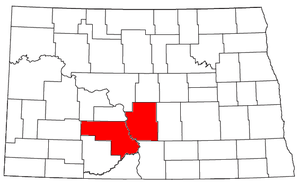 | |
|---|---|---|
| Core cities | ||
| Surrounding areas |
| |