Helena Valley Northeast, Montana
| Helena Valley Northeast, Montana | |
|---|---|
| CDP | |
 Location of Helena Valley Northeast, Montana | |
| Coordinates: 46°40′18″N 111°56′29″W / 46.67167°N 111.94139°WCoordinates: 46°40′18″N 111°56′29″W / 46.67167°N 111.94139°W | |
| Country | United States |
| State | Montana |
| County | Lewis and Clark |
| Area | |
| • Total | 51.3 sq mi (132.9 km2) |
| • Land | 46.8 sq mi (121.2 km2) |
| • Water | 4.5 sq mi (11.7 km2) |
| Population (2010) | |
| • Total | 3,470 |
| • Density | 45.4/sq mi (17.5/km2) |
| Time zone | Mountain (MST) (UTC-7) |
| • Summer (DST) | MDT (UTC-6) |
| Area code(s) | 406 |
| FIPS code | 30-35628 |
Helena Valley Northeast is a census-designated place (CDP) in Lewis and Clark County, Montana, United States. The population was 3,470 at the 2010 census. It is part of the Helena Micropolitan Statistical Area.
Geography
Helena Valley Northeast is located at 46°40′18″N 111°56′29″W / 46.67167°N 111.94139°W (46.671590, -111.941337).[1]
According to the United States Census Bureau, the CDP has a total area of 51.3 square miles (133 km2), of which, 46.8 square miles (121 km2) of it is land and 4.5 square miles (12 km2) of it (8.81%) is water.
Demographics
As of the census[2] of 2000, there were 2,122 people, 776 households, and 619 families residing in the CDP. The population density was 45.4 people per square mile (17.5/km²). There were 830 housing units at an average density of 17.7/sq mi (6.9/km²). The racial makeup of the CDP was 97.74% White, 0.09% African American, 1.23% Native American, 0.05% Asian, 0.19% from other races, and 0.71% from two or more races. Hispanic or Latino of any race were 0.90% of the population.
There were 776 households out of which 37.0% had children under the age of 18 living with them, 69.8% were married couples living together, 5.5% had a female householder with no husband present, and 20.2% were non-families. 16.4% of all households were made up of individuals and 3.4% had someone living alone who was 65 years of age or older. The average household size was 2.68 and the average family size was 3.00.
In the CDP the population was spread out with 26.0% under the age of 18, 5.5% from 18 to 24, 29.8% from 25 to 44, 28.9% from 45 to 64, and 9.8% who were 65 years of age or older. The median age was 39 years. For every 100 females there were 106.0 males. For every 100 females age 18 and over, there were 104.0 males.
The median income for a household in the CDP was $50,804, and the median income for a family was $54,728. Males had a median income of $32,140 versus $26,563 for females. The per capita income for the CDP was $20,283. About 1.4% of families and 3.8% of the population were below the poverty line, including 3.6% of those under age 18 and 7.5% of those age 65 or over.
References
- ↑ "US Gazetteer files: 2010, 2000, and 1990". United States Census Bureau. 2011-02-12. Retrieved 2011-04-23.
- ↑ "American FactFinder". United States Census Bureau. Retrieved 2008-01-31.
Municipalities and communities of Lewis and Clark County, Montana, United States | ||
|---|---|---|
| City | 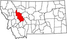 | |
| Town | ||
| CDPs | ||
| Other unincorporated communities | ||