Lincoln, Montana
| Lincoln, Montana | |
|---|---|
| CDP | |
|
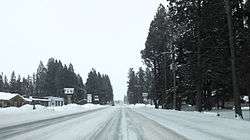
Downtown Lincoln in the winter | |
 | |
| Coordinates: 46°57′28″N 112°40′20″W / 46.95778°N 112.67222°WCoordinates: 46°57′28″N 112°40′20″W / 46.95778°N 112.67222°W | |
| Country | United States |
| State | Montana |
| County | Lewis and Clark |
| Area | |
| • Total | 18.2 sq mi (47.1 km2) |
| • Land | 17.9 sq mi (46.5 km2) |
| • Water | 0.2 sq mi (0.6 km2) |
| Elevation | 4,541 ft (1,384 m) |
| Population (2000) | |
| • Total | 1,100 |
| • Density | 61.3/sq mi (23.7/km2) |
| Time zone | Mountain (MST) (UTC-7) |
| • Summer (DST) | MDT (UTC-6) |
| ZIP code | 59639 |
| Area code(s) | 406 |
| FIPS code | 30-43675 |
| GNIS feature ID | 0801064 |
Lincoln is a census-designated place (CDP) in Lewis and Clark County, Montana, United States. As of the 2000 census, the city population was 1,100.
History
On April 3, 1996, Federal officers arrested Theodore Kaczynski at his remote cabin outside of Lincoln under suspicion of being the "Unabomber", a political terrorist who placed pressure-sensitive bombs inside mailed packages. The bombing campaign resulted in three deaths and 23 wounded. Kaczynski is currently serving eight life sentences plus 30 years.
Geography and Climate
Lincoln is located at 46°57′28″N 112°40′20″W / 46.957713°N 112.672178°W (46.957713, -112.672178).[1] Its elevation is 4536 feet (1382 meters) above sea level. According to the United States Census Bureau, the CDP has a total area of 18.2 square miles (47 km2), of which, 17.9 square miles (46 km2) of it is land and 0.2 square miles (0.52 km2) of it (1.32%) is water.
Lincoln holds the record low for the month of November for the entire lower 48 with the record low of -53. Lincoln has a humid continental climate bordering on semi-arid.
| Climate data for Lincoln, Montana | |||||||||||||
|---|---|---|---|---|---|---|---|---|---|---|---|---|---|
| Month | Jan | Feb | Mar | Apr | May | Jun | Jul | Aug | Sep | Oct | Nov | Dec | Year |
| Record high °F (°C) | 58 (14) |
70 (21) |
81 (27) |
90 (32) |
96 (36) |
100 (38) |
103 (39) |
102 (39) |
98 (37) |
84 (29) |
68 (20) |
55 (13) |
103 (39) |
| Average high °F (°C) | 33 (1) |
37 (3) |
45 (7) |
55 (13) |
64 (18) |
71 (22) |
81 (27) |
80 (27) |
69 (21) |
56 (13) |
39 (4) |
31 (−1) |
55.1 (12.9) |
| Average low °F (°C) | 10 (−12) |
15 (−9) |
19 (−7) |
26 (−3) |
33 (1) |
39 (4) |
42 (6) |
40 (4) |
32 (0) |
27 (−3) |
19 (−7) |
12 (−11) |
26.2 (−3.1) |
| Record low °F (°C) | −48 (−44) |
−44 (−42) |
−40 (−40) |
−8 (−22) |
8 (−13) |
19 (−7) |
24 (−4) |
15 (−9) |
0 (−18) |
−20 (−29) |
−53 (−47) |
−55 (−48) |
−55 (−48) |
| Average precipitation inches (mm) | 1.89 (48) |
1.35 (34.3) |
1.24 (31.5) |
1.35 (34.3) |
2.17 (55.1) |
2.26 (57.4) |
1.16 (29.5) |
1.32 (33.5) |
1.22 (31) |
1.23 (31.2) |
1.44 (36.6) |
1.75 (44.4) |
18.47 (469.1) |
| Source: Lincoln Ranger Station[2] | |||||||||||||
Demographics
| Historical population | |||
|---|---|---|---|
| Census | Pop. | %± | |
| 2000 | 1,100 | — | |
| U.S. Decennial Census | |||
As of the census[3] of 2000, there were 1,100 people, 480 households, and 315 families residing in the CDP. The population density was 61.3 people per square mile (23.7/km2). There were 777 housing units at an average density of 43.3 per square mile (16.7/km2). The racial makeup of the CDP was 95.18% White, 1.91% Native American, 0.18% Asian, and 2.73% from two or more races. Hispanic or Latino of any race were 0.73% of the population.
There were 480 households out of which 27.7% had children under the age of 18 living with them, 55.4% were married couples living together, 7.3% had a female householder with no husband present, and 34.2% were non-families. 29.6% of all households were made up of individuals and 10.6% had someone living alone who was 65 years of age or older. The average household size was 2.28 and the average family size was 2.83.
In the CDP the population was spread out with 25.1% under the age of 18, 3.6% from 18 to 24, 24.6% from 25 to 44, 30.9% from 45 to 64, and 15.7% who were 65 years of age or older. The median age was 43 years. For every 100 females there were 106.4 males. For every 100 females age 18 and over, there were 107.6 males.
The median income for a household in the CDP was $26,688, and the median income for a family was $32,784. Males had a median income of $24,583 versus $15,227 for females. The per capita income for the CDP was $14,243. About 17.4% of families and 21.2% of the population were below the poverty line, including 28.8% of those under age 18 and 9.8% of those age 65 or over.
Media attention
Nearby Bugle Mountain (also known as "Bugle Peak"), located in the Scapegoat Wilderness, was the setting of a forest fire in the fictional 1952 motion picture Red Skies of Montana. The film, based in part on the tragic 1949 Mann Gulch fire, was filmed in Montana.
Notable people
- Doug Swingley, four-time winner of the Iditarod Trail Sled Dog Race
- Theodore Kaczynski, "Unabomber"
References
- ↑ "US Gazetteer files: 2010, 2000, and 1990". United States Census Bureau. 2011-02-12. Retrieved 2011-04-23.
- ↑ . Lincoln, Montana climate. 2014 http://www.wrcc.dri.edu/cgi-bin/cliMAIN.pl?mtlinc. Retrieved 2014-08-23. Missing or empty
|title=(help) - ↑ "American FactFinder". United States Census Bureau. Retrieved 2008-01-31.
External links
- Blackfoot Valley Dispatch, local newspaper
- Lincoln schools
Municipalities and communities of Lewis and Clark County, Montana, United States | ||
|---|---|---|
| City | 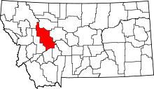 | |
| Town | ||
| CDPs | ||
| Other unincorporated communities | ||