Vantaa
| Vantaa Vantaa – Vanda | ||
|---|---|---|
| City | ||
| Vantaan kaupunki Vanda stad | ||
|
Clockwise from top-left: Kielotorni in Tikkurila, Helsinki Airport, Sotunki, Flamingo and Jumbo shopping centers, the Church of St. Lawrence, Ostari shopping center in Martinlaakso, and the Vaarala Church. | ||
| ||
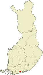 Location of Vantaa in Finland | ||
| Coordinates: 60°17′40″N 025°02′25″E / 60.29444°N 25.04028°ECoordinates: 60°17′40″N 025°02′25″E / 60.29444°N 25.04028°E | ||
| Country | Finland | |
| Region | Uusimaa | |
| Sub-region | Greater Helsinki | |
| Charter | 1351 | |
| Köping | 1972 | |
| City | 1974 | |
| Government | ||
| • Mayor | Kari Nenonen[1] | |
| • Deputy mayors | Martti Lipponen, Jukka T. Salminen, Juha-Veikko Nikulainen, Elina Lehto-Häggroth[1] | |
| • Sector directors | Heidi Nygren, Juha-Veikko Nikulainen[1] | |
| Area (2011-01-01)[2] | ||
| • Total | 240.34 km2 (92.80 sq mi) | |
| • Land | 238.37 km2 (92.04 sq mi) | |
| • Water | 1.97 km2 (0.76 sq mi) | |
| Area rank | 291st largest in Finland | |
| Population (2016-03-31)[3] | ||
| • Total | 215,813 | |
| • Rank | 4th largest in Finland | |
| • Density | 905.37/km2 (2,344.9/sq mi) | |
| Population by native language[4] | ||
| • Finnish | 88.6% (official) | |
| • Swedish | 3% (official) | |
| • Others | 8.4% | |
| Population by age[5] | ||
| • 0 to 14 | 18.5% | |
| • 15 to 64 | 70.5% | |
| • 65 or older | 11.1% | |
| Time zone | EET (UTC+2) | |
| • Summer (DST) | EEST (UTC+3) | |
| Municipal tax rate[6] | 19% | |
| Unemployment rate | 7.8% | |
| Climate | Dfb | |
| Website | www.vantaa.fi | |
Vantaa (Finnish pronunciation: [ˈʋɑntɑː]; Swedish: Vanda) is a city and municipality in Finland. It is part of the inner core of the Finnish Capital Region along with Helsinki, Espoo, and Kauniainen. With a population of 215,813 (31 March 2016[3]), Vantaa is the fourth most populated city of Finland.
Vantaa is bordered by Helsinki, the Finnish capital, to the south; Espoo to the southwest; Nurmijärvi to the northwest; Kerava and Tuusula to the north; and Sipoo to the east. The city encompasses 240.34 square kilometres (92.80 sq mi), of which 1.97 km2 (0.76 sq mi) is water.[2]
The largest airport in Finland, and the main airport and airline hub of Greater Helsinki, the Helsinki Airport, is located in Vantaa. Companies with headquarters in Vantaa include Finnair, Finavia,[7] Air Finland,[8] Blue1,[9] R-kioski, Tikkurila Oyj, Veikkaus Oy, and Metsähallitus. The city also hosts a science center, Heureka.
The city of Vantaa is bilingual, both Finnish and Swedish being official languages. 88.6% of the population are Finnish speakers, while 3% speak Swedish as their first language. 8.4% of the population speak a native language other than Finnish or Swedish.[10]
History
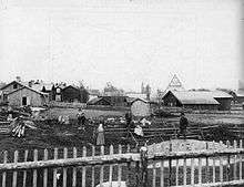
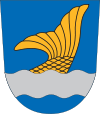
Prior to the name Vantaa being taken into use in 1974, the area was known as Helsingin Pitäjä (Swedish: Helsinge; "Socken of Helsinki"). The earliest record of the area is as Helsinge in 1351 when king Magnus II of Sweden granted salmon fishing rights on the river Vantaa to the Estonian Padise monastery. The rapids of river Vantaa were known as Helsingfors, from which the current Swedish name of Helsinki derives. Early settlement in Vantaa was centered around the river, and from it the city's current coat of arms derived its imagery.
Since the 14th century, the road between Turku and Vyborg, King's Road, has run through Vantaa. The road brought significant attention to the city, and its location on the salmon rich river led to a permanent population.
Ore deposits in Helsingin Pitäjä had been discovered in the 1700s, but weren't utilized until Finland transferred to Russian control in the early 1800s. Ore extraction and processing lead to rapid industrialization in the area, with communities forming around locations like Tikkurila and Kerava. The industrial community in Tikkurila included an expeller pressing plant, which currently operates in the area as the paint manufacturer Tikkurila Oyj.
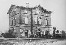
In 1862, the railway between Helsinki and Hämeenlinna was constructed, and one of its seven stations was built in Tikkurila, on its intersection with King's Road. The Swedish architect Carl Albert Edelfelt designed a Renaissance Revival styled station building, which is the oldest extant station building in Finland and (as of 1978) has been adapted into the Vantaa City Museum. The railway brought industry and induced population growth.
Helsingin Pitäjä gained municipality rights in 1865, after which it was named Helsingin maalaiskunta ("Rural Municipality of Helsinki").
In 1972, the municipality was renamed Vantaa (Swedish: Vanda) and promoted to a köping (market town) (i.e. Vantaan kauppala/Vanda köping). In 1974, the town got full city rights as Vantaan kaupunki/Vanda stad or "City of Vantaa".[11]
On October 11 2002, a bomb exploded in the mall of Myyrmanni in Myyrmäki district, killing 7 (including the perpetrator) and injuring 166 people.
Geography
Location
Vantaa is located in southern Finland, in the region of Uusimaa and the Helsinki sub-region. It is separated from the Gulf of Finland by Helsinki. Prior to the abolition of Finnish provinces in 2009, Vantaa was a part of the Southern Finland Province.
The city borders Helsinki, the Finnish capital, which is to the south and southwest. Other neighbouring municipalities are Espoo to the west; Nurmijärvi, Kerava, and Tuusula to the north; and Sipoo to the east. Vantaa is a part of the Finnish Capital Region, which is the inner core of the Greater Helsinki metropolitan area.
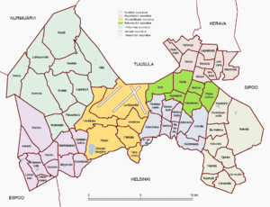
Subdivision
Vantaa is divided into seven major regions (Finnish: suuralueet, Swedish: storområden): Tikkurila (Dickursby), Hakunila (Håkansböle), Koivukylä (Björkby), Korso, Aviapolis, Myyrmäki (Myrbacka), and Kivistö.[12] These major regions are then divided into a total of 60 city districts, the most populated of which are Myyrmäki, Martinlaakso, Hakunila, and Pakkala.
Features
Vantaa encompasses 240.34 square kilometres (92.80 sq mi), of which 1.97 km2 (0.76 sq mi) is water.[2] The city is mostly suburban and urban area with some rural landscape, notably in the districts of Sotunki and Seutula. Average population density is 905.37/km2 (2,344.9/sq mi), which rises above 5,000 inhabitants per square kilometre (13,000/sq mi) in concentrated urban districts like Myyrmäki and Tikkurila.
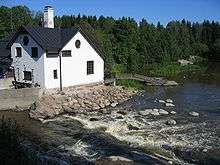
The river Vantaa runs through western Vantaa, and its tributary Keravanjoki runs through eastern Vantaa.
For its area, Vantaa has relatively few lakes. The city encompasses two natural lakes: Kuusijärvi in Kuninkaanmäki and Lammaslampi Pähkinärinne, Hämeenkylä. In addition to these, there is an artificial lake, Silvolan tekojärvi. Vantaa shares two lakes with Espoo: Odilampi and Pitkäjärvi.
Vantaa exhibits frequent exposed granite bedrock ground, which is common in Finland. Resulting from erosion in the last glacial period (about 10,000 years ago), elevated surfaces often lack soil (superficial deposits), revealing bare stone unsuitable for most plant life. Other geological impacts of the last Ice Age include a series of eskers running through central Vantaa.
Climate
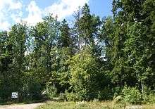
Vantaa has a humid continental climate (Köppen: Dfb), slightly above the threshold for subarctic classification. Although the city no longer (since 2009) has a coastline along the Baltic Sea, it is close enough to experience the mitigating influence of the sea and the Gulf Stream. The record low temperature in Vantaa is −35.9 °C (−32.6 °F) and the record high is 34.0 °C (93.2 °F).
| Climate data for Helsinki Airport (Aviapolis) | |||||||||||||
|---|---|---|---|---|---|---|---|---|---|---|---|---|---|
| Month | Jan | Feb | Mar | Apr | May | Jun | Jul | Aug | Sep | Oct | Nov | Dec | Year |
| Record high °C (°F) | 8.2 (46.8) |
10.0 (50) |
17.5 (63.5) |
23.6 (74.5) |
28.8 (83.8) |
31.4 (88.5) |
34.0 (93.2) |
31.5 (88.7) |
25.3 (77.5) |
18.2 (64.8) |
10.5 (50.9) |
9.6 (49.3) |
34.0 (93.2) |
| Average high °C (°F) | −2.4 (27.7) |
−2.7 (27.1) |
1.5 (34.7) |
8.7 (47.7) |
15.8 (60.4) |
19.6 (67.3) |
22.5 (72.5) |
20.5 (68.9) |
14.8 (58.6) |
8.6 (47.5) |
2.6 (36.7) |
−0.7 (30.7) |
9.1 (48.4) |
| Daily mean °C (°F) | −5.0 (23) |
−5.7 (21.7) |
−1.9 (28.6) |
4.1 (39.4) |
10.4 (50.7) |
14.6 (58.3) |
17.7 (63.9) |
15.8 (60.4) |
10.7 (51.3) |
5.6 (42.1) |
0.4 (32.7) |
−3.2 (26.2) |
5.3 (41.5) |
| Average low °C (°F) | −8.1 (17.4) |
−8.9 (16) |
−5.4 (22.3) |
−0.2 (31.6) |
4.8 (40.6) |
9.5 (49.1) |
12.6 (54.7) |
11.3 (52.3) |
6.9 (44.4) |
2.7 (36.9) |
−2.1 (28.2) |
−6.0 (21.2) |
1.4 (34.5) |
| Record low °C (°F) | −35.9 (−32.6) |
−30.2 (−22.4) |
−27.2 (−17) |
−12.1 (10.2) |
−5.4 (22.3) |
−0.5 (31.1) |
4.0 (39.2) |
2.0 (35.6) |
−7.3 (18.9) |
−14.5 (5.9) |
−19.9 (−3.8) |
−29.5 (−21.1) |
−35.9 (−32.6) |
| Average precipitation mm (inches) | 54 (2.13) |
37 (1.46) |
37 (1.46) |
32 (1.26) |
39 (1.54) |
61 (2.4) |
66 (2.6) |
79 (3.11) |
64 (2.52) |
82 (3.23) |
73 (2.87) |
58 (2.28) |
682 (26.86) |
| Mean monthly sunshine hours | 38 | 74 | 131 | 196 | 275 | 266 | 291 | 219 | 143 | 84 | 37 | 26 | 1,780 |
| Source: Climatological statistics for the normal period 1981–2010 [13] Sun and record temperatures 1981-2011 only | |||||||||||||
Demographics
The city is bilingual, both Finnish and Swedish being official languages.[10] A majority (88.6%) of the population are Finnish speakers while 3% speak Swedish as their first language. Vantaa's residents that speak a native language other than Finnish or Swedish stand at 8.4% of the population.
In 2011, 199,236 of the municipality's 203,001 residents lived in officially recognized urban areas (Finnish: taajama; Swedish: tätort). The remaining population lives in the few rural sections of Vantaa, such as those in Sotunki and Seutula.[14]
In 2015, 60.7% of the population were members of the Lutheran Church of Finland.
Population
| Year | Population |
|---|---|
| 1980 | 132,050 |
| 1985 | 143,844 |
| 1990 | 152,263 |
| 1995 | 166,480 |
| 2000 | 178,471 |
| 2005 | 187,281 |
| 2010 | 200,055 |
| 2015 | 211,206 |
Economy
Of those employed, two thirds are in the private sector. The most common industries in Vantaa include the food, architectural engineering, and machine industries. In 2007, the unemployment rate was 6.3%.
Companies that have their headquarters in Vantaa (at the Helsinki Airport, in Aviapolis) include Finnair, Finavia, Nordic Regional Airlines, Air Finland, and Blue1.[7][8][9][16] Companies with headquarters in Vantaa outside of Aviapolis include R-kioski, Tikkurila Oyj, Veikkaus Oy, and Metsähallitus.
The City of Vantaa has been in increasing debt since the early 2000s, due to a decrease in state funding and an increase in investments. A contributing factor to its situation is the high concentration of families with children, leading to comparatively larger social expenditure.[17] According to the former mayor Juhani Paajanen, the worst expenditures have ended, and the city's gains are increasing.[18]
Arts and culture
Music
There are about 20 choirs in Vantaa,[19] like Vantaan Laulu and Vantaa Chamber Choir. Three actively performing concert bands Tikkurilan Soittokunta, Lumon Puhaltajat and Puhallinorkesteri Louhi exist at the east, north and west corners of the city respectively.[20] Vantaa Pops (Vantaan Viihdeorkesteri in Finnish), conducted by a Welshman Nick Davies,[21] is the only professional full symphonic pops orchestra in Finland.
Ankkarock was a rock music festival held every summer in Korso between 1989-2010.
Museums
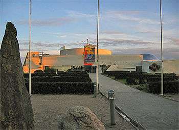
Tikkurila is home of the major science centre in Finland, Heureka. In addition there is the city museum next to the railway station in Tikkurila which has exhibitions with various themes on local history. The museum is housed in the oldest station building in Finland, designed by Carl Albert Edelfelt and completed in 1861. The Finnish Aviation Museum is located in Vantaa, near Helsinki Airport.
Politics
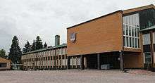
Vantaa's city council has 67 seats. Following the 2012 municipal election the council seats are allocated in the following way: Social Democrats 18 seats, National Coalition Party 18, True Finns 11, Greens 9, Left Alliance 4, Centre Party 3, Christian Democrats 2, Swedish People's Party 2.[22]
Mayors
- Lauri Lairala 1974–1989
- Pirjo Ala-Kapee 1989–1997
- Erkki Rantala 1997–2003
- Juhani Paajanen 2003-2011
- Jukka Peltomäki 2011
- Kari Nenonen 2012-
Infrastructure
Services
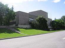
Vantaa has two hospitals, Peijas Hospital in Asola and Katriina Hospital in Seutula. Peijas is responsible for emergency and short-term health services, while Katriina specializes in long-term care and elderly care. The Vantaa branch of the HelMet library network has 10 libraries in Vantaa, with a total of 518,117 books in 2005. The main library is in Tikkurila.
For sports, the city has five swimming halls, four sports halls, two gyms, six tennis courts, 69 hockey and skating rinks, and 19 lit-up running tracks. Additionally, Vantaa has two golf courses, in Hiekkaharju and Keimola.
Transportation

Vantaa infrastructurally serves as the transportational hub of the Helsinki metropolitan area. Several key freeways and highways, such as Ring III and Porvoonväylä, originate in or pass through the municipality. Additionally, two of the three railway lines exiting Helsinki pass through Vantaa, connecting the city's 14 stations. All long-distance trains exiting Helsinki stop at Tikkurila railway station in Vantaa, with the exception of train D.
Public transport in Vantaa consists of a bus network and commuter rail, provided by HSL/HRT and VR. Since the introduction of the Ring Rail Line in 2015, Vantaa has had a total of 14 stations. Key railway stations also act as central bus stations. The Ring Rail Line is speeding up the development in Western parts of Vantaa. For example, the Vantaankoski area is foreseen to double the amount of jobs in the future. Planning ideas are sought through an ideas competition.[23]
The largest airport in Finland, and the primary airport of Greater Helsinki, Helsinki Airport, is located in Vantaa. In 2015, it attracted a total of 16.4 million passengers.
Education
Vantaa has a total of 50 Finnish-speaking, five Swedish-speaking, and one English-speaking primary and junior high schools. The city has nine upper secondary schools, including Tikkurila Upper Secondary, Finland's largest upper secondary school. For vocational education, Vantaa has two vocational schools and two universities of applied sciences: Metropolia and Laurea.
International relations
Twin towns and sister cities
Vantaa is twinned with:
|
|
Gallery

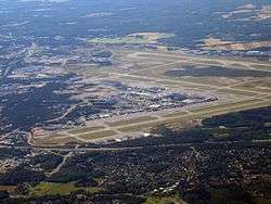 Aerial view of Helsinki Airport, located in Lentokenttä, Vantaa
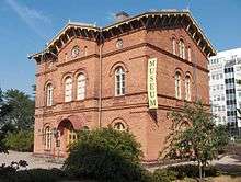 The old railway station building of Tikkurila, now a museum
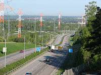 Ring III (national road 50, E18)
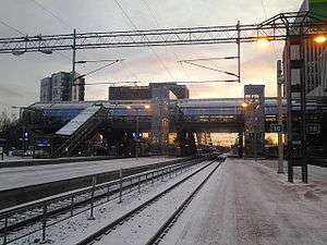 Tikkurila railway station, as of 2015
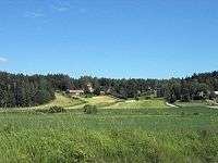 Rural hills of Sotunki
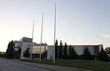 Tikkurila Upper Secondary, the largest high school in Finland
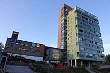 Martintorni, the tallest building in Vantaa at 56 m.
.jpg)
See also
- People from Vantaa
- Districts of Vantaa
References
- Notes
- 1 2 3 "City of Vantaa - City Management". www.vantaa.fi. Retrieved 16 February 2015.
- 1 2 3 "Area by municipality as of 1 January 2011" (PDF) (in Finnish and Swedish). Land Survey of Finland. Retrieved 9 March 2011.
- 1 2 "Ennakkoväkiluku sukupuolen mukaan alueittain, maaliskuu.2016" (in Finnish). Statistics Finland. Retrieved 31 March 2016.
- ↑ "Population according to language and the number of foreigners and land area km2 by area as of 31 December 2008". Statistics Finland's PX-Web databases. Statistics Finland. Retrieved 29 March 2009.
- ↑ "Population according to age and gender by area as of 31 December 2008". Statistics Finland's PX-Web databases. Statistics Finland. Retrieved 28 April 2009.
- ↑ "List of municipal and parish tax rates in 2011". Tax Administration of Finland. 29 November 2010. Retrieved 13 March 2011.
- 1 2 "Oy Air Finland Ltd in English." Air Finland. Retrieved on 25 February 2010.
- 1 2 "Privacy Policy
- 1 2 Government Decree on the Official Languages in Administrative Districts for 2003–2012 (in Finnish); (the same in Swedish). Retrieved on 7 July 2012
- ↑ "Vantaan kaupunki - Vantaan historiaa". www.vantaa.fi. Retrieved 16 February 2015.
- ↑ "City of Vantaa - The Major Regions of Vantaa". www.vantaa.fi. Retrieved 16 February 2015.
- ↑ "Normal period 1981-2010".
- ↑ "Taajama-aste alueittain 31.12.2011". Tilastokeskus. Retrieved 23 March 2015.
- ↑ "Väestö kielen mukaan sekä ulkomaan kansalaisten määrä ja maa-pinta-ala alueittain 1980–2012" (in Finnish). Tilastokeskus. 22 March 2013. Retrieved 1 April 2013.
- ↑ "About Us." Nordic Regional Airlines. Retrieved on October 25, 2016. "Nordic Regional Airlines Oy Öljykuja 2, 01530 Vantaa, Finland"
- ↑ Vantaan kuntakonsernianalyysi 2005, Bo-Erik Ekström 28.10.2005.
- ↑ http://www.vantaanlauri.fi/arkisto/2006/2006-01-12/ajankohtaista/Kaupunkien_yhdistaminen
- ↑ "Vantaan kaupunki - Kulttuuri". www.vantaa.fi. Retrieved 16 February 2015.
- ↑ "Vantaan kaupunki - Kulttuuri". www.vantaa.fi. Retrieved 16 February 2015.
- ↑ http://www.hs.fi/kulttuuri/artikkeli/Nick+Davies+Vantaan+viihdeorkesterin+ylikapellimestariksi/1135259753244
- ↑ http://www.vaalikone.fi/kunta2012/tulos/02/092/
- ↑ Uusi Vantaankoski -ideakilpailu
External links
| Wikivoyage has a travel guide for Vantaa and Northern Helsinki. |
| Wikimedia Commons has media related to Vantaa. |
- City of Vantaa – Official website
- Map of Vantaa
- The Finnish Science Center
- Helsinki Airport
- Vantaa City Museum
- Helsinki.fi – Helsinki region in a nutshell
.jpg)
