Houli District
| Houli 后里區 | |
|---|---|
| District | |
| Houli District | |
 | |
 Houli District in Taichung City | |
| Coordinates: 24°19′N 120°43′E / 24.317°N 120.717°ECoordinates: 24°19′N 120°43′E / 24.317°N 120.717°E | |
| Country | Taiwan |
| Special municipality | Taichung |
| Established (District) | 2010 |
| Area | |
| • Total | 58.9439 km2 (22.7584 sq mi) |
| Population (January 2016) | |
| • Total | 54,313 |
| • Density | 920/km2 (2,400/sq mi) |
| Time zone | CST (UTC+8) |
| Website |
www |
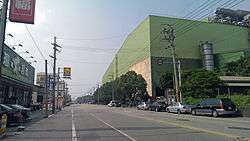
Houli District (Chinese: 后里區; pinyin: Hòulǐ Qū) is a rural district in northwestern Taichung City, Taiwan.[1]

History
Houli District used to be a rural township of Taichung County before it was upgraded to a district of Taichung City on 25 December 2010.
Administrative divisions
Guangfu Village, Renli Village, Yili Village, Yide Village, Houli Village, Houli Village, Duntung Village, Dunxi Village, Dunnan Village, Dunbei Village, Zhonghe Village, Jiushe Village, Liange Village, Taiping Village, Meishan Village, Yuemei Village, Gongguan Village, Taian Village.[2]
Local products
- Sugar cane
- grapes and wine
- soybean
Industrial products
- Iron plants
- Musical instrument manufacturing. Known locally for Saxophones.
Military stables
Military stables (后里馬場) were built in Houli in mid 50's and function until today. Stables' main stock includes some of the horses that were given to Taiwan as a gift from Arabia.
Tourist attractions
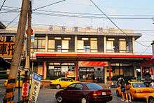
Transportation
See also
| Wikimedia Commons has media related to Houli District, Taichung. |
References
External links
- 臺中市后里區公所 (Chinese)
Districts of Taichung | ||
|---|---|---|
City seat: Xitun | ||
| Urban area | .svg.png) | |
| Coastal area | ||
| Highland area | ||
| Mountain indigenous district | ||
Note: Although Hanyu Pinyin is the national standard; Central, East, South, West, and North District uses English instead. | ||
This article is issued from Wikipedia - version of the 6/12/2016. The text is available under the Creative Commons Attribution/Share Alike but additional terms may apply for the media files.