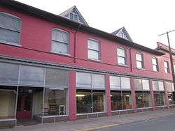
Houtzdale, Pennsylvania
| Houtzdale, Pennsylvania | |
|---|---|
| Borough | |
|
Houtzdale, Pennsylvania | |
|
Map showing Houtzdale in Clearfield County | |
|
Map showing Clearfield County in Pennsylvania | |
 Houtzdale Pennsylvania | |
| Coordinates: 40°49′34″N 78°21′06″W / 40.82611°N 78.35167°WCoordinates: 40°49′34″N 78°21′06″W / 40.82611°N 78.35167°W | |
| Country | United States |
| State | Pennsylvania |
| County | Clearfield |
| Settled | 1870 |
| Incorporated | March 20, 1872 (Borough) |
| Government | |
| • Type | Borough Council |
| Area | |
| • Total | 0.38 sq mi (0.99 km2) |
| • Land | 0.38 sq mi (0.99 km2) |
| • Water | 0.0 sq mi (0.0 km2) |
| Elevation | 1,530 ft (470 m) |
| Population (2010) | |
| • Total | 797 |
| • Density | 2,082/sq mi (803.7/km2) |
| Time zone | Eastern (EST) (UTC-5) |
| • Summer (DST) | EDT (UTC-4) |
| ZIP code | 16651 |
| Area code(s) | 814 |
Houtzdale is a borough in Clearfield County, Pennsylvania, United States. The population was 797 at the 2010 census.[1]
History
Houtzdale is named after Dr. Daniel Houtz, the original owner of the town site.[2]
Geography
Houtzdale is located in southeastern Clearfield County at 40°49′34″N 78°21′6″W / 40.82611°N 78.35167°W (40.825984, -78.351663).[3] It is bordered to the north by the borough of Brisbin. Pennsylvania Route 53 passes through Houtzdale, leading east 5 miles (8 km) to Osceola Mills and west 9 miles (14 km) to Glen Hope. Pennsylvania Route 153 leads north from Houtzdale 17 miles (27 km) to Clearfield, the county seat, and south via PA 453 18 miles (29 km) to Tyrone.
According to the United States Census Bureau, Houtzdale has a total area of 0.38 square miles (0.99 km2), all of it land.[1]
Demographics
| Historical population | |||
|---|---|---|---|
| Census | Pop. | %± | |
| 1880 | 2,060 | — | |
| 1890 | 2,231 | 8.3% | |
| 1900 | 1,482 | −33.6% | |
| 1910 | 1,434 | −3.2% | |
| 1920 | 1,504 | 4.9% | |
| 1930 | 1,351 | −10.2% | |
| 1940 | 1,430 | 5.8% | |
| 1950 | 1,306 | −8.7% | |
| 1960 | 1,239 | −5.1% | |
| 1970 | 1,193 | −3.7% | |
| 1980 | 1,222 | 2.4% | |
| 1990 | 1,204 | −1.5% | |
| 2000 | 941 | −21.8% | |
| 2010 | 797 | −15.3% | |
| Est. 2015 | 775 | [4] | −2.8% |
| Sources:[5][6][7] | |||
As of the census[6] of 2000, there were 941 people, 380 households, and 275 families residing in the borough. The population density was 2,682.2 people per square mile (1,038.1/km²). There were 432 housing units at an average density of 1,231.4 per square mile (476.6/km²). The racial makeup of the borough was 99.57% White, 0.21% Native American, and 0.21% from two or more races.
There were 380 households, out of which 34.5% had children under the age of 18 living with them, 51.1% were married couples living together, 15.3% had a female householder with no husband present, and 27.4% were non-families. 25.8% of all households were made up of individuals, and 11.8% had someone living alone who was 65 years of age or older. The average household size was 2.47 and the average family size was 2.89.
In the borough the population was spread out, with 25.8% under the age of 18, 5.8% from 18 to 24, 27.2% from 25 to 44, 22.4% from 45 to 64, and 18.7% who were 65 years of age or older. The median age was 39 years. For every 100 females there were 94.0 males. For every 100 females age 18 and over, there were 83.7 males.
The median income for a household in the borough was $29,219, and the median income for a family was $33,309. Males had a median income of $27,039 versus $20,438 for females. The per capita income for the borough was $14,177. About 9.3% of families and 12.3% of the population were below the poverty line, including 14.2% of those under age 18 and 15.4% of those age 65 or over.
Notable natives
- Mayor Camille George, who has been a member of the Pennsylvania State House since 1975.[8]
- Irving Kahal (1903–1942), popular song lyricist in the 1920s and 1930s.
References
| Wikimedia Commons has media related to Houtzdale, Pennsylvania. |
- 1 2 "Geographic Identifiers: 2010 Census Summary File 1 (G001): Houtzdale borough, Pennsylvania". U.S. Census Bureau, American Factfinder. Retrieved May 1, 2015.
- ↑ Gannett, Henry (1905). The Origin of Certain Place Names in the United States. Govt. Print. Off. p. 162.
- ↑ "US Gazetteer files: 2010, 2000, and 1990". United States Census Bureau. 2011-02-12. Retrieved 2011-04-23.
- ↑ "Annual Estimates of the Resident Population for Incorporated Places: April 1, 2010 to July 1, 2015". Retrieved July 2, 2016.
- ↑ "Census of Population and Housing". U.S. Census Bureau. Retrieved 11 December 2013.
- 1 2 "American FactFinder". United States Census Bureau. Retrieved 2008-01-31.
- ↑ "Incorporated Places and Minor Civil Divisions Datasets: Subcounty Resident Population Estimates: April 1, 2010 to July 1, 2012". Population Estimates. U.S. Census Bureau. Retrieved 11 December 2013.
- ↑ "Camille Bud George". Pennsylvania House of Representatives. Retrieved 2008-06-23.
Municipalities and communities of Clearfield County, Pennsylvania, United States | ||
|---|---|---|
| City | ||
| Boroughs | ||
| Townships | ||
| CDPs | ||
| Unincorporated communities | ||
| Footnotes | ‡This populated place also has portions in an adjacent county or counties | |