Mahaffey, Pennsylvania
| Mahaffey, Pennsylvania | |
|---|---|
| Borough | |
|
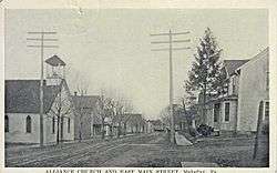
East Main Street, c. 1923 | |
|
Location of Mahaffey in Clearfield County | |
|
Location of Clearfield County in Pennsylvania | |
 Mahaffey Location in Pennsylvania | |
| Coordinates: 40°52′33″N 78°43′41″W / 40.87583°N 78.72806°WCoordinates: 40°52′33″N 78°43′41″W / 40.87583°N 78.72806°W | |
| Country | United States |
| State | Pennsylvania |
| County | Clearfield |
| Settled | 1841 |
| Incorporated | 1889 |
| Government | |
| • Type | Borough Council |
| Area | |
| • Total | 0.44 sq mi (1.13 km2) |
| • Land | 0.43 sq mi (1.11 km2) |
| • Water | 0.008 sq mi (0.02 km2) |
| Elevation | 1,320 ft (400 m) |
| Population (2010) | |
| • Total | 368 |
| • Density | 860/sq mi (331.9/km2) |
| Time zone | Eastern (EST) (UTC-5) |
| • Summer (DST) | EDT (UTC-4) |
| ZIP code | 15757 |
| Area code(s) | 814 |
Mahaffey is a borough in Clearfield County, Pennsylvania, United States. The population was 368 at the 2010 census.[1]
The community is served by U.S. Route 219.
History
The borough was founded by Robert Mahaffey in 1841, at a point where Chest Creek flows into the West Branch Susquehanna River.
First called "Franklin", the borough was incorporated in 1841. At the time it had a public school, four churches, a grist mill and a tannery.
Mahaffey was located at the junction of the New York Central & Hudson River Railroad and the Pennsylvania & Northwestern Railroad.[2]
Geography
Mahaffey is located in southwestern Clearfield County at 40°52′33″N 78°43′41″W / 40.875779°N 78.728108°W.[3] U.S. Route 219 passes through the borough, leading northeast 11 miles (18 km) to Grampian and southwest 8 miles (13 km) to Burnside.
According to the United States Census Bureau, Mahaffey has a total area of 0.44 square miles (1.13 km2), of which 0.43 square miles (1.11 km2) is land and 0.008 square miles (0.02 km2), or 1.92%, is water.[1]
It is a beautiful area. There isn't much traffic. The crime rate is very low in the town. It is your typical everyone knows everyone kind of country town. Some of the grounds are covered by farm land, but there is still many acres that are available for hunting. The wildlife may include deer, bear, turkey, and many small game animals. There is a public park located in the heart of town. Nature trails, play equipment for kids, and baseball fields are there for use. The town has emergency services of a volunteer fire company and ambulance service. Dining in town would include the Starlite which is a restaurant and a bar and the Chestquehanna is a family restaurant that is nestled where the Susquehanna and Chest Branch meet. Newly to the neighborhood would be the Family Dollar. This was just built over the last summer and provides many things to the people that live in the area.
Demographics
| Historical population | |||
|---|---|---|---|
| Census | Pop. | %± | |
| 1890 | 627 | — | |
| 1900 | 741 | 18.2% | |
| 1910 | 754 | 1.8% | |
| 1920 | 801 | 6.2% | |
| 1930 | 667 | −16.7% | |
| 1940 | 609 | −8.7% | |
| 1950 | 646 | 6.1% | |
| 1960 | 582 | −9.9% | |
| 1970 | 482 | −17.2% | |
| 1980 | 513 | 6.4% | |
| 1990 | 341 | −33.5% | |
| 2000 | 402 | 17.9% | |
| 2010 | 368 | −8.5% | |
| Est. 2015 | 353 | [4] | −4.1% |
| Sources:[5][6][7] | |||
As of the census[6] of 2000, there were 402 people, 142 households, and 105 families residing in the borough. The population density was 1,085.5 people per square mile (419.5/km2). There were 157 housing units at an average density of 423.9 per square mile (163.8/km2). The racial makeup of the borough was 100.00% White.
There were 142 households, out of which 34.5% had children under the age of 18 living with them, 60.6% were married couples living together, 7.0% had a female householder with no husband present, and 25.4% were non-families. 24.6% of all households were made up of individuals, and 15.5% had someone living alone who was 65 years of age or older. The average household size was 2.83 and the average family size was 3.38.
In the borough the population was spread out, with 27.6% under the age of 18, 6.5% from 18 to 24, 26.1% from 25 to 44, 23.1% from 45 to 64, and 16.7% who were 65 years of age or older. The median age was 40 years. For every 100 females there were 100.0 males. For every 100 females age 18 and over, there were 99.3 males.
The median income for a household in the borough was $28,750, and the median income for a family was $31,250. Males had a median income of $21,250 versus $20,000 for females. The per capita income for the borough was $11,320. About 6.0% of families and 12.2% of the population were below the poverty line, including 25.2% of those under age 18 and none of those age 65 or over.

Parks and recreation
Located north of the borough is Mahaffey Camp, a camp and conference center affiliated with the Christian and Missionary Alliance.
McGees Mills Covered Bridge is located west of Mahaffey on U.S. Route 219. It is one of the few remaining covered bridges in Pennsylvania, and is listed on the National Register of Historic Places.
Education
The community is served by the Purchase Line School District.
Notable people
- Melvin L. Brown, awarded a Medal of Honor for his actions in the Korean War.
References
- 1 2 "Geographic Identifiers: 2010 Census Summary File 1 (G001): Mahaffey borough, Pennsylvania". U.S. Census Bureau, American Factfinder. Retrieved May 4, 2015.
- ↑ Swoope Jr., Roland D. "BOROUGH OF MAHAFFEY". History of Borough of Mahaffey, Pa. Richmond-Arnold Publishing.
- ↑ "US Gazetteer files: 2010, 2000, and 1990". United States Census Bureau. 2011-02-12. Retrieved 2011-04-23.
- ↑ "Annual Estimates of the Resident Population for Incorporated Places: April 1, 2010 to July 1, 2015". Retrieved July 2, 2016.
- ↑ "Census of Population and Housing". U.S. Census Bureau. Retrieved 11 December 2013.
- 1 2 "American FactFinder". United States Census Bureau. Retrieved 2008-01-31.
- ↑ "Incorporated Places and Minor Civil Divisions Datasets: Subcounty Resident Population Estimates: April 1, 2010 to July 1, 2012". Population Estimates. U.S. Census Bureau. Retrieved 11 December 2013.
Municipalities and communities of Clearfield County, Pennsylvania, United States | ||
|---|---|---|
| City | ||
| Boroughs | ||
| Townships | ||
| CDPs | ||
| Unincorporated communities | ||
| Footnotes | ‡This populated place also has portions in an adjacent county or counties | |