Huntleys Cove, New South Wales
| Huntleys Cove Sydney, New South Wales | |||||||||||||
|---|---|---|---|---|---|---|---|---|---|---|---|---|---|
 Mortimer Lewis Drive | |||||||||||||
| Population | 736 (2011 census)[1] | ||||||||||||
| Postcode(s) | 2111 | ||||||||||||
| Location | 9 km (6 mi) north-west of Sydney CBD | ||||||||||||
| LGA(s) | Municipality of Hunter's Hill | ||||||||||||
| State electorate(s) | Lane Cove | ||||||||||||
| Federal Division(s) | North Sydney | ||||||||||||
| |||||||||||||
Huntleys Cove is a suburb on the lower Northern Suburbs of Sydney, in the state of New South Wales, Australia. Huntleys Cove is located 9 kilometres north-west of the Sydney central business district, in the local government area of the Municipality of Hunter's Hill. Huntleys Cove sits on the peninsula between Tarban Creek and the Parramatta River.
History
Huntleys Cove was originally part of the suburb of Gladesville and a site of part of the Gladesville Mental Hospital. When it became a separate suburb it was known as Tarban, taking its name from Tarban Creek. This was changed to Huntleys Cove in 2002 after residents voted on the issue.[2]
Population
At the 2011 census, there were 736 residents in Huntleys Cove. The median age of residents was 49 and people aged 65 years and over made up 23.5% of the population. The majority of people were born in Australia and the most common ancestries were English, Australian and Irish. The median household weekly income was quite high at $2,069. There was a high rate of participation in voluntary work, with 26.3% of people volunteering in the previous 12 months.[1]
Landmarks
Tarban Creek is a Lower North Shore estuary of great importance to Sydney Harbour, the Parramatta River and the Ryde-Hunters Hill waterways & stormwater systems. Tarban Creek Bridge links Huntleys Point north to Hunters Hill.
The UNSW Rowing Club has maintained a boatshed and pontoon at Huntley's Cove since 1966. Since 2009 the club has also shared a second modern boathouse and clubrooms with the rowing club of the Sydney Girls High School situated close to the southern underspan of the Tarban Creek bridge.
-
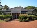
Huntleys Cafe
-
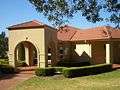
Function Centre
-
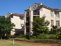
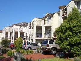
Mortimer Lewis Drive
References
- The Book of Sydney Suburbs, Compiled by Frances Pollen, Angus & Robertson Publishers, 1990, Published in Australia ISBN 0-207-14495-8
- 1 2 Australian Bureau of Statistics (31 October 2012). "Huntleys Cove (State Suburb)". 2011 Census QuickStats. Retrieved 12 May 2013.
- ↑ "Huntleys Cove". Geographical Names Register (GNR) of NSW. Geographical Names Board of New South Wales. Geographical Names Board]
External links
Coordinates: 33°50′20″S 151°08′28″E / 33.839°S 151.141°E